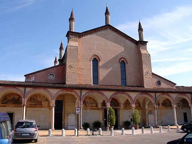
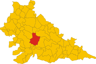
Castellucchio (Castellucchio)
.svg)
- Italian comune
 Hiking in Castellucchio
Castellucchio, located in the Lombardy region of Italy, is not as widely known for hiking as some other areas in the country, but it offers a unique experience for those looking to explore the Italian countryside. While it may not boast towering mountains, there are several trails and natural landscapes that can be enjoyable for hikers seeking a peaceful retreat.
Hiking Opportunities in Castellucchio:
-
Local Trails: While specific hiking trails may vary, the surrounding countryside typically features rural paths, small hills, and scenic views of fields and farms. You can often find trails that connect small towns and offer a glimpse into the region's agricultural lifestyle.
-
Nature Reserves: Nearby natural areas and reserves may provide more structured hiking paths. The area around Castellucchio is part of the Po River basin, where you can find wetland habitats offering opportunities for wildlife observation and leisurely walks.
-
Cultural and Historical Sites: Hiking in Castellucchio can also be combined with visits to historical landmarks. Exploring the villages in the surrounding area can add a cultural dimension to your hike, as you encounter ancient churches, castles, and traditional architecture.
-
Accessibility: Castellucchio’s flat terrain is ideal for all levels of hikers, including families and beginners. Make sure to wear comfortable footwear, as some paths may be unpaved or have uneven surfaces.
-
Local Maps and Guidance: It’s always a good idea to check local resources, such as tourist information centers or local hiking clubs, for maps and advice on the best routes. They can provide insight into seasonal hiking conditions and any guided tours available.
Recommendations:
- Timing: The best times to hike in this region are during the spring and autumn months when the weather is mild and the landscapes are particularly beautiful.
- Stay Hydrated: Bring plenty of water and snacks, especially if you plan to hike during warmer months.
- Respect Nature: Follow Leave No Trace principles to keep the natural environment pristine for others to enjoy.
If you're planning a hike in or around Castellucchio, consider combining your experience with some local cuisine and exploring the cultural heritage of the area. Enjoy your adventure!
- Country:

- Postal Code: 46014
- Local Dialing Code: 0376
- Licence Plate Code: MN
- Coordinates: 45° 9' 0" N, 10° 39' 0" E


- GPS tracks (wikiloc): [Link]
- AboveSeaLevel: 26 м m
- Area: 46.34 sq km
- Population: 5235
- Web site: http://www.comune.castelluccioinferiore.pz.it
- Wikipedia en: wiki(en)
- Wikipedia: wiki(it)
- Wikidata storage: Wikidata: Q42261
- Wikipedia Commons Category: [Link]
- Freebase ID: [/m/0gj_x7]
- GeoNames ID: Alt: [6536588]
- OSM relation ID: [44333]
- UN/LOCODE: [ITCLU]
- ISTAT ID: 020016
- Italian cadastre code: C195
Shares border with regions:


Rodigo
- Italian comune
Hiking in Rodigo
Rodigo is a small town in the Lombardy region of Italy, known for its historical architecture and charming countryside. While it's not a major hiking destination like the nearby Alps or National Parks, there are still opportunities for hiking and enjoying nature in the surrounding areas....
- Country:
- Postal Code: 46040
- Local Dialing Code: 0376
- Licence Plate Code: MN
- Coordinates: 45° 12' 0" N, 10° 38' 0" E
- GPS tracks (wikiloc): [Link]
- AboveSeaLevel: 31 м m
- Area: 41.61 sq km
- Population: 5272
- Web site: [Link]


Gazoldo degli Ippoliti
- Italian comune
Hiking in Gazoldo degli Ippoliti
Gazoldo degli Ippoliti is a charming town in the Lombardy region of Italy, surrounded by a picturesque landscape ideal for hiking. While the town itself might not be a major hiking destination, the surrounding countryside offers beautiful trails and scenic routes that are perfect for outdoor enthusiasts....
- Country:
- Postal Code: 46040
- Local Dialing Code: 0376
- Licence Plate Code: MN
- Coordinates: 45° 12' 0" N, 10° 35' 0" E
- GPS tracks (wikiloc): [Link]
- AboveSeaLevel: 35 м m
- Area: 13.03 sq km
- Population: 2970
- Web site: [Link]


Marcaria
- Italian comune
Hiking in Marcaria
Marcaria is a small town located in the Lombardy region of Italy. While it may not be a well-known hiking destination, it is surrounded by beautiful landscapes and natural areas that can provide a pleasant experience for hikers....
- Country:
- Postal Code: 46010
- Local Dialing Code: 0376
- Licence Plate Code: MN
- Coordinates: 45° 7' 0" N, 10° 32' 0" E
- GPS tracks (wikiloc): [Link]
- AboveSeaLevel: 25 м m
- Area: 89.79 sq km
- Population: 6591
- Web site: [Link]
Curtatone
- Italian comune
Hiking in Curtatone
Curtatone is a picturesque town located in the Emilia-Romagna region of Italy, near the city of Mantua (Mantova). While it may not be as famous for hiking as some mountainous regions, the area offers delightful walking and hiking opportunities, particularly for those who enjoy exploring flat terrains, rural landscapes, and cultural sites....
- Country:
- Postal Code: 46010
- Local Dialing Code: 0376
- Licence Plate Code: MN
- Coordinates: 45° 9' 0" N, 10° 43' 0" E
- GPS tracks (wikiloc): [Link]
- AboveSeaLevel: 26 м m
- Area: 67.47 sq km
- Population: 14796
- Web site: [Link]