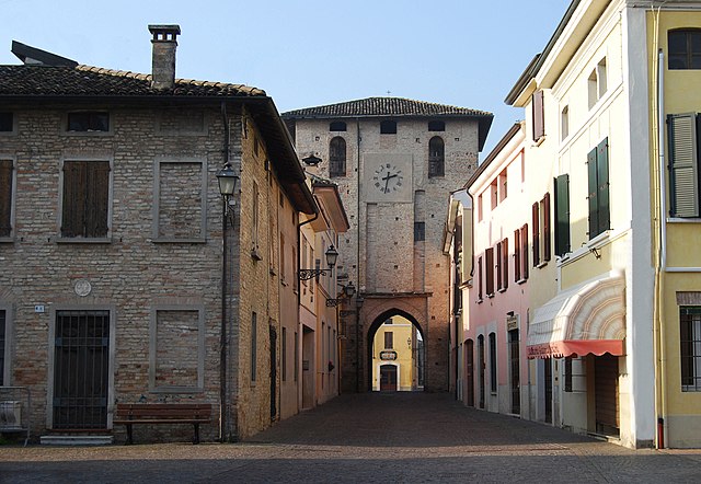
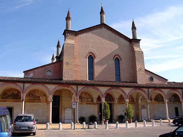
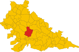
Rodigo (Rodigo)
.svg)
- Italian comune
 Hiking in Rodigo
Rodigo is a small town in the Lombardy region of Italy, known for its historical architecture and charming countryside. While it's not a major hiking destination like the nearby Alps or National Parks, there are still opportunities for hiking and enjoying nature in the surrounding areas.
Hiking in and around Rodigo
-
Local Trails: You can find several local paths and trails that can be explored on foot. Look for marked trails in the countryside where you can enjoy beautiful landscapes of fields, vineyards, and traditional Italian farmhouses.
-
Parco dell'Oglio Sud: This nearby regional park offers several walking and biking trails along the Oglio River. It's an excellent spot for nature lovers, where you can see various wildlife and plant species.
-
Grotte di Catullo: Though a little further away, the Grotte di Catullo in Sirmione, located by Lake Garda, presents fantastic views and scenic trails. It’s an excellent day trip from Rodigo if you're looking for a more extensive hiking experience.
-
Cultural Walks: Enjoy a hiking experience that combines nature with history by exploring the medieval sites in Rodigo. You can walk around the town, visiting historical landmarks, and enjoy the local cuisine at the end of your hike.
Tips for Hiking in Rodigo
-
Maps and Guides: Check local tourist information for maps of hiking trails, as some paths may not be marked as clearly as in more touristy hiking areas.
-
Weather: The weather in Lombardy can vary greatly; spring and fall are ideal for hiking. Summers can be hot, and winters might present snowy conditions.
-
Gear: Wear comfortable hiking shoes and bring enough water and snacks, especially if you plan to hike the longer trails.
-
Respect the Environment: Always stick to marked paths and practice Leave No Trace principles to preserve the natural beauty of the area.
If you plan your hike accordingly, you can enjoy a peaceful day surrounded by the beautiful Italian landscape.
- Country:

- Postal Code: 46040
- Local Dialing Code: 0376
- Licence Plate Code: MN
- Coordinates: 45° 12' 0" N, 10° 38' 0" E


- GPS tracks (wikiloc): [Link]
- AboveSeaLevel: 31 м m
- Area: 41.61 sq km
- Population: 5272
- Web site: http://www.comune.rodigo.mn.it
- Wikipedia en: wiki(en)
- Wikipedia: wiki(it)
- Wikidata storage: Wikidata: Q42324
- Wikipedia Commons Category: [Link]
- Freebase ID: [/m/0gk0n1]
- GeoNames ID: Alt: [6536223]
- VIAF ID: Alt: [234787087]
- OSM relation ID: [44361]
- UN/LOCODE: [ITRGX]
- ISTAT ID: 020051
- Italian cadastre code: H481
Shares border with regions:
Porto Mantovano
- Italian comune
Hiking in Porto Mantovano
Hiking in Porto Mantovano offers a blend of natural beauty, cultural heritage, and picturesque landscapes. Located in the Lombardy region of Italy, near the city of Mantua, this area is characterized by its gentle hills, agricultural lands, and tranquil waterways....
- Country:
- Postal Code: 46047
- Local Dialing Code: 0376
- Licence Plate Code: MN
- Coordinates: 45° 11' 48" N, 10° 47' 38" E
- GPS tracks (wikiloc): [Link]
- AboveSeaLevel: 29 м m
- Area: 37.44 sq km
- Population: 16479
- Web site: [Link]


Castellucchio
- Italian comune
Hiking in Castellucchio
Castellucchio, located in the Lombardy region of Italy, is not as widely known for hiking as some other areas in the country, but it offers a unique experience for those looking to explore the Italian countryside. While it may not boast towering mountains, there are several trails and natural landscapes that can be enjoyable for hikers seeking a peaceful retreat....
- Country:
- Postal Code: 46014
- Local Dialing Code: 0376
- Licence Plate Code: MN
- Coordinates: 45° 9' 0" N, 10° 39' 0" E
- GPS tracks (wikiloc): [Link]
- AboveSeaLevel: 26 м m
- Area: 46.34 sq km
- Population: 5235
- Web site: [Link]

Ceresara
- Italian comune
Hiking in Ceresara
Ceresara is a charming village located in the Lombardy region of Italy, near the banks of the Po River. While it may not be as well-known as some of Italy’s more famous hiking destinations, the surrounding areas offer a variety of trails and natural landscapes for outdoor enthusiasts to explore....
- Country:
- Postal Code: 46040
- Local Dialing Code: 0376
- Licence Plate Code: MN
- Coordinates: 45° 15' 44" N, 10° 34' 10" E
- GPS tracks (wikiloc): [Link]
- AboveSeaLevel: 44 м m
- Area: 37.31 sq km
- Population: 2609
- Web site: [Link]


Gazoldo degli Ippoliti
- Italian comune
Hiking in Gazoldo degli Ippoliti
Gazoldo degli Ippoliti is a charming town in the Lombardy region of Italy, surrounded by a picturesque landscape ideal for hiking. While the town itself might not be a major hiking destination, the surrounding countryside offers beautiful trails and scenic routes that are perfect for outdoor enthusiasts....
- Country:
- Postal Code: 46040
- Local Dialing Code: 0376
- Licence Plate Code: MN
- Coordinates: 45° 12' 0" N, 10° 35' 0" E
- GPS tracks (wikiloc): [Link]
- AboveSeaLevel: 35 м m
- Area: 13.03 sq km
- Population: 2970
- Web site: [Link]


Goito
- Italian comune
Hiking in Goito
Goito is a charming municipality located in the Lombardy region of northern Italy. While it is not as well-known for hiking as some of the more prominent regions in Italy (like the Dolomites or the Aosta Valley), there are still opportunities for outdoor enthusiasts to explore the natural beauty of the area....
- Country:
- Postal Code: 46044
- Local Dialing Code: 0376
- Licence Plate Code: MN
- Coordinates: 45° 15' 0" N, 10° 40' 0" E
- GPS tracks (wikiloc): [Link]
- AboveSeaLevel: 33 м m
- Area: 79.22 sq km
- Population: 10222
- Web site: [Link]
Curtatone
- Italian comune
Hiking in Curtatone
Curtatone is a picturesque town located in the Emilia-Romagna region of Italy, near the city of Mantua (Mantova). While it may not be as famous for hiking as some mountainous regions, the area offers delightful walking and hiking opportunities, particularly for those who enjoy exploring flat terrains, rural landscapes, and cultural sites....
- Country:
- Postal Code: 46010
- Local Dialing Code: 0376
- Licence Plate Code: MN
- Coordinates: 45° 9' 0" N, 10° 43' 0" E
- GPS tracks (wikiloc): [Link]
- AboveSeaLevel: 26 м m
- Area: 67.47 sq km
- Population: 14796
- Web site: [Link]