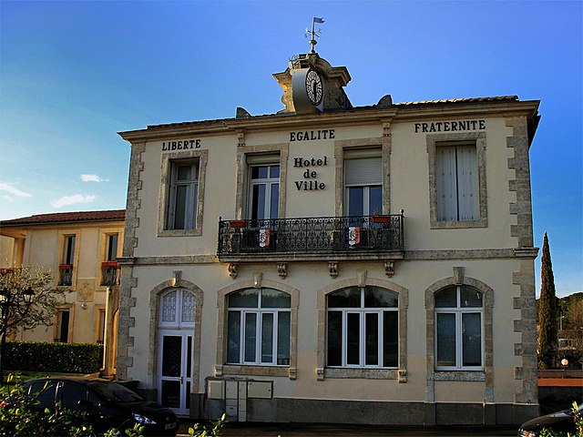
Castelnau-le-Lez (Castelnau-le-Lez)

- commune in Hérault, France
- Country:

- Postal Code: 34170
- Coordinates: 43° 38' 10" N, 3° 54' 5" E


- GPS tracks (wikiloc): [Link]
- Area: 11.18 sq km
- Population: 19504
- Web site: http://www.castelnau-le-lez.fr
- Wikipedia en: wiki(en)
- Wikipedia: wiki(fr)
- Wikidata storage: Wikidata: Q474555
- Wikipedia Commons Category: [Link]
- Freebase ID: [/m/03mgnwr]
- Freebase ID: [/m/03mgnwr]
- GeoNames ID: Alt: [3028337]
- GeoNames ID: Alt: [3028337]
- SIREN number: [213400575]
- SIREN number: [213400575]
- BnF ID: [15256658n]
- BnF ID: [15256658n]
- VIAF ID: Alt: [150156120]
- VIAF ID: Alt: [150156120]
- OSM relation ID: [28810]
- OSM relation ID: [28810]
- GND ID: Alt: [4669218-6]
- GND ID: Alt: [4669218-6]
- Library of Congress authority ID: Alt: [n85046793]
- Library of Congress authority ID: Alt: [n85046793]
- SUDOC authorities ID: [086199773]
- SUDOC authorities ID: [086199773]
- Twitter username: Alt: [CastelnauleLez]
- Twitter username: Alt: [CastelnauleLez]
- INSEE municipality code: 34057
- INSEE municipality code: 34057
Shares border with regions:


Le Crès
- commune in Hérault, France
- Country:
- Postal Code: 34920
- Coordinates: 43° 38' 50" N, 3° 56' 21" E
- GPS tracks (wikiloc): [Link]
- Area: 5.84 sq km
- Population: 9220
- Web site: [Link]


Saint-Aunès
- commune in Hérault, France
- Country:
- Postal Code: 34130
- Coordinates: 43° 38' 24" N, 3° 57' 55" E
- GPS tracks (wikiloc): [Link]
- Area: 12.32 sq km
- Population: 3212
- Web site: [Link]
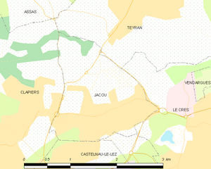
Jacou
- commune in Hérault, France
- Country:
- Postal Code: 34830
- Coordinates: 43° 39' 39" N, 3° 54' 37" E
- GPS tracks (wikiloc): [Link]
- Area: 3.43 sq km
- Population: 6756
- Web site: [Link]


Montpellier
- city in Hérault, France
- Country:
- Postal Code: 34090; 34080; 34070; 34000
- Local Dialing Code: 467
- Coordinates: 43° 36' 39" N, 3° 52' 38" E
- GPS tracks (wikiloc): [Link]
- AboveSeaLevel: 121 м m
- Area: 56.88 sq km
- Population: 277639
- Web site: [Link]


Clapiers
- commune in Hérault, France
- Country:
- Postal Code: 34830
- Coordinates: 43° 39' 27" N, 3° 53' 18" E
- GPS tracks (wikiloc): [Link]
- Area: 7.69 sq km
- Population: 5426
- Web site: [Link]