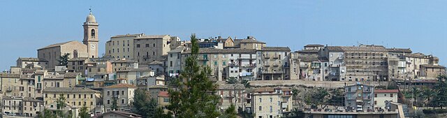
Castorano (Castorano)
.svg)
- Italian comune
 Hiking in Castorano
Castorano is a small town located in the Marche region of Italy, nestled in the foothills of the Apennine mountains. The area around Castorano offers a variety of hiking opportunities that cater to different skill levels, from leisurely strolls to more challenging treks.
Hiking Trails in Castorano:
-
Monte Ascensione:
- A popular hiking destination near Castorano, Monte Ascensione offers routes with stunning views of the surrounding landscapes. The trails vary in difficulty, with options for beginners as well as those seeking more strenuous hikes.
-
Parco Nazionale dei Monti Sibillini:
- While a bit further out, this national park is accessible from Castorano and features impressive mountain scenery, rich biodiversity, and numerous hiking trails. It's an excellent option for a day trip and offers everything from easy walks to demanding climbs.
-
Countryside Trails:
- The area surrounding Castorano is dotted with picturesque vineyards and olive groves. Many trails wind through this rural landscape, allowing hikers to enjoy the local flora and fauna as well as the beautiful views of the rolling hills.
Tips for Hiking in Castorano:
- Check the Weather: The weather can change quickly in the hills, so it's important to check the forecast before heading out.
- Footwear: Sturdy hiking shoes are recommended, as some trails may be rocky or uneven.
- Bring Water and Snacks: Staying hydrated and energized is key, especially on longer hikes.
- Local Maps: It's useful to have a detailed map or a GPS device, as some trails might not be well-marked.
- Respect Nature: Follow the “Leave No Trace” principles to preserve the beauty of the area.
Best Times to Hike:
- Spring (April to June): Ideal due to mild temperatures and blooming wildflowers.
- Autumn (September to November): Also a great time, with cooler weather and beautiful fall colors.
Hiking in and around Castorano can be a wonderful way to immerse yourself in the natural beauty of the Marche region while enjoying the local culture and cuisine afterward. Be sure to explore the local villages and try some regional dishes to round off your hiking experience!
- Country:

- Postal Code: 63081
- Local Dialing Code: 0736
- Licence Plate Code: AP
- Coordinates: 42° 53' 54" N, 13° 43' 39" E


- GPS tracks (wikiloc): [Link]
- AboveSeaLevel: 279 м m
- Area: 14.08 sq km
- Population: 2344
- Web site: http://www.comune.castorano.ap.it
- Wikipedia en: wiki(en)
- Wikipedia: wiki(it)
- Wikidata storage: Wikidata: Q56048
- Wikipedia Commons Gallery: [Link]
- Wikipedia Commons Category: [Link]
- Freebase ID: [/m/0gl7qs]
- GeoNames ID: Alt: [6540459]
- VIAF ID: Alt: [316603265]
- OSM relation ID: [42205]
- GND ID: Alt: [1153435853]
- Library of Congress authority ID: Alt: [no2017152140]
- Google Maps Customer ID: [501957189272713429]
- ISTAT ID: 044013
- Italian cadastre code: C331
Shares border with regions:
Castel di Lama
- Italian comune
Hiking in Castel di Lama
Castel di Lama, located in the Marche region of Italy, offers a beautiful setting for hiking enthusiasts. The area is characterized by rolling hills, lush greenery, and stunning views of the surrounding landscapes, including vineyards and olive groves....
- Country:
- Postal Code: 63082
- Local Dialing Code: 0736
- Licence Plate Code: AP
- Coordinates: 42° 52' 10" N, 13° 42' 48" E
- GPS tracks (wikiloc): [Link]
- AboveSeaLevel: 201 м m
- Area: 10.98 sq km
- Population: 8614
- Web site: [Link]
Colli del Tronto
- Italian comune
Hiking in Colli del Tronto
Colli del Tronto, located in the Marche region of Italy, is a beautiful area for hiking enthusiasts. The region is characterized by rolling hills, scenic landscapes, and a mix of natural and historical attractions. Here are some highlights and tips for hiking in Colli del Tronto:...
- Country:
- Postal Code: 63079
- Local Dialing Code: 0736
- Licence Plate Code: AP
- Coordinates: 42° 52' 41" N, 13° 44' 54" E
- GPS tracks (wikiloc): [Link]
- AboveSeaLevel: 168 м m
- Area: 5.94 sq km
- Population: 3696
- Web site: [Link]

Monsampolo del Tronto
- Italian comune
Hiking in Monsampolo del Tronto
Monsampolo del Tronto, located in the Marche region of Italy, offers a blend of beautiful landscapes, historical sites, and a rich cultural experience for hikers. Here’s what to consider for hiking in this area:...
- Country:
- Postal Code: 63077
- Local Dialing Code: 0735
- Licence Plate Code: AP
- Coordinates: 42° 53' 52" N, 13° 47' 38" E
- GPS tracks (wikiloc): [Link]
- AboveSeaLevel: 184 м m
- Area: 15.43 sq km
- Population: 4547
- Web site: [Link]


Offida
- Italian comune
Hiking in Offida
Offida is a charming medieval town located in the Marche region of Italy, known for its stunning landscape, rich history, and cultural heritage. It sits on a hilltop, offering breathtaking views of the surrounding countryside, making it an excellent destination for hiking enthusiasts....
- Country:
- Postal Code: 63073
- Local Dialing Code: 0736
- Licence Plate Code: AP
- Coordinates: 42° 56' 7" N, 13° 41' 31" E
- GPS tracks (wikiloc): [Link]
- AboveSeaLevel: 293 м m
- Area: 49.6 sq km
- Population: 4962
- Web site: [Link]


Spinetoli
- Italian comune
Hiking in Spinetoli
Spinetoli is a charming village located in the Marche region of Italy, known for its beautiful landscapes, rolling hills, and proximity to the Adriatic Sea. While it may not be as famous as some other hiking destinations, Spinetoli and its surrounding areas offer several opportunities for hiking enthusiasts....
- Country:
- Postal Code: 63078
- Local Dialing Code: 0736
- Licence Plate Code: AP
- Coordinates: 42° 53' 19" N, 13° 46' 23" E
- GPS tracks (wikiloc): [Link]
- AboveSeaLevel: 176 м m
- Area: 12.58 sq km
- Population: 7132
- Web site: [Link]
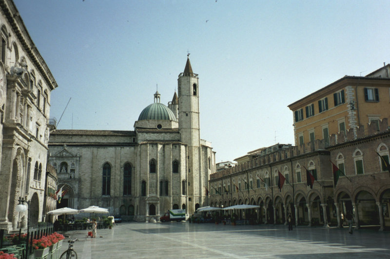

Ascoli Piceno
- Italian comune
Hiking in Ascoli Piceno
Ascoli Piceno, a charming town in the Marche region of Italy, offers a variety of hiking opportunities that allow you to explore its stunning landscapes, rich history, and charming villages. Here are some details about hiking in and around Ascoli Piceno:...
- Country:
- Postal Code: 63100
- Local Dialing Code: 0736
- Licence Plate Code: AP
- Coordinates: 42° 51' 17" N, 13° 34' 31" E
- GPS tracks (wikiloc): [Link]
- AboveSeaLevel: 154 м m
- Area: 158.02 sq km
- Population: 48773
- Web site: [Link]