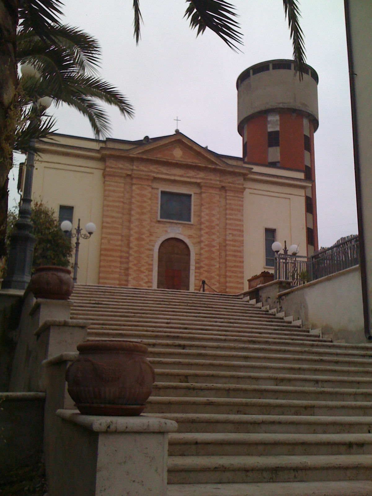
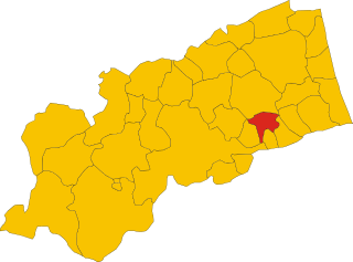
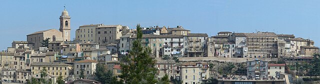
Spinetoli (Spinetoli)
.svg)
- Italian comune
 Hiking in Spinetoli
Spinetoli is a charming village located in the Marche region of Italy, known for its beautiful landscapes, rolling hills, and proximity to the Adriatic Sea. While it may not be as famous as some other hiking destinations, Spinetoli and its surrounding areas offer several opportunities for hiking enthusiasts.
Hiking Trails
-
Mount Ascensione: Close to Spinetoli, this mountain offers various trails that vary in difficulty. Hikers can enjoy panoramic views of the surrounding valleys and the Adriatic coastline.
-
Local Nature Reserves: The nearby Nature Reserve of Foce del Chienti provides a mix of coastal and forested trails. It's ideal for those looking to explore diverse ecosystems.
-
Historical Routes: Some trails connect Spinetoli with nearby historical sites and other villages, allowing hikers to enjoy both nature and cultural heritage.
Recommendations
-
Trail Difficulty: Be sure to check trail difficulty ratings and choose according to your fitness level. There are options for both beginners and more experienced hikers.
-
Best Time to Hike: Late spring (May to June) and early autumn (September to October) are ideal times for hiking in this region, with mild weather and fewer crowds.
-
Local Guides: Consider hiring a local guide or joining a hiking group for a richer experience. They can provide insights into the area's history, flora, and fauna.
-
Safety Precautions: Always bring enough water, wear suitable footwear, and inform someone about your hiking plans. Mobile service might be limited in some areas, so plan accordingly.
Conclusion
Overall, hiking in Spinetoli can be a delightful experience, especially for those who appreciate stunning landscapes and a touch of Italian culture. Whether you’re seeking a relaxing stroll or a more challenging hike, you’re likely to find something that suits your preferences in this lovely part of the Marche region.
- Country:

- Postal Code: 63078
- Local Dialing Code: 0736
- Licence Plate Code: AP
- Coordinates: 42° 53' 19" N, 13° 46' 23" E


- GPS tracks (wikiloc): [Link]
- AboveSeaLevel: 176 м m
- Area: 12.58 sq km
- Population: 7132
- Web site: http://www.comune.spinetoli.ap.it/
- Wikipedia en: wiki(en)
- Wikipedia: wiki(it)
- Wikidata storage: Wikidata: Q56090
- Wikipedia Commons Gallery: [Link]
- Wikipedia Commons Category: [Link]
- Freebase ID: [/m/0gl8yh]
- GeoNames ID: Alt: [6536806]
- VIAF ID: Alt: [236131161]
- OSM relation ID: [42202]
- UN/LOCODE: [ITTLI]
- Google Maps Customer ID: [1284086623892335341]
- ISTAT ID: 044071
- Italian cadastre code: I912
Shares border with regions:

Ancarano
- Italian comune
Hiking in Ancarano
Ancarano, a small town in the Abruzzo region of Italy, is surrounded by beautiful natural landscapes that offer great opportunities for hiking enthusiasts. The area is characterized by rolling hills, lush greenery, and stunning views of the Gran Sasso and Monti della Laga National Park, making it an ideal destination for outdoor activities....
- Country:
- Postal Code: 64010
- Local Dialing Code: 0861
- Licence Plate Code: TE
- Coordinates: 42° 50' 13" N, 13° 44' 25" E
- GPS tracks (wikiloc): [Link]
- AboveSeaLevel: 294 м m
- Area: 13.92 sq km
- Population: 1890
- Web site: [Link]
Controguerra
- Italian comune
Hiking in Controguerra
Controguerra is a small town located in the Abruzzo region of Italy, nestled between the Apennine mountains and the Adriatic Sea. It offers a range of hiking opportunities, combining beautiful landscapes with cultural experiences....
- Country:
- Postal Code: 64010
- Local Dialing Code: 0861
- Licence Plate Code: TE
- Coordinates: 42° 51' 0" N, 13° 49' 0" E
- GPS tracks (wikiloc): [Link]
- AboveSeaLevel: 267 м m
- Area: 22.82 sq km
- Population: 2365
- Web site: [Link]

Castorano
- Italian comune
Hiking in Castorano
Castorano is a small town located in the Marche region of Italy, nestled in the foothills of the Apennine mountains. The area around Castorano offers a variety of hiking opportunities that cater to different skill levels, from leisurely strolls to more challenging treks....
- Country:
- Postal Code: 63081
- Local Dialing Code: 0736
- Licence Plate Code: AP
- Coordinates: 42° 53' 54" N, 13° 43' 39" E
- GPS tracks (wikiloc): [Link]
- AboveSeaLevel: 279 м m
- Area: 14.08 sq km
- Population: 2344
- Web site: [Link]
Colli del Tronto
- Italian comune
Hiking in Colli del Tronto
Colli del Tronto, located in the Marche region of Italy, is a beautiful area for hiking enthusiasts. The region is characterized by rolling hills, scenic landscapes, and a mix of natural and historical attractions. Here are some highlights and tips for hiking in Colli del Tronto:...
- Country:
- Postal Code: 63079
- Local Dialing Code: 0736
- Licence Plate Code: AP
- Coordinates: 42° 52' 41" N, 13° 44' 54" E
- GPS tracks (wikiloc): [Link]
- AboveSeaLevel: 168 м m
- Area: 5.94 sq km
- Population: 3696
- Web site: [Link]

Monsampolo del Tronto
- Italian comune
Hiking in Monsampolo del Tronto
Monsampolo del Tronto, located in the Marche region of Italy, offers a blend of beautiful landscapes, historical sites, and a rich cultural experience for hikers. Here’s what to consider for hiking in this area:...
- Country:
- Postal Code: 63077
- Local Dialing Code: 0735
- Licence Plate Code: AP
- Coordinates: 42° 53' 52" N, 13° 47' 38" E
- GPS tracks (wikiloc): [Link]
- AboveSeaLevel: 184 м m
- Area: 15.43 sq km
- Population: 4547
- Web site: [Link]


Offida
- Italian comune
Hiking in Offida
Offida is a charming medieval town located in the Marche region of Italy, known for its stunning landscape, rich history, and cultural heritage. It sits on a hilltop, offering breathtaking views of the surrounding countryside, making it an excellent destination for hiking enthusiasts....
- Country:
- Postal Code: 63073
- Local Dialing Code: 0736
- Licence Plate Code: AP
- Coordinates: 42° 56' 7" N, 13° 41' 31" E
- GPS tracks (wikiloc): [Link]
- AboveSeaLevel: 293 м m
- Area: 49.6 sq km
- Population: 4962
- Web site: [Link]