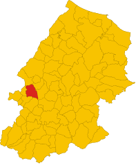
Castropignano (Castropignano)
.svg)
- Italian comune
 Hiking in Castropignano
Castropignano is a charming village located in the Molise region of Italy, surrounded by stunning landscapes and natural beauty. The area is rich in history, with medieval architecture and picturesque views that make it an attractive destination for hiking enthusiasts.
Hiking Trails
-
Local Trails: There are several trails around Castropignano that vary in difficulty. Many of these paths wind through lush forests, hills, and offer panoramic views of the surrounding countryside.
-
Nature Reserves: The nearby areas may include nature reserves that provide trails with marked paths where you can observe local flora and fauna. Look for trails that lead to scenic overlooks or spots that reveal the region’s natural beauty.
-
Historical Walks: In addition to natural trails, there are routes that take you through the village itself, allowing you to explore historical sites, such as ancient churches and castles, while enjoying the local architecture.
Preparation Tips
-
Map and Navigation: While many trails are marked, it's always good to carry a map or GPS device. Be sure to check local resources for trail maps.
-
Local Advice: Engage with local guides or hiking clubs for up-to-date information on trail conditions and recommendations.
-
Footwear: Wear proper hiking shoes with good grip. The terrain can vary, and sturdy footwear helps with stability.
-
Water and Snacks: Carry sufficient water and snacks, especially if you plan on hiking longer trails.
Best Seasons to Hike
Spring (March to June) and fall (September to November) are the ideal times for hiking in Castropignano. The weather tends to be mild and the landscapes vibrant, providing a comfortable experience.
Cultural Insights
While hiking, take the opportunity to interact with locals and learn about their culture and traditions. You might discover regional culinary delights or even local festivals if your visit coincides with special events.
Overall, hiking in Castropignano can be a rewarding experience filled with natural beauty, history, and cultural exploration. Just make sure to prepare appropriately for your adventure!
- Country:

- Postal Code: 86010
- Local Dialing Code: 0874
- Licence Plate Code: CB
- Coordinates: 41° 37' 0" N, 14° 34' 0" E


- GPS tracks (wikiloc): [Link]
- AboveSeaLevel: 590 м m
- Area: 26.96 sq km
- Population: 922
- Web site: http://www.comunecastropignano.cb.it
- Wikipedia en: wiki(en)
- Wikipedia: wiki(it)
- Wikidata storage: Wikidata: Q277456
- Wikipedia Commons Category: [Link]
- Freebase ID: [/m/0gnns9]
- GeoNames ID: Alt: [6538903]
- VIAF ID: Alt: [239263979]
- OSM relation ID: [41399]
- GND ID: Alt: [7726635-3]
- WOEID: [713565]
- Digital Atlas of the Roman Empire ID: [26469]
- ISTAT ID: 070016
- Italian cadastre code: C346
Shares border with regions:
Busso
- Italian comune
Hiking in Busso
Busso, a region in Western Australia, is known for its scenic beauty and hiking opportunities. While it might not be as internationally recognized as some other hiking destinations, it offers several trails and experiences for outdoor enthusiasts. Here are some highlights regarding hiking in and around Busso:...
- Country:
- Postal Code: 86010
- Local Dialing Code: 0874
- Licence Plate Code: CB
- Coordinates: 41° 33' 0" N, 14° 33' 0" E
- GPS tracks (wikiloc): [Link]
- AboveSeaLevel: 756 м m
- Area: 23.81 sq km
- Population: 1214
- Web site: [Link]
Casalciprano
- Italian comune
Hiking in Casalciprano
Casalciprano is a small town located in the Molise region of Italy. While it may not be widely known for hiking, the surrounding area boasts beautiful landscapes, rolling hills, and nature trails that can offer a great experience for hikers of all skill levels. Here are some highlights and tips for hiking in and around Casalciprano:...
- Country:
- Postal Code: 86010
- Local Dialing Code: 0874
- Licence Plate Code: CB
- Coordinates: 41° 35' 0" N, 14° 32' 0" E
- GPS tracks (wikiloc): [Link]
- AboveSeaLevel: 662 м m
- Area: 19.07 sq km
- Population: 534
- Web site: [Link]

Fossalto
- Italian comune
Hiking in Fossalto
Fossalto is a charming municipality located in the Molise region of Italy, known for its picturesque landscapes and beautiful natural surroundings. Hiking in Fossalto offers a unique opportunity to explore the rugged terrain, lush forests, and stunning views of the Italian countryside....
- Country:
- Postal Code: 86020
- Local Dialing Code: 0874
- Licence Plate Code: CB
- Coordinates: 41° 40' 0" N, 14° 33' 0" E
- GPS tracks (wikiloc): [Link]
- AboveSeaLevel: 511 м m
- Area: 28.33 sq km
- Population: 1296
- Web site: [Link]


Limosano
- Italian comune
Hiking in Limosano
Limosano is a picturesque village in the Molise region of Italy, known for its beautiful landscapes and rich history. Hiking in and around Limosano offers a unique opportunity to explore the natural beauty of central Italy, combined with cultural experiences....
- Country:
- Postal Code: 86022
- Local Dialing Code: 0874
- Licence Plate Code: CB
- Coordinates: 41° 41' 0" N, 14° 37' 0" E
- GPS tracks (wikiloc): [Link]
- AboveSeaLevel: 687 м m
- Area: 28.27 sq km
- Population: 744
- Web site: [Link]


Oratino
- Italian comune
Hiking in Oratino
Oratino is a charming village located in the province of Campobasso in the Molise region of Italy. It is known for its beautiful landscapes, historic architecture, and rich cultural heritage, making it an excellent destination for hiking enthusiasts....
- Country:
- Postal Code: 86010
- Local Dialing Code: 0874
- Licence Plate Code: CB
- Coordinates: 41° 35' 0" N, 14° 35' 0" E
- GPS tracks (wikiloc): [Link]
- AboveSeaLevel: 789 м m
- Area: 17.89 sq km
- Population: 1682
- Web site: [Link]
Ripalimosani
- Italian comune
Hiking in Ripalimosani
Ripalimosani is a small municipality located in the Molise region of Italy, nestled in the Apennine mountains. It offers a beautiful backdrop for hiking, featuring a mix of lush landscapes, rolling hills, and historical sites. Here’s what you can expect when hiking in Ripalimosani:...
- Country:
- Postal Code: 86025
- Local Dialing Code: 0874
- Licence Plate Code: CB
- Coordinates: 41° 37' 0" N, 14° 40' 0" E
- GPS tracks (wikiloc): [Link]
- AboveSeaLevel: 640 м m
- Area: 33.83 sq km
- Population: 3102
- Web site: [Link]
Torella del Sannio
- Italian comune
Hiking in Torella del Sannio
Torella del Sannio is a charming village located in the Molise region of Italy, surrounded by picturesque landscapes and natural beauty, making it an excellent destination for hiking enthusiasts. Here are some highlights and tips for hiking in and around Torella del Sannio:...
- Country:
- Postal Code: 86028
- Local Dialing Code: 0874
- Licence Plate Code: CB
- Coordinates: 41° 38' 0" N, 14° 31' 0" E
- GPS tracks (wikiloc): [Link]
- AboveSeaLevel: 837 м m
- Area: 16.73 sq km
- Population: 759
- Web site: [Link]


Campobasso
- Italian comune
Hiking in Campobasso
Campobasso, the capital of the Molise region in Italy, offers a variety of hiking opportunities set against a backdrop of beautiful landscapes, historical sites, and a rich natural environment. Here are some highlights of hiking in and around Campobasso:...
- Country:
- Postal Code: 86100
- Local Dialing Code: 0874
- Licence Plate Code: CB
- Coordinates: 41° 33' 40" N, 14° 40' 6" E
- GPS tracks (wikiloc): [Link]
- AboveSeaLevel: 701 м m
- Area: 56.11 sq km
- Population: 49320
- Web site: [Link]