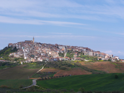
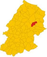
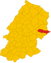
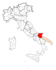
Province of Campobasso (provincia di Campobasso)

- province of Italy
 Hiking in Province of Campobasso
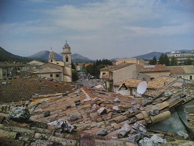
The Province of Campobasso, located in the Molise region of Italy, offers a range of hiking opportunities for both beginners and experienced trekkers. The area is characterized by its stunning landscapes, which include mountains, forests, and picturesque villages. Here are some highlights to consider for hiking in this region:
Natural Attractions
-
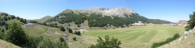
Pizzo Campello: This is the highest peak in the Matese mountain range. The trails here offer both challenging hikes and rewarding views of the surrounding valleys and mountains. The diverse flora and fauna make it an excellent spot for nature lovers.
-
Parco Nazionale del Matese: This national park is a great destination for hiking, featuring numerous trails that traverse varied landscapes, from rocky ridges to lush valleys. Wildlife watching is a bonus, as the park is home to species such as deer and many bird species.
-
Forests of Civitella Alfedena: This area has well-marked trails through ancient forests, where you can enjoy the serenity of nature and the opportunity to see local wildlife.
Cultural Aspects
-
Historic Villages: Many hiking trails in Campobasso take you through charming towns and villages, such as Campobasso itself, which has historical significance and architecture worth exploring. Along the way, you can experience local culture and cuisine.
-
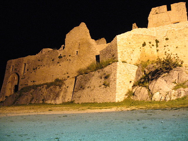
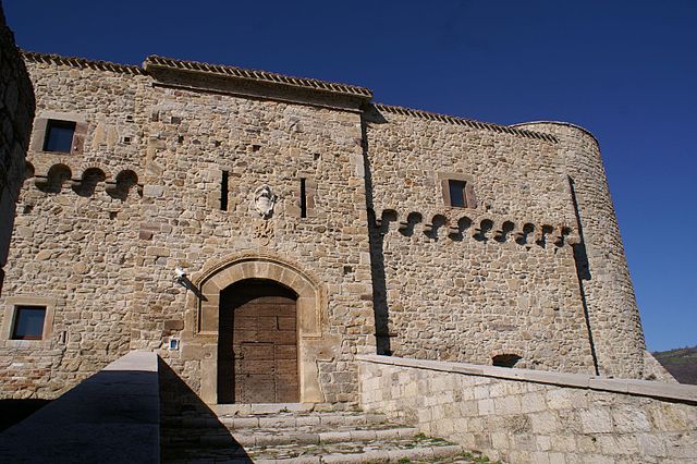
Castles and Ruins: Some hikes lead to historical sites like Castello Monforte in Campobasso or the ruins in nearby towns, adding a cultural dimension to your outdoor experience.
Hiking Tips
-
Preparation: Ensure you have a good map or a reliable GPS device since some trails may not be well-marked. Check local guides for trail conditions and advice.
-
Gear: Wear sturdy hiking boots and carry plenty of water, snacks, and a first-aid kit. Depending on the season, dress in layers, as temperatures can vary dramatically.
-
Best Time to Hike: Spring (April to June) and fall (September to October) are the best seasons for hiking in Campobasso, as the weather is mild and the landscapes are particularly beautiful.
-
Guided Tours: If you prefer to explore with a guide, there are local hiking organizations that offer guided tours, which can enhance your experience by providing insights into the natural and cultural history of the area.
Overall, hiking in the Province of Campobasso allows for a blend of adventure, nature, and culture, making it a rewarding destination for outdoor enthusiasts.
- Country:

- Capital: Campobasso
- Postal Code: 86049; 86010; 86100
- Local Dialing Code: 0875; 0874
- Licence Plate Code: CB
- Coordinates: 41° 34' 0" N, 14° 40' 0" E


- GPS tracks (wikiloc): [Link]
- Area: 2908.80 sq km
- Web site: http://www.provincia.campobasso.it/
- Wikipedia en: wiki(en)
- Wikipedia: wiki(it)
- Wikidata storage: Wikidata: Q16151
- Wikipedia Commons Gallery: [Link]
- Wikipedia Commons Category: [Link]
- Freebase ID: [/m/052fnk]
- GeoNames ID: Alt: [3180990]
- VIAF ID: Alt: [144232064]
- GND ID: Alt: [7551352-3]
- archINFORM location ID: [7739]
- MusicBrainz area ID: [b07bc026-bae1-4dbc-8271-194d479b901f]
- SUDOC authorities ID: [135709091]
- ISNI: Alt: [0000 0004 1775 1548]
- NUTS code: [ITF22]
- Ringgold ID: [260575]
- ISTAT ID: 070
- ISO 3166-2 code: IT-CB
Includes regions:

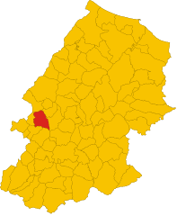
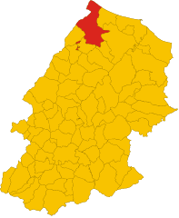
Termoli
- Italian comune
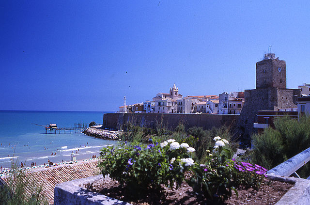
Hiking in Termoli
Termoli is a charming coastal town located in the Molise region of Italy, known for its beautiful beaches, historic architecture, and stunning views of the Adriatic Sea. While Termoli itself may not be renowned specifically for hiking, there are several opportunities for outdoor enthusiasts in the surrounding areas and nearby countryside. Here are some highlights for hiking in and around Termoli:...
- Country:
- Postal Code: 86039
- Local Dialing Code: 0875
- Licence Plate Code: CB
- Coordinates: 42° 0' 10" N, 14° 59' 41" E
- GPS tracks (wikiloc): [Link]
- AboveSeaLevel: 15 м m
- Area: 55.64 sq km
- Population: 33583
- Web site: [Link]
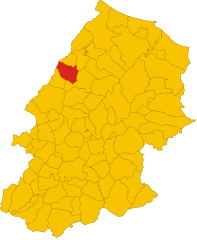
Pietracatella
- Italian comune
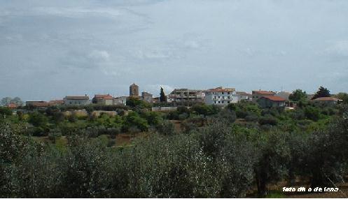
Hiking in Pietracatella
Pietracatella is a small town located in the Molise region of Italy, surrounded by beautiful landscapes that are ideal for hiking enthusiasts. The area is known for its rolling hills, ancient paths, and scenic views of the surrounding countryside....
- Country:
- Postal Code: 86040
- Local Dialing Code: 0874
- Licence Plate Code: CB
- Coordinates: 41° 35' 0" N, 14° 52' 0" E
- GPS tracks (wikiloc): [Link]
- AboveSeaLevel: 666 м m
- Area: 50.28 sq km
- Population: 1307
- Web site: [Link]


Lupara, Molise
- Italian comune
Hiking in Lupara, Molise
Hiking in the region of Molise, particularly in and around Lupara, offers a unique experience for outdoor enthusiasts. Molise is often less crowded than other Italian regions, providing a more tranquil and pristine natural environment....
- Country:
- Postal Code: 86030
- Local Dialing Code: 0874
- Licence Plate Code: CB
- Coordinates: 41° 46' 0" N, 14° 44' 0" E
- GPS tracks (wikiloc): [Link]
- AboveSeaLevel: 505 м m
- Area: 25.87 sq km
- Population: 483
- Web site: [Link]
Lucito
- Italian comune
Hiking in Lucito
Lucito is a small town located in the Molise region of Italy. While it may not be as well-known for hiking as other Italian destinations, the surrounding landscapes offer beautiful opportunities for outdoor activities, including hiking....
- Country:
- Postal Code: 86030
- Local Dialing Code: 0874
- Licence Plate Code: CB
- Coordinates: 41° 44' 0" N, 14° 41' 0" E
- GPS tracks (wikiloc): [Link]
- AboveSeaLevel: 480 м m
- Area: 31.56 sq km
- Population: 666
- Web site: [Link]
Sant’Elia a Pianisi
- Italian comune
Hiking in Sant’Elia a Pianisi
Sant'Elia a Pianisi is a charming town located in the Molise region of Italy. While it may not be the most famous hiking destination, it offers a beautiful natural landscape and some opportunities for outdoor activities. If you're interested in hiking in this area, here are some insights:...
- Country:
- Postal Code: 86048
- Local Dialing Code: 0874
- Licence Plate Code: CB
- Coordinates: 41° 37' 17" N, 14° 52' 34" E
- GPS tracks (wikiloc): [Link]
- AboveSeaLevel: 666 м m
- Area: 68.25 sq km
- Population: 1732
- Web site: [Link]
Ripabottoni
- Italian comune
Hiking in Ripabottoni
Ripabottoni is a small town located in the Molise region of Italy, surrounded by the beautiful Apennine Mountains and lush countryside, making it an excellent destination for hiking enthusiasts. Here are some key points to consider when planning a hiking trip in Ripabottoni:...
- Country:
- Postal Code: 86040
- Local Dialing Code: 0874
- Licence Plate Code: CB
- Coordinates: 41° 41' 0" N, 14° 49' 0" E
- GPS tracks (wikiloc): [Link]
- AboveSeaLevel: 695 м m
- Area: 31.96 sq km
- Population: 531
- Web site: [Link]


San Giovanni in Galdo
- Italian comune
Hiking in San Giovanni in Galdo
San Giovanni in Galdo is a charming village located in the Molise region of Italy, known for its beautiful landscapes, rural charm, and a variety of outdoor recreational opportunities, including hiking. Here are some key points to consider if you're planning to hike in or around San Giovanni in Galdo:...
- Country:
- Postal Code: 86010
- Local Dialing Code: 0874
- Licence Plate Code: CB
- Coordinates: 41° 35' 0" N, 14° 45' 0" E
- GPS tracks (wikiloc): [Link]
- AboveSeaLevel: 552 м m
- Area: 19.45 sq km
- Population: 556
- Web site: [Link]
Acquaviva Collecroce
- Italian comune
Hiking in Acquaviva Collecroce
Acquaviva Collecroce is a small village located in the Molise region of Italy, known for its stunning landscapes and diverse hiking opportunities. Nestled in the Apennine Mountains, the area offers several trails that showcase the natural beauty and cultural heritage of the region. Here are some highlights of hiking in and around Acquaviva Collecroce:...
- Country:
- Postal Code: 86030
- Local Dialing Code: 0875
- Licence Plate Code: CB
- Coordinates: 41° 52' 0" N, 14° 45' 0" E
- GPS tracks (wikiloc): [Link]
- AboveSeaLevel: 425 м m
- Area: 28.6 sq km
- Population: 644
- Web site: [Link]


Baranello
- Italian comune
Hiking in Baranello
Baranello is a charming village located in the Molise region of Italy, known for its picturesque landscapes and rich history. Hiking around Baranello offers opportunities to explore both natural beauty and historical sites. Here are some key points to consider when planning a hiking adventure in and around Baranello:...
- Country:
- Postal Code: 86011
- Local Dialing Code: 0874
- Licence Plate Code: CB
- Coordinates: 41° 32' 0" N, 14° 33' 0" E
- GPS tracks (wikiloc): [Link]
- AboveSeaLevel: 610 м m
- Area: 25 sq km
- Population: 2619
- Web site: [Link]

Bojano
- Italian comune
Hiking in Bojano
Bojano, located in the Molise region of Italy, offers a unique blend of natural beauty, rich history, and local culture, making it a worthwhile destination for hiking enthusiasts. Here are some highlights for hiking in and around Bojano:...
- Country:
- Postal Code: 86021
- Local Dialing Code: 0874
- Licence Plate Code: CB
- Coordinates: 41° 29' 0" N, 14° 28' 0" E
- GPS tracks (wikiloc): [Link]
- AboveSeaLevel: 480 м m
- Area: 52.63 sq km
- Population: 8178
- Web site: [Link]


Bonefro
- Italian comune
Hiking in Bonefro
Bonefro, a small town located in the province of Campobasso in the Molise region of Italy, offers beautiful hiking opportunities amidst a rich natural landscape. Here are some highlights for hiking in and around Bonefro:...
- Country:
- Postal Code: 86041
- Local Dialing Code: 0874
- Licence Plate Code: CB
- Coordinates: 41° 42' 15" N, 14° 56' 9" E
- GPS tracks (wikiloc): [Link]
- AboveSeaLevel: 631 м m
- Area: 31.28 sq km
- Population: 1331
- Web site: [Link]
Busso
- Italian comune
Hiking in Busso
Busso, a region in Western Australia, is known for its scenic beauty and hiking opportunities. While it might not be as internationally recognized as some other hiking destinations, it offers several trails and experiences for outdoor enthusiasts. Here are some highlights regarding hiking in and around Busso:...
- Country:
- Postal Code: 86010
- Local Dialing Code: 0874
- Licence Plate Code: CB
- Coordinates: 41° 33' 0" N, 14° 33' 0" E
- GPS tracks (wikiloc): [Link]
- AboveSeaLevel: 756 м m
- Area: 23.81 sq km
- Population: 1214
- Web site: [Link]
Campochiaro
- Italian comune
Hiking in Campochiaro
Campochiaro is a picturesque village located in the Molise region of Italy, known for its beautiful landscapes and outdoor activities, including hiking. The area offers a range of trails that showcase the natural beauty of the Apennine Mountains, with diverse terrain and varying levels of difficulty suitable for hikers of all experiences....
- Country:
- Postal Code: 86020
- Local Dialing Code: 0874
- Licence Plate Code: CB
- Coordinates: 41° 27' 0" N, 14° 31' 0" E
- GPS tracks (wikiloc): [Link]
- AboveSeaLevel: 750 м m
- Area: 35.7 sq km
- Population: 635
- Web site: [Link]
Campodipietra
- Italian comune
Hiking in Campodipietra
Campodipietra, a picturesque town in the Molise region of Italy, offers a variety of hiking opportunities that showcase its beautiful landscapes, rich history, and natural beauty. Here are some highlights for hiking in and around Campodipietra:...
- Country:
- Postal Code: 86010
- Local Dialing Code: 0874
- Licence Plate Code: CB
- Coordinates: 41° 33' 0" N, 14° 45' 0" E
- GPS tracks (wikiloc): [Link]
- AboveSeaLevel: 520 м m
- Area: 19.72 sq km
- Population: 2514
- Web site: [Link]


Campolieto
- Italian comune
Hiking in Campolieto
Campolieto is a small town in the Molise region of Italy, known for its picturesque landscapes and proximity to the Apennine mountains. While it may not be as widely recognized as a hiking destination as other areas in Italy, it offers several opportunities for outdoor enthusiasts....
- Country:
- Postal Code: 86040
- Local Dialing Code: 0874
- Licence Plate Code: CB
- Coordinates: 41° 38' 0" N, 14° 46' 0" E
- GPS tracks (wikiloc): [Link]
- AboveSeaLevel: 735 м m
- Area: 24.43 sq km
- Population: 872
- Web site: [Link]


Campomarino
- Italian comune
Hiking in Campomarino
Campomarino is a charming coastal town located in the Molise region of Italy, known for its beautiful beaches, historical sites, and proximity to nature. While it may not be as famous for hiking as other regions in Italy, there are certainly opportunities for outdoor enthusiasts to explore the surrounding areas. Here are some aspects to consider if you're thinking about hiking in and around Campomarino:...
- Country:
- Postal Code: 86042
- Local Dialing Code: 0875
- Licence Plate Code: CB
- Coordinates: 41° 57' 24" N, 15° 2' 4" E
- GPS tracks (wikiloc): [Link]
- AboveSeaLevel: 52 м m
- Area: 76.68 sq km
- Population: 8074
- Web site: [Link]


Casacalenda
- Italian comune
Hiking in Casacalenda
Casacalenda is a charming village located in the Molise region of Italy, surrounded by beautiful landscapes that are ideal for hiking enthusiasts. The area is characterized by its rolling hills, lush greenery, and a mix of natural and cultural attractions. Here are some highlights for hiking in and around Casacalenda:...
- Country:
- Postal Code: 86043
- Local Dialing Code: 0874
- Licence Plate Code: CB
- Coordinates: 41° 44' 29" N, 14° 50' 56" E
- GPS tracks (wikiloc): [Link]
- AboveSeaLevel: 670 м m
- Area: 67.28 sq km
- Population: 2049
- Web site: [Link]
Casalciprano
- Italian comune
Hiking in Casalciprano
Casalciprano is a small town located in the Molise region of Italy. While it may not be widely known for hiking, the surrounding area boasts beautiful landscapes, rolling hills, and nature trails that can offer a great experience for hikers of all skill levels. Here are some highlights and tips for hiking in and around Casalciprano:...
- Country:
- Postal Code: 86010
- Local Dialing Code: 0874
- Licence Plate Code: CB
- Coordinates: 41° 35' 0" N, 14° 32' 0" E
- GPS tracks (wikiloc): [Link]
- AboveSeaLevel: 662 м m
- Area: 19.07 sq km
- Population: 534
- Web site: [Link]
Castelbottaccio
- Italian comune
Hiking in Castelbottaccio
Castelbottaccio is a charming village located in the Molise region of Italy. It offers a unique hiking experience for those looking to explore the natural beauty and cultural heritage of the area. Here are some highlights and tips for hiking in and around Castelbottaccio:...
- Country:
- Postal Code: 86030
- Local Dialing Code: 0874
- Licence Plate Code: CB
- Coordinates: 41° 45' 0" N, 14° 42' 0" E
- GPS tracks (wikiloc): [Link]
- AboveSeaLevel: 618 м m
- Area: 11.22 sq km
- Population: 274
- Web site: [Link]


Castellino del Biferno
- Italian comune
Hiking in Castellino del Biferno
Castellino del Biferno is a quaint little town located in the Molise region of Italy. While it's not as well-known as some of Italy's more famous hiking destinations, it offers some beautiful landscapes and opportunities for outdoor enthusiasts. Here are a few aspects to consider if you're planning to hike in or around Castellino del Biferno:...
- Country:
- Postal Code: 86020
- Local Dialing Code: 0874
- Licence Plate Code: CB
- Coordinates: 41° 42' 0" N, 14° 44' 0" E
- GPS tracks (wikiloc): [Link]
- AboveSeaLevel: 450 м m
- Area: 15.54 sq km
- Population: 556
- Web site: [Link]


Castelmauro
- Italian comune
Hiking in Castelmauro
Castelmauro is a picturesque village located in the Molise region of Italy. Nestled in the Apennine Mountains, it offers beautiful landscapes and a serene hiking experience. Here are some highlights regarding hiking in and around Castelmauro:...
- Country:
- Postal Code: 86031
- Local Dialing Code: 0874
- Licence Plate Code: CB
- Coordinates: 41° 50' 0" N, 14° 43' 0" E
- GPS tracks (wikiloc): [Link]
- AboveSeaLevel: 692 м m
- Area: 43.62 sq km
- Population: 1446
- Web site: [Link]

Castropignano
- Italian comune
Hiking in Castropignano
Castropignano is a charming village located in the Molise region of Italy, surrounded by stunning landscapes and natural beauty. The area is rich in history, with medieval architecture and picturesque views that make it an attractive destination for hiking enthusiasts....
- Country:
- Postal Code: 86010
- Local Dialing Code: 0874
- Licence Plate Code: CB
- Coordinates: 41° 37' 0" N, 14° 34' 0" E
- GPS tracks (wikiloc): [Link]
- AboveSeaLevel: 590 м m
- Area: 26.96 sq km
- Population: 922
- Web site: [Link]
Cercemaggiore
- Italian comune
Hiking in Cercemaggiore
Cercemaggiore is a charming village located in the Molise region of Italy, surrounded by beautiful landscapes and offering various opportunities for hiking and outdoor activities. Here are a few points to consider if you're planning a hiking trip to the area:...
- Country:
- Postal Code: 86012
- Local Dialing Code: 0874
- Licence Plate Code: CB
- Coordinates: 41° 28' 0" N, 14° 43' 0" E
- GPS tracks (wikiloc): [Link]
- AboveSeaLevel: 930 м m
- Area: 56.91 sq km
- Population: 3723
- Web site: [Link]
Cercepiccola
- Italian comune
Hiking in Cercepiccola
Cercepiccola, located in the Molise region of Italy, offers a variety of hiking opportunities for outdoor enthusiasts. The area is characterized by its picturesque landscapes, rolling hills, and lush greenery, making it a great destination for both seasoned hikers and beginners....
- Country:
- Postal Code: 86010
- Local Dialing Code: 0874
- Licence Plate Code: CB
- Coordinates: 41° 28' 0" N, 14° 40' 0" E
- GPS tracks (wikiloc): [Link]
- AboveSeaLevel: 680 м m
- Area: 16.79 sq km
- Population: 657
- Web site: [Link]

Civitacampomarano
- Italian comune
Hiking in Civitacampomarano
Civitacampomarano is a charming village located in the Molise region of Italy, known for its stunning landscapes, rich history, and traditional architecture. Hiking in and around Civitacampomarano provides a unique opportunity to explore the natural beauty and cultural heritage of this lesser-known area of Italy....
- Country:
- Postal Code: 86030
- Local Dialing Code: 0874
- Licence Plate Code: CB
- Coordinates: 41° 47' 0" N, 14° 41' 0" E
- GPS tracks (wikiloc): [Link]
- AboveSeaLevel: 520 м m
- Area: 38.89 sq km
- Population: 385
- Web site: [Link]
Colle d'Anchise
- Italian comune
Hiking in Colle d'Anchise
Colle d'Anchise, located in the Molise region of Italy, primarily offers a serene and picturesque hiking experience. Here’s what you need to know if you’re considering a hiking trip there:...
- Country:
- Postal Code: 86020
- Local Dialing Code: 0874
- Licence Plate Code: CB
- Coordinates: 41° 31' 0" N, 14° 31' 0" E
- GPS tracks (wikiloc): [Link]
- AboveSeaLevel: 649 м m
- Area: 15.69 sq km
- Population: 791
- Web site: [Link]


Colletorto
- Italian comune
Hiking in Colletorto
Colletorto is a charming village located in the Molise region of Italy, known for its stunning landscapes and natural beauty, making it a great destination for hiking enthusiasts. The area features rolling hills, lush forests, and breathtaking views of the surrounding countryside, providing a serene backdrop for outdoor activities....
- Country:
- Postal Code: 86044
- Local Dialing Code: 0874
- Licence Plate Code: CB
- Coordinates: 41° 39' 50" N, 14° 58' 27" E
- GPS tracks (wikiloc): [Link]
- AboveSeaLevel: 508 м m
- Area: 35.91 sq km
- Population: 1866
- Web site: [Link]
Duronia
- Italian comune
Hiking in Duronia
Duronia is a picturesque village located in the Molise region of Italy, surrounded by beautiful landscapes and natural beauty, making it a great destination for hiking enthusiasts. Here are some highlights about hiking in and around Duronia:...
- Country:
- Postal Code: 86020
- Local Dialing Code: 0874
- Licence Plate Code: CB
- Coordinates: 41° 40' 0" N, 14° 28' 0" E
- GPS tracks (wikiloc): [Link]
- AboveSeaLevel: 918 м m
- Area: 22.47 sq km
- Population: 407
- Web site: [Link]
Ferrazzano
- Italian comune
Hiking in Ferrazzano
Ferrazzano is a charming village in the Molise region of Italy, known for its picturesque scenery and historical significance. Hiking in this area offers beautiful landscapes characterized by lush greenery, hills, and stunning views of the surrounding countryside....
- Country:
- Postal Code: 86010
- Local Dialing Code: 0874
- Licence Plate Code: CB
- Coordinates: 41° 32' 0" N, 14° 40' 0" E
- GPS tracks (wikiloc): [Link]
- AboveSeaLevel: 870 м m
- Area: 16.77 sq km
- Population: 3316
- Web site: [Link]

Fossalto
- Italian comune
Hiking in Fossalto
Fossalto is a charming municipality located in the Molise region of Italy, known for its picturesque landscapes and beautiful natural surroundings. Hiking in Fossalto offers a unique opportunity to explore the rugged terrain, lush forests, and stunning views of the Italian countryside....
- Country:
- Postal Code: 86020
- Local Dialing Code: 0874
- Licence Plate Code: CB
- Coordinates: 41° 40' 0" N, 14° 33' 0" E
- GPS tracks (wikiloc): [Link]
- AboveSeaLevel: 511 м m
- Area: 28.33 sq km
- Population: 1296
- Web site: [Link]


Gambatesa
- Italian comune
Hiking in Gambatesa
Gambatesa, located in the Molise region of Italy, is a charming town known for its picturesque landscapes and rich history. While it may not be as widely recognized as major hiking destinations, it offers beautiful trails and paths that are perfect for walking and exploring the surrounding natural beauty....
- Country:
- Postal Code: 86013
- Local Dialing Code: 0874
- Licence Plate Code: CB
- Coordinates: 41° 30' 0" N, 14° 55' 0" E
- GPS tracks (wikiloc): [Link]
- AboveSeaLevel: 468 м m
- Area: 43.69 sq km
- Population: 1433
- Web site: [Link]
Gildone
- Italian comune
Hiking in Gildone
Gildone, a small town in the province of Campobasso, Molise, Italy, offers a unique hiking experience, especially for those looking to explore the picturesque Italian countryside. While Gildone itself may not be as widely known as major hiking destinations, the surrounding area provides several opportunities for outdoor enthusiasts....
- Country:
- Postal Code: 86010
- Local Dialing Code: 0874
- Licence Plate Code: CB
- Coordinates: 41° 31' 0" N, 14° 44' 0" E
- GPS tracks (wikiloc): [Link]
- AboveSeaLevel: 608 м m
- Area: 29.76 sq km
- Population: 787
- Web site: [Link]


Guardialfiera
- Italian comune
Hiking in Guardialfiera
Guardialfiera is a beautiful destination located in the Molise region of Italy, known for its stunning landscapes and outdoor recreational opportunities, especially hiking. Here are some key points about hiking in Guardialfiera:...
- Country:
- Postal Code: 86030
- Local Dialing Code: 0874
- Licence Plate Code: CB
- Coordinates: 41° 48' 13" N, 14° 47' 36" E
- GPS tracks (wikiloc): [Link]
- AboveSeaLevel: 274 м m
- Area: 43.53 sq km
- Population: 1045
- Web site: [Link]


Guardiaregia
- Italian comune
Hiking in Guardiaregia
Guardiaregia is a beautiful village located in the Molise region of Italy, nestled in the Apennine mountains. It offers incredible hiking opportunities, thanks to its stunning landscapes, rich wildlife, and well-marked trails. Here are some key aspects to consider if you're planning to hike in Guardiaregia:...
- Country:
- Postal Code: 86014
- Local Dialing Code: 0874
- Licence Plate Code: CB
- Coordinates: 41° 26' 0" N, 14° 33' 0" E
- GPS tracks (wikiloc): [Link]
- AboveSeaLevel: 730 м m
- Area: 43.71 sq km
- Population: 780
- Web site: [Link]


Guglionesi
- Italian comune
Hiking in Guglionesi
Guglionesi is a charming village located in the Molise region of Italy, surrounded by beautiful countryside and rolling hills, making it a great destination for hiking enthusiasts. Here's what you can expect when hiking in and around Guglionesi:...
- Country:
- Postal Code: 86034
- Local Dialing Code: 0875
- Licence Plate Code: CB
- Coordinates: 41° 55' 0" N, 14° 55' 0" E
- GPS tracks (wikiloc): [Link]
- AboveSeaLevel: 369 м m
- Area: 100.95 sq km
- Population: 5246
- Web site: [Link]
Jelsi
- Italian comune
Hiking in Jelsi
Jelsi is a charming village located in the Molise region of Italy, known for its picturesque landscapes and rich cultural heritage. Hiking in and around Jelsi offers a variety of trails that cater to different skill levels, and the scenery includes rolling hills, lush forests, and panoramic views of the surrounding countryside....
- Country:
- Postal Code: 86015
- Local Dialing Code: 0874
- Licence Plate Code: CB
- Coordinates: 41° 31' 0" N, 14° 48' 0" E
- GPS tracks (wikiloc): [Link]
- AboveSeaLevel: 580 м m
- Area: 28.50 sq km
- Population: 1769
- Web site: [Link]


Larino
- Italian comune
Hiking in Larino
Larino, located in the Molise region of Italy, is a small town rich in history and natural beauty, making it a charming destination for hiking enthusiasts. The surrounding area offers a variety of hiking trails that cater to different skill levels. Here are some highlights to consider when hiking in Larino:...
- Country:
- Postal Code: 86035
- Local Dialing Code: 0874
- Licence Plate Code: CB
- Coordinates: 41° 48' 0" N, 14° 55' 0" E
- GPS tracks (wikiloc): [Link]
- AboveSeaLevel: 341 м m
- Area: 88.77 sq km
- Population: 6680
- Web site: [Link]


Limosano
- Italian comune
Hiking in Limosano
Limosano is a picturesque village in the Molise region of Italy, known for its beautiful landscapes and rich history. Hiking in and around Limosano offers a unique opportunity to explore the natural beauty of central Italy, combined with cultural experiences....
- Country:
- Postal Code: 86022
- Local Dialing Code: 0874
- Licence Plate Code: CB
- Coordinates: 41° 41' 0" N, 14° 37' 0" E
- GPS tracks (wikiloc): [Link]
- AboveSeaLevel: 687 м m
- Area: 28.27 sq km
- Population: 744
- Web site: [Link]
Macchia Valfortore
- Italian comune
Hiking in Macchia Valfortore
Macchia Valfortore, located in the province of Campobasso in the Molise region of Italy, offers a picturesque setting for hiking enthusiasts. This charming area is characterized by its lush landscapes, rolling hills, and a rich biodiversity that makes it ideal for outdoor activities....
- Country:
- Postal Code: 86040
- Local Dialing Code: 0874
- Licence Plate Code: CB
- Coordinates: 41° 36' 0" N, 14° 55' 0" E
- GPS tracks (wikiloc): [Link]
- AboveSeaLevel: 477 м m
- Area: 26.77 sq km
- Population: 570
- Web site: [Link]
Mafalda, Molise
- Italian comune
Hiking in Mafalda, Molise
Mafalda is a small town located in the Molise region of Italy, known for its picturesque landscapes and charming rural setting. Hiking in and around Mafalda offers a unique opportunity to explore the natural beauty of southern Italy, characterized by rolling hills, lush countryside, and panoramic views....
- Country:
- Postal Code: 86030
- Local Dialing Code: 0875
- Licence Plate Code: CB
- Coordinates: 41° 57' 0" N, 14° 43' 0" E
- GPS tracks (wikiloc): [Link]
- AboveSeaLevel: 460 м m
- Area: 32.61 sq km
- Population: 1184
- Web site: [Link]
Matrice
- Italian comune
Hiking in Matrice
It appears there may be a misunderstanding, as "Matrice" does not correspond to a well-known hiking destination or natural park. It’s possible you might be referring to a specific location or region that has a different name or spelling....
- Country:
- Postal Code: 86030
- Local Dialing Code: 0874
- Licence Plate Code: CB
- Coordinates: 41° 37' 0" N, 14° 43' 0" E
- GPS tracks (wikiloc): [Link]
- AboveSeaLevel: 690 м m
- Area: 20.42 sq km
- Population: 1111
- Web site: [Link]
Mirabello Sannitico
- Italian comune
Hiking in Mirabello Sannitico
Mirabello Sannitico is a charming town located in the province of Campobasso in the Molise region of Italy. Nestled in the Apennine Mountains, it offers beautiful scenic landscapes, lush greenery, and a variety of hiking opportunities....
- Country:
- Postal Code: 86010
- Local Dialing Code: 0874
- Licence Plate Code: CB
- Coordinates: 41° 31' 0" N, 14° 40' 0" E
- GPS tracks (wikiloc): [Link]
- AboveSeaLevel: 600 м m
- Area: 21.43 sq km
- Population: 2132
- Web site: [Link]
Molise, Campobasso
- Italian comune
Hiking in Molise, Campobasso
Molise, a lesser-known region of Italy, offers some stunning hiking opportunities, particularly in the province of Campobasso. This area is characterized by its picturesque landscapes, rolling hills, charming villages, and a rich cultural heritage. Here are some highlights and suggestions for hiking in the region:...
- Country:
- Postal Code: 86020
- Local Dialing Code: 0874
- Licence Plate Code: CB
- Coordinates: 41° 38' 0" N, 14° 30' 0" E
- GPS tracks (wikiloc): [Link]
- AboveSeaLevel: 868 м m
- Area: 5.2 sq km
- Population: 166
- Web site: [Link]
Monacilioni
- Italian comune
Hiking in Monacilioni
Monacilioni is a charming hilltop village located in the Molise region of Italy. It offers a unique experience for hikers looking to explore the beautiful landscapes of the Italian countryside. Here are some key points to consider when hiking in Monacilioni:...
- Country:
- Postal Code: 86040
- Local Dialing Code: 0874
- Licence Plate Code: CB
- Coordinates: 41° 37' 0" N, 14° 49' 0" E
- GPS tracks (wikiloc): [Link]
- AboveSeaLevel: 590 м m
- Area: 27.21 sq km
- Population: 487
- Web site: [Link]


Montagano
- Italian comune
Hiking in Montagano
Montagano, a picturesque town in Italy’s Molise region, offers a variety of hiking opportunities that cater to different skill levels. The surrounding landscapes feature rolling hills, lush forests, and breathtaking views of the countryside. Here are some highlights to consider when planning a hiking trip in Montagano:...
- Country:
- Postal Code: 86023
- Local Dialing Code: 0874
- Licence Plate Code: CB
- Coordinates: 41° 38' 49" N, 14° 40' 23" E
- GPS tracks (wikiloc): [Link]
- AboveSeaLevel: 803 м m
- Area: 26.62 sq km
- Population: 1059
- Web site: [Link]
Montecilfone
- Italian comune
Hiking in Montecilfone
Montecilfone is a small village located in the Molise region of Italy, known for its stunning landscapes and natural beauty. Hiking in this area can be a delightful experience due to the picturesque views, varied terrain, and the charm of the local culture....
- Country:
- Postal Code: 86032
- Local Dialing Code: 0875
- Licence Plate Code: CB
- Coordinates: 41° 54' 0" N, 14° 50' 0" E
- GPS tracks (wikiloc): [Link]
- AboveSeaLevel: 405 м m
- Area: 22.92 sq km
- Population: 1355
- Web site: [Link]

Montefalcone nel Sannio
- Italian comune
Hiking in Montefalcone nel Sannio
Montefalcone nel Sannio is a picturesque town located in the Molise region of Italy, surrounded by beautiful natural landscapes that are perfect for hiking enthusiasts. The area is characterized by rolling hills, vineyards, and olive groves, providing a unique setting for outdoor activities....
- Country:
- Postal Code: 86033
- Local Dialing Code: 0874
- Licence Plate Code: CB
- Coordinates: 41° 52' 0" N, 14° 38' 0" E
- GPS tracks (wikiloc): [Link]
- AboveSeaLevel: 659 м m
- Area: 32.57 sq km
- Population: 1509
- Web site: [Link]


Montelongo
- Italian comune
Hiking in Montelongo
Montelongo, located in Italy's Abruzzo region, offers a unique hiking experience with its picturesque landscapes, rich history, and diverse flora and fauna. While it may not be as widely known as some other hiking destinations, it provides beautiful trails that enjoy breathtaking views of the surrounding mountains and valleys....
- Country:
- Postal Code: 86040
- Local Dialing Code: 0874
- Licence Plate Code: CB
- Coordinates: 41° 44' 13" N, 14° 57' 1" E
- GPS tracks (wikiloc): [Link]
- AboveSeaLevel: 592 м m
- Area: 12.76 sq km
- Population: 357
- Web site: [Link]
Montemitro
- Italian comune
Hiking in Montemitro
Montemitro is a charming village located in the Molise region of Italy, nestled in the Apennine mountains. It offers a unique hiking experience with its stunning landscapes, rich history, and various trails suitable for different skill levels. Here are some key points for hiking in Montemitro:...
- Country:
- Postal Code: 86030
- Local Dialing Code: 0874
- Licence Plate Code: CB
- Coordinates: 41° 53' 0" N, 14° 39' 0" E
- GPS tracks (wikiloc): [Link]
- AboveSeaLevel: 508 м m
- Area: 16.3 sq km
- Population: 352
- Web site: [Link]
Montenero di Bisaccia
- Italian comune
Hiking in Montenero di Bisaccia
Montenero di Bisaccia is a charming town located in the Molise region of Italy, known for its beautiful landscapes and outdoor activities, including hiking. The area offers a unique blend of rolling hills, coastal views, and rustic countryside, making it an attractive spot for hikers seeking both tranquility and scenic beauty....
- Country:
- Postal Code: 86036
- Local Dialing Code: 0875
- Licence Plate Code: CB
- Coordinates: 41° 57' 0" N, 14° 47' 0" E
- GPS tracks (wikiloc): [Link]
- AboveSeaLevel: 273 м m
- Area: 93.32 sq km
- Population: 6612
- Web site: [Link]

Montorio nei Frentani
- Italian comune
Hiking in Montorio nei Frentani
Montorio nei Frentani is a charming village in the Molise region of Italy, known for its picturesque landscapes and historical significance. Hiking in this area offers a blend of natural beauty, scenic views, and cultural experiences. Here are some highlights and tips for hiking in and around Montorio nei Frentani:...
- Country:
- Postal Code: 86040
- Local Dialing Code: 0874
- Licence Plate Code: CB
- Coordinates: 41° 45' 34" N, 14° 55' 58" E
- GPS tracks (wikiloc): [Link]
- AboveSeaLevel: 654 м m
- Area: 31.66 sq km
- Population: 403
- Web site: [Link]
Morrone del Sannio
- Italian comune
Hiking in Morrone del Sannio
Morrone del Sannio is a picturesque area located in the Molise region of Italy, known for its stunning landscapes and rich natural beauty. It offers a variety of hiking opportunities that cater to different skill levels, from leisurely walks to challenging trails. Here are some highlights of hiking in Morrone del Sannio:...
- Country:
- Postal Code: 86040
- Local Dialing Code: 0874
- Licence Plate Code: CB
- Coordinates: 41° 42' 41" N, 14° 46' 46" E
- GPS tracks (wikiloc): [Link]
- AboveSeaLevel: 827 м m
- Area: 45.84 sq km
- Population: 576
- Web site: [Link]


Oratino
- Italian comune
Hiking in Oratino
Oratino is a charming village located in the province of Campobasso in the Molise region of Italy. It is known for its beautiful landscapes, historic architecture, and rich cultural heritage, making it an excellent destination for hiking enthusiasts....
- Country:
- Postal Code: 86010
- Local Dialing Code: 0874
- Licence Plate Code: CB
- Coordinates: 41° 35' 0" N, 14° 35' 0" E
- GPS tracks (wikiloc): [Link]
- AboveSeaLevel: 789 м m
- Area: 17.89 sq km
- Population: 1682
- Web site: [Link]
Palata
- Italian comune
Hiking in Palata
Palata, a small town in the Molise region of Italy, offers a scenic backdrop for hiking enthusiasts. Nestled in the Apennine Mountains, the area is characterized by rolling hills, lush forests, and captivating views. Here are some key points to consider if you're planning to hike in and around Palata:...
- Country:
- Postal Code: 86037
- Local Dialing Code: 0875
- Licence Plate Code: CB
- Coordinates: 41° 53' 16" N, 14° 47' 16" E
- GPS tracks (wikiloc): [Link]
- AboveSeaLevel: 520 м m
- Area: 43.82 sq km
- Population: 1676
- Web site: [Link]


Petacciato
- Italian comune
Hiking in Petacciato
Petacciato is a small town located in the Molise region of Italy, known for its beautiful landscapes, rolling hills, and proximity to the Adriatic Sea. Hiking in and around Petacciato can provide a wonderful experience for outdoor enthusiasts, with options for various skill levels. Here are some aspects to consider:...
- Country:
- Postal Code: 86038
- Local Dialing Code: 0875
- Licence Plate Code: CB
- Coordinates: 42° 1' 0" N, 14° 52' 0" E
- GPS tracks (wikiloc): [Link]
- AboveSeaLevel: 225 м m
- Area: 35.4 sq km
- Population: 3811
- Web site: [Link]


Petrella Tifernina
- Italian comune
Hiking in Petrella Tifernina
Petrella Tifernina is a charming village located in the Molise region of Italy, which is known for its beautiful natural landscapes, rustic charm, and historical sites. Hiking in and around Petrella Tifernina offers a unique opportunity to explore picturesque trails that showcase the region's stunning scenery, rolling hills, and traditional rural architecture....
- Country:
- Postal Code: 86024
- Local Dialing Code: 0874
- Licence Plate Code: CB
- Coordinates: 41° 41' 0" N, 14° 42' 0" E
- GPS tracks (wikiloc): [Link]
- AboveSeaLevel: 651 м m
- Area: 26.52 sq km
- Population: 1131
- Web site: [Link]


Pietracupa
- Italian comune
Hiking in Pietracupa
Pietracupa, located in the Molise region of Italy, is a fantastic destination for hiking enthusiasts. Nestled in the Apennine Mountains, it offers numerous trails that vary in difficulty, making it suitable for everyone from beginners to experienced hikers....
- Country:
- Postal Code: 86020
- Local Dialing Code: 0874
- Licence Plate Code: CB
- Coordinates: 41° 41' 0" N, 14° 31' 0" E
- GPS tracks (wikiloc): [Link]
- AboveSeaLevel: 695 м m
- Area: 10.08 sq km
- Population: 208
- Web site: [Link]
Portocannone
- Italian comune
Hiking in Portocannone
Portocannone is a small town located in the Molise region of Italy, known for its picturesque landscapes and proximity to both the Adriatic coast and the Apennine Mountains. While it may not be as well-known as some other hiking destinations in Italy, the area offers opportunities for outdoor enthusiasts to enjoy hiking amidst natural beauty and local culture....
- Country:
- Postal Code: 86045
- Local Dialing Code: 0875
- Licence Plate Code: CB
- Coordinates: 41° 55' 0" N, 15° 1' 0" E
- GPS tracks (wikiloc): [Link]
- AboveSeaLevel: 148 м m
- Area: 13.11 sq km
- Population: 2490
- Web site: [Link]
Provvidenti
- Italian comune
Hiking in Provvidenti
It seems there might be a misunderstanding, as "Provvidenti" may not refer to a well-known hiking destination. However, if you're looking for hiking information in a specific region, please clarify the location—perhaps it's a different name, or a specific trail or park you're interested in....
- Country:
- Postal Code: 86040
- Local Dialing Code: 0874
- Licence Plate Code: CB
- Coordinates: 41° 43' 0" N, 14° 49' 0" E
- GPS tracks (wikiloc): [Link]
- AboveSeaLevel: 570 м m
- Area: 14.03 sq km
- Population: 112
- Web site: [Link]
Riccia, Molise
- Italian comune
Hiking in Riccia, Molise
Riccia is a charming town located in the province of Campobasso, in the Molise region of Italy. The area surrounding Riccia offers a variety of opportunities for hiking enthusiasts. Here are some key highlights and tips for hiking in and around Riccia:...
- Country:
- Postal Code: 86016
- Local Dialing Code: 0874
- Licence Plate Code: CB
- Coordinates: 41° 29' 0" N, 14° 50' 0" E
- GPS tracks (wikiloc): [Link]
- AboveSeaLevel: 680 м m
- Area: 70.04 sq km
- Population: 5150
- Web site: [Link]
Ripalimosani
- Italian comune
Hiking in Ripalimosani
Ripalimosani is a small municipality located in the Molise region of Italy, nestled in the Apennine mountains. It offers a beautiful backdrop for hiking, featuring a mix of lush landscapes, rolling hills, and historical sites. Here’s what you can expect when hiking in Ripalimosani:...
- Country:
- Postal Code: 86025
- Local Dialing Code: 0874
- Licence Plate Code: CB
- Coordinates: 41° 37' 0" N, 14° 40' 0" E
- GPS tracks (wikiloc): [Link]
- AboveSeaLevel: 640 м m
- Area: 33.83 sq km
- Population: 3102
- Web site: [Link]
Roccavivara
- Italian comune
Hiking in Roccavivara
Roccavivara is a small town located in the Molise region of Italy, offering a range of hiking opportunities in a beautiful landscape characterized by rolling hills, forests, and historical sites. Here are some key points for hiking in and around Roccavivara:...
- Country:
- Postal Code: 86020
- Local Dialing Code: 0874
- Licence Plate Code: CB
- Coordinates: 41° 50' 0" N, 14° 36' 0" E
- GPS tracks (wikiloc): [Link]
- AboveSeaLevel: 652 м m
- Area: 21.05 sq km
- Population: 795
- Web site: [Link]
Rotello
- Italian comune
Hiking in Rotello
Rotello is a charming village located in the Molise region of Italy, known for its beautiful landscapes and hiking opportunities. The surrounding area offers scenic trails that range from easy to more challenging routes, making it suitable for hikers of all skill levels. Here are some things to consider when hiking in Rotello:...
- Country:
- Postal Code: 86040
- Local Dialing Code: 0874
- Licence Plate Code: CB
- Coordinates: 41° 44' 51" N, 15° 0' 15" E
- GPS tracks (wikiloc): [Link]
- AboveSeaLevel: 360 м m
- Area: 70.75 sq km
- Population: 1191
- Web site: [Link]
Salcito
- Italian comune
Hiking in Salcito
Salcito is a small town located in the Molise region of Italy, known for its picturesque landscapes and historical significance. Hiking in and around Salcito offers a unique opportunity to explore the beautiful natural surroundings, including rolling hills, forests, and charming countryside....
- Country:
- Postal Code: 86026
- Local Dialing Code: 0874
- Licence Plate Code: CB
- Coordinates: 41° 45' 0" N, 14° 31' 0" E
- GPS tracks (wikiloc): [Link]
- AboveSeaLevel: 678 м m
- Area: 28.26 sq km
- Population: 666
- Web site: [Link]
San Biase
- Italian comune
Hiking in San Biase
San Biase is a picturesque area in Italy, located in the Campania region. While it's not as widely recognized as some larger national parks or hiking destinations, it does offer beautiful landscapes and opportunities for hiking enthusiasts....
- Country:
- Postal Code: 86020
- Local Dialing Code: 0874
- Licence Plate Code: CB
- Coordinates: 41° 42' 55" N, 14° 35' 26" E
- GPS tracks (wikiloc): [Link]
- AboveSeaLevel: 804 м m
- Area: 11.85 sq km
- Population: 173
- Web site: [Link]
San Felice del Molise
- Italian comune
Hiking in San Felice del Molise
San Felice del Molise is a charming village located in the Molise region of Italy, surrounded by beautiful landscapes that are perfect for hiking enthusiasts. Here’s what you can expect when hiking in this picturesque area:...
- Country:
- Postal Code: 86030
- Local Dialing Code: 0874
- Licence Plate Code: CB
- Coordinates: 41° 53' 0" N, 14° 42' 0" E
- GPS tracks (wikiloc): [Link]
- AboveSeaLevel: 546 м m
- Area: 24.24 sq km
- Population: 620
- Web site: [Link]

San Giacomo degli Schiavoni
- Italian comune
Hiking in San Giacomo degli Schiavoni
San Giacomo degli Schiavoni is a small town located in the Molise region of Italy, and while it may not be as widely known for hiking as some of the larger national parks or mountainous areas in the country, it offers a unique and beautiful landscape that can be enjoyable for hikers....
- Country:
- Postal Code: 86030
- Local Dialing Code: 0875
- Licence Plate Code: CB
- Coordinates: 41° 58' 0" N, 14° 57' 0" E
- GPS tracks (wikiloc): [Link]
- AboveSeaLevel: 169 м m
- Area: 11.08 sq km
- Population: 1406
- Web site: [Link]
San Giuliano del Sannio
- Italian comune
Hiking in San Giuliano del Sannio
San Giuliano del Sannio is a charming town located in the Molise region of Italy, nestled in the Apennine Mountains. This area offers some beautiful hiking opportunities, showcasing stunning landscapes, local flora and fauna, and a taste of Italian mountain culture. Here are some highlights to consider when hiking in and around San Giuliano del Sannio:...
- Country:
- Postal Code: 86010
- Local Dialing Code: 0874
- Licence Plate Code: CB
- Coordinates: 41° 27' 0" N, 14° 38' 0" E
- GPS tracks (wikiloc): [Link]
- AboveSeaLevel: 621 м m
- Area: 24.05 sq km
- Population: 995
- Web site: [Link]


San Giuliano di Puglia
- Italian comune
Hiking in San Giuliano di Puglia
San Giuliano di Puglia is a small town located in the Molise region of Italy, surrounded by picturesque landscapes that are ideal for hiking and outdoor activities. While San Giuliano itself is not a widely known hiking destination, its proximity to the Apennine Mountains and the surrounding countryside offers several opportunities for nature lovers and hikers....
- Country:
- Postal Code: 86040
- Local Dialing Code: 0874
- Licence Plate Code: CB
- Coordinates: 41° 41' 0" N, 14° 58' 0" E
- GPS tracks (wikiloc): [Link]
- AboveSeaLevel: 890 м m
- Area: 42.05 sq km
- Population: 1024
- Web site: [Link]


San Martino in Pensilis
- Italian comune
Hiking in San Martino in Pensilis
San Martino in Pensilis is a charming municipality located in the Molise region of Italy. While it may not be as widely known for hiking as some other Italian destinations, it offers a variety of options for those looking to explore its picturesque landscapes....
- Country:
- Postal Code: 86046
- Local Dialing Code: 0875
- Licence Plate Code: CB
- Coordinates: 41° 52' 0" N, 15° 1' 0" E
- GPS tracks (wikiloc): [Link]
- AboveSeaLevel: 15 м m
- Area: 100.66 sq km
- Population: 4752
- Web site: [Link]

San Massimo
- Italian comune
Hiking in San Massimo
San Massimo, located in the Molise region of Italy, is known for its stunning natural landscapes and rich cultural heritage. It offers a variety of hiking opportunities suitable for different skill levels. Here are some key points about hiking in San Massimo:...
- Country:
- Postal Code: 86027
- Local Dialing Code: 0874
- Licence Plate Code: CB
- Coordinates: 41° 29' 0" N, 14° 25' 0" E
- GPS tracks (wikiloc): [Link]
- AboveSeaLevel: 630 м m
- Area: 27.33 sq km
- Population: 873
- Web site: [Link]
San Polo Matese
- Italian comune
Hiking in San Polo Matese
San Polo Matese, located in the Campania region of Italy, offers beautiful hiking opportunities, particularly in the area of the Matese Massif. This mountain range is characterized by its stunning landscapes, rich biodiversity, and a variety of trails suited for different skill levels....
- Country:
- Postal Code: 86020
- Local Dialing Code: 0874
- Licence Plate Code: CB
- Coordinates: 41° 28' 0" N, 14° 30' 0" E
- GPS tracks (wikiloc): [Link]
- AboveSeaLevel: 730 м m
- Area: 15.28 sq km
- Population: 483
- Web site: [Link]


Sant'Angelo Limosano
- Italian comune
Hiking in Sant'Angelo Limosano
Sant'Angelo Limosano, a picturesque village in the Molise region of Italy, offers a unique hiking experience characterized by its scenic landscapes, historical sites, and charming rural atmosphere. Here are some highlights of hiking in and around Sant'Angelo Limosano:...
- Country:
- Postal Code: 86020
- Local Dialing Code: 0874
- Licence Plate Code: CB
- Coordinates: 41° 42' 0" N, 14° 36' 0" E
- GPS tracks (wikiloc): [Link]
- AboveSeaLevel: 900 м m
- Area: 16.87 sq km
- Population: 347
- Web site: [Link]

Santa Croce di Magliano
- Italian comune
Hiking in Santa Croce di Magliano
Santa Croce di Magliano is a charming town located in the Molise region of Italy, known for its scenic landscapes and rich history. Hiking in this area offers a unique opportunity to explore the natural beauty and cultural heritage of the region....
- Country:
- Postal Code: 86047
- Local Dialing Code: 0874
- Licence Plate Code: CB
- Coordinates: 41° 43' 0" N, 14° 59' 0" E
- GPS tracks (wikiloc): [Link]
- AboveSeaLevel: 608 м m
- Area: 53.37 sq km
- Population: 4345
- Web site: [Link]


Sepino
- Italian comune
Hiking in Sepino
Sepino, located in the province of Campobasso in the Molise region of Italy, offers diverse hiking opportunities amidst beautiful landscapes and rich cultural heritage. The area is characterized by its rolling hills, historical sites, and natural parks, making it a great destination for outdoor enthusiasts....
- Country:
- Postal Code: 86017
- Local Dialing Code: 0874
- Licence Plate Code: CB
- Coordinates: 41° 24' 0" N, 14° 37' 0" E
- GPS tracks (wikiloc): [Link]
- AboveSeaLevel: 698 м m
- Area: 61.37 sq km
- Population: 1910
- Web site: [Link]


Spinete
- Italian comune in Molise
Hiking in Spinete
Spinete is a charming town located in the Molise region of Italy. While it may not be as well-known as some other hiking destinations, it is surrounded by beautiful natural landscapes that can offer some lovely hiking opportunities. Here’s an overview of what to expect when hiking in and around Spinete:...
- Country:
- Postal Code: 86020
- Local Dialing Code: 0874
- Licence Plate Code: CB
- Coordinates: 41° 33' 0" N, 14° 29' 0" E
- GPS tracks (wikiloc): [Link]
- AboveSeaLevel: 600 м m
- Area: 17.83 sq km
- Population: 1251
- Web site: [Link]
Tavenna
- Italian comune
Hiking in Tavenna
Tavenna is a charming town located in the Molise region of Italy, surrounded by stunning natural landscapes that are perfect for hiking. The area offers a range of trails, suitable for various skill levels, allowing hikers to explore the beautiful countryside, hills, and possibly even the nearby mountains....
- Country:
- Postal Code: 86030
- Local Dialing Code: 0875
- Licence Plate Code: CB
- Coordinates: 41° 55' 0" N, 14° 46' 0" E
- GPS tracks (wikiloc): [Link]
- AboveSeaLevel: 550 м m
- Area: 21.97 sq km
- Population: 875
- Web site: [Link]
Vinchiaturo
- Italian comune
Hiking in Vinchiaturo
Vinchiaturo is a charming town located in the Molise region of Italy, surrounded by beautiful landscapes that offer great opportunities for hiking and outdoor activities. The area is characterized by rolling hills, dense forests, and panoramic views of the surrounding countryside, making it an ideal destination for nature enthusiasts....
- Country:
- Postal Code: 86019
- Local Dialing Code: 0874
- Licence Plate Code: CB
- Coordinates: 41° 30' 0" N, 14° 35' 0" E
- GPS tracks (wikiloc): [Link]
- AboveSeaLevel: 620 м m
- Area: 35.48 sq km
- Population: 3320
- Web site: [Link]
Torella del Sannio
- Italian comune
Hiking in Torella del Sannio
Torella del Sannio is a charming village located in the Molise region of Italy, surrounded by picturesque landscapes and natural beauty, making it an excellent destination for hiking enthusiasts. Here are some highlights and tips for hiking in and around Torella del Sannio:...
- Country:
- Postal Code: 86028
- Local Dialing Code: 0874
- Licence Plate Code: CB
- Coordinates: 41° 38' 0" N, 14° 31' 0" E
- GPS tracks (wikiloc): [Link]
- AboveSeaLevel: 837 м m
- Area: 16.73 sq km
- Population: 759
- Web site: [Link]
Toro, Molise
- Italian comune
Hiking in Toro, Molise
Hiking in Toro, a quaint village in the Molise region of Italy, offers a unique blend of natural beauty, history, and cultural experiences. Toro is located in a picturesque setting, surrounded by rolling hills, vineyards, and ancient woodlands, making it an ideal destination for outdoor enthusiasts....
- Country:
- Postal Code: 86018
- Local Dialing Code: 0874
- Licence Plate Code: CB
- Coordinates: 41° 34' 0" N, 14° 46' 0" E
- GPS tracks (wikiloc): [Link]
- AboveSeaLevel: 588 м m
- Area: 24.06 sq km
- Population: 1327
- Web site: [Link]


Trivento
- Italian comune
Hiking in Trivento
Trivento is a charming town located in the Molise region of Italy, known for its beautiful landscapes and rich history. Hiking in and around Trivento can offer a unique experience, featuring a mix of natural beauty, cultural heritage, and a chance to explore the surrounding countryside....
- Country:
- Postal Code: 86029
- Local Dialing Code: 0874
- Licence Plate Code: CB
- Coordinates: 41° 46' 0" N, 14° 33' 0" E
- GPS tracks (wikiloc): [Link]
- AboveSeaLevel: 599 м m
- Area: 73 sq km
- Population: 4663
- Web site: [Link]


Tufara
- Italian comune
Hiking in Tufara
Tufara is a less commonly known destination for hiking but offers some beautiful landscapes and experiences for nature enthusiasts. Located in the Abruzzo region of Italy, Tufara is surrounded by the Apennine Mountains, providing various trails that cater to different skill levels. Here are some highlights about hiking in the area:...
- Country:
- Postal Code: 86010
- Local Dialing Code: 0874
- Licence Plate Code: CB
- Coordinates: 41° 29' 0" N, 14° 57' 0" E
- GPS tracks (wikiloc): [Link]
- AboveSeaLevel: 420 м m
- Area: 35.52 sq km
- Population: 887
- Web site: [Link]


Ururi
- Italian comune
Hiking in Ururi
Ururi, although not widely known, is a charming location for outdoor enthusiasts and hikers seeking a mix of adventure and tranquility. Whether nestled in a natural park or surrounded by stunning landscapes, the region typically offers beautiful trails, scenic views, and the opportunity to engage with nature....
- Country:
- Postal Code: 86049
- Local Dialing Code: 0874
- Licence Plate Code: CB
- Coordinates: 41° 49' 0" N, 15° 1' 0" E
- GPS tracks (wikiloc): [Link]
- AboveSeaLevel: 262 м m
- Area: 31.65 sq km
- Population: 2652
- Web site: [Link]


Campobasso
- Italian comune
Hiking in Campobasso
Campobasso, the capital of the Molise region in Italy, offers a variety of hiking opportunities set against a backdrop of beautiful landscapes, historical sites, and a rich natural environment. Here are some highlights of hiking in and around Campobasso:...
- Country:
- Postal Code: 86100
- Local Dialing Code: 0874
- Licence Plate Code: CB
- Coordinates: 41° 33' 40" N, 14° 40' 6" E
- GPS tracks (wikiloc): [Link]
- AboveSeaLevel: 701 м m
- Area: 56.11 sq km
- Population: 49320
- Web site: [Link]
Shares border with regions:

Province of Foggia
- province of Italy
Hiking in Province of Foggia
The Province of Foggia, located in the Apulia region of Italy, is known for its diverse landscapes that offer unique hiking opportunities. Here are some highlights for hiking in this area:...
- Country:
- Capital: Foggia
- Postal Code: 71121-71122, 71010-71049
- Licence Plate Code: FG
- Coordinates: 41° 28' 0" N, 15° 34' 0" E
- GPS tracks (wikiloc): [Link]
- Area: 6965 sq km
- Web site: [Link]

Benevento Province
- province of Italy
Hiking in Benevento Province
The Province of Benevento, located in the Campania region of Italy, offers a variety of hiking opportunities set against a backdrop of stunning landscapes, historical sites, and natural beauty. Here are some key highlights about hiking in this area:...
- Country:
- Capital: Benevento
- Postal Code: 82010; 82100
- Local Dialing Code: 0824; 0823
- Licence Plate Code: BN
- Coordinates: 41° 8' 0" N, 14° 47' 0" E
- GPS tracks (wikiloc): [Link]
- Area: 2070.63 sq km
- Web site: [Link]
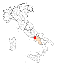
Province of Caserta
- province of Italy
Hiking in Province of Caserta
The Province of Caserta, located in the Campania region of Italy, is known for its beautiful landscapes, historical sites, and a variety of hiking opportunities. Here are some highlights for hiking in this region:...
- Country:
- Capital: Caserta
- Postal Code: 81010–81059; 81100
- Local Dialing Code: 081; 0823
- Licence Plate Code: CE
- Coordinates: 41° 10' 0" N, 14° 13' 0" E
- GPS tracks (wikiloc): [Link]
- Area: 2639 sq km
- Web site: [Link]

Province of Chieti
- province of Italy
Hiking in Province of Chieti
The Province of Chieti, located in the Abruzzo region of Italy, is a fantastic destination for hiking enthusiasts. With its diverse landscapes, ranging from rugged mountains to serene coastal areas, Chieti offers numerous trails suitable for all levels of hikers....
- Country:
- Capital: Chieti
- Postal Code: 66054; 66050–66052; 66045–66047; 66040–66043; 66036–66038; 66030–66034; 66026; 66014–66023; 66010-66100-66012
- Local Dialing Code: 0873; 0872; 0871; 085
- Licence Plate Code: CH
- Coordinates: 42° 21' 0" N, 14° 10' 0" E
- GPS tracks (wikiloc): [Link]
- Area: 2588.35 sq km
- Web site: [Link]


Province of Isernia
- province of Italy
Hiking in Province of Isernia
The Province of Isernia, located in the Molise region of Italy, offers a variety of hiking opportunities for outdoor enthusiasts. The area is known for its beautiful landscapes, featuring rolling hills, mountains, and a rich diversity of flora and fauna. Here are some highlights of hiking in the Province of Isernia:...
- Country:
- Capital: Isernia
- Postal Code: 86170; 86070–86097
- Local Dialing Code: 0874; 0865
- Licence Plate Code: IS
- Coordinates: 41° 39' 0" N, 14° 16' 0" E
- GPS tracks (wikiloc): [Link]
- Area: 1528.85 sq km
- Web site: [Link]