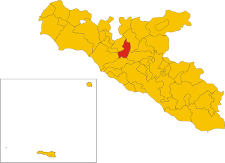
Cattolica Eraclea (Cattolica Eraclea)
.svg)
- Italian comune
 Hiking in Cattolica Eraclea
Cattolica Eraclea is a charming town located in Sicily, Italy. The surrounding areas offer a variety of hiking opportunities, with beautiful landscapes, historical sites, and stunning views of the Mediterranean coastline.
Hiking Trails
-
Natural Reserves: Nearby, you can explore the Cascata delle Marmore and other natural reserves which contain various trails ranging from easy to moderate difficulty. These trails often provide scenic views of waterfalls and lush vegetation.
-
The Scala dei Turchi: One of the most famous hiking spots near Cattolica Eraclea is the Scala dei Turchi, located in Realmonte. The striking white limestone cliffs offer breathtaking views, and while the hike to the top is not overly challenging, the reward is a stunning panoramic view of the coast.
-
Agrigento and the Valley of the Temples: About a 30-minute drive from Cattolica Eraclea, you can explore this UNESCO World Heritage Site. The trails within the valley allow you to take in ancient ruins while enjoying the beautiful landscape.
-
Hiking in the Sicani Mountains: For more adventurous hikers, the Sicani Mountains offer rugged terrain and picturesque trails. You may encounter local flora and fauna, as well as stunning views of the surrounding valleys.
Tips for Hiking in Cattolica Eraclea
- Best Time to Hike: The best time to hike is in spring or fall when temperatures are mild and the landscapes are vibrant.
- Preparation: Make sure to wear appropriate hiking footwear, carry plenty of water, and pack some snacks. A camera is also a good idea to capture the stunning scenery!
- Local Guides: Consider hiring a local guide if you are unfamiliar with the area. They can provide valuable insights into the local flora, fauna, and history.
- Respect Nature: Follow the Leave No Trace principles to preserve the beauty of the landscapes for future hikers.
Conclusion
Hiking in and around Cattolica Eraclea offers an excellent way to enjoy Sicily's natural beauty and rich history. With its diverse trails and stunning scenery, it’s sure to provide memorable experiences for both beginners and experienced hikers alike.
- Country:

- Postal Code: 92011
- Local Dialing Code: 0922
- Licence Plate Code: AG
- Coordinates: 37° 26' 31" N, 13° 23' 34" E


- GPS tracks (wikiloc): [Link]
- AboveSeaLevel: 220 м m
- Area: 62.16 sq km
- Population: 3665
- Web site: http://www.comune.cattolicaeraclea.ag.it/
- Wikipedia en: wiki(en)
- Wikipedia: wiki(it)
- Wikidata storage: Wikidata: Q332922
- Wikipedia Commons Category: [Link]
- Freebase ID: [/m/0gqg2h]
- GeoNames ID: Alt: [6541460]
- VIAF ID: Alt: [240158846]
- OSM relation ID: [39238]
- GND ID: Alt: [7718526-2]
- WOEID: [12678392]
- UN/LOCODE: [ITC6E]
- ISTAT ID: 084014
- Italian cadastre code: C356
Shares border with regions:


Agrigento
- Italian comune
Hiking in Agrigento
Agrigento, located on the southern coast of Sicily, boasts stunning natural landscapes, rich history, and a variety of hiking opportunities. Here are some highlights for hiking in the Agrigento area:...
- Country:
- Postal Code: 92100
- Local Dialing Code: 0922
- Licence Plate Code: AG
- Coordinates: 37° 18' 40" N, 13° 34' 36" E
- GPS tracks (wikiloc): [Link]
- AboveSeaLevel: 230 м m
- Area: 245.32 sq km
- Population: 59705
- Web site: [Link]


Montallegro
- Italian comune
Hiking in Montallegro
Montallegro, located in the southern part of Italy in the province of Agrigento in Sicily, offers some fantastic hiking opportunities that showcase the region’s natural beauty, historical sites, and coastal landscapes. Here are some key points to consider when planning a hiking trip in Montallegro:...
- Country:
- Postal Code: 92010
- Local Dialing Code: 0922
- Licence Plate Code: AG
- Coordinates: 37° 23' 38" N, 13° 21' 6" E
- GPS tracks (wikiloc): [Link]
- AboveSeaLevel: 100 м m
- Area: 27.41 sq km
- Population: 2500
- Web site: [Link]

Cianciana
- Italian comune
Hiking in Cianciana
Cianciana is a charming town located in the province of Agrigento, Sicily, Italy. Nestled in the Sicilian Mountains, it offers beautiful landscapes and various opportunities for hiking enthusiasts. Here are some highlights for hiking in and around Cianciana:...
- Country:
- Postal Code: 92012
- Local Dialing Code: 0922
- Licence Plate Code: AG
- Coordinates: 37° 31' 17" N, 13° 26' 4" E
- GPS tracks (wikiloc): [Link]
- AboveSeaLevel: 390 м m
- Area: 38.08 sq km
- Population: 3401
- Web site: [Link]


Ribera
- Italian comune
Hiking in Ribera
Hiking in Ribera, a charming town in the Agrigento province of Sicily, offers a unique blend of stunning landscapes, rich culture, and historical significance. The area is characterized by its rolling hills, olive groves, and beautiful views of the nearby coast and mountains....
- Country:
- Postal Code: 92016
- Local Dialing Code: 0925
- Licence Plate Code: AG
- Coordinates: 37° 29' 58" N, 13° 15' 54" E
- GPS tracks (wikiloc): [Link]
- AboveSeaLevel: 223 м m
- Area: 118.52 sq km
- Population: 18832
- Web site: [Link]


Sant'Angelo Muxaro
- Italian comune
Hiking in Sant'Angelo Muxaro
Sant'Angelo Muxaro is a picturesque village located in Sicily, Italy, known for its stunning landscapes, rich history, and charming architecture. Hiking in this area can offer a variety of experiences, whether you're looking for leisurely strolls or more challenging trails....
- Country:
- Postal Code: 92020
- Local Dialing Code: 0922
- Licence Plate Code: AG
- Coordinates: 37° 28' 51" N, 13° 32' 47" E
- GPS tracks (wikiloc): [Link]
- AboveSeaLevel: 335 м m
- Area: 64.52 sq km
- Population: 1321
- Web site: [Link]