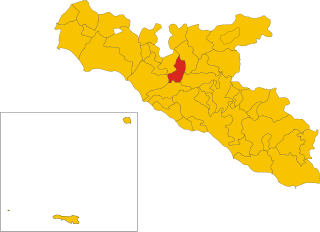
Cianciana (Cianciana)
- Italian comune
Cianciana is a charming town located in the province of Agrigento, Sicily, Italy. Nestled in the Sicilian Mountains, it offers beautiful landscapes and various opportunities for hiking enthusiasts. Here are some highlights for hiking in and around Cianciana:
Natural Beauty
-
Scenic Views: Hiking in the area offers stunning views of the surrounding countryside and mountains. The varied terrain includes rolling hills, olive groves, and rugged landscapes.
-
Wildlife and Flora: The region is rich in biodiversity, and you may encounter various plant species, wildflowers, and possibly some local wildlife during your hikes.
Hiking Trails
-
Local Trails: While there may not be extensive marked hiking trails, local paths and old mule tracks can provide adventurous hiking opportunities. Exploring these routes can lead you to fascinating rural landscapes.
-
Nearby Natural Parks: Consider exploring nearby natural parks, such as the Parco dei Monti Sicani, where you can find more developed trails suitable for hiking and enjoying nature.
Cultural Aspects
-
Historic Town: While hiking, take time to explore the town itself, which has a rich history and traditional Sicilian architecture. You may discover ancient churches and local eateries serving delicious Sicilian cuisine.
-
Cultural Events: If your visit coincides with local festivals, you can combine your hiking adventure with cultural experiences, tasting local food and engaging with the community.
Tips for Hiking in Cianciana
- Preparation: Ensure you're prepared with adequate hiking gear, maps, sufficient water, and snacks. As some trails may be less well-marked, having a GPS or a local guide can be helpful.
- Weather Considerations: The best time for hiking is generally during spring and early autumn when temperatures are milder.
- Local Guidance: Engaging with local hiking groups or guides can enhance your experience, offering insights into the best trails and safety tips.
Conclusion
Hiking in Cianciana can be a rewarding experience, combining nature, adventure, and cultural enrichment. Whether you are an experienced hiker or just looking for a scenic walk, Cianciana offers beautiful landscapes and an authentic Sicilian experience.
- Country:

- Postal Code: 92012
- Local Dialing Code: 0922
- Licence Plate Code: AG
- Coordinates: 37° 31' 17" N, 13° 26' 4" E


- GPS tracks (wikiloc): [Link]
- AboveSeaLevel: 390 м m
- Area: 38.08 sq km
- Population: 3401
- Web site: http://www.cianciana.com/
- Wikipedia en: wiki(en)
- Wikipedia: wiki(it)
- Wikidata storage: Wikidata: Q431492
- Wikipedia Commons Category: [Link]
- Freebase ID: [/m/0gqg38]
- GeoNames ID: Alt: [6537779]
- VIAF ID: Alt: [138572526]
- OSM relation ID: [39252]
- GND ID: Alt: [4748179-1]
- WOEID: [714055]
- ISTAT ID: 084015
- Italian cadastre code: C668
Shares border with regions:


Cattolica Eraclea
- Italian comune
Cattolica Eraclea is a charming town located in Sicily, Italy. The surrounding areas offer a variety of hiking opportunities, with beautiful landscapes, historical sites, and stunning views of the Mediterranean coastline....
- Country:

- Postal Code: 92011
- Local Dialing Code: 0922
- Licence Plate Code: AG
- Coordinates: 37° 26' 31" N, 13° 23' 34" E


- GPS tracks (wikiloc): [Link]
- AboveSeaLevel: 220 м m
- Area: 62.16 sq km
- Population: 3665
- Web site: [Link]


Alessandria della Rocca
- Italian comune
 Hiking in Alessandria della Rocca
Alessandria della Rocca is a charming village located in the Sicilian region of Italy, offering stunning landscapes and a rich cultural history that make it a great destination for hiking enthusiasts. Here are some key points about hiking in and around this area:...
- Country:

- Postal Code: 92010
- Local Dialing Code: 0922
- Licence Plate Code: AG
- Coordinates: 37° 34' 11" N, 13° 27' 12" E


- GPS tracks (wikiloc): [Link]
- AboveSeaLevel: 533 м m
- Area: 62.24 sq km
- Population: 2867
- Web site: [Link]


Bivona
- Italian comune
Bivona is a charming town located in the Sicilian province of Agrigento, Italy. Known for its natural beauty and rich history, Bivona offers several hiking opportunities that allow you to experience its stunning landscapes and diverse flora and fauna....
- Country:

- Postal Code: 92010
- Local Dialing Code: 0922
- Licence Plate Code: AG
- Coordinates: 37° 37' 6" N, 13° 26' 26" E


- GPS tracks (wikiloc): [Link]
- AboveSeaLevel: 503 м m
- Area: 88.57 sq km
- Population: 3596
- Web site: [Link]


Ribera
- Italian comune
Hiking in Ribera, a charming town in the Agrigento province of Sicily, offers a unique blend of stunning landscapes, rich culture, and historical significance. The area is characterized by its rolling hills, olive groves, and beautiful views of the nearby coast and mountains....
- Country:

- Postal Code: 92016
- Local Dialing Code: 0925
- Licence Plate Code: AG
- Coordinates: 37° 29' 58" N, 13° 15' 54" E


- GPS tracks (wikiloc): [Link]
- AboveSeaLevel: 223 м m
- Area: 118.52 sq km
- Population: 18832
- Web site: [Link]


Sant'Angelo Muxaro
- Italian comune
Sant'Angelo Muxaro is a picturesque village located in Sicily, Italy, known for its stunning landscapes, rich history, and charming architecture. Hiking in this area can offer a variety of experiences, whether you're looking for leisurely strolls or more challenging trails....
- Country:

- Postal Code: 92020
- Local Dialing Code: 0922
- Licence Plate Code: AG
- Coordinates: 37° 28' 51" N, 13° 32' 47" E


- GPS tracks (wikiloc): [Link]
- AboveSeaLevel: 335 м m
- Area: 64.52 sq km
- Population: 1321
- Web site: [Link]
