Cazats (Cazats)

- commune in Gironde, France
- Country:

- Postal Code: 33430
- Coordinates: 44° 28' 18" N, 0° 12' 28" E


- GPS tracks (wikiloc): [Link]
- Area: 7.48 sq km
- Population: 410
- Web site: http://cc-bazadais.fr/mairie_cazats/
- Wikipedia en: wiki(en)
- Wikipedia: wiki(fr)
- Wikidata storage: Wikidata: Q633725
- Wikipedia Commons Category: [Link]
- Freebase ID: [/m/03nry8t]
- GeoNames ID: Alt: [6432183]
- SIREN number: [213301161]
- BnF ID: [15256168k]
- INSEE municipality code: 33116
Shares border with regions:

Aubiac
- commune in Gironde, France
- Country:
- Postal Code: 33430
- Coordinates: 44° 28' 10" N, 0° 14' 29" E
- GPS tracks (wikiloc): [Link]
- Area: 5.62 sq km
- Population: 276
- Web site: [Link]


Mazères
- commune in Gironde, France
- Country:
- Postal Code: 33210
- Coordinates: 44° 29' 43" N, 0° 15' 31" E
- GPS tracks (wikiloc): [Link]
- Area: 13.14 sq km
- Population: 758
- Web site: [Link]


Brouqueyran
- commune in Gironde, France
- Country:
- Postal Code: 33124
- Coordinates: 44° 29' 2" N, 0° 10' 30" E
- GPS tracks (wikiloc): [Link]
- Area: 5.66 sq km
- Population: 198
- Web site: [Link]


Bazas
- commune in Gironde, France
- Country:
- Postal Code: 33430
- Coordinates: 44° 25' 55" N, 0° 12' 42" E
- GPS tracks (wikiloc): [Link]
- Area: 37.29 sq km
- Population: 4734
- Web site: [Link]

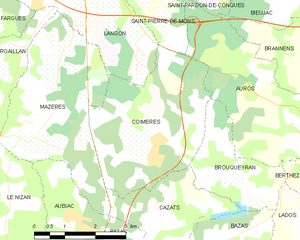
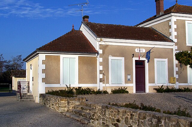
Coimères
- commune in Gironde, France
- Country:
- Postal Code: 33210
- Coordinates: 44° 29' 46" N, 0° 12' 35" E
- GPS tracks (wikiloc): [Link]
- Area: 12.91 sq km
- Population: 1014
- Web site: [Link]