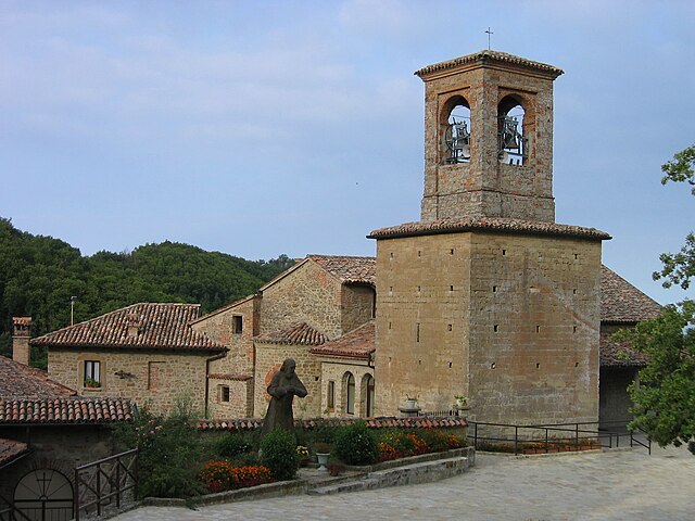
Cecima (Cecima)
.svg)
- Italian comune
 Hiking in Cecima
Cecima is a small town located in the province of Pavia, in the Lombardy region of northern Italy. While it might not be widely known as a hiking destination, the surrounding area offers a variety of landscapes that can be great for outdoor enthusiasts.
Hiking Opportunities in Cecima:
-
Natural Parks: The nearby Ticino Park (Parco del Ticino) is a vast natural area that offers numerous hiking trails. You can explore the rich flora and fauna as you walk along the banks of the Ticino River.
-
Scenic Trails: The region around Cecima features rolling hills, vineyards, and farming landscapes. You might find trails that take you through charming villages and offer stunning views typical of the Lombardy countryside.
-
Wildlife Watching: While hiking, keep an eye out for local wildlife. The areas around here can be a good spot for bird watching, particularly along the river and in the wetlands.
-
Regional Paths: The "Cammino di San Colombano," a pilgrimage route, passes not far from Cecima, which can provide additional hiking options and a historical aspect to your hike.
Preparation Tips:
-
Maps and Navigation: Make sure to carry a map or GPS device, as some trails may not be well-marked. It’s beneficial to check local trail guides or online resources for the best routes.
-
Weather Considerations: The weather can change quickly, especially in hilly areas. Dress in layers, and be prepared for varying conditions.
-
Safety: Bring enough water, snacks, and a basic first aid kit. Always inform someone about your hiking plans, especially if you’re heading out on less populated trails.
-
Local Culture: Make time to enjoy the local cuisine and culture. After your hike, you can explore Cecima and its surrounding areas, tasting regional dishes and enjoying the hospitality of the locals.
Exploring the trails around Cecima can provide a relaxing and scenic experience, particularly if you enjoy less tourist-trodden paths. Always be respectful of nature and local communities while hiking. Happy hiking!
- Country:

- Postal Code: 27050
- Local Dialing Code: 0383
- Licence Plate Code: PV
- Coordinates: 44° 51' 0" N, 9° 5' 0" E


- GPS tracks (wikiloc): [Link]
- AboveSeaLevel: 331 м m
- Area: 10.12 sq km
- Population: 237
- Web site: http://www.comune.cecima.pv.it
- Wikipedia en: wiki(en)
- Wikipedia: wiki(it)
- Wikidata storage: Wikidata: Q41049
- Wikipedia Commons Category: [Link]
- Freebase ID: [/m/0gjhkw]
- GeoNames ID: Alt: [6543762]
- OSM relation ID: [43667]
- ISTAT ID: 018042
- Italian cadastre code: C414
Shares border with regions:
Brignano-Frascata
- municipality in Italy
Hiking in Brignano-Frascata
Brignano-Frascata is a charming municipality located in the province of Alessandria in the Piedmont region of Italy. Nestled in the Apennines, this area offers beautiful landscapes, dense forests, and various hiking trails that cater to different skill levels....
- Country:
- Postal Code: 15050
- Local Dialing Code: 0131
- Licence Plate Code: AL
- Coordinates: 44° 48' 50" N, 9° 2' 29" E
- GPS tracks (wikiloc): [Link]
- AboveSeaLevel: 288 м m
- Area: 17.53 sq km
- Population: 433
- Web site: [Link]

Gremiasco
- municipality in Italy
Hiking in Gremiasco
Gremiasco is a charming village located in the Piedmont region of Italy, surrounded by the beautiful scenery of the Italian Alps. While it may not be one of the most recognized hiking destinations, it offers opportunities for nature enthusiasts and hikers looking for a less crowded experience....
- Country:
- Postal Code: 15050
- Local Dialing Code: 0131
- Licence Plate Code: AL
- Coordinates: 44° 47' 50" N, 9° 6' 28" E
- GPS tracks (wikiloc): [Link]
- AboveSeaLevel: 395 м m
- Area: 17.38 sq km
- Population: 318
- Web site: [Link]
Momperone
- municipality in Italy
Hiking in Momperone
Momperone is a scenic mountain located in the Ligurian Apennines of Italy, well-known for its stunning landscapes, diverse ecosystems, and hiking opportunities. If you're considering hiking in this region, here are some key points to keep in mind:...
- Country:
- Postal Code: 15050
- Local Dialing Code: 0131
- Licence Plate Code: AL
- Coordinates: 44° 50' 22" N, 9° 2' 7" E
- GPS tracks (wikiloc): [Link]
- AboveSeaLevel: 279 м m
- Area: 8.54 sq km
- Population: 224
- Web site: [Link]

Pozzol Groppo
- municipality in Italy
Hiking in Pozzol Groppo
Pozzol Groppo is a charming destination for hikers, nestled in the Piedmont region of Italy. Known for its scenic beauty and diverse landscapes, it's an excellent choice for those looking to explore the outdoors....
- Country:
- Postal Code: 15050
- Local Dialing Code: 0131
- Licence Plate Code: AL
- Coordinates: 44° 52' 44" N, 9° 1' 51" E
- GPS tracks (wikiloc): [Link]
- AboveSeaLevel: 200 м m
- Area: 14.08 sq km
- Population: 303
- Web site: [Link]


Godiasco
- Italian comune
Hiking in Godiasco
Godiasco Salice Terme, located in the Lombardy region of Italy, is a charming area known for its natural beauty, thermal springs, and appealing hiking opportunities. When exploring this picturesque destination, here are some key aspects to consider:...
- Country:
- Postal Code: 27052
- Local Dialing Code: 0383
- Licence Plate Code: PV
- Coordinates: 44° 54' 0" N, 9° 3' 0" E
- GPS tracks (wikiloc): [Link]
- AboveSeaLevel: 196 м m
- Area: 20.61 sq km
- Population: 3258
- Web site: [Link]

Ponte Nizza
- Italian comune
Hiking in Ponte Nizza
Ponte Nizza, located in the province of Pavia in Lombardy, Italy, is an excellent destination for hiking enthusiasts. Nestled in a scenic area characterized by rolling hills, forests, and rivers, it offers a variety of trails suitable for different skill levels....
- Country:
- Postal Code: 27050
- Local Dialing Code: 0383
- Licence Plate Code: PV
- Coordinates: 44° 51' 0" N, 9° 6' 0" E
- GPS tracks (wikiloc): [Link]
- AboveSeaLevel: 267 м m
- Area: 22.96 sq km
- Population: 785
- Web site: [Link]