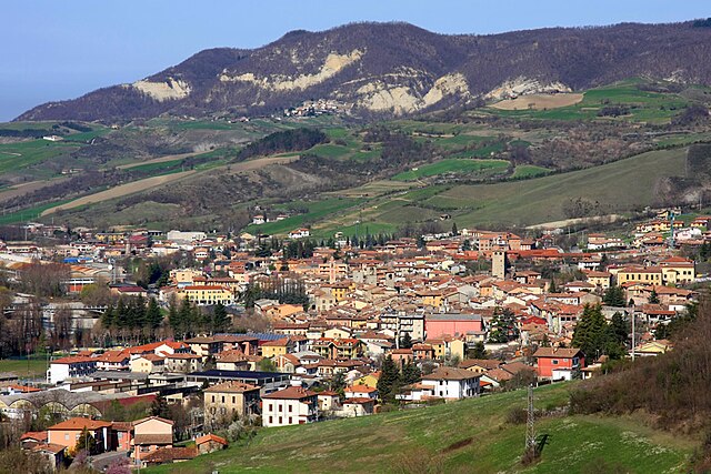
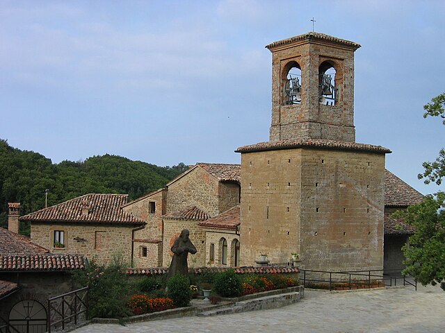
Gremiasco (Gremiasco)
- municipality in Italy
 Hiking in Gremiasco
Gremiasco is a charming village located in the Piedmont region of Italy, surrounded by the beautiful scenery of the Italian Alps. While it may not be one of the most recognized hiking destinations, it offers opportunities for nature enthusiasts and hikers looking for a less crowded experience.
Hiking Opportunities:
-
Scenic Trails: The region around Gremiasco is dotted with various hiking trails that can range from easy walks to more challenging hikes. The trails often pass through tranquil forests, picturesque valleys, and offer stunning views of the surrounding mountains.
-
Alpes Liguri: Just a short drive from Gremiasco, you can access trails in the Alpes Liguri, where you'll find a range of routes, including those leading to mountain lakes and peaks. These trails often provide opportunities for both day hikes and multi-day treks.
-
Nature and Wildlife: While hiking, you're likely to encounter local wildlife including deer, foxes, and a variety of bird species. Wildflowers are abundant in the spring and early summer, making these months an ideal time for hiking.
-
Local Guidance: It's always a good practice to check in with local hiking groups or guides who can provide valuable information on trail conditions and safety tips.
Tips for Hiking in Gremiasco:
- Maps and Navigation: Make sure to carry a good map of the trails or a GPS device, as some paths may not be well signposted.
- Weather Considerations: Weather in the mountains can change rapidly, so be prepared for varying conditions, even in summer.
- Gear Up: Wear proper hiking boots and clothing suitable for the terrain and weather. Carry sufficient water and snacks, especially for longer hikes.
- Respect Nature: Follow the Leave No Trace principles to preserve the natural beauty of the area for future hikers.
Conclusion:
Hiking in Gremiasco can be a serene and rewarding experience, especially for those seeking to connect with nature away from the bustling tourist spots. With its beautiful landscapes and the opportunity to explore lesser-known trails, it can be a hidden gem for outdoor enthusiasts.
- Country:

- Postal Code: 15050
- Local Dialing Code: 0131
- Licence Plate Code: AL
- Coordinates: 44° 47' 50" N, 9° 6' 28" E


- GPS tracks (wikiloc): [Link]
- AboveSeaLevel: 395 м m
- Area: 17.38 sq km
- Population: 318
- Web site: http://www.comune.gremiasco.al.it/
- Wikipedia en: wiki(en)
- Wikipedia: wiki(it)
- Wikidata storage: Wikidata: Q17371
- Wikipedia Commons Category: [Link]
- Freebase ID: [/m/0gbm23]
- GeoNames ID: Alt: [6543526]
- OSM relation ID: [43620]
- ISTAT ID: 006083
- Italian cadastre code: E164
Shares border with regions:
Brignano-Frascata
- municipality in Italy
Hiking in Brignano-Frascata
Brignano-Frascata is a charming municipality located in the province of Alessandria in the Piedmont region of Italy. Nestled in the Apennines, this area offers beautiful landscapes, dense forests, and various hiking trails that cater to different skill levels....
- Country:
- Postal Code: 15050
- Local Dialing Code: 0131
- Licence Plate Code: AL
- Coordinates: 44° 48' 50" N, 9° 2' 29" E
- GPS tracks (wikiloc): [Link]
- AboveSeaLevel: 288 м m
- Area: 17.53 sq km
- Population: 433
- Web site: [Link]

Fabbrica Curone
- municipality in Italy
Hiking in Fabbrica Curone
Fabbrica Curone is a beautiful area located in the province of Alessandria, in the Piedmont region of Italy. Nestled in the Apennine Mountains, this area offers a variety of hiking opportunities for nature lovers and outdoor enthusiasts. Here are some highlights and tips for hiking in Fabbrica Curone:...
- Country:
- Postal Code: 15054
- Local Dialing Code: 0131
- Licence Plate Code: AL
- Coordinates: 44° 45' 19" N, 9° 9' 18" E
- GPS tracks (wikiloc): [Link]
- AboveSeaLevel: 440 м m
- Area: 53.84 sq km
- Population: 631
- Web site: [Link]
Montacuto
- municipality in Italy
Hiking in Montacuto
Montacuto is a beautiful area for hiking, known for its stunning landscapes, diverse flora and fauna, and panoramic views. While it may not be as widely recognized as some major hiking destinations, it offers plenty of opportunities for outdoor enthusiasts. Here are some key points to consider:...
- Country:
- Postal Code: 15050
- Local Dialing Code: 0131
- Licence Plate Code: AL
- Coordinates: 44° 45' 59" N, 9° 6' 18" E
- GPS tracks (wikiloc): [Link]
- AboveSeaLevel: 525 м m
- Area: 23.75 sq km
- Population: 263
- Web site: [Link]

San Sebastiano Curone
- municipality in Italy
Hiking in San Sebastiano Curone
San Sebastiano Curone is a charming village in the province of Alessandria, nestled in the picturesque hills of the Piedmont region of Italy. The surrounding area offers a fantastic landscape for hiking enthusiasts, combining lush vegetation, rolling hills, and scenic views....
- Country:
- Postal Code: 15056
- Local Dialing Code: 0131
- Licence Plate Code: AL
- Coordinates: 44° 47' 15" N, 9° 3' 57" E
- GPS tracks (wikiloc): [Link]
- AboveSeaLevel: 342 м m
- Area: 3.89 sq km
- Population: 576
- Web site: [Link]


Bagnaria
- Italian comune
Hiking in Bagnaria
Bagnaria is a small village located in the province of Pavia, Lombardy, Italy, known for its picturesque landscapes and natural beauty. While it may not be as popular as some larger hiking destinations, it does offer opportunities for light to moderate hiking with a focus on enjoying the tranquility of nature....
- Country:
- Postal Code: 27050
- Local Dialing Code: 0383
- Licence Plate Code: PV
- Coordinates: 44° 50' 0" N, 9° 7' 0" E
- GPS tracks (wikiloc): [Link]
- AboveSeaLevel: 333 м m
- Area: 16.66 sq km
- Population: 666
- Web site: [Link]

Varzi
- Italian comune
Hiking in Varzi
Varzi, located in the Lombardy region of Italy, is a lovely destination for hiking enthusiasts due to its beautiful landscapes and diverse terrain. Here are some highlights about hiking in and around Varzi:...
- Country:
- Postal Code: 27057
- Local Dialing Code: 0383
- Licence Plate Code: PV
- Coordinates: 44° 49' 0" N, 9° 12' 0" E
- GPS tracks (wikiloc): [Link]
- AboveSeaLevel: 426 м m
- Area: 57.61 sq km
- Population: 3194
- Web site: [Link]


Cecima
- Italian comune
Hiking in Cecima
Cecima is a small town located in the province of Pavia, in the Lombardy region of northern Italy. While it might not be widely known as a hiking destination, the surrounding area offers a variety of landscapes that can be great for outdoor enthusiasts....
- Country:
- Postal Code: 27050
- Local Dialing Code: 0383
- Licence Plate Code: PV
- Coordinates: 44° 51' 0" N, 9° 5' 0" E
- GPS tracks (wikiloc): [Link]
- AboveSeaLevel: 331 м m
- Area: 10.12 sq km
- Population: 237
- Web site: [Link]

Ponte Nizza
- Italian comune
Hiking in Ponte Nizza
Ponte Nizza, located in the province of Pavia in Lombardy, Italy, is an excellent destination for hiking enthusiasts. Nestled in a scenic area characterized by rolling hills, forests, and rivers, it offers a variety of trails suitable for different skill levels....
- Country:
- Postal Code: 27050
- Local Dialing Code: 0383
- Licence Plate Code: PV
- Coordinates: 44° 51' 0" N, 9° 6' 0" E
- GPS tracks (wikiloc): [Link]
- AboveSeaLevel: 267 м m
- Area: 22.96 sq km
- Population: 785
- Web site: [Link]