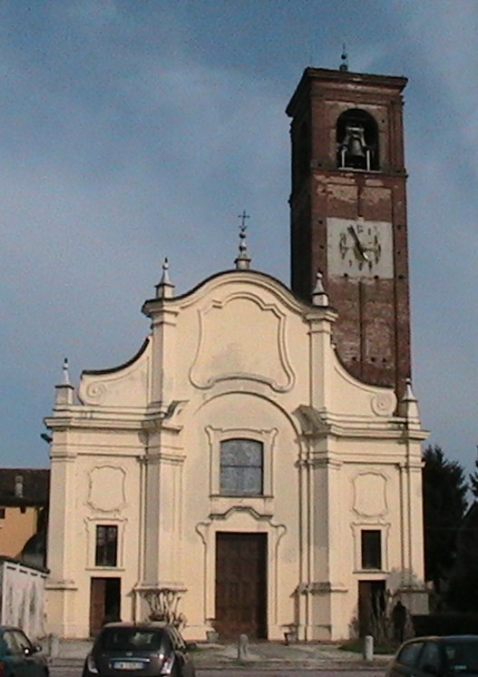
Cella Dati (Cella Dati)
.svg)
- Italian comune
 Hiking in Cella Dati
Cella Dati is a small town in Italy, located in the Lombardy region. While it may not be as renowned for hiking as some of Italy's more famous mountainous areas, such as the Dolomites or the Apennines, there are still opportunities for outdoor activities and hiking in the surrounding areas.
If you're interested in hiking near Cella Dati, consider the following tips:
-
Local Trails: Look for local trails that may not be widely known but can offer enjoyable hikes. Use mapping apps or local hiking guides to discover paths that may be less crowded and provide beautiful views of the countryside.
-
Explore Nearby Natural Parks: Within the Lombardy region, several natural parks may be accessible from Cella Dati. Research parks like the Parco Regionale della Valle del Lambro or Parco Agricolo Sud Milano, which might offer hiking trails and scenic views.
-
Consider Season: Depending on the time of year, the hiking experience can vary. Spring and fall are typically the best seasons for hiking in terms of weather. Summer can be hot, while winter might limit access to some trails.
-
Safety and Preparation: Always check the local weather forecast before heading out, inform someone about your hiking plans, and carry the essential gear including water, snacks, appropriate clothing, and a first aid kit.
-
Join Local Hiking Groups: If you're new to the area or hiking in general, consider joining local hiking clubs or groups. They often have organized hikes and can offer valuable insight into the trails and best practices.
-
Respect Nature: Please remember to follow Leave No Trace principles to preserve the natural beauty of the surroundings.
If Cella Dati's immediate vicinity doesn't offer what you're looking for, consider a day trip to nearby regions known for hiking, as Lombardy has many breathtaking options within a short drive.
- Country:

- Postal Code: 26040
- Local Dialing Code: 0372
- Licence Plate Code: CR
- Coordinates: 45° 6' 0" N, 10° 13' 0" E


- GPS tracks (wikiloc): [Link]
- AboveSeaLevel: 34 м m
- Area: 18.92 sq km
- Population: 511
- Web site: http://www.comune.celladati.cr.it
- Wikipedia en: wiki(en)
- Wikipedia: wiki(it)
- Wikidata storage: Wikidata: Q42444
- Wikipedia Commons Category: [Link]
- Freebase ID: [/m/0gjyrs]
- GeoNames ID: Alt: [6542973]
- OSM relation ID: [44138]
- MusicBrainz area ID: [981162d2-6c5a-4c7e-935a-0c38a4d10839]
- ISTAT ID: 019028
- Italian cadastre code: C435
Shares border with regions:


Sospiro
- Italian comune
Hiking in Sospiro
Sospiro is a small municipality located in the province of Cremona, northern Italy. While it might not be a well-known hiking destination compared to more mountainous regions, the surrounding areas offer some opportunities for scenic walks and hikes....
- Country:
- Postal Code: 26048
- Local Dialing Code: 0372
- Licence Plate Code: CR
- Coordinates: 45° 6' 0" N, 10° 9' 0" E
- GPS tracks (wikiloc): [Link]
- AboveSeaLevel: 36 м m
- Area: 18.96 sq km
- Population: 3103
- Web site: [Link]

Pieve San Giacomo
- Italian comune
Hiking in Pieve San Giacomo
Pieve San Giacomo is a small hamlet located in the province of Brescia, Italy. It's nestled in the beautiful landscape of the Lombardy region, making it an excellent destination for hiking enthusiasts. Here’s what you can expect when hiking in and around Pieve San Giacomo:...
- Country:
- Postal Code: 26035
- Local Dialing Code: 0372
- Licence Plate Code: CR
- Coordinates: 45° 8' 0" N, 10° 11' 0" E
- GPS tracks (wikiloc): [Link]
- AboveSeaLevel: 39 м m
- Area: 14.85 sq km
- Population: 1586
- Web site: [Link]


Motta Baluffi
- Italian comune
Hiking in Motta Baluffi
Motta Baluffi is a small village located in the province of Cremona, in the Lombardy region of Italy. While it may not be a well-known hiking destination compared to the larger mountain ranges in Italy, it offers a unique experience for hikers interested in exploring the serene natural beauty and rural landscapes of the Po Valley....
- Country:
- Postal Code: 26045
- Local Dialing Code: 0375
- Licence Plate Code: CR
- Coordinates: 45° 3' 0" N, 10° 16' 0" E
- GPS tracks (wikiloc): [Link]
- AboveSeaLevel: 31 м m
- Area: 16.47 sq km
- Population: 899
- Web site: [Link]


San Daniele Po
- Italian comune
Hiking in San Daniele Po
San Daniele Po is a charming commune located in the province of Cremona in northern Italy. While it’s not primarily known for extensive hiking trails like some of Italy's more mountainous regions, there are still opportunities for pleasant walks and outdoor activities in the surrounding countryside and natural areas....
- Country:
- Postal Code: 26046
- Local Dialing Code: 0372
- Licence Plate Code: CR
- Coordinates: 45° 4' 0" N, 10° 11' 0" E
- GPS tracks (wikiloc): [Link]
- AboveSeaLevel: 33 м m
- Area: 22.69 sq km
- Population: 1374
- Web site: [Link]


Cingia de' Botti
- Italian comune
Hiking in Cingia de' Botti
Cingia de' Botti is a small town located in the province of Cremona, in the Lombardy region of Italy. While it may not be as widely recognized as some other hiking destinations in Italy, it offers beautiful natural landscapes and a peaceful atmosphere, ideal for those looking to explore the outdoors....
- Country:
- Postal Code: 26042
- Local Dialing Code: 0375
- Licence Plate Code: CR
- Coordinates: 45° 5' 0" N, 10° 17' 0" E
- GPS tracks (wikiloc): [Link]
- AboveSeaLevel: 31 м m
- Area: 14.36 sq km
- Population: 1254
- Web site: [Link]


Derovere
- Italian comune
Hiking in Derovere
It seems there might be a typo or misunderstanding, as I couldn't find information regarding a hiking destination called "Derovere." If you meant a specific location, please check the spelling, or provide more context, such as the country or region it's in....
- Country:
- Postal Code: 26040
- Local Dialing Code: 0372
- Licence Plate Code: CR
- Coordinates: 45° 6' 39" N, 10° 14' 56" E
- GPS tracks (wikiloc): [Link]
- AboveSeaLevel: 36 м m
- Area: 9.99 sq km
- Population: 296
- Web site: [Link]