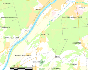
Cellettes (Cellettes)

- commune in Loir-et-Cher, France
- Country:

- Postal Code: 41120
- Coordinates: 47° 31' 41" N, 1° 22' 50" E


- GPS tracks (wikiloc): [Link]
- Area: 20.96 sq km
- Population: 2564
- Wikipedia en: wiki(en)
- Wikipedia: wiki(fr)
- Wikidata storage: Wikidata: Q1135624
- Wikipedia Commons Category: [Link]
- Freebase ID: [/m/03qd2bf]
- GeoNames ID: Alt: [6448908]
- SIREN number: [214100315]
- BnF ID: [15259307n]
- INSEE municipality code: 41031
Shares border with regions:


Chitenay
- commune in Loir-et-Cher, France
- Country:
- Postal Code: 41120
- Coordinates: 47° 29' 50" N, 1° 22' 14" E
- GPS tracks (wikiloc): [Link]
- Area: 15.61 sq km
- Population: 1054
Cormeray
- commune in Loir-et-Cher, France
- Country:
- Postal Code: 41120
- Coordinates: 47° 29' 21" N, 1° 24' 23" E
- GPS tracks (wikiloc): [Link]
- Area: 10.31 sq km
- Population: 1569


Saint-Gervais-la-Forêt
- commune in Loir-et-Cher, France
- Country:
- Postal Code: 41350
- Coordinates: 47° 34' 8" N, 1° 21' 36" E
- GPS tracks (wikiloc): [Link]
- Area: 8.97 sq km
- Population: 3224
- Web site: [Link]
Seur
- commune in Loir-et-Cher, France
- Country:
- Postal Code: 41120
- Coordinates: 47° 30' 10" N, 1° 20' 2" E
- GPS tracks (wikiloc): [Link]
- AboveSeaLevel: 86 м m
- Area: 3.85 sq km
- Population: 481


Cour-Cheverny
- commune in Loir-et-Cher, France
- Country:
- Postal Code: 41700
- Coordinates: 47° 30' 34" N, 1° 27' 22" E
- GPS tracks (wikiloc): [Link]
- Area: 29.8 sq km
- Population: 2822
- Web site: [Link]

Chailles
- commune in Loir-et-Cher, France
- Country:
- Postal Code: 41120
- Coordinates: 47° 32' 30" N, 1° 18' 37" E
- GPS tracks (wikiloc): [Link]
- Area: 18.54 sq km
- Population: 2673
Mont-près-Chambord
- commune in Loir-et-Cher, France
- Country:
- Postal Code: 41250
- Coordinates: 47° 33' 46" N, 1° 27' 44" E
- GPS tracks (wikiloc): [Link]
- Area: 28.51 sq km
- Population: 3244


Cheverny
- commune in Loir-et-Cher, France
- Country:
- Postal Code: 41700
- Coordinates: 47° 29' 57" N, 1° 27' 37" E
- GPS tracks (wikiloc): [Link]
- Area: 33 sq km
- Population: 1011
- Web site: [Link]