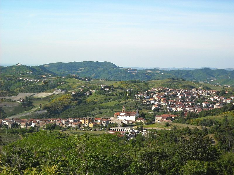
Ceranesi (Ceranesi)
.svg)
- Italian comune
 Hiking in Ceranesi
Ceranesi is a charming village located in the Liguria region of Italy, nestled in the foothills of the Apennines not far from Genoa. The area is known for its stunning natural landscapes, making it a great destination for hiking enthusiasts. Here are some highlights of hiking in and around Ceranesi:
Scenic Trails:
-
Local Hiking Paths: Ceranesi offers various marked trails that cater to different levels of hikers. You can find easy walks suitable for families or more challenging paths for experienced hikers.
-
The Alta Via dei Monti Liguri: This long-distance trail runs through the Ligurian mountains and offers spectacular views of the surrounding landscapes. Portions of this trail can be accessed from Ceranesi.
-
Nature Reserves: The region is home to several natural parks and reserves, providing opportunities to explore diverse flora and fauna, as well as panoramic views from higher elevations.
Key Features:
-
Panoramic Views: Many trails lead to elevated viewpoints, where hikers can catch stunning vistas of the Ligurian Sea, the Apennine mountains, and the lush valleys below.
-
Historical Sites: While hiking, you might encounter remnants of old farms, rural chapels, and ancient pathways that tell the story of the region's agricultural past.
-
Wildlife Observation: The region is rich in biodiversity, making it a great spot for birdwatching and observing other wildlife.
Tips for Hiking in Ceranesi:
-
Wear Appropriate Gear: Good hiking boots, weather-appropriate clothing, and a sturdy backpack are essential for a comfortable hike.
-
Stay Hydrated and Nourished: Bring enough water and snacks to keep your energy up while exploring the trails.
-
Check Trail Conditions: Before heading out, it's a good idea to check the weather and trail conditions, as some paths may be affected by seasonal changes.
-
Local Maps and Guides: Utilize local hiking maps and guides to help navigate the area, and consider joining a guided hike if you're unfamiliar with the region.
-
Respect Nature: Follow the Leave No Trace principles to preserve the natural beauty of the area for future hikers.
Whether you're looking for a leisurely day hike or a more strenuous adventure, Ceranesi and its nearby areas offer a wonderful opportunity to immerse yourself in the breathtaking landscapes of Northern Italy. Happy hiking!
- Country:

- Postal Code: 16014
- Local Dialing Code: 010
- Licence Plate Code: GE
- Coordinates: 44° 30' 30" N, 8° 53' 2" E


- GPS tracks (wikiloc): [Link]
- AboveSeaLevel: 80 м m
- Area: 30.7 sq km
- Population: 3797
- Web site: http://www.comune.ceranesi.ge.it/
- Wikipedia en: wiki(en)
- Wikipedia: wiki(it)
- Wikidata storage: Wikidata: Q265498
- Wikipedia Commons Category: [Link]
- Freebase ID: [/m/0ghw3d]
- GeoNames ID: Alt: [6542793]
- OSM relation ID: [44878]
- UN/LOCODE: [ITCER]
- ISTAT ID: 010014
- Italian cadastre code: C481
Shares border with regions:


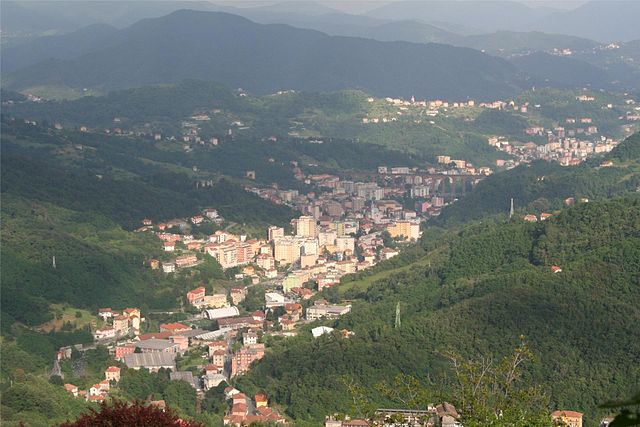
Genoa
- Italian city
Hiking in Genoa
Genoa, located on the northwest coast of Italy, is not only known for its rich maritime history and vibrant culture but also offers a variety of hiking opportunities in the surrounding regions. Here are some highlights for hiking enthusiasts:...
- Country:
- Postal Code: 16121–16167
- Local Dialing Code: 010
- Licence Plate Code: GE
- AboveSeaLevel: 20 м m
- Area: 240.29 sq km
- Population: 583601
- Web site: [Link]

Bosio
- municipality in Italy
Hiking in Bosio
Bosio, a charming town located in the province of Genoa in the Liguria region of Italy, offers a variety of hiking opportunities that showcase the beautiful natural landscapes of the Apennine Mountains. Here are some key points to consider when hiking in Bosio:...
- Country:
- Postal Code: 15060
- Local Dialing Code: 0143
- Licence Plate Code: AL
- Coordinates: 44° 39' 3" N, 8° 47' 38" E
- GPS tracks (wikiloc): [Link]
- AboveSeaLevel: 358 м m
- Area: 67.61 sq km
- Population: 1195
- Web site: [Link]

Campomorone
- Italian comune
Hiking in Campomorone
Campomorone, located in the Liguria region of Italy near Genoa, offers some beautiful hiking opportunities amidst its lush landscapes and charming scenery. Here are some highlights and tips for hiking in the area:...
- Country:
- Postal Code: 16014
- Local Dialing Code: 010
- Licence Plate Code: GE
- Coordinates: 44° 30' 25" N, 8° 53' 30" E
- GPS tracks (wikiloc): [Link]
- AboveSeaLevel: 118 м m
- Area: 25.91 sq km
- Population: 6849
- Web site: [Link]