Bosio (Bosio)
- municipality in Italy
Bosio, a charming town located in the province of Genoa in the Liguria region of Italy, offers a variety of hiking opportunities that showcase the beautiful natural landscapes of the Apennine Mountains. Here are some key points to consider when hiking in Bosio:
Trails
-
Sentiero del Crinale: This is a popular ridge trail that offers stunning panoramic views of the surrounding valleys and mountains. The trail is well-marked and can be followed for various distances depending on your fitness level.
-
Valle Stura: The valleys surrounding Bosio, including Valle Stura, have numerous hiking paths that lead through lush forests and past picturesque landscapes.
-
Monti di Villa: There are several trails that lead to the Monti di Villa area, providing hikers with the chance to see diverse flora and fauna native to the region.
Difficulty Levels
- Easy Trails: Suitable for beginners and families, these trails are generally flat and well-maintained.
- Moderate Trails: Some trails may have moderate elevation changes and require a bit more stamina, perfect for those looking for a challenge.
- Difficult Trails: For experienced hikers, there are more challenging routes that include steep ascents and rugged terrain.
Tips for Hiking in Bosio
- Weather: Check the weather conditions before you head out, as the Apennines can have sudden changes in weather.
- Equipment: Wear sturdy hiking shoes, and consider bringing trekking poles if you're tackling steeper trails. A detailed map or a GPS app can also be beneficial.
- Hydration and Snacks: Carry sufficient water and snacks, especially on longer hikes, as amenities might be limited on the trails.
- Respect Nature: Adhere to the Leave No Trace principles and respect local wildlife and habitats.
Local Culture
While hiking, take the time to appreciate the local culture. Bosio has a rich history, and you might encounter ancient structures or local fauna. Engage with locals to learn more about their traditions and the area.
Best Time to Hike
The ideal times for hiking in Bosio are during the spring (April to June) and fall (September to October) when the weather is generally mild, and the landscapes are particularly beautiful.
With its natural beauty and diverse trails, Bosio is an excellent destination for hikers of all levels looking to explore the Italian countryside. Enjoy your adventure!
- Country:

- Postal Code: 15060
- Local Dialing Code: 0143
- Licence Plate Code: AL
- Coordinates: 44° 39' 3" N, 8° 47' 38" E


- GPS tracks (wikiloc): [Link]
- AboveSeaLevel: 358 м m
- Area: 67.61 sq km
- Population: 1195
- Web site: http://www.comune.bosio.al.it/
- Wikipedia en: wiki(en)
- Wikipedia: wiki(it)
- Wikidata storage: Wikidata: Q17287
- Wikipedia Commons Category: [Link]
- Freebase ID: [/m/0gbky5]
- GeoNames ID: Alt: [6542860]
- VIAF ID: Alt: [244769429]
- OSM relation ID: [43219]
- UN/LOCODE: [ITOIO]
- ISTAT ID: 006022
- Italian cadastre code: B080
Shares border with regions:


Genoa
- Italian city
Genoa, located on the northwest coast of Italy, is not only known for its rich maritime history and vibrant culture but also offers a variety of hiking opportunities in the surrounding regions. Here are some highlights for hiking enthusiasts:...
- Country:

- Postal Code: 16121–16167
- Local Dialing Code: 010
- Licence Plate Code: GE
- AboveSeaLevel: 20 м m
- Area: 240.29 sq km
- Population: 583601
- Web site: [Link]
Carrosio
- municipality in Italy
Carrosio is a quaint municipality in the province of Genoa, Italy, situated in the Ligurian Apennines. It offers a wonderful opportunity for hikers due to its varied landscapes, picturesque views, and rich natural environment. Here are some highlights and tips for hiking in and around Carrosio:...
- Country:

- Postal Code: 15060
- Local Dialing Code: 0143
- Licence Plate Code: AL
- Coordinates: 44° 39' 33" N, 8° 49' 57" E


- GPS tracks (wikiloc): [Link]
- AboveSeaLevel: 254 м m
- Area: 6.92 sq km
- Population: 507
- Web site: [Link]

Casaleggio Boiro
- municipality in Italy
Casaleggio Boiro, located in the Piedmont region of Italy, offers beautiful hiking opportunities surrounded by nature and scenic landscapes. The area is characterized by its rolling hills, dense forests, and even some mountainous terrain, making it ideal for hikers of various skill levels....
- Country:

- Postal Code: 15070
- Local Dialing Code: 0143
- Licence Plate Code: AL
- Coordinates: 44° 38' 4" N, 8° 43' 53" E


- GPS tracks (wikiloc): [Link]
- AboveSeaLevel: 321 м m
- Area: 12.01 sq km
- Population: 373
- Web site: [Link]

Gavi, Piedmont
- municipality in Italy
Gavi, located in the Piedmont region of Italy, is known for its stunning landscapes, picturesque vineyards, and rich history, making it a delightful destination for hiking enthusiasts. The area is characterized by rolling hills, lush greenery, and a serene atmosphere, ideal for both casual walkers and more adventurous trekkers....
- Country:

- Postal Code: 15066
- Local Dialing Code: 0143
- Licence Plate Code: AL
- Coordinates: 44° 41' 19" N, 8° 48' 37" E


- GPS tracks (wikiloc): [Link]
- AboveSeaLevel: 233 м m
- Area: 45.04 sq km
- Population: 4533
- Web site: [Link]
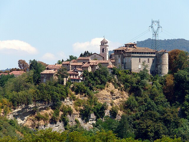
Lerma
- municipality in Italy
Lerma, located in the Piedmont region of Italy, is a charming hilltop village known for its scenic landscapes and rich history. Hiking in this area offers a unique combination of natural beauty and cultural heritage. Here are some key points to consider when hiking in and around Lerma:...
- Country:

- Postal Code: 15070
- Local Dialing Code: 0143
- Licence Plate Code: AL
- Coordinates: 44° 38' 13" N, 8° 42' 59" E


- GPS tracks (wikiloc): [Link]
- AboveSeaLevel: 293 м m
- Area: 14.54 sq km
- Population: 837
- Web site: [Link]

Mornese
- municipality in Italy
Mornese, a picturesque village located in the Piedmont region of northern Italy, offers a variety of beautiful hiking trails that allow outdoor enthusiasts to explore its stunning natural surroundings, including gentle hills, vineyards, and panoramic views of the surrounding countryside....
- Country:

- Postal Code: 15075
- Local Dialing Code: 0143
- Licence Plate Code: AL
- Coordinates: 44° 38' 25" N, 8° 45' 26" E


- GPS tracks (wikiloc): [Link]
- AboveSeaLevel: 380 м m
- Area: 13.22 sq km
- Population: 730
- Web site: [Link]
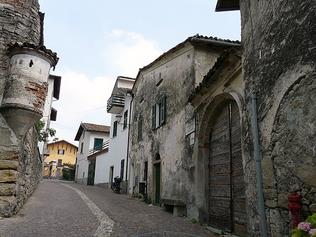
Parodi Ligure
- municipality in Italy
Parodi Ligure is a picturesque village in the Liguria region of Italy, nestled in the Apennine Mountains. It is an excellent destination for hiking enthusiasts looking to explore the beautiful natural landscape, charming rural settings, and rich historical sites....
- Country:

- Postal Code: 15060
- Local Dialing Code: 0143
- Licence Plate Code: AL
- Coordinates: 44° 40' 15" N, 8° 45' 35" E


- GPS tracks (wikiloc): [Link]
- AboveSeaLevel: 330 м m
- Area: 12.54 sq km
- Population: 646
- Web site: [Link]
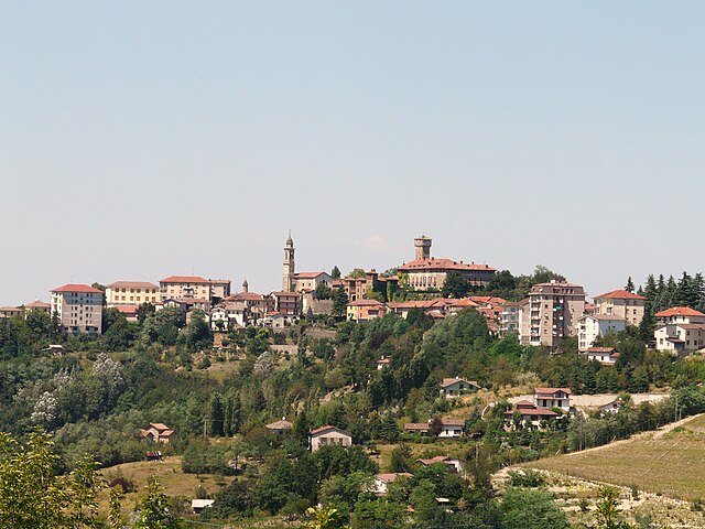
Tagliolo Monferrato
- municipality in Italy
Tagliolo Monferrato is a charming village located in the Monferrato region of northern Italy, known for its stunning landscapes, vineyards, and rich cultural heritage. Hiking in this area offers a fantastic opportunity to explore the picturesque countryside, rolling hills, and ancient villages....
- Country:

- Postal Code: 15070
- Local Dialing Code: 0143
- Licence Plate Code: AL
- Coordinates: 44° 38' 21" N, 8° 40' 1" E


- GPS tracks (wikiloc): [Link]
- AboveSeaLevel: 315 м m
- Area: 26.21 sq km
- Population: 1567
- Web site: [Link]
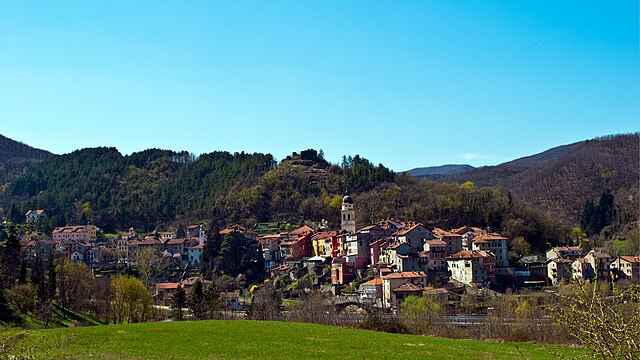
Voltaggio
- Italian comune
Voltaggio is a charming mountain village located in the Italian region of Liguria. Nestled in the Apennines, it offers a variety of hiking opportunities for both beginners and experienced hikers. The area is characterized by its scenic landscapes, lush forests, and panoramic views of both the mountains and the surrounding countryside....
- Country:

- Postal Code: 15060
- Local Dialing Code: 010
- Licence Plate Code: AL
- Coordinates: 44° 37' 22" N, 8° 50' 39" E


- GPS tracks (wikiloc): [Link]
- AboveSeaLevel: 342 м m
- Area: 52.18 sq km
- Population: 724
- Web site: [Link]


Mele
- Italian comune
Mele, located on the island of Efate in Vanuatu, offers breathtaking landscapes and diverse hiking experiences. The region is particularly known for its lush tropical forests, cascading waterfalls, and stunning coastal views....
- Country:

- Postal Code: 16010
- Local Dialing Code: 010
- Licence Plate Code: GE
- Coordinates: 44° 26' 44" N, 8° 44' 53" E


- GPS tracks (wikiloc): [Link]
- AboveSeaLevel: 125 м m
- Area: 16.93 sq km
- Population: 2708
- Web site: [Link]


Campo Ligure
- Italian comune
Campo Ligure is a picturesque town located in the Liguria region of Italy, quite known for its beautiful hiking trails and stunning natural landscapes. Here are some highlights you might find interesting about hiking in the area:...
- Country:

- Postal Code: 16013
- Local Dialing Code: 010
- Licence Plate Code: GE
- Coordinates: 44° 32' 17" N, 8° 41' 52" E


- GPS tracks (wikiloc): [Link]
- AboveSeaLevel: 342 м m
- Area: 23.74 sq km
- Population: 2885
- Web site: [Link]


Masone
- Italian comune
Masone, a town located in the province of Genoa in the Liguria region of Italy, offers picturesque hiking opportunities, characterized by its lush landscapes, hills, and proximity to the Apennine mountains. Here are some highlights for hiking in Masone:...
- Country:

- Postal Code: 16010
- Local Dialing Code: 010
- Licence Plate Code: GE
- Coordinates: 44° 30' 13" N, 8° 42' 43" E


- GPS tracks (wikiloc): [Link]
- AboveSeaLevel: 406 м m
- Area: 29.44 sq km
- Population: 3694
- Web site: [Link]
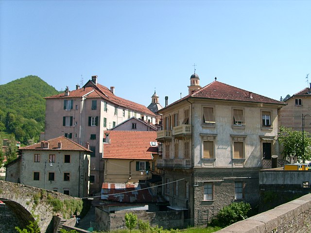

Rossiglione
- Italian comune
Rossiglione is a charming village located in the Liguria region of Italy, nestled among the lush hills and landscapes of the Apennines. It's an excellent spot for hiking, offering a variety of trails that cater to different skill levels and interests. Here are some highlights about hiking in Rossiglione:...
- Country:

- Postal Code: 16010
- Local Dialing Code: 010
- Licence Plate Code: GE
- Coordinates: 44° 34' 0" N, 8° 40' 0" E


- GPS tracks (wikiloc): [Link]
- AboveSeaLevel: 300 м m
- Area: 47.59 sq km
- Population: 2693
- Web site: [Link]
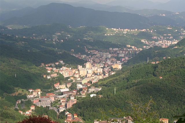

Campomorone
- Italian comune
Campomorone, located in the Liguria region of Italy near Genoa, offers some beautiful hiking opportunities amidst its lush landscapes and charming scenery. Here are some highlights and tips for hiking in the area:...
- Country:

- Postal Code: 16014
- Local Dialing Code: 010
- Licence Plate Code: GE
- Coordinates: 44° 30' 25" N, 8° 53' 30" E


- GPS tracks (wikiloc): [Link]
- AboveSeaLevel: 118 м m
- Area: 25.91 sq km
- Population: 6849
- Web site: [Link]


Ceranesi
- Italian comune
Ceranesi is a charming village located in the Liguria region of Italy, nestled in the foothills of the Apennines not far from Genoa. The area is known for its stunning natural landscapes, making it a great destination for hiking enthusiasts. Here are some highlights of hiking in and around Ceranesi:...
- Country:

- Postal Code: 16014
- Local Dialing Code: 010
- Licence Plate Code: GE
- Coordinates: 44° 30' 30" N, 8° 53' 2" E


- GPS tracks (wikiloc): [Link]
- AboveSeaLevel: 80 м m
- Area: 30.7 sq km
- Population: 3797
- Web site: [Link]

