Châteaufort (Châteaufort)
- commune in Alpes-de-Haute-Provence, France
Châteaufort, located in the Alpes-de-Haute-Provence region of France, is known for its stunning landscapes and rich natural beauty, making it an excellent destination for hiking enthusiasts. Here are some key points to consider if you're planning a hiking trip in the area:
Scenic Landscapes
- Diverse Terrain: The region features a variety of terrains, from gentle rolling hills to more rugged mountainous landscapes. This diversity provides a range of hiking options for all skill levels.
- Natural Parks: Châteaufort is near the Verdon Regional Natural Park, famed for its striking gorges and green valleys, which offer breathtaking views and dramatic landscapes.
Hiking Trails
- Marked Trails: There are numerous marked trails in and around Châteaufort. Look for local signs or guides that can provide you with maps and information on different routes.
- Difficulty Levels: Trails vary from easy day hikes suitable for families to more challenging hikes that require good fitness levels and experience. Routes may lead to scenic viewpoints, waterfalls, and historical sites.
Flora and Fauna
- Biodiversity: The region is home to a rich variety of plant and animal life. During your hike, keep an eye out for local wildlife and unique flora, which can be especially vibrant in spring and early summer.
- Photography Opportunities: The natural beauty of the area provides ample opportunities for photography, whether it's the panoramic views or intricate details of plants and wildlife.
Best Time to Hike
- Spring and Fall: The best times to hike in Châteaufort are during the spring (April to June) and fall (September to October), when the weather is typically mild and the landscapes are particularly beautiful.
- Summer: While summer is also popular for hiking, it can be hot, so be prepared with plenty of water and sun protection.
Local Culture and Experience
- Historical Context: The region has a rich cultural history, and you may encounter ancient ruins or historical markers along some trails.
- Local Cuisine: Post-hike, consider sampling local cuisine in nearby villages. Many offer delightful Provençal dishes that can be a perfect way to refuel after a day of walking.
Safety Tips
- Preparation: Ensure you are well-prepared with appropriate gear, such as sturdy hiking boots, sufficient water, snacks, and a map or GPS.
- Weather Awareness: Check the weather conditions before setting out, as they can change rapidly in mountainous areas.
- Respect Nature: Follow Leave No Trace principles to preserve the natural beauty of the area for future visitors.
Whether you're looking for a leisurely hike or an adventurous trek, Châteaufort and its surroundings have much to offer. Enjoy your hiking experience!
- Country:

- Postal Code: 04250
- Coordinates: 44° 16' 27" N, 6° 0' 58" E


- GPS tracks (wikiloc): [Link]
- Area: 13.73 sq km
- Population: 28
- Wikipedia en: wiki(en)
- Wikipedia: wiki(fr)
- Wikidata storage: Wikidata: Q871460
- Wikipedia Commons Category: [Link]
- Freebase ID: [/m/03m7_5j]
- Freebase ID: [/m/03m7_5j]
- GeoNames ID: Alt: [6446593]
- GeoNames ID: Alt: [6446593]
- SIREN number: [210400503]
- SIREN number: [210400503]
- INSEE municipality code: 04050
- INSEE municipality code: 04050
Shares border with regions:

Saint-Geniez
- commune in Alpes-de-Haute-Provence, France
Saint-Geniez is a charming village located in the heart of the Aveyron department in southern France. The area is known for its stunning landscapes, rich history, and excellent hiking opportunities. Here are some things you can expect when hiking in and around Saint-Geniez:...
- Country:

- Postal Code: 04200
- Coordinates: 44° 14' 43" N, 6° 3' 11" E


- GPS tracks (wikiloc): [Link]
- Area: 38.94 sq km
- Population: 95

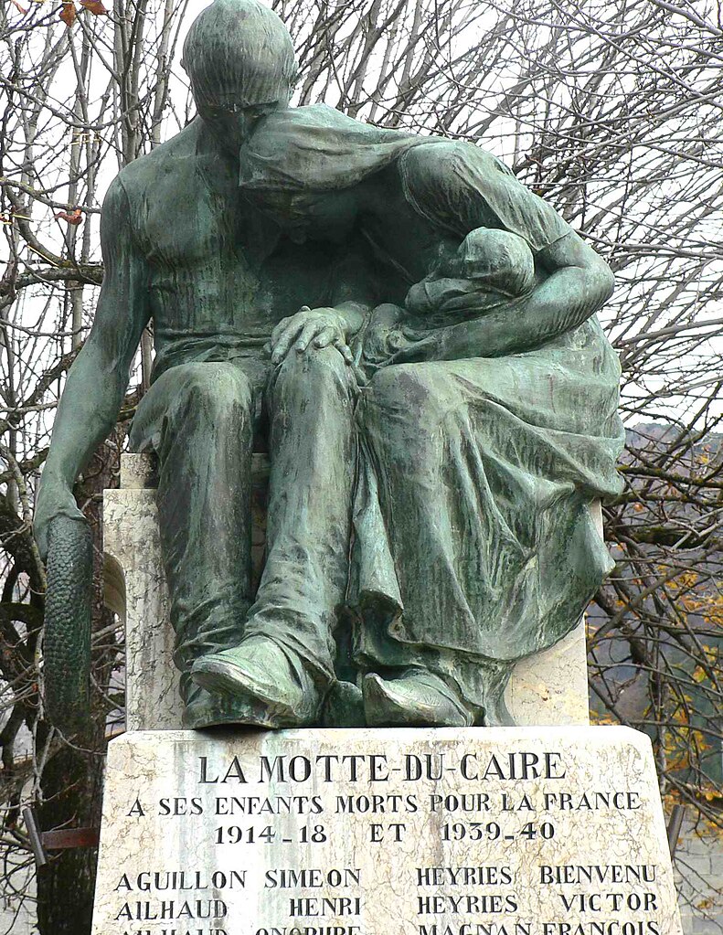
La Motte-du-Caire
- commune in Alpes-de-Haute-Provence, France
La Motte-du-Caire is a charming village located in the Alpes-de-Haute-Provence region of southeastern France. It's a great area for hiking, offering beautiful landscapes, diverse flora and fauna, and various trails that cater to different skill levels. Here are some key points to consider if you're planning a hiking trip in La Motte-du-Caire:...
- Country:

- Postal Code: 04250
- Coordinates: 44° 20' 38" N, 6° 1' 42" E


- GPS tracks (wikiloc): [Link]
- Area: 27.27 sq km
- Population: 554

Valernes
- commune in Alpes-de-Haute-Provence, France
Valernes is a lesser-known yet charming destination for hiking enthusiasts, located in the Alpes-de-Haute-Provence region of France. Surrounded by picturesque landscapes, Valernes offers a variety of trails suitable for different skill levels, allowing hikers to immerse themselves in the stunning natural beauty of the area....
- Country:

- Postal Code: 04200
- Coordinates: 44° 15' 44" N, 5° 57' 29" E


- GPS tracks (wikiloc): [Link]
- Area: 28.49 sq km
- Population: 253

Valavoire
- commune in Alpes-de-Haute-Provence, France
Valavoire, located in the beautiful region of the French Alps, offers stunning landscapes and a variety of hiking trails suitable for different skill levels. Here’s what you should know about hiking in Valavoire:...
- Country:

- Postal Code: 04250
- Coordinates: 44° 16' 45" N, 6° 3' 59" E


- GPS tracks (wikiloc): [Link]
- Area: 16.81 sq km
- Population: 43

Nibles
- commune in Alpes-de-Haute-Provence, France
It seems there might be a small misunderstanding—there isn't a widely recognized hiking destination specifically called "Nibles." However, if you're referring to a particular place or a lesser-known trail, please provide more context or correct the name, and I'd be happy to help!...
- Country:

- Postal Code: 04250
- Coordinates: 44° 16' 53" N, 6° 1' 9" E


- GPS tracks (wikiloc): [Link]
- Area: 12.31 sq km
- Population: 43

Clamensane
- commune in Alpes-de-Haute-Provence, France
Clamensane is a picturesque commune in the Alpes-de-Haute-Provence department of southeastern France. It offers beautiful hiking opportunities, particularly for those who enjoy mountainous terrain and stunning landscapes....
- Country:

- Postal Code: 04250
- Coordinates: 44° 19' 19" N, 6° 4' 5" E


- GPS tracks (wikiloc): [Link]
- Area: 23.73 sq km
- Population: 176
