Châteauneuf-Val-de-Bargis (Châteauneuf-Val-de-Bargis)

- commune in Nièvre, France
- Country:

- Postal Code: 58350
- Coordinates: 47° 17' 1" N, 3° 13' 35" E


- GPS tracks (wikiloc): [Link]
- Area: 47.56 sq km
- Population: 546
- Web site: http://chateauneufvaldebargis.fr
- Wikipedia en: wiki(en)
- Wikipedia: wiki(fr)
- Wikidata storage: Wikidata: Q890158
- Wikipedia Commons Category: [Link]
- Freebase ID: [/m/03qfc7d]
- GeoNames ID: Alt: [3026220]
- SIREN number: [215800640]
- BnF ID: [15266329f]
- VIAF ID: Alt: [262048540]
- Library of Congress authority ID: Alt: [n93120054]
- PACTOLS thesaurus ID: [pcrtF4dPXZTtfJ]
- INSEE municipality code: 58064
Shares border with regions:


Dompierre-sur-Nièvre
- commune in Nièvre, France
- Country:
- Postal Code: 58350
- Coordinates: 47° 14' 18" N, 3° 15' 6" E
- GPS tracks (wikiloc): [Link]
- Area: 18.6 sq km
- Population: 200


Nannay
- commune in Nièvre, France
- Country:
- Postal Code: 58350
- Coordinates: 47° 15' 44" N, 3° 11' 28" E
- GPS tracks (wikiloc): [Link]
- Area: 11.44 sq km
- Population: 118
- Web site: [Link]


Vielmanay
- commune in Nièvre, France
- Country:
- Postal Code: 58150
- Coordinates: 47° 16' 1" N, 3° 6' 52" E
- GPS tracks (wikiloc): [Link]
- Area: 21.33 sq km
- Population: 181


Saint-Malo-en-Donziois
- commune in Nièvre, France
- Country:
- Postal Code: 58350
- Coordinates: 47° 18' 48" N, 3° 16' 3" E
- GPS tracks (wikiloc): [Link]
- Area: 14.81 sq km
- Population: 130


Sainte-Colombe-des-Bois
- commune in Nièvre, France
- Country:
- Postal Code: 58220
- Coordinates: 47° 19' 19" N, 3° 8' 29" E
- GPS tracks (wikiloc): [Link]
- AboveSeaLevel: 194 м m
- Area: 29.59 sq km
- Population: 120


Cessy-les-Bois
- commune in Nièvre, France
- Country:
- Postal Code: 58220
- Coordinates: 47° 20' 10" N, 3° 12' 21" E
- GPS tracks (wikiloc): [Link]
- AboveSeaLevel: 235 м m
- Area: 17.49 sq km
- Population: 99


Champlemy
- commune in Nièvre, France
- Country:
- Postal Code: 58210
- Coordinates: 47° 17' 9" N, 3° 21' 4" E
- GPS tracks (wikiloc): [Link]
- Area: 36.82 sq km
- Population: 336

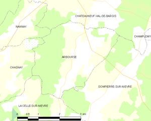
Arbourse
- commune in Nièvre, France
- Country:
- Postal Code: 58350
- Coordinates: 47° 14' 56" N, 3° 13' 37" E
- GPS tracks (wikiloc): [Link]
- Area: 9.2 sq km
- Population: 124