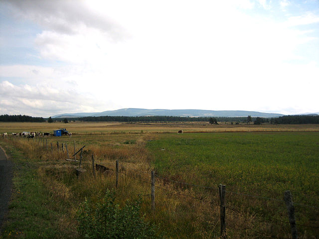
Châteauneuf-de-Randon (Châteauneuf-de-Randon)

- commune in Lozère, France
- Country:

- Postal Code: 48170
- Coordinates: 44° 38' 26" N, 3° 40' 31" E


- GPS tracks (wikiloc): [Link]
- Area: 24.49 sq km
- Population: 565
- Web site: http://www.ot-chateauneufderandon.fr
- Wikipedia en: wiki(en)
- Wikipedia: wiki(fr)
- Wikidata storage: Wikidata: Q454435
- Wikipedia Commons Category: [Link]
- Freebase ID: [/m/08nm4w]
- Freebase ID: [/m/08nm4w]
- GeoNames ID: Alt: [3026239]
- GeoNames ID: Alt: [3026239]
- SIREN number: [214800435]
- SIREN number: [214800435]
- BnF ID: [15261450b]
- BnF ID: [15261450b]
- VIAF ID: Alt: [129456703]
- VIAF ID: Alt: [129456703]
- Library of Congress authority ID: Alt: [nr93041808]
- Library of Congress authority ID: Alt: [nr93041808]
- WOEID: [584975]
- WOEID: [584975]
- INSEE municipality code: 48043
- INSEE municipality code: 48043
- US National Archives Identifier: 10038032
- US National Archives Identifier: 10038032
Shares border with regions:
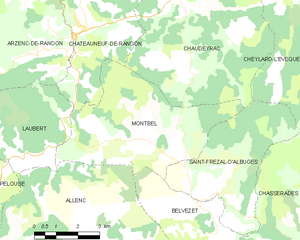
Montbel
- commune in Lozère, France
- Country:
- Postal Code: 48170
- Coordinates: 44° 35' 31" N, 3° 42' 56" E
- GPS tracks (wikiloc): [Link]
- Area: 22.87 sq km
- Population: 118
Pierrefiche
- commune in Lozère, France
- Country:
- Postal Code: 48300
- Coordinates: 44° 41' 26" N, 3° 44' 0" E
- GPS tracks (wikiloc): [Link]
- Area: 16.82 sq km
- Population: 165

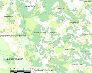
Saint-Jean-la-Fouillouse
- commune in Lozère, France
- Country:
- Postal Code: 48170
- Coordinates: 44° 42' 3" N, 3° 41' 29" E
- GPS tracks (wikiloc): [Link]
- Area: 29.27 sq km
- Population: 159


Arzenc-de-Randon
- commune in Lozère, France
- Country:
- Postal Code: 48170
- Coordinates: 44° 39' 43" N, 3° 37' 55" E
- GPS tracks (wikiloc): [Link]
- Area: 69.2 sq km
- Population: 213


Laubert
- commune in Lozère, France
- Country:
- Postal Code: 48170
- Coordinates: 44° 35' 8" N, 3° 38' 25" E
- GPS tracks (wikiloc): [Link]
- Area: 14.28 sq km
- Population: 102


Chaudeyrac
- commune in Lozère, France
- Country:
- Postal Code: 48170
- Coordinates: 44° 39' 34" N, 3° 45' 23" E
- GPS tracks (wikiloc): [Link]
- Area: 44.1 sq km
- Population: 310