Châteney (Châteney)

- commune in Haute-Saône, France
- Country:

- Postal Code: 70240
- Coordinates: 47° 41' 32" N, 6° 18' 50" E


- GPS tracks (wikiloc): [Link]
- AboveSeaLevel: 360 м m
- Area: 2.6 sq km
- Population: 54
- Wikipedia en: wiki(en)
- Wikipedia: wiki(fr)
- Wikidata storage: Wikidata: Q832872
- Wikipedia Commons Category: [Link]
- Freebase ID: [/m/03ntl7n]
- GeoNames ID: Alt: [6617474]
- SIREN number: [217001403]
- archINFORM location ID: [8251]
- INSEE municipality code: 70140
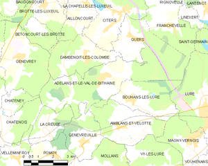
Shares border with regions:


Saulx, Haute-Saône
- commune in Haute-Saône, France
- Country:
- Postal Code: 70240
- Coordinates: 47° 41' 43" N, 6° 16' 45" E
- GPS tracks (wikiloc): [Link]
- AboveSeaLevel: 310 м m
- Area: 15.12 sq km
- Population: 908
- Web site: [Link]

Adelans-et-le-Val-de-Bithaine
- commune in Haute-Saône, France
- Country:
- Postal Code: 70200
- Coordinates: 47° 42' 35" N, 6° 23' 52" E
- GPS tracks (wikiloc): [Link]
- AboveSeaLevel: 387 м m
- Area: 17.3 sq km
- Population: 298


Châtenois
- commune in Haute-Saône, France
- Country:
- Postal Code: 70240
- Coordinates: 47° 41' 3" N, 6° 18' 48" E
- GPS tracks (wikiloc): [Link]
- Area: 5.75 sq km
- Population: 125

Genevrey
- commune in Haute-Saône, France
- Country:
- Postal Code: 70240
- Coordinates: 47° 43' 26" N, 6° 19' 29" E
- GPS tracks (wikiloc): [Link]
- Area: 11.97 sq km
- Population: 244