Chérencé-le-Héron (Chérencé-le-Héron)

- commune in Manche, France
- Country:

- Postal Code: 50800
- Coordinates: 48° 48' 7" N, 1° 11' 48" E


- GPS tracks (wikiloc): [Link]
- AboveSeaLevel: 230 м m
- Area: 9.54 sq km
- Population: 388
- Wikipedia en: wiki(en)
- Wikipedia: wiki(fr)
- Wikidata storage: Wikidata: Q1071726
- Wikipedia Commons Category: [Link]
- Freebase ID: [/m/03qcqvp]
- Freebase ID: [/m/03qcqvp]
- GeoNames ID: Alt: [6616902]
- GeoNames ID: Alt: [6616902]
- SIREN number: [215001306]
- SIREN number: [215001306]
- BnF ID: [15262107m]
- BnF ID: [15262107m]
- VIAF ID: Alt: [148188342]
- VIAF ID: Alt: [148188342]
- Library of Congress authority ID: Alt: [nr91006624]
- Library of Congress authority ID: Alt: [nr91006624]
- INSEE municipality code: 50130
- INSEE municipality code: 50130
Shares border with regions:


La Chaise-Baudouin
- commune in Manche, France
- Country:
- Postal Code: 50370
- Coordinates: 48° 45' 49" N, 1° 14' 13" E
- GPS tracks (wikiloc): [Link]
- Area: 12.06 sq km
- Population: 489

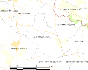
La Chapelle-Cécelin
- commune in Manche, France
- Country:
- Postal Code: 50800
- Coordinates: 48° 48' 39" N, 1° 9' 38" E
- GPS tracks (wikiloc): [Link]
- Area: 5.22 sq km
- Population: 238


Saint-Jean-du-Corail-des-Bois
- commune in Manche, France
- Country:
- Postal Code: 50370
- Coordinates: 48° 46' 3" N, 1° 12' 4" E
- GPS tracks (wikiloc): [Link]
- Area: 3.63 sq km
- Population: 71


La Trinité
- commune in Manche, France
- Country:
- Postal Code: 50800
- Coordinates: 48° 47' 26" N, 1° 14' 7" E
- GPS tracks (wikiloc): [Link]
- Area: 9.16 sq km
- Population: 400


Sainte-Cécile
- commune in Manche, France
- Country:
- Postal Code: 50800
- Coordinates: 48° 50' 8" N, 1° 11' 22" E
- GPS tracks (wikiloc): [Link]
- Area: 11.29 sq km
- Population: 829


Saint-Martin-le-Bouillant
- commune in Manche, France
- Country:
- Postal Code: 50800
- Coordinates: 48° 47' 7" N, 1° 10' 38" E
- GPS tracks (wikiloc): [Link]
- Area: 12.37 sq km
- Population: 316

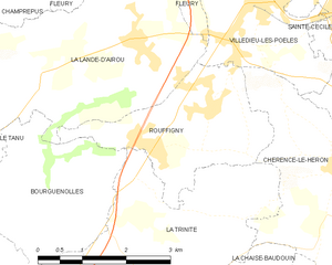
Rouffigny
- former commune in Manche, France
- Country:
- Postal Code: 50800
- Coordinates: 48° 48' 13" N, 1° 15' 14" E
- GPS tracks (wikiloc): [Link]
- Area: 6.72 sq km
- Population: 308