La Chaise-Baudouin (La Chaise-Baudouin)

- commune in Manche, France
- Country:

- Postal Code: 50370
- Coordinates: 48° 45' 49" N, 1° 14' 13" E


- GPS tracks (wikiloc): [Link]
- Area: 12.06 sq km
- Population: 489
- Wikipedia en: wiki(en)
- Wikipedia: wiki(fr)
- Wikidata storage: Wikidata: Q1071302
- Wikipedia Commons Category: [Link]
- Freebase ID: [/m/03x_vtn]
- Freebase ID: [/m/03x_vtn]
- GeoNames ID: Alt: [6614483]
- GeoNames ID: Alt: [6614483]
- SIREN number: [215001124]
- SIREN number: [215001124]
- BnF ID: [15262089h]
- BnF ID: [15262089h]
- INSEE municipality code: 50112
- INSEE municipality code: 50112
Shares border with regions:


Braffais
- former commune in Manche, France
- Country:
- Postal Code: 50870
- Coordinates: 48° 45' 25" N, 1° 15' 40" E
- GPS tracks (wikiloc): [Link]
- Area: 5.79 sq km
- Population: 192


Tirepied
- commune in Manche, France
- Country:
- Postal Code: 50870
- Coordinates: 48° 42' 36" N, 1° 15' 50" E
- GPS tracks (wikiloc): [Link]
- Area: 18.77 sq km
- Population: 802

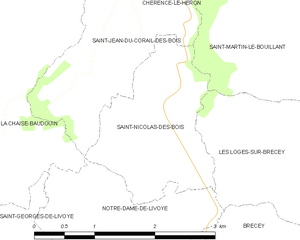
Saint-Nicolas-des-Bois
- commune in Manche, France
- Country:
- Postal Code: 50370
- Coordinates: 48° 45' 21" N, 1° 11' 38" E
- GPS tracks (wikiloc): [Link]
- AboveSeaLevel: 88 м m
- Area: 3.57 sq km
- Population: 99


Saint-Georges-de-Livoye
- commune in Manche, France
- Country:
- Postal Code: 50370
- Coordinates: 48° 44' 12" N, 1° 12' 59" E
- GPS tracks (wikiloc): [Link]
- Area: 5.53 sq km
- Population: 203


Notre-Dame-de-Livoye
- commune in Manche, France
- Country:
- Postal Code: 50370
- Coordinates: 48° 44' 39" N, 1° 12' 24" E
- GPS tracks (wikiloc): [Link]
- Area: 3.54 sq km
- Population: 139


Chérencé-le-Héron
- commune in Manche, France
- Country:
- Postal Code: 50800
- Coordinates: 48° 48' 7" N, 1° 11' 48" E
- GPS tracks (wikiloc): [Link]
- AboveSeaLevel: 230 м m
- Area: 9.54 sq km
- Population: 388


Saint-Jean-du-Corail-des-Bois
- commune in Manche, France
- Country:
- Postal Code: 50370
- Coordinates: 48° 46' 3" N, 1° 12' 4" E
- GPS tracks (wikiloc): [Link]
- Area: 3.63 sq km
- Population: 71


La Trinité
- commune in Manche, France
- Country:
- Postal Code: 50800
- Coordinates: 48° 47' 26" N, 1° 14' 7" E
- GPS tracks (wikiloc): [Link]
- Area: 9.16 sq km
- Population: 400