Cham (Cham)

- municipality in Switzerland
 Hiking in Cham
Hiking in Cham, Switzerland, offers a beautiful blend of scenic views, diverse trails, and rich cultural experiences. Located in the Zug region, Cham lies along the shores of Lake Zug and is surrounded by stunning countryside and mountains. Here are some highlights and tips for hiking in this area:
Trails
-
Lake Zug Circumference: This is a popular trail that loops around Lake Zug, offering picturesque views of the water and surrounding mountains. The trail is relatively flat and suitable for all levels of hikers.
-
Zugerberg Mountain: A hike up Zugerberg provides an opportunity to enjoy panoramic views of the Alps and Lake Zug. There are various trails on the mountain ranging from beginner to more challenging routes.
-
Hochschwendi: This trail offers a more secluded hiking experience, leading you through beautiful meadows and forests with picturesque viewpoints along the way.
-
Hiking to Walchwil: A moderately challenging hike that takes you to the nearby village of Walchwil, providing stunning views of the lake and hills.
Landscape & Views
Hiking in Cham allows you to experience lush green forests, charming village landscapes, and breathtaking views of the Swiss Alps. The changing seasons also transform the scenery—spring brings blooming flowers, summer offers vibrant greenery, autumn showcases colorful foliage, and winter provides a serene snow-covered landscape.
Tips for Hiking in Cham
- Weather: Check the weather conditions before setting out, as they can change rapidly in the mountains.
- Gear: Wear appropriate hiking boots with good grip and dress in layers to handle varying temperatures.
- Stay Hydrated: Carry enough water and snacks to keep your energy up during your hikes.
- Maps and Apps: Use a hiking app or a good physical map to navigate the trails. Some trails are well-marked, but it's always good to be prepared.
- Public Transport: Cham is well connected by public transport, making it easy to access trailheads.
Local Attractions
After a day of hiking, consider enjoying the local cuisine at one of Cham’s restaurants, or relaxing by the lake. The area is known for its cheese and other Swiss specialties.
Conclusion
Hiking in Cham, Switzerland, is a delightful experience for both beginners and seasoned hikers. With its stunning natural beauty, well-maintained trails, and charming surroundings, it's a perfect destination for outdoor enthusiasts. Make sure to plan your hike according to your skill level, and most importantly, enjoy the incredible scenery that this region has to offer!
- Country:

- Postal Code: 6330
- Local Dialing Code: 041
- Licence Plate Code: ZG
- Coordinates: 47° 10' 49" N, 8° 27' 34" E


- GPS tracks (wikiloc): [Link]
- AboveSeaLevel: 420 м m
- Area: 19.82 sq km
- Population: 16690
- Web site: http://www.cham.ch
- Wikipedia en: wiki(en)
- Wikipedia: wiki(de)
- Wikidata storage: Wikidata: Q69235
- Wikipedia Commons Gallery: [Link]
- Wikipedia Commons Category: [Link]
- Freebase ID: [/m/04232y]
- GeoNames ID: Alt: [2661228]
- BnF ID: [125510833]
- VIAF ID: Alt: [132144814514014221228]
- OSM relation ID: [1683139]
- GND ID: Alt: [4009720-1]
- archINFORM location ID: [14014]
- Library of Congress authority ID: Alt: [n85318134]
- MusicBrainz area ID: [4994682f-4e6b-4d06-9810-5b8594fa9513]
- HDS ID: [788]
- Swiss municipality code: [1702]
- FAST ID: [1234537]
Shares border with regions:
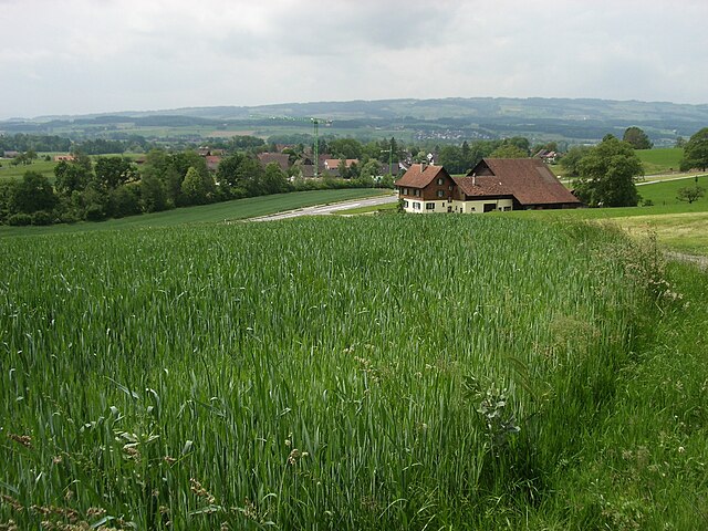

Maschwanden
- municipality in Switzerland
Hiking in Maschwanden
Maschwanden is a picturesque village located near Zug in Switzerland, surrounded by beautiful natural landscapes that are ideal for hiking. The area offers several trails suitable for various skill levels, making it a great destination for both novice and experienced hikers....
- Country:
- Postal Code: 8933
- Local Dialing Code: 044
- Licence Plate Code: ZH
- Coordinates: 47° 14' 5" N, 8° 25' 45" E
- GPS tracks (wikiloc): [Link]
- AboveSeaLevel: 407 м m
- Area: 4.67 sq km
- Population: 641
- Web site: [Link]
Hünenberg
- municipality in Switzerland
Hiking in Hünenberg
Hünenberg, located in the Canton of Zug in Switzerland, offers a blend of beautiful landscapes, scenic views, and various hiking opportunities. Here are some key points to consider if you’re planning a hike in this area:...
- Country:
- Postal Code: 6331
- Local Dialing Code: 041
- Licence Plate Code: ZG
- Coordinates: 47° 11' 29" N, 8° 25' 11" E
- GPS tracks (wikiloc): [Link]
- AboveSeaLevel: 403 м m
- Area: 18.7 sq km
- Population: 8824
- Web site: [Link]
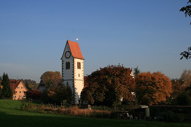

Knonau
- municipality in Switzerland
Hiking in Knonau
Knonau is a picturesque town located in the Canton of Zurich, Switzerland, known for its beautiful landscapes and rich natural surroundings, making it an excellent destination for hiking enthusiasts. Here are some key points to consider when hiking in and around Knonau:...
- Country:
- Postal Code: 8934
- Local Dialing Code: 044
- Licence Plate Code: ZH
- Coordinates: 47° 13' 28" N, 8° 27' 45" E
- GPS tracks (wikiloc): [Link]
- AboveSeaLevel: 430 м m
- Area: 6.48 sq km
- Population: 2301
- Web site: [Link]

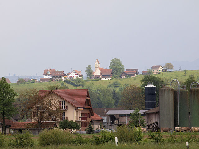
Steinhausen
- municipality in Switzerland
Hiking in Steinhausen
Steinhausen is a charming municipality located in the canton of Zug, Switzerland. Although it may not be as widely known for hiking as some of the larger mountainous regions, there are still opportunities in and around the area for enjoyable outdoor activities....
- Country:
- Postal Code: 6312
- Local Dialing Code: 041
- Licence Plate Code: ZG
- Coordinates: 47° 11' 49" N, 8° 29' 10" E
- GPS tracks (wikiloc): [Link]
- AboveSeaLevel: 427 м m
- Area: 5.10 sq km
- Population: 9875
- Web site: [Link]


Zug
- city in Switzerland, capital of its canton
Hiking in Zug
Hiking in Zug, Switzerland, offers a wonderful blend of scenic beauty, varied terrain, and accessible trails, making it an ideal destination for both casual walkers and experienced hikers. Here are some key highlights about hiking in the area:...
- Country:
- Postal Code: 6317; 6305; 6300; 6310; 6300–6305
- Local Dialing Code: 041
- Licence Plate Code: ZG
- Coordinates: 47° 10' 9" N, 8° 30' 59" E
- GPS tracks (wikiloc): [Link]
- AboveSeaLevel: 611 м m
- Area: 21.61 sq km
- Population: 30205
- Web site: [Link]