Canton of Zug (Kanton Zug)


- canton of Switzerland
 Hiking in Canton of Zug
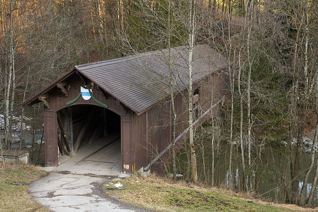
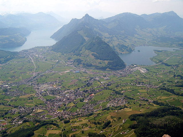
Hiking in the Canton of Zug, Switzerland, offers a unique blend of stunning landscapes, quaint villages, and a variety of trails suitable for all levels of hikers. The canton is known for its picturesque lakes, rolling hills, and proximity to the mountains, particularly the nearby Zugerberg and the Rigi massif.
Key Features of Hiking in Zug:
-
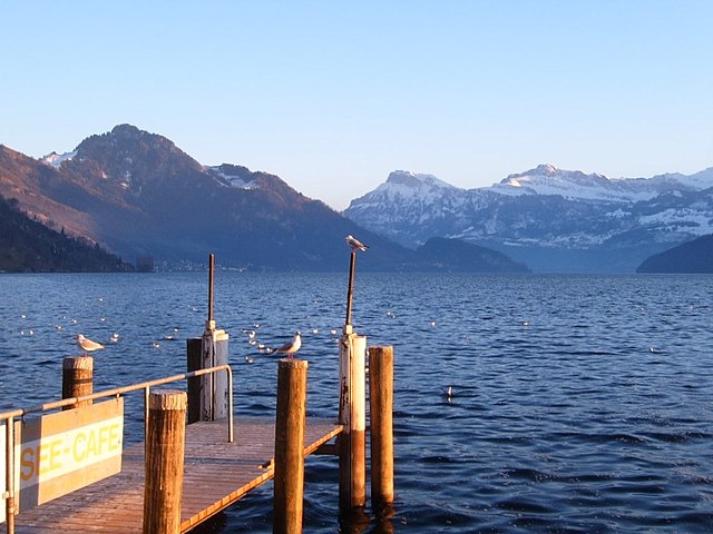
Scenic Trails: The region boasts a network of well-marked hiking trails, many of which offer breathtaking views of Lake Zug, the Swiss Alps, and the surrounding countryside. Popular hikes include the circular route around Lake Zug and trails leading up to the Zugerberg.
-
Accessibility: Zug is conveniently located and easily accessible by public transportation, making it a great starting point for many hiking adventures. From the city center, you can quickly reach various trailheads.
-
Variety of Difficulties: Whether you are looking for a leisurely stroll or a challenging hike, there are options for everyone. Some trails are family-friendly and suitable for all ages, while others provide a more demanding experience for seasoned hikers.
-
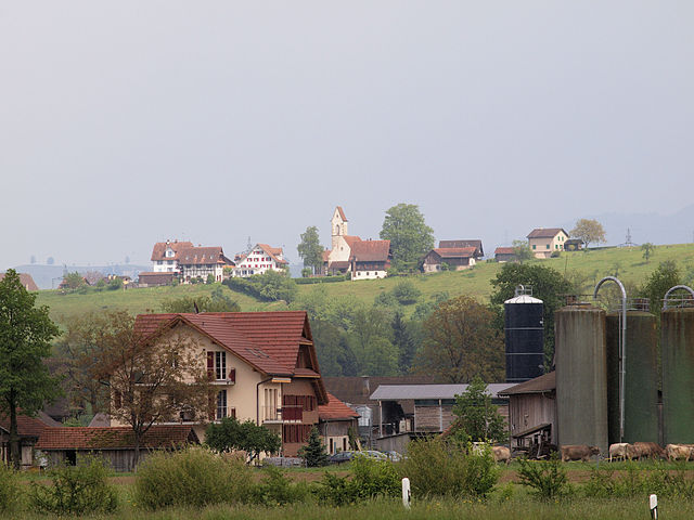
Cultural Experiences: Hiking in the Canton of Zug allows you to explore charming villages, traditional Swiss architecture, and local cuisine. Take breaks in local restaurants or pack a picnic to enjoy in nature.
-
Seasonal Hiking: Each season offers a different experience. Spring and summer bring lush greenery and blooming flowers, while autumn showcases vibrant foliage. Winter hiking and snowshoeing are also popular in the winter months.
-
Natural Attractions: In addition to the stunning lake views, you can explore geological features and diverse flora and fauna. The surrounding mountains provide opportunities for alpine scenery and wildlife sightings.
Recommended Hikes:
-
Zugerberg: A popular destination with panoramic views. You can hike up or take a cogwheel train. The trails are well maintained, and you'll find various routes to suit your preferences.
-
Lake Zug Loop: A flat, scenic trail that circles the lake and provides easy access to several picturesque spots for relaxation.
-
Hiking to Rigi: Though slightly outside of Zug, a trip to Rigi offers spectacular views and more challenging hikes. It's easily reachable via public transport.
Tips for Hiking in Zug:
-
Check Weather Conditions: The weather in the Alps can change quickly, so check the forecasts and dress accordingly.
-
Stay Hydrated and Pack Snacks: Carry water and energy-rich snacks to keep your stamina up during your hikes.
-
Respect Nature: Stay on marked trails, and follow local guidelines for preserving the natural environment.
-
Be Prepared: Bring a map or use a hiking app to keep your route in view, especially if you are venturing into less populated areas.
Overall, hiking in the Canton of Zug is a rewarding experience filled with beautiful landscapes and local charm, making it a must-visit destination for outdoor enthusiasts.
- Country:

- Capital: Zug
- Licence Plate Code: ZG
- Coordinates: 47° 0' 0" N, 8° 31' 0" E


- GPS tracks (wikiloc): [Link]
- AboveSeaLevel: 425 м m
- Area: 238.73 sq km
- Web site: http://www.zug.ch/
- Wikipedia en: wiki(en)
- Wikipedia: wiki(de)
- Wikidata storage: Wikidata: Q11933
- Wikipedia Commons Gallery: [Link]
- Wikipedia Commons Category: [Link]
- Freebase ID: [/m/01hyt8]
- GeoNames ID: Alt: [2657907]
- BnF ID: [12354706z]
- VIAF ID: Alt: [129025236]
- OSM relation ID: [53131]
- GND ID: Alt: [4068064-2]
- archINFORM location ID: [4388]
- Library of Congress authority ID: Alt: [n82050742]
- MusicBrainz area ID: [81c0bef1-9878-48bf-aaa2-e0342f0688cc]
- Quora topic ID: [Canton-of-Zug]
- SUDOC authorities ID: [082029717]
- Encyclopædia Britannica Online ID: [place/Zug-canton-Switzerland]
- HDS ID: [7373]
- ISNI: Alt: [0000 0001 1533 7501]
- NUTS code: [CH066]
- Klexikon article ID: [Zug_(Kanton)]
- Ringgold ID: [371179]
- STW Thesaurus for Economics ID: [16981-0]
- ISO 3166-2 code: CH-ZG
- FIPS 10-4 (countries and regions): SZ24
Includes regions:

Baar
- municipality in Switzerland
Hiking in Baar
Baar, located in the canton of Zug in Switzerland, offers a variety of hiking opportunities that allow you to enjoy the stunning natural landscapes of the region. The area is characterized by rolling hills, lush forests, and beautiful views of the surrounding mountains and Lake Zug....
- Country:
- Postal Code: 6340
- Local Dialing Code: 041
- Licence Plate Code: ZG
- Coordinates: 47° 11' 44" N, 8° 31' 35" E
- GPS tracks (wikiloc): [Link]
- AboveSeaLevel: 443 м m
- Area: 24.83 sq km
- Population: 24322
- Web site: [Link]

Oberägeri
- municipality in Switzerland
Hiking in Oberägeri
Oberägeri, located in the Canton of Zug in Switzerland, is a beautiful destination for hiking enthusiasts. Nestled between the Ägeri lake and the surrounding hills, it offers a variety of trails that cater to different skill levels and provide stunning views of the Swiss landscape....
- Country:
- Postal Code: 6315
- Local Dialing Code: 041
- Licence Plate Code: ZG
- Coordinates: 47° 8' 9" N, 8° 36' 49" E
- GPS tracks (wikiloc): [Link]
- AboveSeaLevel: 737 м m
- Area: 36.2 sq km
- Population: 6059
- Web site: [Link]

Unterägeri
- municipality in Switzerland
Hiking in Unterägeri
Unterägeri is a picturesque municipality located in the Canton of Zug, Switzerland, surrounded by stunning landscapes and offering fantastic opportunities for hiking enthusiasts. Here are some highlights and points of interest for hiking in and around Unterägeri:...
- Country:
- Postal Code: 6314
- Local Dialing Code: 041
- Licence Plate Code: ZG
- Coordinates: 47° 7' 14" N, 8° 34' 40" E
- GPS tracks (wikiloc): [Link]
- AboveSeaLevel: 763 м m
- Area: 26.7 sq km
- Population: 8689
- Web site: [Link]
Neuheim
- municipality in Switzerland
Hiking in Neuheim
Neuheim, located in the Canton of Zug in Switzerland, offers a variety of beautiful hiking opportunities that showcase the stunning landscapes of the region. The area is characterized by rolling hills, lush forests, and panoramic views of the surrounding mountains and Lake Zug. Here’s a brief overview of what you can expect when hiking in Neuheim:...
- Country:
- Postal Code: 6345
- Local Dialing Code: 041
- Licence Plate Code: ZG
- Coordinates: 47° 12' 24" N, 8° 34' 40" E
- GPS tracks (wikiloc): [Link]
- AboveSeaLevel: 666 м m
- Area: 7.9 sq km
- Population: 2245
- Web site: [Link]

Menzingen
- municipality in Switzerland
Hiking in Menzingen
Menzingen is a charming municipality located in the Canton of Zug, Switzerland. It is surrounded by beautiful nature and rolling hills, making it an ideal location for hiking enthusiasts. Here are some highlights and tips for hiking in Menzingen:...
- Country:
- Postal Code: 6313
- Local Dialing Code: 041
- Licence Plate Code: ZG
- Coordinates: 47° 10' 12" N, 8° 36' 11" E
- GPS tracks (wikiloc): [Link]
- AboveSeaLevel: 801 м m
- Area: 27.50 sq km
- Population: 4499
- Web site: [Link]
Hünenberg
- municipality in Switzerland
Hiking in Hünenberg
Hünenberg, located in the Canton of Zug in Switzerland, offers a blend of beautiful landscapes, scenic views, and various hiking opportunities. Here are some key points to consider if you’re planning a hike in this area:...
- Country:
- Postal Code: 6331
- Local Dialing Code: 041
- Licence Plate Code: ZG
- Coordinates: 47° 11' 29" N, 8° 25' 11" E
- GPS tracks (wikiloc): [Link]
- AboveSeaLevel: 403 м m
- Area: 18.7 sq km
- Population: 8824
- Web site: [Link]

Walchwil
- municipality in Switzerland
Hiking in Walchwil
Walchwil is a picturesque village located in the Canton of Zug in Switzerland, situated on the shores of Lake Zug. It offers a range of hiking opportunities, making it an excellent destination for both casual walkers and seasoned hikers. Here are some highlights and tips for hiking in and around Walchwil:...
- Country:
- Postal Code: 6318
- Local Dialing Code: 041
- Licence Plate Code: ZG
- Coordinates: 47° 6' 31" N, 8° 31' 57" E
- GPS tracks (wikiloc): [Link]
- AboveSeaLevel: 942 м m
- Area: 15.9 sq km
- Population: 3617
- Web site: [Link]


Risch-Rotkreuz
- municipality in Switzerland
Hiking in Risch-Rotkreuz
Risch-Rotkreuz, located in the Canton of Zug in Switzerland, is a beautiful area for hiking enthusiasts. It offers a mix of scenic landscapes, well-marked trails, and diverse nature, making it a great destination for both casual walkers and more experienced hikers....
- Country:
- Postal Code: 6343
- Local Dialing Code: 041
- Licence Plate Code: ZG
- Coordinates: 47° 8' 28" N, 8° 25' 53" E
- GPS tracks (wikiloc): [Link]
- AboveSeaLevel: 442 м m
- Area: 22.9 sq km
- Population: 10515
- Web site: [Link]

Steinhausen
- municipality in Switzerland
Hiking in Steinhausen
Steinhausen is a charming municipality located in the canton of Zug, Switzerland. Although it may not be as widely known for hiking as some of the larger mountainous regions, there are still opportunities in and around the area for enjoyable outdoor activities....
- Country:
- Postal Code: 6312
- Local Dialing Code: 041
- Licence Plate Code: ZG
- Coordinates: 47° 11' 49" N, 8° 29' 10" E
- GPS tracks (wikiloc): [Link]
- AboveSeaLevel: 427 м m
- Area: 5.10 sq km
- Population: 9875
- Web site: [Link]


Zug
- city in Switzerland, capital of its canton
Hiking in Zug
Hiking in Zug, Switzerland, offers a wonderful blend of scenic beauty, varied terrain, and accessible trails, making it an ideal destination for both casual walkers and experienced hikers. Here are some key highlights about hiking in the area:...
- Country:
- Postal Code: 6317; 6305; 6300; 6310; 6300–6305
- Local Dialing Code: 041
- Licence Plate Code: ZG
- Coordinates: 47° 10' 9" N, 8° 30' 59" E
- GPS tracks (wikiloc): [Link]
- AboveSeaLevel: 611 м m
- Area: 21.61 sq km
- Population: 30205
- Web site: [Link]

Cham
- municipality in Switzerland
Hiking in Cham
Hiking in Cham, Switzerland, offers a beautiful blend of scenic views, diverse trails, and rich cultural experiences. Located in the Zug region, Cham lies along the shores of Lake Zug and is surrounded by stunning countryside and mountains. Here are some highlights and tips for hiking in this area:...
- Country:
- Postal Code: 6330
- Local Dialing Code: 041
- Licence Plate Code: ZG
- Coordinates: 47° 10' 49" N, 8° 27' 34" E
- GPS tracks (wikiloc): [Link]
- AboveSeaLevel: 420 м m
- Area: 19.82 sq km
- Population: 16690
- Web site: [Link]
Shares border with regions:

canton of Zürich
- canton of Switzerland
Hiking in canton of Zürich
The Canton of Zürich offers a rich variety of hiking opportunities, suitable for all skill levels and preferences. Here are some highlights and tips for hiking in this region:...
- Country:
- Capital: Zürich
- Licence Plate Code: ZH
- Coordinates: 47° 0' 0" N, 9° 0' 0" E
- GPS tracks (wikiloc): [Link]
- AboveSeaLevel: 408 м m
- Area: 1729 sq km
- Population: 1408575
- Web site: [Link]


Aargau
- canton of Switzerland
Hiking in Aargau
The Canton of Aargau, located in Switzerland, offers a variety of hiking opportunities that cater to different skill levels and preferences. Here's an overview of what you can expect when hiking in this beautiful region:...
- Country:
- Capital: Aarau
- Licence Plate Code: AG
- Coordinates: 47° 22' 49" N, 8° 0' 51" E
- GPS tracks (wikiloc): [Link]
- AboveSeaLevel: 382 м m
- Area: 1403.77 sq km
- Population: 568671
- Web site: [Link]

Canton of Lucerne
- canton of Switzerland
Hiking in Canton of Lucerne
Hiking in the Canton of Lucerne, located in central Switzerland, offers a diverse range of trails that showcase stunning landscapes, picturesque lakes, and the majestic Alps. Here are some highlights and tips for hiking in this beautiful region:...
- Country:
- Capital: Lucerne
- Licence Plate Code: LU
- Coordinates: 47° 5' 0" N, 8° 7' 0" E
- GPS tracks (wikiloc): [Link]
- AboveSeaLevel: 436 м m
- Area: 1493.51 sq km
- Web site: [Link]

Schwyz
- canton of Switzerland
Hiking in Schwyz
Hiking in the Canton of Schwyz in Switzerland offers a fantastic blend of stunning landscapes, rich cultural history, and well-maintained trails. The region features a variety of terrains, including mountains, lakes, and picturesque villages, making it a great destination for both novice and experienced hikers....
- Country:
- Capital: Schwyz
- Licence Plate Code: SZ
- Coordinates: 47° 4' 0" N, 8° 45' 0" E
- GPS tracks (wikiloc): [Link]
- AboveSeaLevel: 516 м m
- Area: 907.88 sq km
- Population: 155863
- Web site: [Link]