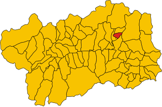
Chamois, Aosta Valley (Chamois)
- Italian comune
 Hiking in Chamois, Aosta Valley
Chamois is a charming village located in the Aosta Valley region of Italy. It is known for its stunning natural scenery, making it a fantastic destination for hiking enthusiasts. Here are some key points about hiking in Chamois:
Scenic Trails:
-
Trail Variety: Chamois boasts a range of hiking trails that cater to various skill levels, from easy walks to challenging treks. You can find paths suitable for beginners, families, and seasoned hikers.
-
Panoramic Views: Many trails offer breathtaking views of the surrounding mountains, including the impressive Grand Combin and Monte Rosa ranges. Be prepared to take plenty of photos!
-
Lakes and Flora: The area is dotted with picturesque alpine lakes, like Lago di Cignana, where you can enjoy peaceful resting spots. The trails showcase diverse flora and fauna unique to the alpine environment.
Notable Routes:
- Chamois to Lago di Cignana: An accessible hike leading to the serene lake, ideal for families and beginners.
- Circular route to Col de Balm: This trail varies in difficulty and provides stunning mountain vistas and a real sense of adventure.
- Chamois-Montagna di Valtournenche trail: A more challenging hike that climbs through lush forests and leads to breathtaking viewpoints.
Tips for Hiking in Chamois:
- Weather Considerations: The weather can change rapidly in the mountains, so check local forecasts and be prepared for varying conditions.
- Proper Gear: Wear suitable hiking boots and carry essentials like water, snacks, a map, and a first-aid kit.
- Local Regulations: Respect nature and the local regulations; stay on marked trails and consider using eco-friendly practices.
- Wildlife Awareness: Be mindful of the local wildlife, and take care to leave no trace.
Getting There:
Chamois is accessible via a cable car from the valley floor, which can be an exciting part of your hiking experience. The lack of road access keeps it serene and less crowded.
Conclusion:
Hiking in Chamois offers an excellent opportunity to immerse yourself in the beauty of the Aosta Valley's mountains. Whether you're looking for a leisurely stroll or an exhilarating trek, Chamois has something for every hiker. Enjoy your adventure!
- Country:

- Postal Code: 11020
- Local Dialing Code: 0166
- Licence Plate Code: AO
- Coordinates: 45° 50' 0" N, 7° 37' 0" E


- GPS tracks (wikiloc): [Link]
- AboveSeaLevel: 1800 м m
- Area: 14.53 sq km
- Population: 95
- Web site: http://www.comune.chamois.ao.it/
- Wikipedia en: wiki(en)
- Wikipedia: wiki(it)
- Wikidata storage: Wikidata: Q34924
- Wikipedia Commons Category: [Link]
- Wikipedia Commons Maps Category: [Link]
- Freebase ID: [/m/0fs_w4]
- GeoNames ID: Alt: [6542489]
- OSM relation ID: [2525]
- BabelNet ID: [03452041n]
- ISTAT ID: 007016
- Italian cadastre code: B491
Shares border with regions:


Antey-Saint-André
- Italian comune
Antey-Saint-André is a charming commune located in the Aosta Valley region of Italy, surrounded by stunning Alpine scenery, making it a great destination for hiking enthusiasts. Here are some key points to consider for hiking in this area:...
- Country:

- Postal Code: 11020
- Local Dialing Code: 0166
- Licence Plate Code: AO
- Coordinates: 45° 48' 0" N, 7° 36' 0" E


- GPS tracks (wikiloc): [Link]
- AboveSeaLevel: 1074 м m
- Area: 11.81 sq km
- Population: 573
- Web site: [Link]


Ayas, Aosta Valley
- Italian comune
Ayas, located in the Aosta Valley region of Italy, is a stunning area known for its picturesque landscapes, charming alpine villages, and a variety of hiking trails that cater to different experience levels. Here are some highlights and recommendations for hiking in Ayas:...
- Country:

- Postal Code: 11020
- Local Dialing Code: 0125
- Licence Plate Code: AO
- Coordinates: 45° 48' 41" N, 7° 41' 12" E


- GPS tracks (wikiloc): [Link]
- AboveSeaLevel: 1698 м m
- Area: 129.42 sq km
- Population: 1377
- Web site: [Link]


La Magdeleine
- Italian comune
La Magdeleine is a beautiful area located in the Aosta Valley region of Italy, known for its stunning landscapes, rich culture, and outdoor activities. While it might not be as widely recognized as some other hiking destinations in the Alps, it offers a range of hiking opportunities for both beginners and experienced hikers....
- Country:

- Postal Code: 11020
- Local Dialing Code: 0166
- Licence Plate Code: AO
- Coordinates: 45° 49' 0" N, 7° 37' 0" E


- GPS tracks (wikiloc): [Link]
- AboveSeaLevel: 1644 м m
- Area: 8.94 sq km
- Population: 108
- Web site: [Link]


Valtournenche
- Italian comune
Valtournenche, located in the Aosta Valley of Italy near the Swiss border, is a stunning destination for hiking enthusiasts. It's well-known for its breathtaking mountain scenery, including views of the iconic Matterhorn, which is particularly visible from the valley and its surrounding areas. Here are some highlights about hiking in Valtournenche:...
- Country:

- Postal Code: 11028
- Local Dialing Code: 0166
- Licence Plate Code: AO
- Coordinates: 45° 53' 0" N, 7° 37' 0" E


- GPS tracks (wikiloc): [Link]
- AboveSeaLevel: 1528 м m
- Area: 116.15 sq km
- Population: 2294
- Web site: [Link]
