
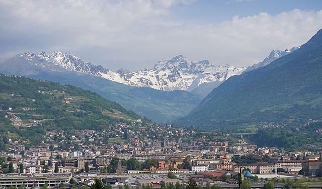
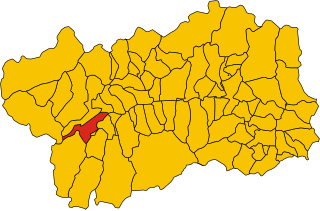
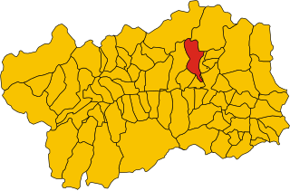
Aosta Valley (Valle d'Aosta)


- Italian mountainous semi-autonomous region in the North-West
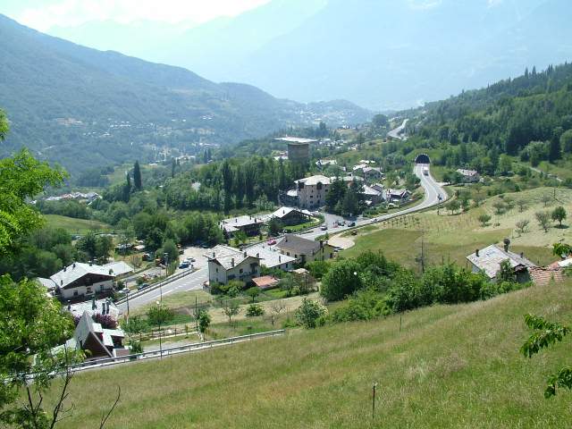
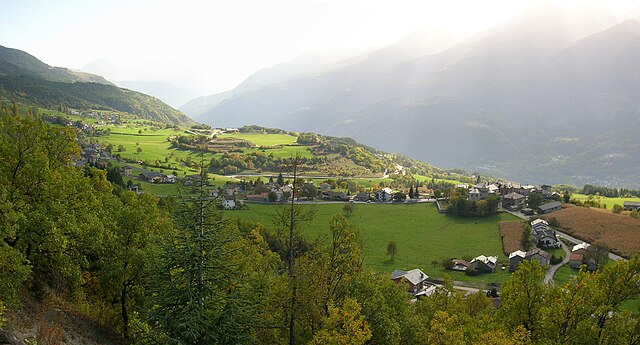
 Hiking in Aosta Valley
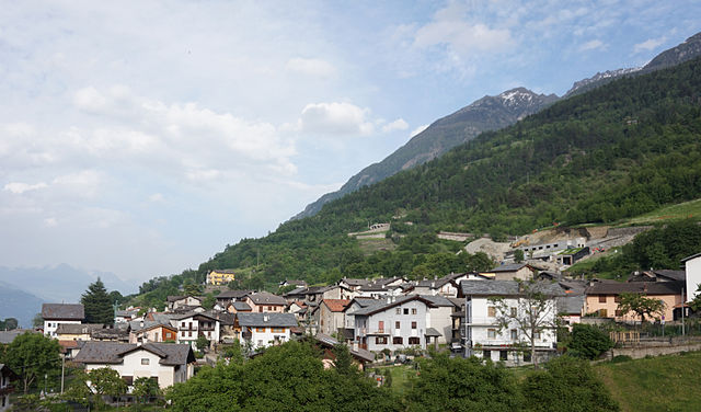
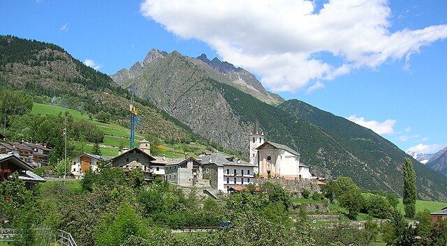
Aosta Valley, located in the northwest of Italy, is a mountainous region known for its stunning landscapes, rich history, and diverse outdoor activities, making it a paradise for hikers. Here’s a comprehensive overview of hiking in Aosta Valley:
Landscape and Natural Features
- Alpine Scenery: The valley is surrounded by iconic peaks, including the Matterhorn and Mont Blanc, offering breathtaking views that are perfect for nature photography.
- Lush Green Valleys and Glacial Lakes: Hikers can enjoy lush valleys, alpine meadows, and pristine glacial lakes, like Lake Bleu and Lake of Combiner.
Trails and Routes
-
Variety of Trails: Aosta Valley offers hiking trails for all skill levels, from easy walks to challenging high-alpine routes. Popular hikes include:
- Gran Paradiso National Park: Home to various trails, including routes to the Gran Paradiso peak.
- Tour du Mont Blanc: An iconic multi-day trek that passes through the Aosta Valley.
- Path of the Forts: A historical route that connects several forts in the region, combining hiking with a taste of local history.
-
Well-Marked Paths: The hiking trails are well-signposted with detailed maps available, making navigation easier.
Flora and Fauna
- The diverse habitats in Aosta Valley support a wide array of flora and fauna, including ibex, chamois, and various bird species, particularly in protected areas like Gran Paradiso National Park.
Cultural Aspects
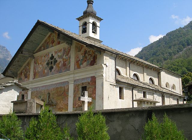
- The region is rich in history with charming villages, ancient castles, and Roman ruins. Hikers can explore local culture along the trails, with opportunities to sample traditional cuisine, local cheeses, and wines.
Best Time to Hike
- Summer (June to September): Ideal for hiking, as the weather is mild, and trails are generally clear of snow.
- Autumn (October): Offers beautiful fall foliage, but it can be colder, and some high-altitude trails may be inaccessible due to snow.
Essential Tips
- Gear Up: Wear sturdy hiking boots and dress in layers. The weather in the mountains can change rapidly, so be prepared for various conditions.
- Hydration and Nutrition: Carry sufficient water and snacks, especially on longer hikes.
- Respect Nature: Follow Leave No Trace principles to help preserve the natural beauty of the area.
Accessibility
- The Aosta Valley is accessible by car and public transport, with various starting points for hikes well connected.
In conclusion, Aosta Valley is an exceptional destination for hiking enthusiasts, combining stunning natural beauty with cultural richness. Whether you're a casual hiker or a seasoned trekker, the region has something to offer everyone.
- Country:

- Capital: Aosta
- Postal Code: 11100, 11010-11029
- Licence Plate Code: AO
- Coordinates: 45° 43' 0" N, 7° 22' 0" E


- GPS tracks (wikiloc): [Link]
- AboveSeaLevel: 951 м m
- Area: 3263.22 sq km
- Population: 125901
- Web site: http://www.regione.vda.it/
- Wikipedia en: wiki(en)
- Wikipedia: wiki(it)
- Wikidata storage: Wikidata: Q1222
- Wikipedia Commons Gallery: [Link]
- Wikipedia Commons Category: [Link]
- Wikipedia Commons Maps Category: [Link]
- Freebase ID: [/m/01rxwl]
- GeoNames ID: Alt: [3164857]
- BnF ID: [118793991]
- VIAF ID: Alt: [123927631]
- OSM relation ID: [45155]
- GND ID: Alt: [4002386-2]
- archINFORM location ID: [2941]
- Library of Congress authority ID: Alt: [n80040687]
- MusicBrainz area ID: [fc7bbbe5-5fa7-4695-b32e-f919f0017843]
- TGN ID: [7003126]
- SUDOC authorities ID: [026572435]
- Gran Enciclopèdia Catalana ID: [0069121]
- Encyclopædia Universalis ID: [val-d-aoste]
- HDS ID: [7023]
- ISNI: Alt: [0000 0001 2242 5737]
- DMOZ ID: Alt: [Regional/Europe/Italy/Regions/Valle_d'Aosta/]
- National Library of Israel ID: [000136642]
- NUTS code: [ITC20]
- BabelNet ID: [00079501n]
- ISTAT ID: 02
- ISO 3166-2 code: IT-23
- FIPS 10-4 (countries and regions): IT19
Includes regions:

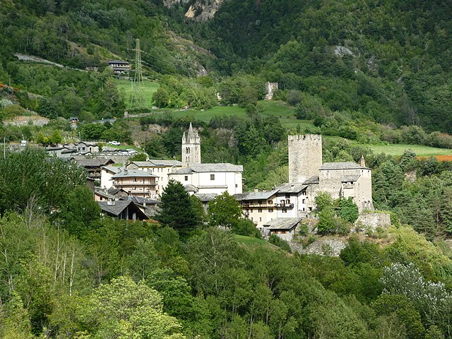
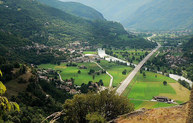
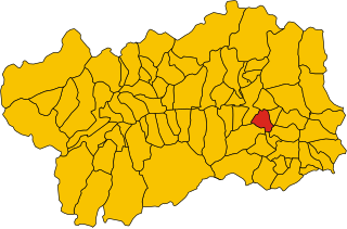
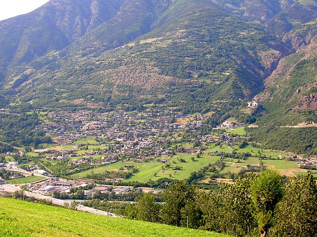
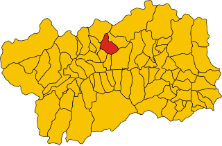
Aosta
- Italian comune
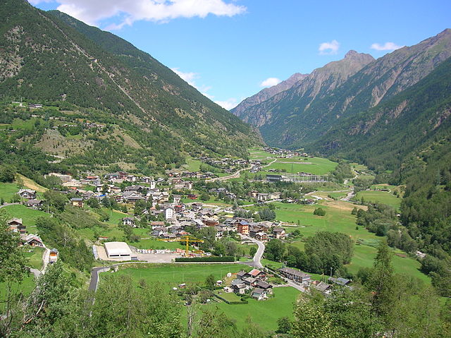
Hiking in Aosta
Aosta, the capital of the Aosta Valley in Italy, is a fantastic destination for hiking enthusiasts. Nestled in the Italian Alps, the region offers stunning landscapes, charming villages, and a mix of both easy and challenging hiking trails. Here are some key points to consider for hiking in Aosta:...
- Country:
- Postal Code: 11100
- Local Dialing Code: 0165
- Licence Plate Code: AO
- Coordinates: 45° 44' 14" N, 7° 19' 14" E
- GPS tracks (wikiloc): [Link]
- AboveSeaLevel: 583 м m
- Area: 21 sq km
- Population: 34324
- Web site: [Link]

Allein
- Italian comune
Hiking in Allein
If you're considering hiking in Allan, it seems you might be referring to a specific location or region. However, there might be some confusion about the name. Could you clarify whether you meant Allan, which may refer to places in different countries, or if you possibly meant another name, such as "Alps," or "Alaska," known for their hiking trails?...
- Country:
- Postal Code: 11010
- Local Dialing Code: 0165
- Licence Plate Code: AO
- Coordinates: 45° 48' 30" N, 7° 16' 21" E
- GPS tracks (wikiloc): [Link]
- AboveSeaLevel: 1190 м m
- Area: 7.96 sq km
- Population: 219
- Web site: [Link]


Antey-Saint-André
- Italian comune
Hiking in Antey-Saint-André
Antey-Saint-André is a charming commune located in the Aosta Valley region of Italy, surrounded by stunning Alpine scenery, making it a great destination for hiking enthusiasts. Here are some key points to consider for hiking in this area:...
- Country:
- Postal Code: 11020
- Local Dialing Code: 0166
- Licence Plate Code: AO
- Coordinates: 45° 48' 0" N, 7° 36' 0" E
- GPS tracks (wikiloc): [Link]
- AboveSeaLevel: 1074 м m
- Area: 11.81 sq km
- Population: 573
- Web site: [Link]

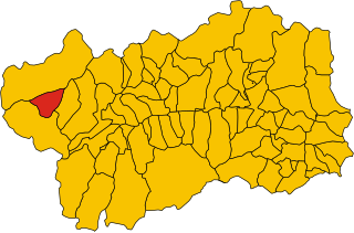
Avise
- Italian comune
Hiking in Avise
Avise is a charming commune in the Aosta Valley region of Italy, located in the picturesque Alpine area. It offers a variety of hiking opportunities that cater to different skill levels and preferences. Here are some highlights for those interested in hiking in Avise:...
- Country:
- Postal Code: 11010
- Local Dialing Code: 0165
- Licence Plate Code: AO
- Coordinates: 45° 42' 31" N, 7° 8' 26" E
- GPS tracks (wikiloc): [Link]
- AboveSeaLevel: 775 м m
- Area: 52.62 sq km
- Population: 298
- Web site: [Link]
Arvier
- Italian comune
Hiking in Arvier
Arvier, a charming town located in the Aosta Valley region of Italy, offers a wealth of hiking opportunities surrounded by stunning alpine scenery. Here are some highlights to consider when planning a hiking adventure in and around Arvier:...
- Country:
- Postal Code: 11011
- Local Dialing Code: 0165
- Licence Plate Code: AO
- Coordinates: 45° 42' 11" N, 7° 10' 0" E
- GPS tracks (wikiloc): [Link]
- AboveSeaLevel: 776 м m
- Area: 33.36 sq km
- Population: 865
- Web site: [Link]


Arnad
- Italian comune
Hiking in Arnad
Arnad is a charming commune located in the Aosta Valley region of Italy, known for its beautiful landscapes and outdoor activities, particularly hiking. Nestled in the foothills of the Alps, Arnad offers a variety of trails suitable for different skill levels, making it an excellent destination for both novice and experienced hikers....
- Country:
- Postal Code: 11020
- Local Dialing Code: 0125
- Licence Plate Code: AO
- Coordinates: 45° 38' 0" N, 7° 43' 0" E
- GPS tracks (wikiloc): [Link]
- AboveSeaLevel: 361 м m
- Area: 28.84 sq km
- Population: 1251
- Web site: [Link]


Ayas, Aosta Valley
- Italian comune
Hiking in Ayas, Aosta Valley
Ayas, located in the Aosta Valley region of Italy, is a stunning area known for its picturesque landscapes, charming alpine villages, and a variety of hiking trails that cater to different experience levels. Here are some highlights and recommendations for hiking in Ayas:...
- Country:
- Postal Code: 11020
- Local Dialing Code: 0125
- Licence Plate Code: AO
- Coordinates: 45° 48' 41" N, 7° 41' 12" E
- GPS tracks (wikiloc): [Link]
- AboveSeaLevel: 1698 м m
- Area: 129.42 sq km
- Population: 1377
- Web site: [Link]


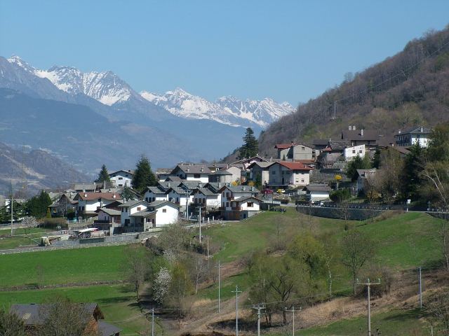
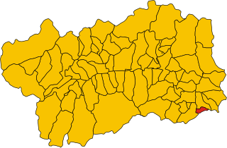
Aymavilles
- Italian comune
Hiking in Aymavilles
Aymavilles is a picturesque village located in the Aosta Valley region of Italy, known for its stunning Alpine scenery and rich cultural heritage. Hiking in Aymavilles offers a mix of challenging trails, beautiful landscapes, and opportunities to experience the local flora and fauna....
- Country:
- Postal Code: 11010
- Local Dialing Code: 0165
- Licence Plate Code: AO
- Coordinates: 45° 42' 4" N, 7° 14' 25" E
- GPS tracks (wikiloc): [Link]
- AboveSeaLevel: 640 м m
- Area: 53.24 sq km
- Population: 2065
- Web site: [Link]


Bard, Aosta Valley
- Italian comune
Hiking in Bard, Aosta Valley
Bard is a picturesque village located in the Aosta Valley of northern Italy, known for its stunning scenery and rich history. The surrounding region is a hiker's paradise, offering a variety of trails for different skill levels, making it an ideal destination for both novice and experienced hikers....
- Country:
- Postal Code: 11020
- Local Dialing Code: 0125
- Licence Plate Code: AO
- Coordinates: 45° 37' 0" N, 7° 45' 0" E
- GPS tracks (wikiloc): [Link]
- AboveSeaLevel: 400 м m
- Area: 3.03 sq km
- Population: 113
- Web site: [Link]


Bionaz
- Italian comune
Hiking in Bionaz
Bionaz is a picturesque valley located in the Aosta Valley region of Italy, offering stunning landscapes, charming scenery, and a variety of hiking opportunities. Here’s what you need to know about hiking in Bionaz:...
- Country:
- Postal Code: 11010
- Local Dialing Code: 0165
- Licence Plate Code: AO
- Coordinates: 45° 52' 0" N, 7° 25' 0" E
- GPS tracks (wikiloc): [Link]
- AboveSeaLevel: 1606 м m
- Area: 142.09 sq km
- Population: 235
- Web site: [Link]


Brissogne
- Italian comune
Hiking in Brissogne
Brissogne is a charming small village located in the Aosta Valley region of Italy. It's known for its stunning natural scenery, including the surrounding mountains and lush landscapes, making it an excellent destination for hiking enthusiasts of all levels....
- Country:
- Postal Code: 11020
- Local Dialing Code: 0165
- Licence Plate Code: AO
- Coordinates: 45° 44' 0" N, 7° 24' 0" E
- GPS tracks (wikiloc): [Link]
- AboveSeaLevel: 839 м m
- Area: 25.51 sq km
- Population: 969
- Web site: [Link]


Brusson
- town and comune in Aosta Valley, Italy
Hiking in Brusson
Brusson is a charming village located in the Aosta Valley region of Italy, known for its stunning natural scenery and excellent hiking opportunities. Nestled in the midst of the Alps, Brusson offers a mix of challenging trails and easier walks suitable for hikers of all levels. Here’s what you need to know about hiking in Brusson:...
- Country:
- Postal Code: 11022
- Local Dialing Code: 0125
- Licence Plate Code: AO
- Coordinates: 45° 46' 0" N, 7° 44' 0" E
- GPS tracks (wikiloc): [Link]
- AboveSeaLevel: 1338 м m
- Area: 55.26 sq km
- Population: 887
- Web site: [Link]


Challand-Saint-Anselme
- Italian comune
Hiking in Challand-Saint-Anselme
Challand-Saint-Anselme is a charming village located in the Aosta Valley of Italy, surrounded by beautiful mountainous landscapes, making it an excellent destination for hiking enthusiasts. Here are some highlights and tips for hiking in the area:...
- Country:
- Postal Code: 11020
- Local Dialing Code: 0125
- Licence Plate Code: AO
- Coordinates: 45° 43' 0" N, 7° 44' 0" E
- GPS tracks (wikiloc): [Link]
- AboveSeaLevel: 1030 м m
- Area: 27.99 sq km
- Population: 743
- Web site: [Link]


Challand-Saint-Victor
- Italian comune
Hiking in Challand-Saint-Victor
Challand-Saint-Victor is a charming village located in the Aosta Valley region of Italy, known for its picturesque mountain scenery and rich natural landscapes. The area offers a variety of hiking opportunities that cater to different skill levels, making it a great destination for both novice and experienced hikers....
- Country:
- Postal Code: 11020
- Local Dialing Code: 0125
- Licence Plate Code: AO
- Coordinates: 45° 41' 0" N, 7° 42' 0" E
- GPS tracks (wikiloc): [Link]
- AboveSeaLevel: 744 м m
- Area: 25 sq km
- Population: 557
- Web site: [Link]


Chambave
- Italian comune
Hiking in Chambave
Chambave, located in the Aosta Valley of Italy, offers scenic hiking opportunities amidst stunning Alpine landscapes. This charming village is surrounded by picturesque mountains, vineyards, and historical sites, making it a great base for outdoor enthusiasts....
- Country:
- Postal Code: 11023
- Local Dialing Code: 0166
- Licence Plate Code: AO
- Coordinates: 45° 45' 0" N, 7° 33' 0" E
- GPS tracks (wikiloc): [Link]
- AboveSeaLevel: 480 м m
- Area: 21.54 sq km
- Population: 937
- Web site: [Link]


Chamois, Aosta Valley
- Italian comune
Hiking in Chamois, Aosta Valley
Chamois is a charming village located in the Aosta Valley region of Italy. It is known for its stunning natural scenery, making it a fantastic destination for hiking enthusiasts. Here are some key points about hiking in Chamois:...
- Country:
- Postal Code: 11020
- Local Dialing Code: 0166
- Licence Plate Code: AO
- Coordinates: 45° 50' 0" N, 7° 37' 0" E
- GPS tracks (wikiloc): [Link]
- AboveSeaLevel: 1800 м m
- Area: 14.53 sq km
- Population: 95
- Web site: [Link]


Champdepraz
- Italian comune
Hiking in Champdepraz
Champdepraz is a picturesque commune located in the Aosta Valley region of Italy, surrounded by the stunning Alpine landscape, which makes it a great spot for hiking enthusiasts. The area features a variety of trails suitable for different skill levels, offering breathtaking views of the mountains, lush valleys, and traditional chalets....
- Country:
- Postal Code: 11020
- Local Dialing Code: 0125
- Licence Plate Code: AO
- Coordinates: 45° 41' 0" N, 7° 39' 0" E
- GPS tracks (wikiloc): [Link]
- AboveSeaLevel: 523 м m
- Area: 48.79 sq km
- Population: 714
- Web site: [Link]


Champorcher
- Italian comune
Hiking in Champorcher
Champorcher is a beautiful alpine village located in the Aosta Valley region of Italy, nestled in the Italian Alps. It offers a fantastic environment for hiking enthusiasts, featuring a diverse range of trails that cater to various skill levels, from casual walkers to experienced trekkers....
- Country:
- Postal Code: 11020
- Local Dialing Code: 0125
- Licence Plate Code: AO
- Coordinates: 45° 37' 0" N, 7° 37' 0" E
- GPS tracks (wikiloc): [Link]
- AboveSeaLevel: 1427 м m
- Area: 68.43 sq km
- Population: 391
- Web site: [Link]

Charvensod
- Italian comune
Hiking in Charvensod
Charvensod, a charming commune located in the Aosta Valley region of Italy, offers a variety of hiking opportunities that cater to all levels of hikers. Nestled at the foot of the impressive Mont Emilius, Charvensod is surrounded by stunning alpine scenery, making it an ideal base for outdoor activities....
- Country:
- Postal Code: 11020
- Local Dialing Code: 0165
- Licence Plate Code: AO
- Coordinates: 45° 43' 0" N, 7° 19' 0" E
- GPS tracks (wikiloc): [Link]
- AboveSeaLevel: 749 м m
- Area: 25.86 sq km
- Population: 2428
- Web site: [Link]


Châtillon
- Italian comune
Hiking in Châtillon
Châtillon is a charming town located in the Aosta Valley region of Italy, surrounded by stunning mountainous landscapes that make it a great starting point for hiking enthusiasts. Here’s what you should know about hiking in and around Châtillon:...
- Country:
- Postal Code: 11024
- Local Dialing Code: 0166
- Licence Plate Code: AO
- Coordinates: 45° 45' 0" N, 7° 37' 0" E
- GPS tracks (wikiloc): [Link]
- AboveSeaLevel: 549 м m
- Area: 39.68 sq km
- Population: 4654
- Web site: [Link]


Cogne
- town and comune in Italy
Hiking in Cogne
Cogne is a stunning valley located in the Aosta region of northern Italy, surrounded by the majestic Grand Paradiso National Park. It offers a variety of hiking opportunities that cater to different skill levels and preferences, from leisurely walks to challenging treks....
- Country:
- Postal Code: 11012
- Local Dialing Code: 0165
- Licence Plate Code: AO
- Coordinates: 45° 36' 27" N, 7° 21' 29" E
- GPS tracks (wikiloc): [Link]
- AboveSeaLevel: 1534 м m
- Area: 213.04 sq km
- Population: 1370
- Web site: [Link]
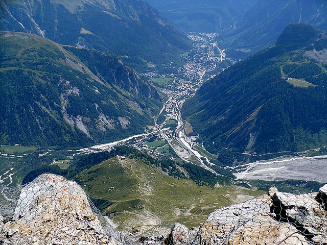

Courmayeur
- Italian comune
Hiking in Courmayeur
Courmayeur, located in the Aosta Valley of Italy, is a fantastic destination for hikers. Nestled at the foot of Mont Blanc, the area offers a variety of trails that cater to all skill levels, from leisurely walks to challenging alpine hikes. Here are some highlights for hiking in Courmayeur:...
- Country:
- Postal Code: 11013
- Local Dialing Code: 0165
- Licence Plate Code: AO
- Coordinates: 45° 47' 0" N, 6° 58' 0" E
- GPS tracks (wikiloc): [Link]
- AboveSeaLevel: 1224 м m
- Area: 210 sq km
- Population: 2798
- Web site: [Link]


Donnas
- Italian comune
Hiking in Donnas
Donnas, a small town located in the Aosta Valley region of Italy, is surrounded by stunning natural landscapes and offers several hiking opportunities for outdoor enthusiasts. Here are some highlights of hiking in and around Donnas:...
- Country:
- Postal Code: 11020
- Local Dialing Code: 0125
- Licence Plate Code: AO
- Coordinates: 45° 36' 0" N, 7° 46' 0" E
- GPS tracks (wikiloc): [Link]
- AboveSeaLevel: 322 м m
- Area: 33.97 sq km
- Population: 2520
- Web site: [Link]

Doues
- Italian comune
Hiking in Doues
Doues is a small municipality located in the Aosta Valley region of Italy, surrounded by stunning mountainous landscapes that are perfect for hiking enthusiasts. The area offers a range of trails suitable for various skill levels, from easy walks to more challenging treks....
- Country:
- Postal Code: 11010
- Local Dialing Code: 0165
- Licence Plate Code: AO
- Coordinates: 45° 49' 0" N, 7° 18' 0" E
- GPS tracks (wikiloc): [Link]
- AboveSeaLevel: 1176 м m
- Area: 16.25 sq km
- Population: 506
- Web site: [Link]


Emarèse
- Italian comune
Hiking in Emarèse
Émarèse is a charming municipality in the Aosta Valley region of northern Italy, known for its stunning natural landscapes, rich history, and outdoor recreational opportunities. Hiking in Émarèse offers a fantastic way to explore the beauty of the Italian Alps and experience the tranquility of nature....
- Country:
- Postal Code: 11020
- Local Dialing Code: 0166
- Licence Plate Code: AO
- Coordinates: 45° 43' 0" N, 7° 42' 0" E
- GPS tracks (wikiloc): [Link]
- AboveSeaLevel: 1170 м m
- Area: 10.23 sq km
- Population: 227
- Web site: [Link]


Etroubles
- Italian comune
Hiking in Etroubles
Etroubles is a charming village located in the Aosta Valley region of Italy, known for its stunning alpine landscapes and rich cultural heritage. Hiking in and around Etroubles offers a fantastic experience for outdoor enthusiasts, with a variety of trails suitable for different skill levels....
- Country:
- Postal Code: 11014
- Local Dialing Code: 0165
- Licence Plate Code: AO
- Coordinates: 45° 49' 17" N, 7° 13' 49" E
- GPS tracks (wikiloc): [Link]
- AboveSeaLevel: 1280 м m
- Area: 39.57 sq km
- Population: 489
- Web site: [Link]


Fénis
- Italian comune
Hiking in Fénis
Fénis is a picturesque village located in the Aosta Valley region of Italy, known for its stunning landscapes, rich history, and outdoor activities, making it an excellent destination for hiking enthusiasts. Here are some key points to consider when exploring hiking in Fénis:...
- Country:
- Postal Code: 11020
- Local Dialing Code: 0165
- Licence Plate Code: AO
- Coordinates: 45° 44' 5" N, 7° 29' 44" E
- GPS tracks (wikiloc): [Link]
- AboveSeaLevel: 541 м m
- Area: 68.12 sq km
- Population: 1818
- Web site: [Link]


Fontainemore
- Italian comune
Hiking in Fontainemore
Fontainemore is a charming village located in the Aosta Valley region of northwestern Italy, known for its stunning natural landscapes and excellent hiking opportunities. Nestled among the mountains, Fontainemore offers a variety of trails suitable for different skill levels, making it a great destination for both beginners and experienced hikers....
- Country:
- Postal Code: 11020
- Local Dialing Code: 0125
- Licence Plate Code: AO
- Coordinates: 45° 39' 0" N, 7° 52' 0" E
- GPS tracks (wikiloc): [Link]
- AboveSeaLevel: 760 м m
- Area: 31.71 sq km
- Population: 434
- Web site: [Link]


Gaby
- Italian comune
Hiking in Gaby
Gaby is a charming small village located in the Aosta Valley region of Italy, which is known for its stunning mountainous landscapes, rich history, and outdoor activities, including hiking. Here are some key points to consider when planning a hiking trip in and around Gaby:...
- Country:
- Postal Code: 11020
- Local Dialing Code: 0125
- Licence Plate Code: AO
- Coordinates: 45° 42' 16" N, 7° 53' 2" E
- GPS tracks (wikiloc): [Link]
- AboveSeaLevel: 1047 м m
- Area: 32.17 sq km
- Population: 467
- Web site: [Link]

Gignod
- Italian comune
Hiking in Gignod
Gignod is a small municipality located in the Aosta Valley region of Italy, surrounded by stunning alpine scenery. It's an excellent destination for hiking enthusiasts of all levels, offering a variety of trails that showcase the natural beauty of the region, its rugged mountains, picturesque valleys, and rich biodiversity. Here are some highlights for hiking in Gignod:...
- Country:
- Postal Code: 11010
- Local Dialing Code: 0165
- Licence Plate Code: AO
- Coordinates: 45° 47' 0" N, 7° 18' 0" E
- GPS tracks (wikiloc): [Link]
- AboveSeaLevel: 988 м m
- Area: 25.98 sq km
- Population: 1727
- Web site: [Link]


Gressan
- town and comune in Aosta Valley, Italy
Hiking in Gressan
Gressan is a beautiful municipality in the Aosta Valley region of Italy. Located near the town of Aosta, it's an excellent destination for hiking enthusiasts, offering a variety of trails suitable for different skill levels. Here are some highlights about hiking in Gressan:...
- Country:
- Postal Code: 11020
- Local Dialing Code: 0165
- Licence Plate Code: AO
- Coordinates: 45° 43' 0" N, 7° 17' 0" E
- GPS tracks (wikiloc): [Link]
- AboveSeaLevel: 626 м m
- Area: 25.3 sq km
- Population: 3378
- Web site: [Link]


Gressoney-La-Trinité
- Italian comune
Hiking in Gressoney-La-Trinité
Gressoney-La-Trinité is a charming village located in the Aosta Valley region of Italy, known for its stunning alpine scenery and a rich mix of Italian and Walser culture. It serves as a perfect base for hiking enthusiasts, offering a variety of trails suitable for different skill levels, from easy walks to more challenging hikes....
- Country:
- Postal Code: 11020
- Local Dialing Code: 0125
- Licence Plate Code: AO
- Coordinates: 45° 50' 0" N, 7° 50' 0" E
- GPS tracks (wikiloc): [Link]
- AboveSeaLevel: 1635 м m
- Area: 66.52 sq km
- Population: 300
- Web site: [Link]


Gressoney-Saint-Jean
- Italian comune
Hiking in Gressoney-Saint-Jean
Gressoney-Saint-Jean, located in the Aosta Valley of Italy, is a beautiful mountain village that offers excellent hiking opportunities in the scenic backdrop of the Alps. The area is particularly known for its stunning landscapes, featuring majestic peaks, lush valleys, and picturesque forests....
- Country:
- Postal Code: 11025
- Local Dialing Code: 0125
- Licence Plate Code: AO
- Coordinates: 45° 47' 0" N, 7° 49' 0" E
- GPS tracks (wikiloc): [Link]
- AboveSeaLevel: 1385 м m
- Area: 69.65 sq km
- Population: 818
- Web site: [Link]


Hône
- Italian comune
Hiking in Hône
Hône is a charming town located in the Aosta Valley region of Italy. It is surrounded by stunning natural landscapes, making it an excellent destination for hiking enthusiasts. Here are some highlights and tips for hiking in and around Hône:...
- Country:
- Postal Code: 11020
- Local Dialing Code: 0125
- Licence Plate Code: AO
- Coordinates: 45° 37' 0" N, 7° 44' 0" E
- GPS tracks (wikiloc): [Link]
- AboveSeaLevel: 364 м m
- Area: 12.64 sq km
- Population: 1176
- Web site: [Link]


Introd
- Italian comune
Hiking in Introd
Introd is a beautiful commune located in the Aosta Valley region of Italy, nestled in the foothills of the Alps. It is surrounded by stunning natural landscapes, making it an excellent destination for hiking enthusiasts. Here are some highlights and tips for hiking in Introd:...
- Country:
- Postal Code: 11010
- Local Dialing Code: 0165
- Licence Plate Code: AO
- Coordinates: 45° 41' 24" N, 7° 11' 15" E
- GPS tracks (wikiloc): [Link]
- AboveSeaLevel: 880 м m
- Area: 20.04 sq km
- Population: 657
- Web site: [Link]
Issime
- Italian comune
Hiking in Issime
Issime is a charming municipality located in the Aosta Valley region of Italy, nestled in the Alps. It offers a variety of hiking opportunities that cater to different levels of experience, making it a great destination for outdoor enthusiasts....
- Country:
- Postal Code: 11020
- Local Dialing Code: 0125
- Licence Plate Code: AO
- Coordinates: 45° 41' 0" N, 7° 51' 0" E
- GPS tracks (wikiloc): [Link]
- AboveSeaLevel: 956 м m
- Area: 35.38 sq km
- Population: 413
- Web site: [Link]


Issogne
- Italian comune
Hiking in Issogne
Issogne is a charming village located in the Aosta Valley region of Italy, known for its stunning landscapes and rich history. Hiking in and around Issogne offers diverse trails that cater to different skill levels, with options for both beginners and experienced hikers....
- Country:
- Postal Code: 11020
- Local Dialing Code: 0125
- Licence Plate Code: AO
- Coordinates: 45° 39' 0" N, 7° 41' 0" E
- GPS tracks (wikiloc): [Link]
- AboveSeaLevel: 387 м m
- Area: 23.61 sq km
- Population: 1386
- Web site: [Link]


Jovençan
- Italian comune
Hiking in Jovençan
Jovençan is a picturesque municipality located in the Aosta Valley region of Italy, nestled in the Alps. It's a great destination for hiking enthusiasts, offering a range of trails that cater to various skill levels. Here are some highlights about hiking in Jovençan:...
- Country:
- Postal Code: 11020
- Local Dialing Code: 0165
- Licence Plate Code: AO
- Coordinates: 45° 42' 56" N, 7° 16' 25" E
- GPS tracks (wikiloc): [Link]
- AboveSeaLevel: 632 м m
- Area: 7 sq km
- Population: 736
- Web site: [Link]


La Magdeleine
- Italian comune
Hiking in La Magdeleine
La Magdeleine is a beautiful area located in the Aosta Valley region of Italy, known for its stunning landscapes, rich culture, and outdoor activities. While it might not be as widely recognized as some other hiking destinations in the Alps, it offers a range of hiking opportunities for both beginners and experienced hikers....
- Country:
- Postal Code: 11020
- Local Dialing Code: 0166
- Licence Plate Code: AO
- Coordinates: 45° 49' 0" N, 7° 37' 0" E
- GPS tracks (wikiloc): [Link]
- AboveSeaLevel: 1644 м m
- Area: 8.94 sq km
- Population: 108
- Web site: [Link]

La Salle, Aosta Valley
- Italian comune
Hiking in La Salle, Aosta Valley
La Salle, located in the Aosta Valley of Italy, is a picturesque destination for hiking enthusiasts. Nestled in the foothills of the Alps, La Salle offers a blend of stunning natural beauty, rich cultural heritage, and diverse hiking trails suitable for various skill levels....
- Country:
- Postal Code: 11015
- Local Dialing Code: 0165
- Licence Plate Code: AO
- Coordinates: 45° 44' 49" N, 7° 4' 22" E
- GPS tracks (wikiloc): [Link]
- AboveSeaLevel: 1001 м m
- Area: 83.94 sq km
- Population: 2056
- Web site: [Link]


La Thuile
- Italian comune
Hiking in La Thuile
La Thuile, located in the Aosta Valley region of Italy, is a fantastic destination for hiking enthusiasts. Nestled in the Alps, this area offers stunning landscapes, diverse wildlife, and a variety of hiking trails suitable for all skill levels, from beginners to experienced adventurers....
- Country:
- Postal Code: 11016
- Local Dialing Code: 0165
- Licence Plate Code: AO
- Coordinates: 45° 42' 58" N, 6° 57' 0" E
- GPS tracks (wikiloc): [Link]
- AboveSeaLevel: 1450 м m
- Area: 125.67 sq km
- Population: 783
- Web site: [Link]


Lillianes
- Italian comune
Hiking in Lillianes
Lillianes is a small village located in the Aosta Valley region of northern Italy, nestled in a picturesque setting at the foot of the Alps. It’s an excellent starting point for various hiking adventures, offering stunning views, rich flora and fauna, and a chance to experience the natural beauty of the region....
- Country:
- Postal Code: 11020
- Local Dialing Code: 0125
- Licence Plate Code: AO
- Coordinates: 45° 38' 0" N, 7° 51' 0" E
- GPS tracks (wikiloc): [Link]
- AboveSeaLevel: 667 м m
- Area: 18.55 sq km
- Population: 456
- Web site: [Link]
Montjovet
- Italian comune
Hiking in Montjovet
Montjovet is a picturesque commune located in the Aosta Valley region of Italy, nestled in the foothills of the Alps. This area is known for its stunning landscapes, diverse ecosystems, and a variety of hiking opportunities that cater to different skill levels. Here are some key points to consider when hiking in Montjovet:...
- Country:
- Postal Code: 11020
- Local Dialing Code: 0166
- Licence Plate Code: AO
- Coordinates: 45° 42' 0" N, 7° 41' 0" E
- GPS tracks (wikiloc): [Link]
- AboveSeaLevel: 406 м m
- Area: 18.76 sq km
- Population: 1774
- Web site: [Link]


Morgex
- Italian comune
Hiking in Morgex
Morgex, located in the Aosta Valley region of Italy, is a beautiful destination for hiking enthusiasts. Nestled in the Italian Alps, it offers stunning landscapes, rich wildlife, and a variety of trails suited for different skill levels. Here are some highlights and tips for hiking in and around Morgex:...
- Country:
- Postal Code: 11017
- Local Dialing Code: 0165
- Licence Plate Code: AO
- Coordinates: 45° 45' 0" N, 7° 2' 0" E
- GPS tracks (wikiloc): [Link]
- AboveSeaLevel: 923 м m
- Area: 43.63 sq km
- Population: 2123
- Web site: [Link]


Nus
- Italian comune
Hiking in Nus
Nus, a charming village located in the Aosta Valley region of Italy, offers some wonderful hiking opportunities. The picturesque landscape is characterized by mountains, valleys, and lush greenery, making it a great destination for outdoor enthusiasts. Here are some key points about hiking in Nus:...
- Country:
- Postal Code: 11020
- Local Dialing Code: 0165
- Licence Plate Code: AO
- Coordinates: 45° 44' 0" N, 7° 28' 0" E
- GPS tracks (wikiloc): [Link]
- AboveSeaLevel: 529 м m
- Area: 57.36 sq km
- Population: 2991
- Web site: [Link]


Ollomont
- Italian comune
Hiking in Ollomont
Ollomont is a charming municipality located in the Aosta Valley region of Italy, known for its stunning natural landscapes and outdoor recreational opportunities, including hiking. Here are some insights into hiking in Ollomont:...
- Country:
- Postal Code: 11010
- Local Dialing Code: 0165
- Licence Plate Code: AO
- Coordinates: 45° 51' 0" N, 7° 19' 0" E
- GPS tracks (wikiloc): [Link]
- AboveSeaLevel: 1356 м m
- Area: 53.48 sq km
- Population: 157
- Web site: [Link]


Oyace
- Italian comune
Hiking in Oyace
Oyace is a picturesque village located in the Aosta Valley region of Italy, surrounded by stunning alpine scenery. It offers various hiking opportunities for outdoor enthusiasts. Here’s an overview of what you can expect when hiking in and around Oyace:...
- Country:
- Postal Code: 11010
- Local Dialing Code: 0165
- Licence Plate Code: AO
- Coordinates: 45° 51' 0" N, 7° 23' 0" E
- GPS tracks (wikiloc): [Link]
- AboveSeaLevel: 1377 м m
- Area: 30.56 sq km
- Population: 211
- Web site: [Link]


Perloz
- Italian comune
Hiking in Perloz
Perloz is a picturesque village located in the Aosta Valley region of Italy, surrounded by stunning alpine scenery, which makes it an excellent destination for hiking enthusiasts. Here are some key points to consider when hiking in Perloz:...
- Country:
- Postal Code: 11002
- Local Dialing Code: 0125
- Licence Plate Code: AO
- Coordinates: 45° 37' 0" N, 7° 49' 0" E
- GPS tracks (wikiloc): [Link]
- AboveSeaLevel: 661 м m
- Area: 23.27 sq km
- Population: 480
- Web site: [Link]

Pollein
- Italian comune
Hiking in Pollein
Pollein is a charming municipality located in the Aosta Valley region of Italy, surrounded by stunning Alpine scenery. It's known for its picturesque landscapes and offers various hiking opportunities suitable for different skill levels. Here’s an overview of what you can expect when hiking in and around Pollein:...
- Country:
- Postal Code: 11020
- Local Dialing Code: 0165
- Licence Plate Code: AO
- Coordinates: 45° 43' 41" N, 7° 21' 25" E
- GPS tracks (wikiloc): [Link]
- AboveSeaLevel: 551 м m
- Area: 15.33 sq km
- Population: 1527
- Web site: [Link]

Pont-Saint-Martin, Aosta Valley
- Italian comune
Hiking in Pont-Saint-Martin, Aosta Valley
Pont-Saint-Martin, located in the Aosta Valley of Italy, is a charming town known for its stunning natural landscapes and rich history. Hikers will find a variety of trails ranging from easy walks to more challenging hikes that offer spectacular views of the surrounding mountains and valleys. Here are some details about hiking in this area:...
- Country:
- Postal Code: 11026
- Local Dialing Code: 0125
- Licence Plate Code: AO
- Coordinates: 45° 36' 0" N, 7° 48' 0" E
- GPS tracks (wikiloc): [Link]
- AboveSeaLevel: 345 м m
- Area: 6.92 sq km
- Population: 3763
- Web site: [Link]

Pontboset
- Italian comune
Hiking in Pontboset
Pontboset is a charming destination for hiking enthusiasts, located in the Aosta Valley region of Italy. The area is known for its stunning natural landscapes, including mountains, valleys, and rich flora and fauna. Here are some key points and recommendations for hiking in Pontboset:...
- Country:
- Postal Code: 11020
- Local Dialing Code: 0125
- Licence Plate Code: AO
- Coordinates: 45° 36' 26" N, 7° 41' 11" E
- GPS tracks (wikiloc): [Link]
- AboveSeaLevel: 780 м m
- Area: 33.56 sq km
- Population: 180
- Web site: [Link]


Pontey
- Italian comune
Hiking in Pontey
Pontey is a small village located in the Aosta Valley region of Italy, surrounded by picturesque landscapes and beautiful mountain scenery. It offers several hiking opportunities that are suitable for a range of skill levels, from beginner to more experienced hikers. Here are some key points about hiking in Pontey:...
- Country:
- Postal Code: 11024
- Local Dialing Code: 0166
- Licence Plate Code: AO
- Coordinates: 45° 44' 0" N, 7° 35' 0" E
- GPS tracks (wikiloc): [Link]
- AboveSeaLevel: 523 м m
- Area: 15.75 sq km
- Population: 815
- Web site: [Link]

Pré-Saint-Didier
- Italian comune
Hiking in Pré-Saint-Didier
Pré-Saint-Didier, located in the Aosta Valley region of Italy, is a picturesque destination for hiking enthusiasts. Nestled in the foothills of the Mont Blanc massif, it offers breathtaking views, challenging trails, and a range of outdoor activities suitable for all levels of hikers....
- Country:
- Postal Code: 11010
- Local Dialing Code: 0165
- Licence Plate Code: AO
- Coordinates: 45° 45' 51" N, 6° 59' 9" E
- GPS tracks (wikiloc): [Link]
- AboveSeaLevel: 1004 м m
- Area: 33.4 sq km
- Population: 1025
- Web site: [Link]

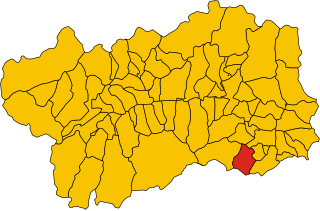
Quart, Aosta Valley
- Italian comune
Hiking in Quart, Aosta Valley
Quart is a charming municipality in the Aosta Valley region of Italy, nestled in the foothills of the Alps. It offers a variety of hiking opportunities that cater to different skill levels and preferences. Here’s an overview of what you can expect when hiking in Quart:...
- Country:
- Postal Code: 11020
- Local Dialing Code: 0165
- Licence Plate Code: AO
- Coordinates: 45° 44' 0" N, 7° 25' 0" E
- GPS tracks (wikiloc): [Link]
- AboveSeaLevel: 535 м m
- Area: 62.05 sq km
- Population: 4066
- Web site: [Link]


Rhêmes-Notre-Dame
- Italian comune
Hiking in Rhêmes-Notre-Dame
Rhêmes-Notre-Dame is a charming village located in the Aosta Valley of Italy, nestled in the heart of the Gran Paradiso National Park. This picturesque area is known for its stunning landscapes, diverse wildlife, and an extensive network of hiking trails that cater to all levels of experience....
- Country:
- Postal Code: 11010
- Local Dialing Code: 0165
- Licence Plate Code: AO
- Coordinates: 45° 34' 11" N, 7° 7' 7" E
- GPS tracks (wikiloc): [Link]
- AboveSeaLevel: 1725 м m
- Area: 86.84 sq km
- Population: 82
- Web site: [Link]

Rhêmes-Saint-Georges
- Italian comune
Hiking in Rhêmes-Saint-Georges
Rhêmes-Saint-Georges is a charming village located in the Aosta Valley region of Italy, known for its stunning landscapes and access to numerous hiking trails. The area is surrounded by the majestic mountains of the Gran Paradiso National Park, making it a fantastic destination for outdoor enthusiasts....
- Country:
- Postal Code: 11010
- Local Dialing Code: 0165
- Licence Plate Code: AO
- Coordinates: 45° 39' 8" N, 7° 9' 16" E
- GPS tracks (wikiloc): [Link]
- AboveSeaLevel: 1218 м m
- Area: 36.34 sq km
- Population: 173
- Web site: [Link]


Roisan
- Italian comune
Hiking in Roisan
Roisan is a charming commune in the Aosta Valley region of Italy, known for its beautiful natural landscapes, historical sites, and cultural heritage. Hiking in Roisan offers access to stunning views of the surrounding mountains, valleys, and forests....
- Country:
- Postal Code: 11010
- Local Dialing Code: 0165
- Licence Plate Code: AO
- Coordinates: 45° 47' 0" N, 7° 19' 0" E
- GPS tracks (wikiloc): [Link]
- AboveSeaLevel: 866 м m
- Area: 14.64 sq km
- Population: 1012
- Web site: [Link]


Saint-Christophe, Aosta Valley
- Italian comune
Hiking in Saint-Christophe, Aosta Valley
Saint-Christophe, located in the Aosta Valley region of northern Italy, is a wonderful destination for hiking enthusiasts. This charming village is surrounded by stunning alpine scenery and offers a variety of trails suitable for different skill levels. Here’s what you can expect when hiking in and around Saint-Christophe:...
- Country:
- Postal Code: 11020
- Local Dialing Code: 0165
- Licence Plate Code: AO
- Coordinates: 45° 45' 0" N, 7° 21' 0" E
- GPS tracks (wikiloc): [Link]
- AboveSeaLevel: 619 м m
- Area: 14.74 sq km
- Population: 3467
- Web site: [Link]
Saint-Denis, Aosta Valley
- Italian comune
Hiking in Saint-Denis, Aosta Valley
Saint-Denis in the Aosta Valley is a beautiful location for hiking, surrounded by stunning alpine landscapes and offering a variety of trails suited for different skill levels. Here are some key points about hiking in this region:...
- Country:
- Postal Code: 11023
- Local Dialing Code: 0166
- Licence Plate Code: AO
- Coordinates: 45° 45' 0" N, 7° 33' 0" E
- GPS tracks (wikiloc): [Link]
- AboveSeaLevel: 820 м m
- Area: 11.39 sq km
- Population: 369
- Web site: [Link]


Saint-Marcel, Aosta Valley
- Italian comune
Hiking in Saint-Marcel, Aosta Valley
Saint-Marcel, located in the Aosta Valley region of Italy, is a beautiful area for hiking enthusiasts, offering stunning landscapes typical of the Alps. The valley is known for its breathtaking views, natural beauty, and a variety of hiking trails that cater to different skill levels....
- Country:
- Postal Code: 11020
- Local Dialing Code: 0165
- Licence Plate Code: AO
- Coordinates: 45° 43' 53" N, 7° 26' 54" E
- GPS tracks (wikiloc): [Link]
- AboveSeaLevel: 625 м m
- Area: 42.38 sq km
- Population: 1348
- Web site: [Link]


Saint-Nicolas, Aosta Valley
- Italian comune
Hiking in Saint-Nicolas, Aosta Valley
Saint-Nicolas, located in the Aosta Valley region of Italy, offers a stunning backdrop for hikers with its beautiful alpine landscapes, charming villages, and rich cultural heritage. Here are some highlights and information about hiking in the area:...
- Country:
- Postal Code: 11010
- Local Dialing Code: 0165
- Licence Plate Code: AO
- Coordinates: 45° 43' 0" N, 7° 10' 0" E
- GPS tracks (wikiloc): [Link]
- AboveSeaLevel: 1200 м m
- Area: 15.46 sq km
- Population: 307
- Web site: [Link]


Saint-Oyen, Aosta Valley
- Italian comune
Hiking in Saint-Oyen, Aosta Valley
Saint-Oyen, located in the Aosta Valley of Italy, is a picturesque destination for hiking enthusiasts. Nestled at the foothills of the Alps, this area is characterized by its stunning natural scenery, rich biodiversity, and a range of hiking trails suitable for various skill levels. Here are some highlights and useful information about hiking in this region:...
- Country:
- Postal Code: 11014
- Local Dialing Code: 0165
- Licence Plate Code: AO
- Coordinates: 45° 49' 0" N, 7° 13' 0" E
- GPS tracks (wikiloc): [Link]
- AboveSeaLevel: 1373 м m
- Area: 9.42 sq km
- Population: 194
- Web site: [Link]

Saint-Pierre
- comune in Aosta Valley, Italy
Hiking in Saint-Pierre
Saint-Pierre, located in the Aosta Valley region of Italy, is a fantastic destination for hiking enthusiasts. The area is known for its stunning mountain scenery, rich history, and diverse trails that cater to a variety of skill levels. Here are some key points about hiking in this picturesque region:...
- Country:
- Postal Code: 11010
- Local Dialing Code: 0165
- Licence Plate Code: AO
- Coordinates: 45° 42' 36" N, 7° 13' 34" E
- GPS tracks (wikiloc): [Link]
- AboveSeaLevel: 731 м m
- Area: 26.18 sq km
- Population: 3213
- Web site: [Link]
Saint-Rhémy-en-Bosses
- Italian comune
Hiking in Saint-Rhémy-en-Bosses
Saint-Rhémy-en-Bosses is a picturesque village located in the Aosta Valley region of Italy, nestled in the Italian Alps. The area is known for its stunning landscapes, charming architecture, and many outdoor activities, including hiking....
- Country:
- Postal Code: 11010
- Local Dialing Code: 0165
- Licence Plate Code: AO
- Coordinates: 45° 49' 19" N, 7° 10' 32" E
- GPS tracks (wikiloc): [Link]
- AboveSeaLevel: 1519 м m
- Area: 64.88 sq km
- Population: 335
- Web site: [Link]


Saint-Vincent, Aosta Valley
- Italian comune
Hiking in Saint-Vincent, Aosta Valley
Saint-Vincent is a charming town located in the Aosta Valley region of Italy, nestled in the beautiful mountains of the Alps. The area is known not only for its rich history and thermal baths but also for its excellent hiking opportunities. Here are some key points about hiking in and around Saint-Vincent:...
- Country:
- Postal Code: 11027
- Local Dialing Code: 0166
- Licence Plate Code: AO
- Coordinates: 45° 45' 0" N, 7° 39' 0" E
- GPS tracks (wikiloc): [Link]
- AboveSeaLevel: 550 м m
- Area: 20.57 sq km
- Population: 4584
- Web site: [Link]

Sarre, Aosta Valley
- Italian comune
Hiking in Sarre, Aosta Valley
Hiking in Sarre, located in the Aosta Valley of northern Italy, offers a fantastic outdoor experience surrounded by stunning mountain scenery. The Aosta Valley is known for its breathtaking landscapes, rich history, and numerous hiking trails suitable for all levels of experience....
- Country:
- Postal Code: 11010
- Local Dialing Code: 0165
- Licence Plate Code: AO
- Coordinates: 45° 43' 4" N, 7° 15' 27" E
- GPS tracks (wikiloc): [Link]
- AboveSeaLevel: 631 м m
- Area: 28.28 sq km
- Population: 4878
- Web site: [Link]

Torgnon
- Italian comune
Hiking in Torgnon
Torgnon is a beautiful village located in the Aosta Valley region of Italy, nestled in the Italian Alps. It's known for its stunning landscapes, lush valleys, and pristine nature, making it an ideal destination for hiking enthusiasts. Here are some key points about hiking in Torgnon:...
- Country:
- Postal Code: 11020
- Local Dialing Code: 0166
- Licence Plate Code: AO
- Coordinates: 45° 48' 0" N, 7° 34' 0" E
- GPS tracks (wikiloc): [Link]
- AboveSeaLevel: 1489 м m
- Area: 42.46 sq km
- Population: 587
- Web site: [Link]


Valgrisenche
- Italian comune
Hiking in Valgrisenche
Valgrisenche is a beautiful and relatively lesser-known valley located in the Aosta Valley region of Italy, nestled within the western Alps. It offers stunning natural scenery, alpine landscapes, and various hiking opportunities suitable for different skill levels. Here are some highlights and tips for hiking in Valgrisenche:...
- Country:
- Postal Code: 11010
- Local Dialing Code: 0165
- Licence Plate Code: AO
- Coordinates: 45° 37' 48" N, 7° 3' 52" E
- GPS tracks (wikiloc): [Link]
- AboveSeaLevel: 1664 м m
- Area: 113.48 sq km
- Population: 192
- Web site: [Link]
Valpelline, Aosta Valley
- Italian comune
Hiking in Valpelline, Aosta Valley
Valpelline, located in the Aosta Valley region of Italy, is an exceptional destination for hiking enthusiasts. This picturesque valley is surrounded by stunning alpine landscapes, rich biodiversity, and charming villages, providing a unique experience for both novice hikers and seasoned trekkers....
- Country:
- Postal Code: 11010
- Local Dialing Code: 0165
- Licence Plate Code: AO
- Coordinates: 45° 50' 0" N, 7° 20' 0" E
- GPS tracks (wikiloc): [Link]
- AboveSeaLevel: 964 м m
- Area: 31.45 sq km
- Population: 625
- Web site: [Link]

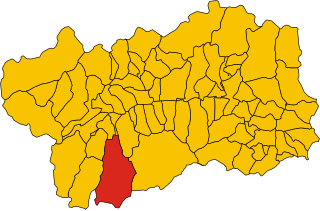
Valsavarenche
- Italian comune
Hiking in Valsavarenche
Valsavarenche is a picturesque valley located in the Aosta Valley region of the Italian Alps, and it is part of the Gran Paradiso National Park. This area is known for its stunning natural beauty, diverse wildlife, and well-maintained trails, making it an excellent destination for hiking enthusiasts....
- Country:
- Postal Code: 11010
- Local Dialing Code: 0165
- Licence Plate Code: AO
- Coordinates: 45° 35' 32" N, 7° 12' 28" E
- GPS tracks (wikiloc): [Link]
- AboveSeaLevel: 1541 м m
- Area: 138.21 sq km
- Population: 164
- Web site: [Link]


Valtournenche
- Italian comune
Hiking in Valtournenche
Valtournenche, located in the Aosta Valley of Italy near the Swiss border, is a stunning destination for hiking enthusiasts. It's well-known for its breathtaking mountain scenery, including views of the iconic Matterhorn, which is particularly visible from the valley and its surrounding areas. Here are some highlights about hiking in Valtournenche:...
- Country:
- Postal Code: 11028
- Local Dialing Code: 0166
- Licence Plate Code: AO
- Coordinates: 45° 53' 0" N, 7° 37' 0" E
- GPS tracks (wikiloc): [Link]
- AboveSeaLevel: 1528 м m
- Area: 116.15 sq km
- Population: 2294
- Web site: [Link]
Verrayes
- Italian comune
Hiking in Verrayes
Verrayes is a beautiful municipality located in the Aosta Valley region of Italy. It's known for its stunning landscapes, charming villages, and the surrounding mountains, which offer a variety of hiking opportunities suitable for different skill levels. Here are some key points about hiking in Verrayes:...
- Country:
- Postal Code: 11020
- Local Dialing Code: 0166
- Licence Plate Code: AO
- Coordinates: 45° 46' 0" N, 7° 32' 0" E
- GPS tracks (wikiloc): [Link]
- AboveSeaLevel: 1017 м m
- Area: 22.36 sq km
- Population: 1303
- Web site: [Link]

Verrès
- Italian comune
Hiking in Verrès
Verrès is a charming town located in the Aosta Valley region of Italy, surrounded by beautiful alpine scenery, making it an excellent destination for hiking enthusiasts. The surrounding area offers a variety of trails suitable for different skill levels, from leisurely walks to more challenging alpine hikes....
- Country:
- Postal Code: 11029
- Local Dialing Code: 0125
- Licence Plate Code: AO
- Coordinates: 45° 40' 0" N, 7° 41' 21" E
- GPS tracks (wikiloc): [Link]
- AboveSeaLevel: 391 м m
- Area: 8.36 sq km
- Population: 2642
- Web site: [Link]

Villeneuve, Aosta Valley
- Italian comune
Hiking in Villeneuve, Aosta Valley
Villeneuve, located in the Aosta Valley of northwestern Italy, is a charming village surrounded by stunning alpine scenery. The area is notable for its outdoor adventure opportunities, particularly hiking....
- Country:
- Postal Code: 11018
- Local Dialing Code: 0165
- Licence Plate Code: AO
- Coordinates: 45° 42' 9" N, 7° 12' 27" E
- GPS tracks (wikiloc): [Link]
- AboveSeaLevel: 670 м m
- Area: 8.8 sq km
- Population: 1236
- Web site: [Link]
Shares border with regions:

Piedmont
- region in North-West Italy
Hiking in Piedmont
Hiking in the Piedmont region offers a wonderful blend of natural beauty, diverse landscapes, and rich cultural heritage. This area, which generally encompasses the foothills of the Appalachian Mountains and stretches across parts of Virginia, North Carolina, South Carolina, and more, features rolling hills, lush forests, and scenic views. Here are some highlights and tips for hiking in Piedmont:...
- Country:
- Capital: Turin
- Coordinates: 45° 15' 0" N, 7° 55' 0" E
- GPS tracks (wikiloc): [Link]
- AboveSeaLevel: 421 м m
- Area: 25402 sq km
- Population: 4367559
- Web site: [Link]

Savoie
- French department in the Auvergne-Rhône-Alpes region of the French Alps
Hiking in Savoie
Savoie, located in the Auvergne-Rhône-Alpes region of France, is a stunning area known for its dramatic landscapes, alpine scenery, and rich cultural heritage. Hiking in Savoie offers a diverse range of trails suitable for all skill levels, from leisurely walks to challenging mountain treks....
- Country:

- Capital: Chambéry
- Coordinates: 45° 35' 0" N, 6° 20' 0" E
- GPS tracks (wikiloc): [Link]
- AboveSeaLevel: 1595 м m
- Area: 6028 sq km
- Population: 428204
- Web site: [Link]


Haute-Savoie
- French department
Hiking in Haute-Savoie
Haute-Savoie, located in the southeastern part of France, is a stunning region of the French Alps known for its breathtaking landscapes, picturesque villages, and a plethora of outdoor activities. Hiking is one of the most popular pursuits in this area, offering trails that cater to all experience levels and showcasing everything from serene lakes to rugged mountain peaks....
- Country:
- Capital: Annecy
- Coordinates: 46° 0' 0" N, 6° 20' 0" E
- GPS tracks (wikiloc): [Link]
- AboveSeaLevel: 1160 м m
- Area: 4388 sq km
- Population: 793938
- Web site: [Link]
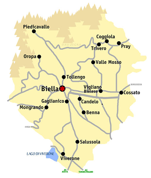
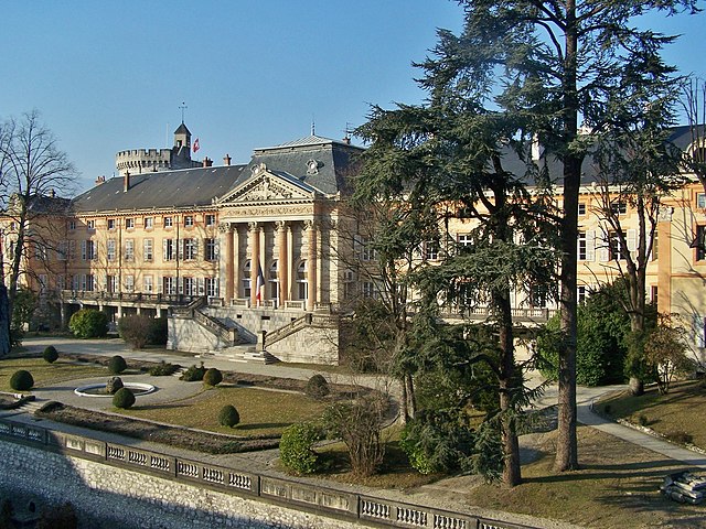
Province of Biella
- province of Italy
Hiking in Province of Biella
The Province of Biella, located in the Piedmont region of northern Italy, offers a rich landscape for hiking enthusiasts, characterized by its beautiful mountains, lush valleys, and scenic views. Here are some highlights and tips for hiking in the area:...
- Country:
- Capital: Biella
- Postal Code: 13811–13899; 13900
- Local Dialing Code: 0163; 0161; 015
- Licence Plate Code: BI
- Coordinates: 46° 0' 0" N, 8° 0' 0" E
- GPS tracks (wikiloc): [Link]
- Area: 913.72 sq km
- Web site: [Link]

Province of Vercelli
- province of Italy
Hiking in Province of Vercelli
The Province of Vercelli, located in the Piedmont region of northwestern Italy, offers a variety of hiking opportunities for outdoor enthusiasts. The landscape is characterized by its diverse terrain, which includes the Po River, rolling hills, rice fields, and the foothills of the Alps....
- Country:
- Capital: Vercelli
- Postal Code: 13010–13060; 13100
- Local Dialing Code: 0163; 0161; 015
- Licence Plate Code: VC
- Coordinates: 45° 19' 0" N, 8° 25' 0" E
- GPS tracks (wikiloc): [Link]
- Area: 2088 sq km
- Web site: [Link]

Province of Turin
- former province of Italy (1847 to 2014), now Metropolitan City of Turin (Q18288162)
Hiking in Province of Turin
The Province of Turin, located in the Piedmont region of northwest Italy, offers a diverse range of hiking opportunities set against stunning mountainous backdrops, particularly in the Susa Valley and the nearby areas of the Alps....
- Country:
- Capital: Turin
- Postal Code: 10010–10099; 10121–10156
- Local Dialing Code: 0161; 0125; 0124; 0123; 0122; 0121; 011
- Licence Plate Code: TO
- Coordinates: 45° 4' 0" N, 7° 42' 0" E
- GPS tracks (wikiloc): [Link]
- Area: 6821 sq km
- Web site: [Link]


Auvergne-Rhône-Alpes
- administrative region of France
Hiking in Auvergne-Rhône-Alpes
Auvergne-Rhône-Alpes is a stunning region in southeastern France known for its diverse landscapes, which include mountains, lakes, and volcanic formations. It offers a wealth of hiking opportunities for all levels of experience. Here are some highlights and notable areas for hiking in this beautiful region:...
- Country:
- Capital: Lyon
- Local Dialing Code: 04
- Coordinates: 45° 44' 25" N, 4° 49' 10" E
- GPS tracks (wikiloc): [Link]
- Area: 69711 sq km
- Population: 7877698
- Web site: [Link]


Canton of Valais
- canton of Switzerland
Hiking in Canton of Valais
The Canton of Valais, located in southwestern Switzerland, is a fantastic destination for hiking enthusiasts. Famous for its stunning landscapes dominated by the Alps, the region offers a wide variety of trails suitable for all levels of hikers. Here are some key points to know about hiking in Valais:...
- Country:

- Capital: Sion
- Licence Plate Code: VS
- Coordinates: 46° 4' 0" N, 7° 36' 0" E
- GPS tracks (wikiloc): [Link]
- AboveSeaLevel: 512 м m
- Area: 5224.50 sq km
- Web site: [Link]