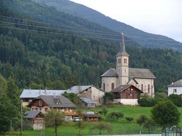
Champ-Laurent (Champ-Laurent)

- commune in Savoie, France
 Hiking in Champ-Laurent
Champ-Laurent, located in the French Alps, is a stunning hiking destination that offers a blend of picturesque landscapes, diverse trails, and a rich natural environment. Here are some highlights and tips for hiking in the area:
Trails and Routes
-
Varied Difficulty Levels: Champ-Laurent offers trails suitable for all skill levels, ranging from easy walks to challenging hikes. Popular trails include scenic woodland paths, alpine meadows, and more rugged mountain paths.
-
Scenic Views: Many of the trails lead to stunning viewpoints, where hikers can take in panoramic views of the surrounding mountains and valleys. Don't forget your camera!
-
Flora and Fauna: The region is rich in biodiversity. While hiking, you might encounter a variety of wildflowers, alpine plants, and even some local wildlife such as deer and various bird species.
Best Time to Hike
- Summer (June to September): The best time for hiking in Champ-Laurent is during the summer months when the trails are clear, and the weather is generally stable. Late spring and early autumn can also be enjoyable if you are prepared for changing weather conditions.
Preparation Tips
-
Safety Gear: Make sure to wear proper hiking footwear and carry a map or GPS device. Always pack essentials like water, snacks, a first aid kit, and sun protection.
-
Weather Awareness: The weather in the mountains can change rapidly, so check the forecast before heading out and be prepared for rain or cooler temperatures, even in summer.
-
Respect Nature: Ensure you follow local guidelines for wildlife and plant preservation. Stick to marked trails to minimize your impact on the environment.
Local Amenities
-
Guided Tours: If you are unfamiliar with the area, consider joining a guided hiking tour. Local guides can provide valuable insights into the region's natural history and help you discover hidden gems.
-
Accommodation: There are various accommodation options in and around Champ-Laurent, from charming lodges to campsites, catering to different preferences and budgets.
Conclusion
Hiking in Champ-Laurent can be a rewarding experience, whether you're looking for a day hike or an extended backcountry adventure. With its stunning scenery and diverse trails, it's an excellent destination for outdoor enthusiasts. Enjoy your hike and stay safe!
- Country:

- Postal Code: 73390
- Coordinates: 45° 30' 31" N, 6° 12' 44" E


- GPS tracks (wikiloc): [Link]
- Area: 5.07 sq km
- Population: 39
- Wikipedia en: wiki(en)
- Wikipedia: wiki(fr)
- Wikidata storage: Wikidata: Q1231325
- Wikipedia Commons Category: [Link]
- Freebase ID: [/m/03qlm2k]
- GeoNames ID: Alt: [6450995]
- SIREN number: [217300722]
- BnF ID: [15274006p]
- INSEE municipality code: 73072
Shares border with regions:

Bourget-en-Huile
- commune in Savoie, France
Hiking in Bourget-en-Huile
Bourget-en-Huile is a charming commune located in the Auvergne-Rhône-Alpes region of France. The area is known for its picturesque landscapes and offers a variety of hiking opportunities that cater to different skill levels. Here are some highlights for hiking in and around Bourget-en-Huile:...
- Country:
- Postal Code: 73110
- Coordinates: 45° 29' 5" N, 6° 12' 25" E
- GPS tracks (wikiloc): [Link]
- Area: 6.79 sq km
- Population: 149
- Web site: [Link]
Montendry
- commune in Savoie, France
Hiking in Montendry
Montendry, while not as widely known as some other hiking destinations, is a charming area that offers scenery and trails appealing to outdoor enthusiasts. Here are some notable aspects of hiking in Montendry:...
- Country:
- Postal Code: 73390
- Coordinates: 45° 31' 32" N, 6° 14' 28" E
- GPS tracks (wikiloc): [Link]
- Area: 8.28 sq km
- Population: 61


Villard-Léger
- commune in Savoie, France
Hiking in Villard-Léger
Villard-Léger is a charming commune located in the French Alps, known for its stunning landscapes and extensive outdoor activities, particularly hiking. Here are some highlights about hiking in Villard-Léger:...
- Country:
- Postal Code: 73390
- Coordinates: 45° 30' 36" N, 6° 10' 44" E
- GPS tracks (wikiloc): [Link]
- Area: 6.73 sq km
- Population: 495
Chamoux-sur-Gelon
- commune in Savoie, France
Hiking in Chamoux-sur-Gelon
Chamoux-sur-Gelon is a charming village located in the French Alps, specifically in the Savoie region. It offers beautiful hiking opportunities for both beginners and experienced hikers....
- Country:
- Postal Code: 73390
- Coordinates: 45° 31' 58" N, 6° 12' 56" E
- GPS tracks (wikiloc): [Link]
- Area: 10.63 sq km
- Population: 924
- Web site: [Link]


La Table
- commune in Savoie, France
Hiking in La Table
La Table, located on the island of La Réunion in the Indian Ocean, is a prominent hiking destination known for its stunning landscapes, unique geological features, and rich biodiversity. Here’s what you need to know about hiking in La Table:...
- Country:
- Postal Code: 73110
- Coordinates: 45° 28' 48" N, 6° 10' 18" E
- GPS tracks (wikiloc): [Link]
- Area: 14.85 sq km
- Population: 475


Le Pontet
- commune in Savoie, France
Hiking in Le Pontet
Le Pontet, located in the Savoie region of the French Alps, offers a beautiful setting for hiking enthusiasts. Nestled in the heart of the mountains, this area features a variety of trails that cater to different skill levels, from leisurely walks to challenging hikes....
- Country:
- Postal Code: 73110
- Coordinates: 45° 29' 54" N, 6° 13' 45" E
- GPS tracks (wikiloc): [Link]
- Area: 8.66 sq km
- Population: 131