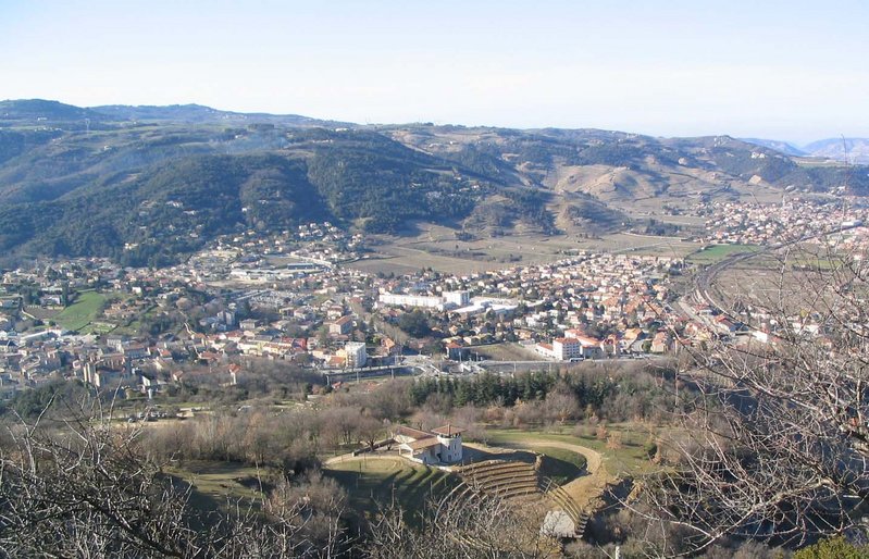
Champis (Champis)
- commune in Ardèche, France
- Country:

- Postal Code: 07440
- Coordinates: 44° 57' 36" N, 4° 44' 1" E


- GPS tracks (wikiloc): [Link]
- AboveSeaLevel: 550 м m
- Area: 16.34 sq km
- Population: 614
- Wikipedia en: wiki(en)
- Wikipedia: wiki(fr)
- Wikidata storage: Wikidata: Q323683
- Wikipedia Commons Category: [Link]
- Freebase ID: [/m/03m8971]
- GeoNames ID: Alt: [6615759]
- SIREN number: [210700522]
- INSEE municipality code: 07052
Shares border with regions:

Alboussière
- commune in Ardèche, France
- Country:

- Postal Code: 07440
- Coordinates: 44° 56' 39" N, 4° 43' 44" E


- GPS tracks (wikiloc): [Link]
- Area: 18.39 sq km
- Population: 1065

Saint-Péray
- commune in Ardèche, France
Saint-Péray, located in the Auvergne-Rhône-Alpes region of France, is a charming destination for hiking enthusiasts. Nestled near the Rhône River and surrounded by picturesque vineyards and rolling hills, it offers a variety of trails that cater to different skill levels....
- Country:

- Postal Code: 07130
- Coordinates: 44° 56' 55" N, 4° 50' 42" E


- GPS tracks (wikiloc): [Link]
- AboveSeaLevel: 128 м m
- Area: 24.05 sq km
- Population: 7572
- Web site: [Link]

Saint-Romain-de-Lerps
- commune in Ardèche, France
- Country:

- Postal Code: 07130
- Coordinates: 44° 58' 44" N, 4° 47' 48" E


- GPS tracks (wikiloc): [Link]
- Area: 14.14 sq km
- Population: 838

Saint-Sylvestre
- commune in Ardèche, France
- Country:

- Postal Code: 07440
- Coordinates: 44° 59' 23" N, 4° 44' 55" E


- GPS tracks (wikiloc): [Link]
- AboveSeaLevel: 420 м m
- Area: 15.16 sq km
- Population: 506

Gilhoc-sur-Ormèze
- commune in Ardèche, France
- Country:

- Postal Code: 07270
- Coordinates: 44° 59' 11" N, 4° 41' 17" E


- GPS tracks (wikiloc): [Link]
- AboveSeaLevel: 500 м m
- Area: 20.74 sq km
- Population: 450
