canton of Saint-Péray (canton de Saint-Péray)
- canton of France (until March 2015)
 Hiking in canton of Saint-Péray
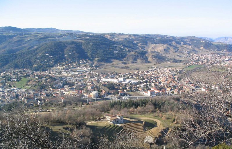
Canton de Saint-Péray, located in the Ardèche department of France, offers beautiful landscapes and diverse hiking opportunities. The region is characterized by its stunning views of the Rhône Valley, vineyards, and the surrounding hills. Here are some highlights for hiking in this area:
Walking Trails
-
Crest to Saint-Péray: This trail offers scenic views over the valley and is suitable for hikers of various experience levels. It's an excellent way to experience the local flora and fauna.
-
Wine Trails: The region is known for its vineyards, particularly for producing classic Rhône wines. There are designated paths for wine lovers that offer the chance to hike through vineyards while sampling local wines.
-
La Colline du Crussol: A hike around the Crussol castle offers a blend of historical significance and natural beauty, with panoramic views of the surrounding area.
Nature and Scenery
- Flora and Fauna: The region features diverse ecosystems, including Mediterranean shrubs, forests, and agricultural lands. Keep an eye out for various bird species and butterflies.
- Landscape: Expect to encounter rocky outcrops, rolling hills, and plenty of greenery, especially in spring and summer.
Best Times to Hike
- Spring (April - June): This time offers mild weather and blooming wildflowers.
- Fall (September - November): The foliage changes, providing a beautiful backdrop for hikes and cooler temperatures.
Preparation
- Trails: Trails can vary in difficulty, so it’s important to select a route that matches your skill level. Always check maps and local guides for trail conditions.
- Gear: Wear sturdy hiking boots, carry plenty of water, and bring snacks. A sturdy backpack and weather-appropriate clothing are essential.
Safety Tips
- Weather: Be aware of the weather conditions and forecast before heading out, as they can change quickly.
- Wildlife: Respect local wildlife and maintain a safe distance.
- Navigation: Consider downloading trail maps or carrying a physical map, as some areas may have limited cell service.
Whether you're an experienced hiker or just looking for a leisurely walk, Canton de Saint-Péray provides an enriching hiking experience amid stunning natural beauty and rich cultural heritage.
- Country:

- Capital: Saint-Péray
- Coordinates: 44° 57' 0" N, 4° 50' 0" E


- GPS tracks (wikiloc): [Link]
- Wikidata storage: Wikidata: Q949001
- Library of Congress authority ID: Alt: [n84009137]
- INSEE canton code: [0719]
Includes regions:

Alboussière
- commune in Ardèche, France
- Country:
- Postal Code: 07440
- Coordinates: 44° 56' 39" N, 4° 43' 44" E
- GPS tracks (wikiloc): [Link]
- Area: 18.39 sq km
- Population: 1065
Saint-Péray
- commune in Ardèche, France
Hiking in Saint-Péray
Saint-Péray, located in the Auvergne-Rhône-Alpes region of France, is a charming destination for hiking enthusiasts. Nestled near the Rhône River and surrounded by picturesque vineyards and rolling hills, it offers a variety of trails that cater to different skill levels....
- Country:
- Postal Code: 07130
- Coordinates: 44° 56' 55" N, 4° 50' 42" E
- GPS tracks (wikiloc): [Link]
- AboveSeaLevel: 128 м m
- Area: 24.05 sq km
- Population: 7572
- Web site: [Link]

Cornas
- commune in Ardèche, France
Hiking in Cornas
Cornas is a charming commune located in the Rhône department of France, known primarily for its picturesque vineyards that produce some exquisite red wines, particularly Syrah. The region offers excellent opportunities for hiking enthusiasts, combining stunning natural landscapes with the rich cultural heritage of the area....
- Country:
- Postal Code: 07130
- Coordinates: 44° 57' 50" N, 4° 50' 54" E
- GPS tracks (wikiloc): [Link]
- Area: 8.33 sq km
- Population: 2213
- Web site: [Link]

Guilherand-Granges
- commune in Ardèche, France
Hiking in Guilherand-Granges
Guilherand-Granges, located in the Auvergne-Rhône-Alpes region of France, offers some beautiful hiking opportunities, especially considering its proximity to the Rhône River and the stunning landscapes of the Ardèche department. Here are some highlights of hiking in and around Guilherand-Granges:...
- Country:
- Postal Code: 07500
- Coordinates: 44° 56' 4" N, 4° 52' 29" E
- GPS tracks (wikiloc): [Link]
- AboveSeaLevel: 123 м m
- Area: 6.55 sq km
- Population: 10862
- Web site: [Link]
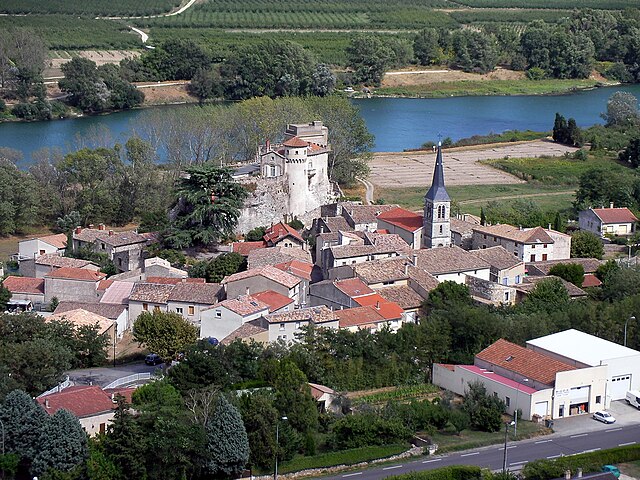
Châteaubourg
- commune in Ardèche, France
Hiking in Châteaubourg
Châteaubourg, located in the Ardèche department of France, is nestled in a region known for its stunning landscapes, picturesque villages, and diverse hiking trails. The Ardèche is famous for its dramatic gorges, limestone cliffs, and forested areas, making it a fantastic destination for hikers of all levels....
- Country:
- Postal Code: 07130
- Coordinates: 44° 59' 49" N, 4° 50' 37" E
- GPS tracks (wikiloc): [Link]
- Area: 4.27 sq km
- Population: 234

Champis
- commune in Ardèche, France
- Country:
- Postal Code: 07440
- Coordinates: 44° 57' 36" N, 4° 44' 1" E
- GPS tracks (wikiloc): [Link]
- AboveSeaLevel: 550 м m
- Area: 16.34 sq km
- Population: 614

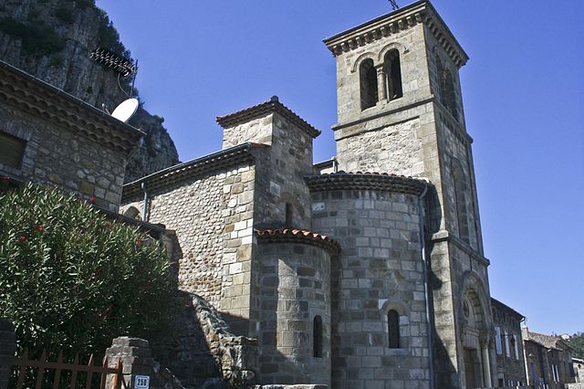
Saint-Romain-de-Lerps
- commune in Ardèche, France
- Country:
- Postal Code: 07130
- Coordinates: 44° 58' 44" N, 4° 47' 48" E
- GPS tracks (wikiloc): [Link]
- Area: 14.14 sq km
- Population: 838
Soyons
- commune in Ardèche, France
Hiking in Soyons
Soyons is a charming village located in the Auvergne-Rhône-Alpes region of France, near the city of Valence. It offers a variety of scenic landscapes ideal for hiking enthusiasts. Here are some features and suggestions for hiking in and around Soyons:...
- Country:
- Postal Code: 07130
- Coordinates: 44° 53' 21" N, 4° 51' 1" E
- GPS tracks (wikiloc): [Link]
- Area: 7.9 sq km
- Population: 2211
- Web site: [Link]

Saint-Sylvestre
- commune in Ardèche, France
- Country:
- Postal Code: 07440
- Coordinates: 44° 59' 23" N, 4° 44' 55" E
- GPS tracks (wikiloc): [Link]
- AboveSeaLevel: 420 м m
- Area: 15.16 sq km
- Population: 506

Toulaud
- commune in Ardèche, France
Hiking in Toulaud
Toulaud is a picturesque commune located in the Auvergne-Rhône-Alpes region of France, specifically in the Ardèche department. It's known for its beautiful landscapes, rolling hills, and natural beauty, making it a great destination for hiking enthusiasts....
- Country:
- Postal Code: 07130
- Coordinates: 44° 53' 52" N, 4° 48' 59" E
- GPS tracks (wikiloc): [Link]
- Area: 34.73 sq km
- Population: 1674