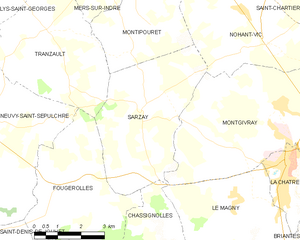
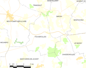
Chassignolles (Chassignolles)
- commune in Indre, France
- Country:

- Postal Code: 36400
- Coordinates: 46° 32' 26" N, 1° 56' 23" E


- GPS tracks (wikiloc): [Link]
- Area: 29.94 sq km
- Population: 578
- Wikipedia en: wiki(en)
- Wikipedia: wiki(fr)
- Wikidata storage: Wikidata: Q1071798
- Wikipedia Commons Category: [Link]
- Freebase ID: [/m/03nw4n7]
- GeoNames ID: Alt: [6448590]
- SIREN number: [213600430]
- BnF ID: [15257347d]
- Library of Congress authority ID: Alt: [n95085847]
- INSEE municipality code: 36043
Shares border with regions:


Le Magny
- commune in Indre, France
- Country:

- Postal Code: 36400
- Coordinates: 46° 34' 2" N, 1° 57' 33" E


- GPS tracks (wikiloc): [Link]
- Area: 17.84 sq km
- Population: 1080
- Web site: [Link]


Saint-Denis-de-Jouhet
- commune in Indre, France
- Country:

- Postal Code: 36230
- Coordinates: 46° 31' 50" N, 1° 52' 7" E


- GPS tracks (wikiloc): [Link]
- Area: 43.48 sq km
- Population: 965
- Web site: [Link]


Pouligny-Saint-Martin
- commune in Indre, France
- Country:

- Postal Code: 36160
- Coordinates: 46° 30' 59" N, 2° 0' 55" E


- GPS tracks (wikiloc): [Link]
- Area: 15.66 sq km
- Population: 227


Pouligny-Notre-Dame
- commune in Indre, France
- Country:

- Postal Code: 36160
- Coordinates: 46° 28' 53" N, 2° 0' 12" E


- GPS tracks (wikiloc): [Link]
- Area: 33.75 sq km
- Population: 700


Sarzay
- commune in Indre, France
- Country:

- Postal Code: 36230
- Coordinates: 46° 36' 6" N, 1° 54' 16" E


- GPS tracks (wikiloc): [Link]
- Area: 18.3 sq km
- Population: 319


Crozon-sur-Vauvre
- commune in Indre, France
- Country:

- Postal Code: 36140
- Coordinates: 46° 29' 19" N, 1° 52' 13" E


- GPS tracks (wikiloc): [Link]
- Area: 27.69 sq km
- Population: 345


Fougerolles
- commune in Indre, France
- Country:

- Postal Code: 36230
- Coordinates: 46° 33' 47" N, 1° 51' 59" E


- GPS tracks (wikiloc): [Link]
- Area: 17.17 sq km
- Population: 343


Crevant
- commune in Indre, France
- Country:

- Postal Code: 36140
- Coordinates: 46° 29' 11" N, 1° 56' 48" E


- GPS tracks (wikiloc): [Link]
- Area: 36.54 sq km
- Population: 722
- Web site: [Link]
