canton of La Châtre (canton de La Châtre)

- canton of France
- Country:

- Capital: La Châtre
- Coordinates: 46° 34' 59" N, 1° 59' 16" E


- GPS tracks (wikiloc): [Link]
- Population: 16413
- Wikipedia en: wiki(en)
- Wikipedia: wiki(fr)
- Wikidata storage: Wikidata: Q681621
- Wikipedia Commons Category: [Link]
- INSEE canton code: [3608]
Includes regions:


La Berthenoux
- commune in Indre, France
- Country:
- Postal Code: 36400
- Coordinates: 46° 39' 40" N, 2° 3' 43" E
- GPS tracks (wikiloc): [Link]
- Area: 39.82 sq km
- Population: 416
- Web site: [Link]

Champillet
- commune in Indre, France
- Country:
- Postal Code: 36160
- Coordinates: 46° 32' 52" N, 2° 6' 50" E
- GPS tracks (wikiloc): [Link]
- Area: 6.94 sq km
- Population: 160


Vicq-Exemplet
- commune in Indre, France
- Country:
- Postal Code: 36400
- Coordinates: 46° 37' 44" N, 2° 8' 28" E
- GPS tracks (wikiloc): [Link]
- Area: 38.74 sq km
- Population: 318


Chassignolles
- commune in Indre, France
- Country:
- Postal Code: 36400
- Coordinates: 46° 32' 26" N, 1° 56' 23" E
- GPS tracks (wikiloc): [Link]
- Area: 29.94 sq km
- Population: 578


La Motte-Feuilly
- commune in Indre, France
- Country:
- Postal Code: 36160
- Coordinates: 46° 32' 31" N, 2° 5' 23" E
- GPS tracks (wikiloc): [Link]
- Area: 5.68 sq km
- Population: 43


Le Magny
- commune in Indre, France
- Country:
- Postal Code: 36400
- Coordinates: 46° 34' 2" N, 1° 57' 33" E
- GPS tracks (wikiloc): [Link]
- Area: 17.84 sq km
- Population: 1080
- Web site: [Link]


Verneuil-sur-Igneraie
- commune in Indre, France
- Country:
- Postal Code: 36400
- Coordinates: 46° 39' 18" N, 2° 0' 38" E
- GPS tracks (wikiloc): [Link]
- Area: 9.84 sq km
- Population: 318


Saint-Christophe-en-Boucherie
- commune in Indre, France
- Country:
- Postal Code: 36400
- Coordinates: 46° 40' 41" N, 2° 7' 16" E
- GPS tracks (wikiloc): [Link]
- Area: 26.89 sq km
- Population: 250


Saint-Août
- commune in Indre, France
- Country:
- Postal Code: 36120
- Coordinates: 46° 43' 53" N, 1° 57' 56" E
- GPS tracks (wikiloc): [Link]
- Area: 54.11 sq km
- Population: 852
- Web site: [Link]

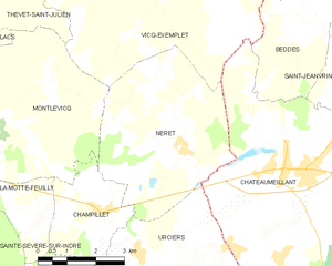
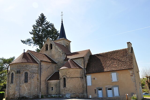
Néret
- commune in Indre, France
- Country:
- Postal Code: 36400
- Coordinates: 46° 34' 8" N, 2° 8' 55" E
- GPS tracks (wikiloc): [Link]
- Area: 19.05 sq km
- Population: 202


Montlevicq
- commune in Indre, France
- Country:
- Postal Code: 36400
- Coordinates: 46° 34' 38" N, 2° 4' 12" E
- GPS tracks (wikiloc): [Link]
- Area: 18.79 sq km
- Population: 115


Lourouer-Saint-Laurent
- commune in Indre, France
- Country:
- Postal Code: 36400
- Coordinates: 46° 37' 24" N, 2° 0' 46" E
- GPS tracks (wikiloc): [Link]
- Area: 11.21 sq km
- Population: 273


Lacs
- commune in Indre, France
- Country:
- Postal Code: 36400
- Coordinates: 46° 35' 7" N, 2° 1' 26" E
- GPS tracks (wikiloc): [Link]
- Area: 13.46 sq km
- Population: 661

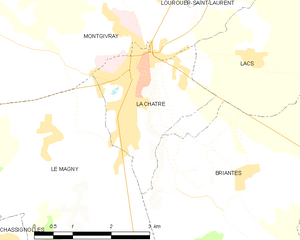
La Châtre
- commune in Indre, France
- Country:
- Postal Code: 36400
- Coordinates: 46° 34' 56" N, 1° 59' 14" E
- GPS tracks (wikiloc): [Link]
- Area: 6.06 sq km
- Population: 4255

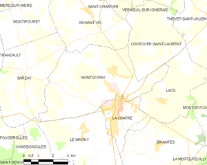
Montgivray
- commune in Indre, France
- Country:
- Postal Code: 36400
- Coordinates: 46° 36' 12" N, 1° 58' 57" E
- GPS tracks (wikiloc): [Link]
- Area: 25.48 sq km
- Population: 1634
- Web site: [Link]

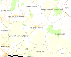
Thevet-Saint-Julien
- commune in Indre, France
- Country:
- Postal Code: 36400
- Coordinates: 46° 38' 14" N, 2° 4' 8" E
- GPS tracks (wikiloc): [Link]
- Area: 30.94 sq km
- Population: 402


Briantes
- commune in Indre, France
- Country:
- Postal Code: 36400
- Coordinates: 46° 33' 28" N, 2° 1' 21" E
- GPS tracks (wikiloc): [Link]
- Area: 23.12 sq km
- Population: 608

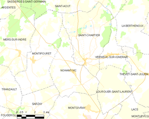
Nohant-Vic
- commune in Indre, France
- Country:
- Postal Code: 36400
- Coordinates: 46° 38' 19" N, 1° 57' 36" E
- GPS tracks (wikiloc): [Link]
- Area: 21.25 sq km
- Population: 463
- Web site: [Link]


Saint-Chartier
- commune in Indre, France
- Country:
- Postal Code: 36400
- Coordinates: 46° 38' 59" N, 1° 58' 38" E
- GPS tracks (wikiloc): [Link]
- Area: 27.52 sq km
- Population: 532