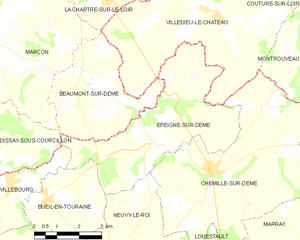
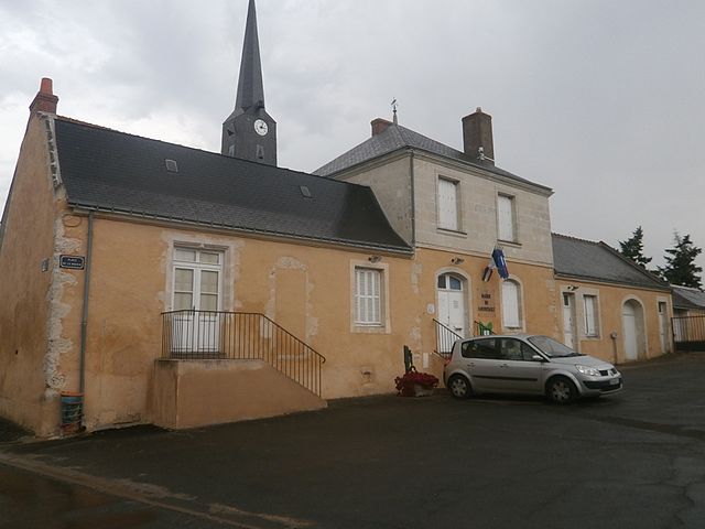
Chemillé-sur-Dême (Chemillé-sur-Dême)

- commune in Indre-et-Loire, France
- Country:

- Postal Code: 37370
- Coordinates: 47° 39' 31" N, 0° 38' 54" E


- GPS tracks (wikiloc): [Link]
- Area: 33.54 sq km
- Population: 713
- Web site: http://www.chemillesurdeme.fr
- Wikipedia en: wiki(en)
- Wikipedia: wiki(fr)
- Wikidata storage: Wikidata: Q1135768
- Wikipedia Commons Category: [Link]
- Freebase ID: [/m/081dpp]
- GeoNames ID: Alt: [6448681]
- SIREN number: [213700685]
- BnF ID: [152576190]
- PACTOLS thesaurus ID: [pcrtHmXknDORc1]
- INSEE municipality code: 37068
Shares border with regions:


Les Hermites
- commune in Indre-et-Loire, France
- Country:
- Postal Code: 37110
- Coordinates: 47° 39' 52" N, 0° 45' 10" E
- GPS tracks (wikiloc): [Link]
- Area: 32.6 sq km
- Population: 582
- Web site: [Link]

Épeigné-sur-Dême
- commune in Indre-et-Loire, France
- Country:
- Postal Code: 37370
- Coordinates: 47° 40' 8" N, 0° 36' 49" E
- GPS tracks (wikiloc): [Link]
- Area: 21.08 sq km
- Population: 170
Montrouveau
- commune in Loir-et-Cher, France
- Country:
- Postal Code: 41800
- Coordinates: 47° 42' 52" N, 0° 43' 44" E
- GPS tracks (wikiloc): [Link]
- Area: 17.7 sq km
- Population: 150


Marray
- commune in Indre-et-Loire, France
- Country:
- Postal Code: 37370
- Coordinates: 47° 37' 16" N, 0° 42' 3" E
- GPS tracks (wikiloc): [Link]
- Area: 23.81 sq km
- Population: 456

Louestault
- former commune in Indre-et-Loire, France
- Country:
- Postal Code: 37370
- Coordinates: 47° 37' 1" N, 0° 39' 5" E
- GPS tracks (wikiloc): [Link]
- Area: 16.45 sq km
- Population: 420

Villedieu-le-Château
- commune in Loir-et-Cher, France
- Country:
- Postal Code: 41800
- Coordinates: 47° 43' 12" N, 0° 38' 53" E
- GPS tracks (wikiloc): [Link]
- Area: 29.65 sq km
- Population: 408
- Web site: [Link]


Neuvy-le-Roi
- commune in Indre-et-Loire, France
- Country:
- Postal Code: 37370
- Coordinates: 47° 36' 13" N, 0° 35' 41" E
- GPS tracks (wikiloc): [Link]
- Area: 47.5 sq km
- Population: 1077
- Web site: [Link]