Montrouveau (Montrouveau)

- commune in Loir-et-Cher, France
- Country:

- Postal Code: 41800
- Coordinates: 47° 42' 52" N, 0° 43' 44" E


- GPS tracks (wikiloc): [Link]
- Area: 17.7 sq km
- Population: 150
- Wikipedia en: wiki(en)
- Wikipedia: wiki(fr)
- Wikidata storage: Wikidata: Q1170573
- Wikipedia Commons Category: [Link]
- Freebase ID: [/m/03nw1m8]
- GeoNames ID: Alt: [2992016]
- SIREN number: [214101537]
- BnF ID: [15259427j]
- INSEE municipality code: 41153
Shares border with regions:

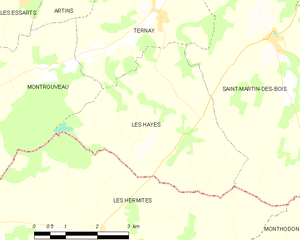
Les Hayes
- commune in Loir-et-Cher, France
- Country:
- Postal Code: 41800
- Coordinates: 47° 42' 55" N, 0° 46' 37" E
- GPS tracks (wikiloc): [Link]
- AboveSeaLevel: 144 м m
- Area: 15.71 sq km
- Population: 181
Les Essarts
- commune in Loir-et-Cher, France
- Country:
- Postal Code: 41800
- Coordinates: 47° 44' 0" N, 0° 43' 4" E
- GPS tracks (wikiloc): [Link]
- Area: 4.38 sq km
- Population: 110
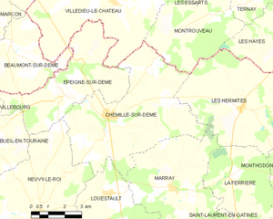
Chemillé-sur-Dême
- commune in Indre-et-Loire, France
- Country:
- Postal Code: 37370
- Coordinates: 47° 39' 31" N, 0° 38' 54" E
- GPS tracks (wikiloc): [Link]
- Area: 33.54 sq km
- Population: 713
- Web site: [Link]


Les Hermites
- commune in Indre-et-Loire, France
- Country:
- Postal Code: 37110
- Coordinates: 47° 39' 52" N, 0° 45' 10" E
- GPS tracks (wikiloc): [Link]
- Area: 32.6 sq km
- Population: 582
- Web site: [Link]


Ternay
- commune in Loir-et-Cher, France
- Country:
- Postal Code: 41800
- Coordinates: 47° 43' 48" N, 0° 46' 45" E
- GPS tracks (wikiloc): [Link]
- Area: 14.38 sq km
- Population: 341

Villedieu-le-Château
- commune in Loir-et-Cher, France
- Country:
- Postal Code: 41800
- Coordinates: 47° 43' 12" N, 0° 38' 53" E
- GPS tracks (wikiloc): [Link]
- Area: 29.65 sq km
- Population: 408
- Web site: [Link]


Couture-sur-Loir
- commune in Loir-et-Cher, France
- Country:
- Postal Code: 41800
- Coordinates: 47° 45' 13" N, 0° 41' 16" E
- GPS tracks (wikiloc): [Link]
- Area: 14.3 sq km
- Population: 413
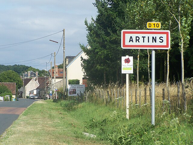

Artins
- commune in Loir-et-Cher, France
- Country:
- Postal Code: 41800
- Coordinates: 47° 44' 42" N, 0° 44' 23" E
- GPS tracks (wikiloc): [Link]
- Area: 11.72 sq km
- Population: 265