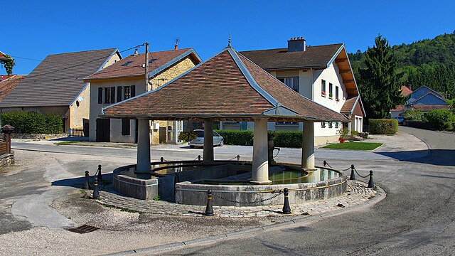
Chenecey-Buillon (Chenecey-Buillon)

- commune in Doubs, France
 Hiking in Chenecey-Buillon
Chenecey-Buillon, located in the Doubs department of the Bourgogne-Franche-Comté region in France, offers a pleasant natural landscape for hiking enthusiasts. The area is characterized by its scenic countryside, rolling hills, and lush forests, making it a wonderful destination for outdoor activities.
Hiking Trails
While specific trails may vary, here are a few highlights you can expect around Chenecey-Buillon:
-
Local Trails: The region features a network of hiking paths that can lead you through beautiful forests, meadows, and along rivers. Many trails are well-marked, offering varying levels of difficulty suitable for both beginners and more experienced hikers.
-
The Doubs River: Following along the Doubs River offers opportunities for scenic views and diverse flora and fauna. You can find trails that take you close to the water, providing a peaceful atmosphere and great spots for picnicking.
-
Historical Sites: While hiking, you may come across historical sites, such as old mills and traditional farms, which add cultural significance to your trekking experience.
Tips for Hiking in Chenecey-Buillon
- Weather: Always check the weather forecast before heading out, as conditions can change quickly in the mountains.
- Gear: Wear appropriate hiking boots for varied terrain and bring layers, as temperatures can fluctuate throughout the day.
- Maps and Guides: Consider picking up a local hiking map or guidebook to help navigate the area.
- Stay Hydrated: Carry enough water and snacks, especially for longer hikes.
- Respect Nature: Stay on marked paths and practice Leave No Trace principles to help preserve the beauty of the area.
Nearby Attractions
If you have extra time, you might also explore nearby attractions:
- The Haut-Doubs region: Known for its stunning landscapes, it's perfect for a day trip adventure.
- Local Cuisine: Don’t miss the opportunity to enjoy local specialties in nearby villages after your hike.
Hiking in Chenecey-Buillon offers a chance to reconnect with nature in a serene environment, perfect for both solitude and sharing experiences with friends or family. Enjoy your hike!
- Country:

- Postal Code: 25440
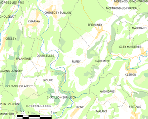
- Coordinates: 47° 8' 24" N, 5° 57' 33" E


- GPS tracks (wikiloc): [Link]
- Area: 16.58 sq km
- Population: 527
- Wikipedia en: wiki(en)
- Wikipedia: wiki(fr)
- Wikidata storage: Wikidata: Q741599
- Wikipedia Commons Category: [Link]
- Freebase ID: [/m/03mgs59]
- Freebase ID: [/m/03mgs59]
- GeoNames ID: Alt: [6429722]
- GeoNames ID: Alt: [6429722]
- SIREN number: [212501498]
- SIREN number: [212501498]
- BnF ID: [15252375f]
- BnF ID: [15252375f]
- INSEE municipality code: 25149
- INSEE municipality code: 25149
Shares border with regions:


Vorges-les-Pins
- commune in Doubs, France
Hiking in Vorges-les-Pins
Vorges-les-Pins is a great destination for hiking enthusiasts, offering a variety of trails that cater to different skill levels. While it may not be as well-known as some larger hiking areas in France, its natural beauty and tranquil setting make it a charming spot for outdoor activities....
- Country:
- Postal Code: 25320
- Coordinates: 47° 9' 28" N, 5° 55' 43" E
- GPS tracks (wikiloc): [Link]
- Area: 4.76 sq km
- Population: 596


Pugey
- commune in Doubs, France
Hiking in Pugey
Pugey, located in the Doubs department of France, is a picturesque area that offers a variety of hiking opportunities amidst beautiful natural landscapes. The region is characterized by rolling hills, lush forests, and striking geological formations, making it an ideal destination for both novice and experienced hikers....
- Country:
- Postal Code: 25720
- Coordinates: 47° 11' 5" N, 5° 59' 26" E
- GPS tracks (wikiloc): [Link]
- Area: 7.32 sq km
- Population: 759
Rurey
- commune in Doubs, France
Hiking in Rurey
It seems like there might be a little confusion with the name "Rurey," as it's not widely recognized as a hiking destination. However, if you're referring to a specific area or region, please provide more context or correct the name, and I'll be happy to give you detailed information....
- Country:
- Postal Code: 25290
- Coordinates: 47° 5' 47" N, 6° 0' 33" E
- GPS tracks (wikiloc): [Link]
- Area: 14.77 sq km
- Population: 333


Busy
- commune in Doubs, France
Hiking in Busy
Busy is a charming village located in the Doubs department in the Bourgogne-Franche-Comté region of eastern France. The area is known for its picturesque landscapes, dense woodlands, and scenic views, making it an excellent destination for hiking enthusiasts....
- Country:
- Postal Code: 25320
- Coordinates: 47° 10' 4" N, 5° 56' 52" E
- GPS tracks (wikiloc): [Link]
- Area: 5.2 sq km
- Population: 618