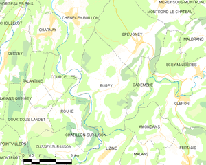
Rurey (Rurey)
- commune in Doubs, France
It seems like there might be a little confusion with the name "Rurey," as it's not widely recognized as a hiking destination. However, if you're referring to a specific area or region, please provide more context or correct the name, and I'll be happy to give you detailed information.
If you're looking for general advice on hiking, here are some tips:
-
Choose the Right Trail: Depending on your skill level, find a trail that matches your experience. Look for trail ratings and read descriptions to gauge difficulty.
-
Check the Weather: Always review the weather forecast before heading out, as conditions can change rapidly in the outdoors.
-
Gear Up: Make sure you have the right equipment, including sturdy hiking boots, appropriate clothing, a map or GPS, plenty of water, snacks, and a first-aid kit.
-
Stay on Marked Trails: To minimize impact on the environment and reduce the risk of getting lost, stick to marked paths.
-
Leave No Trace: Follow the Leave No Trace principles to protect the natural environment by taking all your trash with you and respecting wildlife.
-
Travel in Groups: If possible, hike with a friend or group, especially in remote areas. It's safer and can make the experience more enjoyable.
-
Know Your Limits: Be mindful of your physical condition and energy levels. It's better to turn back than to push yourself too hard.
Feel free to ask about specific trails, regions, or anything else, and I’d be glad to assist!
- Country:

- Postal Code: 25290
- Coordinates: 47° 5' 47" N, 6° 0' 33" E


- GPS tracks (wikiloc): [Link]
- Area: 14.77 sq km
- Population: 333
- Wikipedia en: wiki(en)
- Wikipedia: wiki(fr)
- Wikidata storage: Wikidata: Q907784
- Wikipedia Commons Category: [Link]
- Freebase ID: [/m/03mhcr8]
- Freebase ID: [/m/03mhcr8]
- GeoNames ID: Alt: [6429972]
- GeoNames ID: Alt: [6429972]
- SIREN number: [212505119]
- SIREN number: [212505119]
- BnF ID: [152527370]
- BnF ID: [152527370]
- INSEE municipality code: 25511
- INSEE municipality code: 25511
Shares border with regions:


Épeugney
- commune in Doubs, France
Épeugney is a picturesque village in the Haute-Saône department in the Bourgogne-Franche-Comté region of eastern France. The surrounding landscape is characterized by rolling hills, forests, and meadows, offering a serene backdrop for hiking enthusiasts. Here's what you can expect when hiking in and around Épeugney:...
- Country:

- Postal Code: 25290
- Coordinates: 47° 7' 3" N, 6° 1' 28" E


- GPS tracks (wikiloc): [Link]
- Area: 13.95 sq km
- Population: 603


Amondans
- commune in Doubs, France
It appears there might be a spelling error or misunderstanding regarding "Amondans." If you're referring to a specific location, could you please clarify the name? It could be a lesser-known area or perhaps a local term....
- Country:

- Postal Code: 25330
- Coordinates: 47° 4' 8" N, 6° 2' 25" E


- GPS tracks (wikiloc): [Link]
- Area: 5.68 sq km
- Population: 90

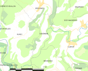
Cademène
- commune in Doubs, France
Cademène is a picturesque area located in the Pyrenees of France, known for its stunning landscapes and extensive hiking trails. Here are some key aspects to know about hiking in Cademène:...
- Country:

- Postal Code: 25290
- Coordinates: 47° 6' 2" N, 6° 1' 39" E


- GPS tracks (wikiloc): [Link]
- Area: 3.39 sq km
- Population: 78


Chenecey-Buillon
- commune in Doubs, France
Chenecey-Buillon, located in the Doubs department of the Bourgogne-Franche-Comté region in France, offers a pleasant natural landscape for hiking enthusiasts. The area is characterized by its scenic countryside, rolling hills, and lush forests, making it a wonderful destination for outdoor activities....
- Country:

- Postal Code: 25440
- Coordinates: 47° 8' 24" N, 5° 57' 33" E


- GPS tracks (wikiloc): [Link]
- Area: 16.58 sq km
- Population: 527

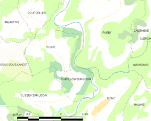
Châtillon-sur-Lison
- commune in Doubs, France
Châtillon-sur-Lison, located in the Franche-Comté region of eastern France, offers a delightful setting for hiking enthusiasts. The area is characterized by its lush landscapes, scenic valleys, and a mix of natural and historical features. Here are some highlights and tips for hiking in Châtillon-sur-Lison:...
- Country:

- Postal Code: 25440
- Coordinates: 47° 3' 50" N, 5° 58' 56" E


- GPS tracks (wikiloc): [Link]
- AboveSeaLevel: 294 м m
- Area: 2.89 sq km
- Population: 9


Rouhe
- commune in Doubs, France
Rouhe, known for its beautiful landscapes and tranquil nature, offers a variety of hiking opportunities for all skill levels. While specific trails and routes may vary, here are some general tips and information to consider when hiking in this area:...
- Country:

- Postal Code: 25440
- Coordinates: 47° 4' 59" N, 5° 57' 50" E


- GPS tracks (wikiloc): [Link]
- Area: 4.19 sq km
- Population: 85


Lizine
- commune in Doubs, France
Lizine is a lesser-known hiking destination, and specific information may vary based on local trails and conditions. However, if you’re looking to explore an area like Lizine, here are some general tips and information you might find useful for hiking in any location:...
- Country:

- Postal Code: 25330
- Coordinates: 47° 3' 23" N, 5° 59' 39" E


- GPS tracks (wikiloc): [Link]
- Area: 7.33 sq km
- Population: 82
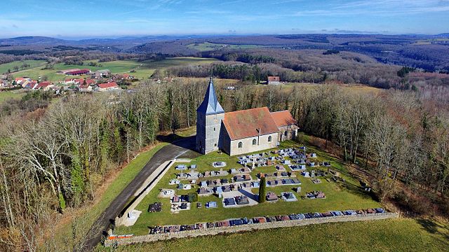
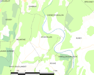
Courcelles
- commune in Doubs, France
Courcelles, located in the Doubs department of the Bourgogne-Franche-Comté region in eastern France, is surrounded by beautiful natural landscapes that make it an appealing destination for hiking enthusiasts. Here are some highlights about hiking in and around Courcelles:...
- Country:

- Postal Code: 25440
- Coordinates: 47° 5' 38" N, 5° 57' 25" E


- GPS tracks (wikiloc): [Link]
- AboveSeaLevel: 360 м m
- Area: 3.61 sq km
- Population: 111
