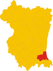
Chions (Chions)
.svg)
- Italian comune
 Hiking in Chions
Chions, a small commune located in the province of Pordenone in the Friuli Venezia Giulia region of northeastern Italy, offers a peaceful environment for hiking enthusiasts. While it may not be as famous as larger national parks or mountains, the surrounding area features beautiful landscapes ideal for hiking.
Here are a few things to consider if you're planning to hike around Chions:
Scenic Trails
-
Natural Beauty: The area around Chions includes gentle hills and agricultural land which can provide serene hiking experiences with picturesque views of rural Italy.
-
Access to Nearby Regions: You can easily access nearby natural parks and reserves such as the Parco Naturale delle Dolomiti Friulane, which features more challenging trails and breathtaking landscapes.
Recommendations for Hiking
-
Local Trails: Look for local trails that may not be well-marked but provide an authentic experience of the countryside. Check with local tourism offices for maps and recommendations.
-
Guided Hikes: Consider joining a guided hiking tour. Local guides can offer insight into the flora, fauna, and history of the area, enhancing your hiking experience.
-
Safety Precautions: Always carry sufficient water, wear proper footwear, and inform someone about your hiking plans. Check the weather before heading out.
Nearby Attractions
-
Cividale del Friuli: This historic town is a short drive from Chions and offers both cultural and natural attractions.
-
Aquileia: Another nearby site rich in history is Aquileia, known for its ancient Roman ruins and archaeological sites.
Best Time to Hike
Spring (April to June) and early fall (September to October) are ideal for hiking in this region due to mild weather and beautiful scenery. Summer can be hot, while winter may see some snow at higher elevations.
Overall, while Chions may not be a major hiking destination, its charming surroundings and access to beautiful landscapes make it a lovely place for a peaceful hike in Italy. Always do thorough research and prepare adequately for the trails you choose to explore.
- Country:

- Postal Code: 33083
- Local Dialing Code: 0434
- Licence Plate Code: PN
- Coordinates: 45° 51' 0" N, 12° 43' 0" E


- GPS tracks (wikiloc): [Link]
- AboveSeaLevel: 15 м m
- Area: 33.45 sq km
- Population: 5180
- Web site: http://www.comune.chions.pn.it/
- Wikipedia en: wiki(en)
- Wikipedia: wiki(it)
- Wikidata storage: Wikidata: Q53161
- Wikipedia Commons Category: [Link]
- Freebase ID: [/m/0gqz54]
- GeoNames ID: Alt: [6539659]
- VIAF ID: Alt: [307295557]
- OSM relation ID: [79134]
- TGN ID: [7048440]
- UN/LOCODE: [ITCHB]
- ISTAT ID: 093013
- Italian cadastre code: C640
Shares border with regions:
Pramaggiore
- Italian comune
Hiking in Pramaggiore
Pramaggiore, located in the Veneto region of Italy, is known for its scenic landscapes and tranquil countryside, making it a lovely spot for hiking enthusiasts. While it may not be as famous as larger national parks, it offers a unique blend of vineyards, rolling hills, and picturesque views, especially of the surrounding mountains....
- Country:
- Postal Code: 30020
- Local Dialing Code: 0421
- Licence Plate Code: VE
- Coordinates: 45° 49' 0" N, 12° 44' 0" E
- GPS tracks (wikiloc): [Link]
- AboveSeaLevel: 11 м m
- Area: 24.22 sq km
- Population: 4644
- Web site: [Link]
Cinto Caomaggiore
- Italian comune
Hiking in Cinto Caomaggiore
Cinto Caomaggiore is a picturesque area located in the Veneto region of Italy, not far from the foothills of the Alps. It offers a range of hiking opportunities that cater to various skill levels, all set against a backdrop of stunning landscapes, quaint villages, and rich biodiversity....
- Country:
- Postal Code: 30020
- Local Dialing Code: 0421
- Licence Plate Code: VE
- Coordinates: 45° 50' 0" N, 12° 47' 0" E
- GPS tracks (wikiloc): [Link]
- AboveSeaLevel: 11 м m
- Area: 21.32 sq km
- Population: 3238
- Web site: [Link]


Azzano Decimo
- Italian comune
Hiking in Azzano Decimo
Azzano Decimo, located in the Friuli Venezia Giulia region of Italy, is an area that offers a mix of nature, culture, and history, making it a great spot for hiking enthusiasts. The region’s diverse landscapes include rolling hills, vineyards, and stretches of the nearby countryside, providing a range of hiking opportunities....
- Country:
- Postal Code: 33082
- Local Dialing Code: 0434
- Licence Plate Code: PN
- Coordinates: 45° 53' 0" N, 12° 43' 0" E
- GPS tracks (wikiloc): [Link]
- AboveSeaLevel: 14 м m
- Area: 51.34 sq km
- Population: 15744
- Web site: [Link]
Fiume Veneto
- Italian comune
Hiking in Fiume Veneto
Fiume Veneto is a charming town located in the Friuli Venezia Giulia region of northeastern Italy. While it may not be as well-known as some of the larger national parks or hiking areas in Italy, it has its own unique appeal for those looking to explore the beautiful landscapes of the region. Here are some key aspects of hiking in and around Fiume Veneto:...
- Country:
- Postal Code: 33080
- Local Dialing Code: 0434
- Licence Plate Code: PN
- Coordinates: 45° 56' 0" N, 12° 44' 0" E
- GPS tracks (wikiloc): [Link]
- AboveSeaLevel: 20 м m
- Area: 35.76 sq km
- Population: 11729
- Web site: [Link]
Pravisdomini
- Italian comune
Hiking in Pravisdomini
Pravisdomini, located in the region of Friuli Venezia Giulia in northeastern Italy, offers a serene and picturesque environment for hiking enthusiasts. The area is characterized by its beautiful landscapes, charming villages, and proximity to both the Julian Alps and the Adriatic coast....
- Country:
- Postal Code: 33076
- Local Dialing Code: 0434
- Licence Plate Code: PN
- Coordinates: 45° 49' 0" N, 12° 41' 0" E
- GPS tracks (wikiloc): [Link]
- AboveSeaLevel: 10 м m
- Area: 16.21 sq km
- Population: 3500
- Web site: [Link]

San Vito al Tagliamento
- Italian comune
Hiking in San Vito al Tagliamento
San Vito al Tagliamento, located in the Friuli Venezia Giulia region of northeastern Italy, is a charming town surrounded by picturesque landscapes, making it a great spot for hiking enthusiasts. The area features a mixture of rolling hills, woodlands, and agricultural fields, providing a variety of trails for different skill levels....
- Country:
- Postal Code: 33078
- Local Dialing Code: 0434
- Licence Plate Code: PN
- Coordinates: 45° 54' 55" N, 12° 51' 20" E
- GPS tracks (wikiloc): [Link]
- AboveSeaLevel: 30 м m
- Area: 60.88 sq km
- Population: 15063
- Web site: [Link]


Sesto al Reghena
- Italian comune
Hiking in Sesto al Reghena
Sesto al Reghena, a charming town in the Friuli Venezia Giulia region of Italy, is not only rich in history and culture but also offers some beautiful hiking opportunities. Nestled in the picturesque countryside, it serves as a great starting point for various hiking trails that allow you to explore the surrounding natural beauty....
- Country:
- Postal Code: 33079
- Local Dialing Code: 0434
- Licence Plate Code: PN
- Coordinates: 45° 51' 0" N, 12° 49' 0" E
- GPS tracks (wikiloc): [Link]
- AboveSeaLevel: 13 м m
- Area: 40.68 sq km
- Population: 6367
- Web site: [Link]