Province of Pordenone (provincia di Pordenone)
- province of Italy
 Hiking in Province of Pordenone
The Province of Pordenone, located in the Friuli Venezia Giulia region of northeastern Italy, offers stunning landscapes and diverse hiking opportunities. From the foothills of the Alps to the lush valleys and picturesque towns, here's an overview of what you can expect when hiking in this area:
Key Highlights
-
Natural Parks:
- Parco Naturale delle Prealpi Friulane: This park features dramatic mountain scenery, deep gorges, and lush forests. There are numerous trails of varying difficulty, suitable for both casual hikers and more experienced trekkers.
- Parco del Fiume Stella: This natural park along the River Stella provides a different experience with its wetlands and lush environments. Trails here often lead to beautiful river views and opportunities for birdwatching.
-
Mountain Trails:
- The Dolomites, particularly the Friulian part, offer stunning alpine landscapes. Many trails, like the Sentiero dei Giganti, allow you to explore the rugged beauty of the region.
- The Monte Cavallo and Monte Prat areas have various paths that offer panoramic views and the chance to experience the diverse flora and fauna of the region.
-
Cultural Experiences:
- While hiking, it’s common to pass through charming villages such as Spilimbergo, known for its historical castle and the beautiful mosaic school. Stopping in these towns can enhance your experience with local culture and cuisine.
-
Historical Trails:
- Some trails lead to historical sites, including ancient ruins and churches. Exploring these areas can provide insight into the history and culture of Pordenone.
-
Suggested Trails:
- Ciclopedonale del Tagliamento: A scenic trail along the Tagliamento River, perfect for hiking and cycling, offering beautiful views and a chance to see local wildlife.
- Sentiero dei Camosci: This trail provides a moderate hike with opportunities to see chamois and stunning alpine scenery.
Tips for Hiking in Pordenone
- Weather: The weather can change quickly in the mountains, so check forecasts and be prepared for varying conditions.
- Gear: Wear appropriate footwear and carry essentials like water, snacks, a map or GPS, and a first-aid kit.
- Permits: Some areas may require permits or have specific regulations, so check in advance.
- Local Guides: Consider hiring a local guide for more remote areas or challenging routes, as they can enhance your experience with their knowledge of the land.
Whether you're looking for a leisurely walk or a challenging trek, the Province of Pordenone has something to offer every type of hiker. Enjoy the stunning landscapes and rich culture that this beautiful region offers!
- Country:

- Capital: Pordenone
- Postal Code: 33170; 33090–33099; 33076–33087; 33072–33074; 33070
- Local Dialing Code: 0427; 0434; 0432
- Licence Plate Code: PN
- Coordinates: 45° 57' 0" N, 12° 41' 0" E


- GPS tracks (wikiloc): [Link]
- Area: 2178 sq km
- Web site: http://www.provincia.pordenone.it/
- Wikipedia en: wiki(en)
- Wikipedia: wiki(it)
- Wikidata storage: Wikidata: Q16247
- Wikipedia Commons Gallery: [Link]
- Wikipedia Commons Category: [Link]
- Freebase ID: [/m/04_xyd]
- GeoNames ID: Alt: [3170146]
- BnF ID: [166780410]
- VIAF ID: Alt: [151263451]
- OSM relation ID: [179293]
- GND ID: Alt: [16313346-3]
- archINFORM location ID: [2568]
- Library of Congress authority ID: Alt: [n82040172]
- MusicBrainz area ID: [69c98518-a65b-421c-a224-be669c31249e]
- SUDOC authorities ID: [035406313]
- NUTS code: [ITH41]
- BAV ID: [ADV10307120]
- ISTAT ID: 093
- ISO 3166-2 code: IT-PN
Includes regions:
Morsano al Tagliamento
- Italian comune
 Hiking in Morsano al Tagliamento
Morsano al Tagliamento is a picturesque village located in the Friuli Venezia Giulia region of northeastern Italy. The area surrounding Morsano al Tagliamento is characterized by its gentle rolling hills, lush farmlands, and scenic landscapes, making it a delightful spot for hiking enthusiasts....
- Country:

- Postal Code: 33075
- Local Dialing Code: 0434
- Licence Plate Code: PN
- Coordinates: 45° 52' 23" N, 12° 57' 12" E


- GPS tracks (wikiloc): [Link]
- AboveSeaLevel: 14 м m
- Area: 32.54 sq km
- Population: 2788
- Web site: [Link]


Valvasone Arzene
- Italian comune
Valvasone Arzene is a charming municipality in the Friuli Venezia Giulia region of northeastern Italy. While it may not be as widely recognized for hiking as some other locations in the Alps or Dolomites, it offers beautiful countryside and scenic trails that can be enjoyed by hikers of all levels. Here are some key points to consider if you're thinking about hiking in this area:...
- Country:

- Postal Code: 33098
- Licence Plate Code: PN
- Coordinates: 46° 0' 8" N, 12° 50' 52" E


- GPS tracks (wikiloc): [Link]
- AboveSeaLevel: 59 м m
- Area: 29.68 sq km
- Population: 3921
- Web site: [Link]
Andreis
- Propiedad de andreys Calderón
Andreis is a picturesque village located in the Friuli Venezia Giulia region of northeastern Italy. Surrounded by stunning landscapes, it offers a variety of hiking opportunities for both beginners and experienced adventurers. Here are some highlights and tips for hiking in and around Andreis:...
- Country:

- Postal Code: 33080
- Local Dialing Code: 0427
- Licence Plate Code: PN
- Coordinates: 46° 12' 0" N, 12° 37' 0" E


- GPS tracks (wikiloc): [Link]
- AboveSeaLevel: 455 м m
- Area: 26.95 sq km
- Population: 248
- Web site: [Link]
Arba, Friuli-Venezia Giulia
- Italian comune
 Hiking in Arba, Friuli-Venezia Giulia
Arba, located in the Friuli-Venezia Giulia region of northeastern Italy, is surrounded by stunning landscapes and offers various hiking opportunities suitable for different skill levels. This area is known for its beautiful natural scenery, including mountains, hills, forests, and rivers, making it an appealing destination for outdoor enthusiasts....
- Country:

- Postal Code: 33090
- Local Dialing Code: 0427
- Licence Plate Code: PN
- Coordinates: 46° 9' 0" N, 12° 47' 0" E


- GPS tracks (wikiloc): [Link]
- AboveSeaLevel: 210 м m
- Area: 15.31 sq km
- Population: 1278
- Web site: [Link]


Aviano
- Italian comune
Aviano, located in the northeastern part of Italy, is surrounded by beautiful landscapes that offer numerous hiking opportunities for outdoor enthusiasts. Nestled near the Friuli Venezia Giulia region and the Dolomites, the area provides a mix of mountainous terrain, forests, and valleys, making it an excellent destination for hikers of all levels....
- Country:

- Postal Code: 33081
- Local Dialing Code: 0434
- Licence Plate Code: PN
- Coordinates: 46° 4' 0" N, 12° 35' 0" E


- GPS tracks (wikiloc): [Link]
- AboveSeaLevel: 159 м m
- Area: 113.35 sq km
- Population: 9080
- Web site: [Link]


Azzano Decimo
- Italian comune
Azzano Decimo, located in the Friuli Venezia Giulia region of Italy, is an area that offers a mix of nature, culture, and history, making it a great spot for hiking enthusiasts. The region’s diverse landscapes include rolling hills, vineyards, and stretches of the nearby countryside, providing a range of hiking opportunities....
- Country:

- Postal Code: 33082
- Local Dialing Code: 0434
- Licence Plate Code: PN
- Coordinates: 45° 53' 0" N, 12° 43' 0" E


- GPS tracks (wikiloc): [Link]
- AboveSeaLevel: 14 м m
- Area: 51.34 sq km
- Population: 15744
- Web site: [Link]


Barcis
- Italian comune
Barcis is a picturesque village located in the Friuli Venezia Giulia region of northeastern Italy, surrounded by stunning natural landscapes, including mountains, lakes, and forests. Hiking in Barcis offers a fantastic opportunity to explore the beautiful surroundings and experience the region's rich biodiversity....
- Country:

- Postal Code: 33080
- Local Dialing Code: 0427
- Licence Plate Code: PN
- Coordinates: 46° 11' 0" N, 12° 34' 0" E


- GPS tracks (wikiloc): [Link]
- AboveSeaLevel: 409 м m
- Area: 103.41 sq km
- Population: 256
- Web site: [Link]
Brugnera
- Italian comune
Brugnera, located in the Friuli Venezia Giulia region of Italy, is a charming town surrounded by a variety of landscapes ideal for hiking enthusiasts. While Brugnera itself is smaller and may not have extensive hiking trails directly in the town, there are numerous trails and natural areas nearby for outdoor exploration....
- Country:

- Postal Code: 33070
- Local Dialing Code: 0434
- Licence Plate Code: PN
- Coordinates: 45° 54' 0" N, 12° 32' 0" E


- GPS tracks (wikiloc): [Link]
- AboveSeaLevel: 16 м m
- Area: 29.12 sq km
- Population: 9290
- Web site: [Link]


Budoia
- Italian comune
Budoia, a picturesque village located in the Friuli Venezia Giulia region of northeastern Italy, offers some beautiful hiking opportunities for outdoor enthusiasts. The surrounding landscape is marked by stunning views, rolling hills, and lush vegetation, making it a great place for both novice and experienced hikers....
- Country:

- Postal Code: 33070
- Local Dialing Code: 0434
- Licence Plate Code: PN
- Coordinates: 46° 3' 0" N, 12° 32' 0" E


- GPS tracks (wikiloc): [Link]
- AboveSeaLevel: 135 м m
- Area: 37.36 sq km
- Population: 2571
- Web site: [Link]
Caneva
- Italian comune
Caneva is a charming town located in the Province of Treviso in northern Italy, not far from the picturesque landscape of the Friuli Venezia Giulia region. The area is known for its beautiful countryside, vineyards, and proximity to the foothills of the Alps. While Caneva itself may not be as famous for hiking as some other locations, there are still several hiking opportunities in and around this region....
- Country:

- Postal Code: 33070
- Local Dialing Code: 0434
- Licence Plate Code: PN
- Coordinates: 45° 58' 0" N, 12° 27' 0" E


- GPS tracks (wikiloc): [Link]
- AboveSeaLevel: 57 м m
- Area: 41.79 sq km
- Population: 6339
- Web site: [Link]


Casarsa della Delizia
- Italian comune
 Hiking in Casarsa della Delizia
Casarsa della Delizia, located in the Friuli Venezia Giulia region of northeastern Italy, is known for its beautiful landscapes and proximity to the striking natural features of the area. While this small town itself may not have extensive hiking trails directly within its limits, it serves as a great base for exploring the surrounding countryside and nearby natural parks....
- Country:

- Postal Code: 33072
- Local Dialing Code: 0434
- Licence Plate Code: PN
- Coordinates: 45° 57' 0" N, 12° 51' 0" E


- GPS tracks (wikiloc): [Link]
- AboveSeaLevel: 44 м m
- Area: 20.47 sq km
- Population: 8404
- Web site: [Link]
Castelnovo del Friuli
- Italian comune
 Hiking in Castelnovo del Friuli
Castelnovo del Friuli is a charming municipality located in the Friuli Venezia Giulia region of northern Italy. It's an excellent destination for hiking enthusiasts, as it offers a variety of landscapes, including hills, forests, and stunning views of the surrounding mountains....
- Country:

- Postal Code: 33090
- Local Dialing Code: 0427
- Licence Plate Code: PN
- Coordinates: 46° 12' 31" N, 12° 53' 37" E


- GPS tracks (wikiloc): [Link]
- AboveSeaLevel: 244 м m
- Area: 22.48 sq km
- Population: 864
- Web site: [Link]


Cavasso Nuovo
- Italian comune
Cavasso Nuovo, located in the Friuli Venezia Giulia region of Italy, offers stunning landscapes and a variety of hiking opportunities. The area is characterized by its hilly terrain, lush forests, and panoramic views of the surrounding countryside, making it an ideal destination for nature enthusiasts and hiking aficionados....
- Country:

- Postal Code: 33092
- Local Dialing Code: 0427
- Licence Plate Code: PN
- Coordinates: 46° 12' 0" N, 12° 46' 0" E


- GPS tracks (wikiloc): [Link]
- AboveSeaLevel: 285 м m
- Area: 10.6 sq km
- Population: 1533
- Web site: [Link]
Chions
- Italian comune
Chions, a small commune located in the province of Pordenone in the Friuli Venezia Giulia region of northeastern Italy, offers a peaceful environment for hiking enthusiasts. While it may not be as famous as larger national parks or mountains, the surrounding area features beautiful landscapes ideal for hiking....
- Country:

- Postal Code: 33083
- Local Dialing Code: 0434
- Licence Plate Code: PN
- Coordinates: 45° 51' 0" N, 12° 43' 0" E


- GPS tracks (wikiloc): [Link]
- AboveSeaLevel: 15 м m
- Area: 33.45 sq km
- Population: 5180
- Web site: [Link]


Cimolais
- Italian comune
Cimolais, located in the beautiful Friuli Venezia Giulia region of Italy, is a stunning destination for hikers. Nestled in the Dolomites, it offers breathtaking landscapes, diverse trails, and a rich natural environment. Here are some highlights about hiking in and around Cimolais:...
- Country:

- Postal Code: 33080
- Local Dialing Code: 0427
- Licence Plate Code: PN
- Coordinates: 46° 17' 0" N, 12° 26' 0" E


- GPS tracks (wikiloc): [Link]
- AboveSeaLevel: 652 м m
- Area: 100.86 sq km
- Population: 363
- Web site: [Link]


Claut
- Italian comune
Claut is a picturesque village located in the Friuli Venezia Giulia region of northeastern Italy. Nestled in the heart of the Carnic Alps, it offers excellent hiking opportunities for both beginners and experienced hikers. Here are some aspects to consider when hiking in Claut:...
- Country:

- Postal Code: 33080
- Local Dialing Code: 0427
- Licence Plate Code: PN
- Coordinates: 46° 16' 0" N, 12° 31' 0" E


- GPS tracks (wikiloc): [Link]
- AboveSeaLevel: 613 м m
- Area: 165.91 sq km
- Population: 946
- Web site: [Link]
Clauzetto
- Italian comune
Clauzetto is a picturesque village located in the province of Pordenone in the Friuli Venezia Giulia region of Italy. Surrounded by beautiful natural landscapes, it offers various hiking opportunities perfect for outdoor enthusiasts....
- Country:

- Postal Code: 33090
- Local Dialing Code: 0427
- Licence Plate Code: PN
- Coordinates: 46° 14' 0" N, 12° 55' 0" E


- GPS tracks (wikiloc): [Link]
- AboveSeaLevel: 454 м m
- Area: 28.31 sq km
- Population: 380
- Web site: [Link]
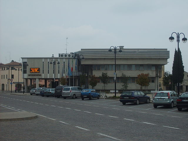

Cordenons
- Italian comune
Cordenons, located in the Friuli Venezia Giulia region of northeastern Italy, offers a beautiful setting for hiking enthusiasts. This area is characterized by its stunning natural landscapes, including rolling hills, lush forests, and views of the nearby Alps. Here are some key points to consider if you plan to hike in Cordenons:...
- Country:

- Postal Code: 33084
- Local Dialing Code: 0434
- Licence Plate Code: PN
- Coordinates: 45° 59' 0" N, 12° 42' 0" E


- GPS tracks (wikiloc): [Link]
- AboveSeaLevel: 44 м m
- Area: 56.34 sq km
- Population: 18210
- Web site: [Link]


Cordovado
- Italian comune
Cordovado is a charming village located in the Friuli Venezia Giulia region of Italy, surrounded by beautiful landscapes and historical sites that make it a great destination for hiking enthusiasts. The area offers a mix of gentle hills, rolling countryside, and stunning mountain views, making it suitable for hikers of various skill levels....
- Country:

- Postal Code: 33075
- Local Dialing Code: 0434
- Licence Plate Code: PN
- Coordinates: 45° 51' 0" N, 12° 53' 0" E


- GPS tracks (wikiloc): [Link]
- AboveSeaLevel: 15 м m
- Area: 12.02 sq km
- Population: 2736
- Web site: [Link]


Erto e Casso
- Italian comune
Erto e Casso is a picturesque municipality in the Friuli Venezia Giulia region of Italy, known for its stunning landscapes, rich history, and outdoor activities. It is situated near the Dolomites and the Friulian Alps, making it a great destination for hiking enthusiasts....
- Country:

- Postal Code: 33080
- Local Dialing Code: 0427
- Licence Plate Code: PN
- Coordinates: 46° 16' 35" N, 12° 22' 17" E


- GPS tracks (wikiloc): [Link]
- AboveSeaLevel: 775 м m
- Area: 52.43 sq km
- Population: 371
- Web site: [Link]


Fanna
- Italian comune
Fanna is a picturesque area in the region of Friuli Venezia Giulia in northeastern Italy, known for its stunning landscapes and rich biodiversity. Hiking in Fanna offers a variety of trails suitable for different skill levels, allowing you to explore its mountainous terrain, lush forests, and serene valleys....
- Country:

- Postal Code: 33092
- Local Dialing Code: 0427
- Licence Plate Code: PN
- Coordinates: 46° 11' 0" N, 12° 45' 0" E


- GPS tracks (wikiloc): [Link]
- AboveSeaLevel: 274 м m
- Area: 10.26 sq km
- Population: 1554
- Web site: [Link]
Fiume Veneto
- Italian comune
Fiume Veneto is a charming town located in the Friuli Venezia Giulia region of northeastern Italy. While it may not be as well-known as some of the larger national parks or hiking areas in Italy, it has its own unique appeal for those looking to explore the beautiful landscapes of the region. Here are some key aspects of hiking in and around Fiume Veneto:...
- Country:

- Postal Code: 33080
- Local Dialing Code: 0434
- Licence Plate Code: PN
- Coordinates: 45° 56' 0" N, 12° 44' 0" E


- GPS tracks (wikiloc): [Link]
- AboveSeaLevel: 20 м m
- Area: 35.76 sq km
- Population: 11729
- Web site: [Link]

Fontanafredda
- Italian comune
Fontanafredda, located in the Friuli-Venezia Giulia region of northern Italy, offers a beautiful hiking experience surrounded by stunning landscapes, mountains, and diverse flora and fauna. It’s part of the broader area that includes the Julian Alps and is known for its picturesque scenery, charming villages, and well-maintained trails....
- Country:

- Postal Code: 33074
- Local Dialing Code: 0434
- Licence Plate Code: PN
- Coordinates: 45° 58' 0" N, 12° 34' 0" E


- GPS tracks (wikiloc): [Link]
- AboveSeaLevel: 52 м m
- Area: 46.4 sq km
- Population: 12521
- Web site: [Link]
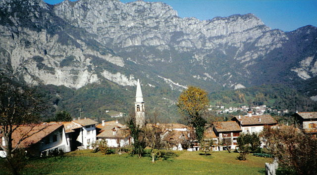

Frisanco
- Italian comune
Frisanco, located in the province of Pordenone in the Friuli Venezia Giulia region of Italy, offers a delightful experience for hikers of all levels. The area is surrounded by the beautiful Friulian Dolomites, providing stunning landscapes, varying terrains, and rich natural biodiversity....
- Country:

- Postal Code: 33080
- Local Dialing Code: 0427
- Licence Plate Code: PN
- Coordinates: 46° 13' 0" N, 12° 44' 0" E


- GPS tracks (wikiloc): [Link]
- AboveSeaLevel: 500 м m
- Area: 60.99 sq km
- Population: 600
- Web site: [Link]
Maniago
- Italian comune
Maniago, located in the Friuli Venezia Giulia region of Italy, is a charming town surrounded by beautiful natural landscapes, making it an excellent destination for hiking enthusiasts. Here are some key points about hiking in and around Maniago:...
- Country:

- Postal Code: 33085
- Local Dialing Code: 0427
- Licence Plate Code: PN
- Coordinates: 46° 10' 0" N, 12° 43' 0" E


- GPS tracks (wikiloc): [Link]
- AboveSeaLevel: 283 м m
- Area: 69.46 sq km
- Population: 11746
- Web site: [Link]
Meduno
- Italian comune
Meduno is a small town located in the Friuli Venezia Giulia region of northeastern Italy, surrounded by beautiful natural landscapes that are great for hiking enthusiasts. The area features diverse terrains, including rolling hills, forests, and stunning views of the surrounding mountains, particularly the nearby Dolomites....
- Country:

- Postal Code: 33092
- Local Dialing Code: 0427
- Licence Plate Code: PN
- Coordinates: 46° 13' 0" N, 12° 48' 0" E


- GPS tracks (wikiloc): [Link]
- AboveSeaLevel: 313 м m
- Area: 31.59 sq km
- Population: 1541
- Web site: [Link]
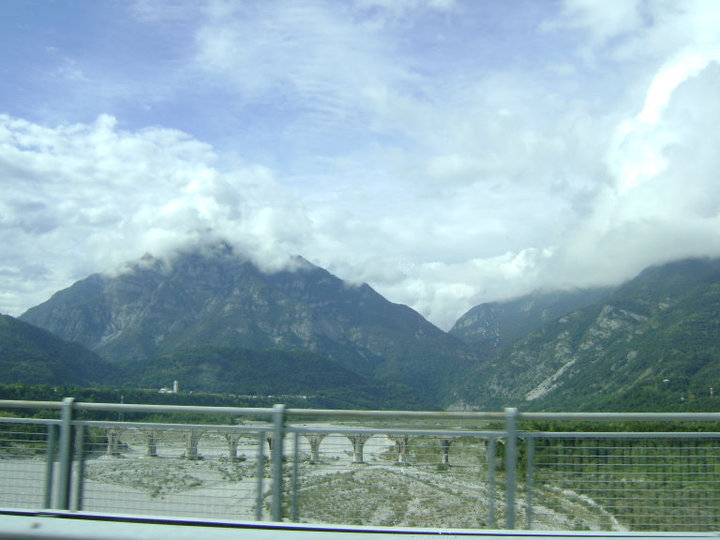

Montereale Valcellina
- Italian comune
 Hiking in Montereale Valcellina
Montereale Valcellina, located in the Friuli Venezia Giulia region of Italy, offers stunning landscapes and a variety of hiking opportunities for outdoor enthusiasts. The area is known for its rugged mountains, lush forests, and the picturesque Valcellina valley, making it a hidden gem for hikers....
- Country:

- Postal Code: 33086
- Local Dialing Code: 0427
- Licence Plate Code: PN
- Coordinates: 46° 10' 0" N, 12° 40' 0" E


- GPS tracks (wikiloc): [Link]
- AboveSeaLevel: 317 м m
- Area: 67.88 sq km
- Population: 4365
- Web site: [Link]
Pasiano di Pordenone
- Italian comune
 Hiking in Pasiano di Pordenone
Pasiano di Pordenone is a charming town in the Friuli Venezia Giulia region of Italy, located in the province of Pordenone. While it may not be a famous hiking destination like the Dolomites, it offers some pleasant outdoor opportunities and picturesque landscapes that can appeal to hikers and nature lovers....
- Country:

- Postal Code: 33087
- Local Dialing Code: 0434
- Licence Plate Code: PN
- Coordinates: 45° 52' 7" N, 12° 38' 40" E


- GPS tracks (wikiloc): [Link]
- AboveSeaLevel: 13 м m
- Area: 45.6 sq km
- Population: 7736
- Web site: [Link]


Pinzano al Tagliamento
- Italian comune
 Hiking in Pinzano al Tagliamento
Pinzano al Tagliamento, located in the Friuli Venezia Giulia region of northeastern Italy, is an excellent destination for hiking enthusiasts. The area is characterized by its stunning natural landscapes, including rolling hills, the Tagliamento River, and lush forests....
- Country:

- Postal Code: 33094
- Local Dialing Code: 0432
- Licence Plate Code: PN
- Coordinates: 46° 10' 59" N, 12° 56' 43" E


- GPS tracks (wikiloc): [Link]
- AboveSeaLevel: 201 м m
- Area: 21.95 sq km
- Population: 1514
- Web site: [Link]


Polcenigo
- Italian comune
Polcenigo is a charming village located in the Friuli Venezia Giulia region of Italy, known for its beautiful landscapes and varied hiking options. The area features rolling hills, lush greenery, and scenic views of the surrounding countryside, making it a great choice for outdoor enthusiasts....
- Country:

- Postal Code: 33070
- Local Dialing Code: 0434
- Licence Plate Code: PN
- Coordinates: 46° 2' 0" N, 12° 30' 0" E


- GPS tracks (wikiloc): [Link]
- AboveSeaLevel: 42 м m
- Area: 49.69 sq km
- Population: 3151
- Web site: [Link]
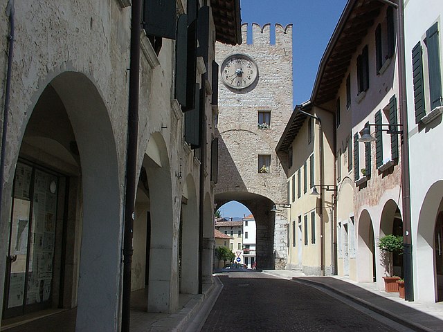

Porcia, Friuli-Venezia Giulia
- Italian comune
 Hiking in Porcia, Friuli-Venezia Giulia
Porcia, located in the Friuli-Venezia Giulia region of northeastern Italy, is a delightful village that serves as a great base for exploring the surrounding natural beauty. Here are some highlights and considerations for hiking in and around Porcia:...
- Country:

- Postal Code: 33080
- Local Dialing Code: 0434
- Licence Plate Code: PN
- Coordinates: 45° 58' 0" N, 12° 37' 0" E


- GPS tracks (wikiloc): [Link]
- AboveSeaLevel: 29 м m
- Area: 29.53 sq km
- Population: 15280
- Web site: [Link]
Prata di Pordenone
- Italian comune
Prata di Pordenone, located in the Friuli Venezia Giulia region of northeastern Italy, offers a range of hiking opportunities set against a backdrop of beautiful landscapes, including hills, forests, and rivers. Here are some key points to consider if you're planning to hike in this area:...
- Country:

- Postal Code: 33080
- Local Dialing Code: 0434
- Licence Plate Code: PN
- Coordinates: 45° 53' 40" N, 12° 35' 19" E


- GPS tracks (wikiloc): [Link]
- AboveSeaLevel: 17 м m
- Area: 22.96 sq km
- Population: 8426
- Web site: [Link]
Pravisdomini
- Italian comune
Pravisdomini, located in the region of Friuli Venezia Giulia in northeastern Italy, offers a serene and picturesque environment for hiking enthusiasts. The area is characterized by its beautiful landscapes, charming villages, and proximity to both the Julian Alps and the Adriatic coast....
- Country:

- Postal Code: 33076
- Local Dialing Code: 0434
- Licence Plate Code: PN
- Coordinates: 45° 49' 0" N, 12° 41' 0" E


- GPS tracks (wikiloc): [Link]
- AboveSeaLevel: 10 м m
- Area: 16.21 sq km
- Population: 3500
- Web site: [Link]
Roveredo in Piano
- Italian comune
Roveredo in Piano, located in the province of Pordenone in the Friuli Venezia Giulia region of Italy, is surrounded by stunning natural landscapes that offer a variety of hiking opportunities. Here’s what you can expect when hiking in this area:...
- Country:

- Postal Code: 33080
- Local Dialing Code: 0434
- Licence Plate Code: PN
- Coordinates: 46° 1' 0" N, 12° 37' 0" E


- GPS tracks (wikiloc): [Link]
- AboveSeaLevel: 99 м m
- Area: 15.86 sq km
- Population: 5939
- Web site: [Link]
Sacile
- Italian comune
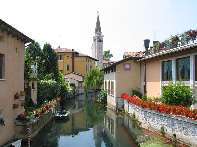
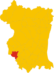
Sacile, located in the Friuli Venezia Giulia region of northern Italy, is a charming town surrounded by beautiful landscapes, making it a great destination for hiking enthusiasts. The area features lush hills, rivers, and stunning views of the surrounding mountains, including the nearby Dolomites. Here are some key points to consider when planning a hiking trip in Sacile:...
- Country:

- Postal Code: 33077
- Local Dialing Code: 0434
- Licence Plate Code: PN
- Coordinates: 45° 57' 15" N, 12° 30' 10" E


- GPS tracks (wikiloc): [Link]
- AboveSeaLevel: 25 м m
- Area: 32.74 sq km
- Population: 19905
- Web site: [Link]
San Giorgio della Richinvelda
- Italian comune
 Hiking in San Giorgio della Richinvelda
San Giorgio della Richinvelda is a charming village located in the Friuli Venezia Giulia region of Italy. While it may not be as widely known for hiking as some of the larger national parks or mountain ranges, there are definitely opportunities for scenic walks and hikes in the surrounding countryside....
- Country:

- Postal Code: 33095
- Local Dialing Code: 0427
- Licence Plate Code: PN
- Coordinates: 46° 3' 0" N, 12° 52' 0" E


- GPS tracks (wikiloc): [Link]
- AboveSeaLevel: 86 м m
- Area: 48.15 sq km
- Population: 4633
- Web site: [Link]
San Martino al Tagliamento
- Italian comune
 Hiking in San Martino al Tagliamento
San Martino al Tagliamento is a picturesque village located in the Friuli Venezia Giulia region of northeastern Italy. Its surrounding natural landscapes offer beautiful opportunities for hiking enthusiasts who appreciate both scenic views and an immersive experience in nature....
- Country:

- Postal Code: 33098
- Local Dialing Code: 0434
- Licence Plate Code: PN
- Coordinates: 46° 1' 0" N, 12° 52' 0" E


- GPS tracks (wikiloc): [Link]
- AboveSeaLevel: 71 м m
- Area: 17.98 sq km
- Population: 1476
- Web site: [Link]
San Quirino
- Italian comune
San Quirino is a charming municipality located in the Friuli Venezia Giulia region of northeastern Italy. Nestled at the foothills of the Julian Alps, it offers a variety of hiking opportunities suitable for different skill levels. Here are some highlights:...
- Country:

- Postal Code: 33080
- Local Dialing Code: 0434
- Licence Plate Code: PN
- Coordinates: 46° 2' 3" N, 12° 40' 42" E


- GPS tracks (wikiloc): [Link]
- AboveSeaLevel: 116 м m
- Area: 51.76 sq km
- Population: 4328
- Web site: [Link]

San Vito al Tagliamento
- Italian comune
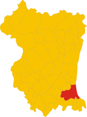
 Hiking in San Vito al Tagliamento
San Vito al Tagliamento, located in the Friuli Venezia Giulia region of northeastern Italy, is a charming town surrounded by picturesque landscapes, making it a great spot for hiking enthusiasts. The area features a mixture of rolling hills, woodlands, and agricultural fields, providing a variety of trails for different skill levels....
- Country:

- Postal Code: 33078
- Local Dialing Code: 0434
- Licence Plate Code: PN
- Coordinates: 45° 54' 55" N, 12° 51' 20" E


- GPS tracks (wikiloc): [Link]
- AboveSeaLevel: 30 м m
- Area: 60.88 sq km
- Population: 15063
- Web site: [Link]
Sequals
- Italian comune
Sequals is a charming town located in northeastern Italy, nestled at the foothills of the Alps. While it may not be as well-known as other hiking destinations in Italy, it offers some beautiful trails and stunning natural scenery for outdoor enthusiasts....
- Country:

- Postal Code: 33090
- Local Dialing Code: 0427
- Licence Plate Code: PN
- Coordinates: 46° 10' 0" N, 12° 50' 0" E


- GPS tracks (wikiloc): [Link]
- AboveSeaLevel: 226 м m
- Area: 27.7 sq km
- Population: 2231
- Web site: [Link]


Sesto al Reghena
- Italian comune
Sesto al Reghena, a charming town in the Friuli Venezia Giulia region of Italy, is not only rich in history and culture but also offers some beautiful hiking opportunities. Nestled in the picturesque countryside, it serves as a great starting point for various hiking trails that allow you to explore the surrounding natural beauty....
- Country:

- Postal Code: 33079
- Local Dialing Code: 0434
- Licence Plate Code: PN
- Coordinates: 45° 51' 0" N, 12° 49' 0" E


- GPS tracks (wikiloc): [Link]
- AboveSeaLevel: 13 м m
- Area: 40.68 sq km
- Population: 6367
- Web site: [Link]


Spilimbergo
- Italian comune
Spilimbergo, a charming town in the Friuli Venezia Giulia region of Italy, is surrounded by beautiful landscapes that offer numerous hiking opportunities. The area is rich in natural beauty, including rolling hills, vineyards, and the nearby Alps, making it an excellent destination for outdoor enthusiasts. Here are some key points to consider when planning a hiking trip in Spilimbergo:...
- Country:

- Postal Code: 33097
- Local Dialing Code: 0427
- Licence Plate Code: PN
- Coordinates: 46° 6' 41" N, 12° 54' 6" E


- GPS tracks (wikiloc): [Link]
- AboveSeaLevel: 132 м m
- Area: 71.88 sq km
- Population: 12151
- Web site: [Link]
Tramonti di Sopra
- Italian comune
Tramonti di Sopra is a beautiful area located in the Friuli Venezia Giulia region of Italy. It's known for its stunning landscapes, lush green valleys, and majestic mountains, making it a great destination for hiking enthusiasts....
- Country:

- Postal Code: 33090
- Local Dialing Code: 0427
- Licence Plate Code: PN
- Coordinates: 46° 19' 0" N, 12° 48' 0" E


- GPS tracks (wikiloc): [Link]
- AboveSeaLevel: 420 м m
- Area: 125.15 sq km
- Population: 301
- Web site: [Link]


Tramonti di Sotto
- Italian comune
Tramonti di Sotto is a picturesque village located in the Friuli Venezia Giulia region of northeastern Italy, nestled within the Julian Alps. The area is known for its natural beauty, offering a range of hiking opportunities suitable for various skill levels. Here are some highlights of hiking in the region:...
- Country:

- Postal Code: 33090
- Local Dialing Code: 0427
- Licence Plate Code: PN
- Coordinates: 46° 17' 0" N, 12° 48' 0" E


- GPS tracks (wikiloc): [Link]
- AboveSeaLevel: 366 м m
- Area: 85.55 sq km
- Population: 367
- Web site: [Link]


Travesio
- Italian comune
Travesio is a picturesque town located in the Friuli-Venezia Giulia region of northeastern Italy. Surrounded by mountains and lush landscapes, it offers a variety of hiking opportunities for both novice and experienced hikers....
- Country:

- Postal Code: 33090
- Local Dialing Code: 0427
- Licence Plate Code: PN
- Coordinates: 46° 11' 52" N, 12° 52' 12" E


- GPS tracks (wikiloc): [Link]
- AboveSeaLevel: 226 м m
- Area: 28.38 sq km
- Population: 1790
- Web site: [Link]


Vajont
- Italian comune
Hiking in the Vajont area, located in northeastern Italy, offers stunning views and diverse landscapes, making it a popular destination for outdoor enthusiasts. Here are some key points about hiking in Vajont:...
- Country:

- Postal Code: 33080
- Local Dialing Code: 0427
- Licence Plate Code: PN
- Coordinates: 46° 8' 50" N, 12° 41' 46" E


- GPS tracks (wikiloc): [Link]
- AboveSeaLevel: 287 м m
- Area: 1.59 sq km
- Population: 1677
- Web site: [Link]

Vito d'Asio
- Italian comune
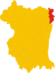
Vito d'Asio is a picturesque village located in the Friuli Venezia Giulia region of northern Italy. Surrounded by the beautiful landscapes of the eastern Alps, this area offers various hiking opportunities for both beginners and experienced hikers. Here are some highlights and tips for hiking in Vito d'Asio:...
- Country:

- Postal Code: 33090
- Local Dialing Code: 0427
- Licence Plate Code: PN
- Coordinates: 46° 14' 0" N, 12° 56' 0" E


- GPS tracks (wikiloc): [Link]
- AboveSeaLevel: 381 м m
- Area: 53.72 sq km
- Population: 734
- Web site: [Link]
Vivaro
- Italian comune
Vivaro, located in the Province of Pordenone in the Friuli Venezia Giulia region of Italy, is a beautiful area that offers a variety of hiking opportunities. The surrounding landscapes are characterized by lush forests, rolling hills, and stunning mountain vistas, making it an attractive destination for both casual walkers and experienced hikers....
- Country:

- Postal Code: 33099
- Local Dialing Code: 0427
- Licence Plate Code: PN
- Coordinates: 46° 4' 36" N, 12° 46' 45" E


- GPS tracks (wikiloc): [Link]
- AboveSeaLevel: 96 м m
- Area: 37.68 sq km
- Population: 1343
- Web site: [Link]


Zoppola
- Italian comune
Zoppola is a charming municipality in the Friuli Venezia Giulia region of northern Italy. While it may not be as widely known for hiking as some other areas, it is surrounded by beautiful landscapes that can offer some enjoyable outdoor experiences. Here are some aspects of hiking in and around Zoppola:...
- Country:

- Postal Code: 33080
- Local Dialing Code: 0434
- Licence Plate Code: PN
- Coordinates: 45° 58' 0" N, 12° 46' 0" E


- GPS tracks (wikiloc): [Link]
- AboveSeaLevel: 36 м m
- Area: 45.54 sq km
- Population: 8483
- Web site: [Link]
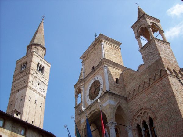
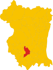
Pordenone
- Italian comune
Pordenone, located in the Friuli Venezia Giulia region of northeastern Italy, offers a variety of hiking opportunities amidst stunning landscapes. The area is characterized by its diverse terrains, including lush forests, rolling hills, and majestic mountains. Here are some highlights for hiking in Pordenone:...
- Country:

- Postal Code: 33170
- Local Dialing Code: 0434
- Licence Plate Code: PN
- Coordinates: 45° 57' 45" N, 12° 39' 23" E


- GPS tracks (wikiloc): [Link]
- AboveSeaLevel: 24 м m
- Area: 38.21 sq km
- Population: 51127
- Web site: [Link]
Shares border with regions:


Province of Belluno
- one of seven provinces in the Italian region Veneto
The Province of Belluno, located in the Veneto region of northern Italy, is a spectacular destination for hiking enthusiasts. This province is predominantly covered by the Dolomites, a UNESCO World Heritage site known for its stunning landscapes, unique geological formations, and rich biodiversity. Here are some key points about hiking in the Province of Belluno:...
- Country:

- Capital: Belluno
- Postal Code: 32010–32047; 32100
- Local Dialing Code: 0437; 0439; 0436; 0435
- Licence Plate Code: BL
- Coordinates: 46° 8' 27" N, 12° 12' 56" E


- GPS tracks (wikiloc): [Link]
- Area: 3677 sq km
- Population: 209550
- Web site: [Link]

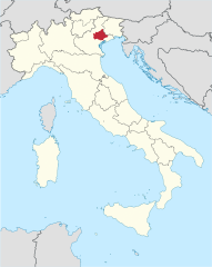
Province of Treviso
- one of the seven provinces of the Italian region Veneto
The Province of Treviso, located in the Veneto region of Italy, offers a variety of hiking opportunities, blending natural beauty with a rich cultural landscape. Here are some highlights and suggestions for hiking in this scenic area:...
- Country:

- Capital: Treviso
- Postal Code: 31010–31059; 31100
- Local Dialing Code: 0434; 0422; 0438; 0423; 0421
- Licence Plate Code: TV
- Coordinates: 45° 40' 20" N, 12° 14' 32" E


- GPS tracks (wikiloc): [Link]
- Area: 2476.68 sq km
- Web site: [Link]
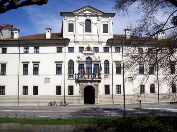

Province of Udine
- province of Italy
The Province of Udine, located in the Friuli Venezia Giulia region of northeastern Italy, offers a rich variety of landscapes perfect for hiking enthusiasts. From the foothills of the Julian Alps to the picturesque landscapes of the Collio wine region, this area is filled with trails suitable for all skill levels....
- Country:

- Capital: Udine
- Postal Code: 33015–33059; 33013; 33010–33011; 33100
- Local Dialing Code: 0427; 0433; 0432; 0431; 0428
- Licence Plate Code: UD
- Coordinates: 46° 4' 0" N, 13° 14' 0" E


- GPS tracks (wikiloc): [Link]
- Area: 4905 sq km
- Population: 528441
- Web site: [Link]

Province of Venice
- former province in the region of Veneto, Italy
Hiking in the Province of Venice offers a unique combination of natural beauty, cultural heritage, and diverse landscapes. While the province is widely known for its famous city of Venice and charming islands like Murano and Burano, it also includes picturesque rural areas and stunning natural parks that are great for hiking....
- Country:

- Capital: Venice
- Postal Code: 30010–30039; 30121–30176
- Local Dialing Code: 049; 0431; 0426; 0422; 0421; 041
- Licence Plate Code: VE
- Coordinates: 45° 27' 0" N, 12° 24' 0" E


- GPS tracks (wikiloc): [Link]
- Area: 2472.91 sq km
- Population: 857841
- Web site: [Link]
