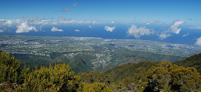
Cilaos (Cilaos)
- commune in La Réunion, France
- Country:

- Postal Code: 97413
- Coordinates: 21° 8' 7" S, 55° 28' 16" W


- GPS tracks (wikiloc): [Link]
- Area: 84.4 sq km
- Population: 5350
- Web site: http://www.ville-cilaos.fr
- Wikipedia en: wiki(en)
- Wikipedia: wiki(fr)
- Wikidata storage: Wikidata: Q1014746
- Wikipedia Commons Gallery: [Link]
- Wikipedia Commons Category: [Link]
- Freebase ID: [/m/03yvrc]
- GeoNames ID: Alt: [935975]
- SIREN number: [219740248]
- BnF ID: [16551282v]
- VIAF ID: Alt: [136161108]
- GND ID: Alt: [4553398-2]
- Library of Congress authority ID: Alt: [n88666572]
- TGN ID: [7032293]
- Encyclopædia Britannica Online ID: [place/Cilaos]
- INSEE municipality code: 97424
Shares border with regions:

Trois-Bassins
- commune in La Réunion, France
- Country:

- Postal Code: 97426
- Coordinates: 21° 6' 21" S, 55° 17' 42" W


- GPS tracks (wikiloc): [Link]
- Area: 42.58 sq km
- Population: 7127
- Web site: [Link]

Salazie
- commune in La Réunion, France
- Country:

- Postal Code: 97433
- Coordinates: 21° 1' 40" S, 55° 32' 21" W


- GPS tracks (wikiloc): [Link]
- Area: 103.82 sq km
- Population: 7384
- Web site: [Link]


Entre-Deux
- commune in La Réunion, France
- Country:

- Postal Code: 97414
- Coordinates: 21° 14' 56" S, 55° 28' 13" W


- GPS tracks (wikiloc): [Link]
- Area: 66.83 sq km
- Population: 6781
- Web site: [Link]

Les Avirons
- commune in La Réunion, France
- Country:

- Postal Code: 97425
- Coordinates: 21° 14' 31" S, 55° 20' 0" W


- GPS tracks (wikiloc): [Link]
- Area: 26.27 sq km
- Population: 11148
- Web site: [Link]

Saint-Louis
- commune in La Réunion, France
- Country:

- Postal Code: 97450
- Coordinates: 21° 17' 12" S, 55° 24' 33" W


- GPS tracks (wikiloc): [Link]
- Area: 98.9 sq km
- Population: 53524
- Web site: [Link]

Saint-Leu
- commune in La Réunion, France
- Country:

- Postal Code: 97436
- Coordinates: 21° 9' 59" S, 55° 17' 13" W


- GPS tracks (wikiloc): [Link]
- Area: 118.37 sq km
- Population: 33701
- Web site: [Link]

Saint-Paul
- commune in La Réunion, France
- Country:

- Postal Code: 97460
- Coordinates: 21° 0' 35" S, 55° 16' 11" W


- GPS tracks (wikiloc): [Link]
- Area: 241.28 sq km
- Population: 105967
- Web site: [Link]

Saint-Benoît
- commune in La Réunion, France
- Country:

- Postal Code: 97470
- Coordinates: 21° 2' 2" S, 55° 42' 46" W


- GPS tracks (wikiloc): [Link]
- AboveSeaLevel: 0 м m
- Area: 229.61 sq km
- Population: 37940
- Web site: [Link]