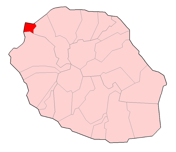
Saint-Paul (Saint-Paul)
- commune in La Réunion, France
- Country:

- Postal Code: 97460
- Coordinates: 21° 0' 35" S, 55° 16' 11" W


- GPS tracks (wikiloc): [Link]
- Area: 241.28 sq km
- Population: 105967
- Web site: http://www.mairie-saintpaul.fr
- Wikipedia en: wiki(en)
- Wikipedia: wiki(fr)
- Wikidata storage: Wikidata: Q316887
- Wikipedia Commons Gallery: [Link]
- Wikipedia Commons Category: [Link]
- Freebase ID: [/m/08sgwk]
- Freebase ID: [/m/08sgwk]
- Freebase ID: [/m/08sgwk]
- Freebase ID: [/m/08sgwk]
- Freebase ID: [/m/08sgwk]
- SIREN number: [219740156]
- SIREN number: [219740156]
- SIREN number: [219740156]
- SIREN number: [219740156]
- SIREN number: [219740156]
- BnF ID: [11998682g]
- BnF ID: [11998682g]
- BnF ID: [11998682g]
- BnF ID: [11998682g]
- BnF ID: [11998682g]
- VIAF ID: Alt: [136838080]
- VIAF ID: Alt: [136838080]
- VIAF ID: Alt: [136838080]
- VIAF ID: Alt: [136838080]
- VIAF ID: Alt: [136838080]
- Library of Congress authority ID: Alt: [n91053503]
- Library of Congress authority ID: Alt: [n91053503]
- Library of Congress authority ID: Alt: [n91053503]
- Library of Congress authority ID: Alt: [n91053503]
- Library of Congress authority ID: Alt: [n91053503]
- MusicBrainz area ID: [27a9dad1-f342-4326-9a0a-50e8e53e7c09]
- MusicBrainz area ID: [27a9dad1-f342-4326-9a0a-50e8e53e7c09]
- MusicBrainz area ID: [27a9dad1-f342-4326-9a0a-50e8e53e7c09]
- MusicBrainz area ID: [27a9dad1-f342-4326-9a0a-50e8e53e7c09]
- MusicBrainz area ID: [27a9dad1-f342-4326-9a0a-50e8e53e7c09]
- SUDOC authorities ID: [174628544]
- SUDOC authorities ID: [174628544]
- SUDOC authorities ID: [174628544]
- SUDOC authorities ID: [174628544]
- SUDOC authorities ID: [174628544]
- Facebook Places ID: [106352712735206]
- Facebook Places ID: [106352712735206]
- Facebook Places ID: [106352712735206]
- Facebook Places ID: [106352712735206]
- Facebook Places ID: [106352712735206]
- INSEE municipality code: 97415
- INSEE municipality code: 97415
- INSEE municipality code: 97415
- INSEE municipality code: 97415
- INSEE municipality code: 97415
Shares border with regions:

Cilaos
- commune in La Réunion, France
- Country:

- Postal Code: 97413
- Coordinates: 21° 8' 7" S, 55° 28' 16" W


- GPS tracks (wikiloc): [Link]
- Area: 84.4 sq km
- Population: 5350
- Web site: [Link]

Trois-Bassins
- commune in La Réunion, France
- Country:

- Postal Code: 97426
- Coordinates: 21° 6' 21" S, 55° 17' 42" W


- GPS tracks (wikiloc): [Link]
- Area: 42.58 sq km
- Population: 7127
- Web site: [Link]

La Possession
- commune in La Réunion, France
- Country:

- Postal Code: 97419
- Coordinates: 20° 55' 35" S, 55° 20' 9" W


- GPS tracks (wikiloc): [Link]
- Area: 118.35 sq km
- Population: 32720
- Web site: [Link]

Le Port
- commune in La Réunion, France
- Country:

- Postal Code: 97420
- Coordinates: 20° 56' 22" S, 55° 17' 14" W


- GPS tracks (wikiloc): [Link]
- Area: 16.62 sq km
- Population: 35280
- Web site: [Link]