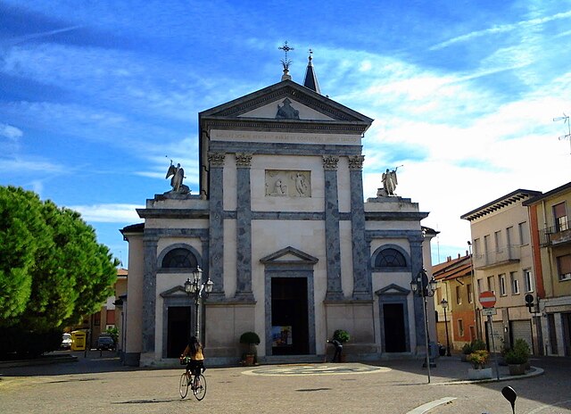
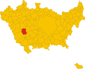
Cisliano (Cisliano)
- Italian comune
Cisliano is a quaint municipality located in the Lombardy region of Italy, near Milan. While it may not be well-known as a major hiking destination, there are still opportunities for outdoor enthusiasts to enjoy the beautiful Italian countryside in and around the area.
Hiking Opportunities in Cisliano:
-
Local Trails: The region has various walking paths and unpaved roads that are suitable for casual hikes. These trails often lead through picturesque agricultural landscapes, woods, and along small rivers.
-
Parco Agricolo Sud Milano: Just a short distance from Cisliano, this large agricultural park offers more structured hiking opportunities with well-marked trails. You can explore the rich biodiversity, historic villas, and vast fields.
-
Nature Walks: The serene environment surrounding Cisliano lends itself to peaceful nature walks. You can enjoy observing local flora and fauna, with opportunities for birdwatching as well.
-
Nearby Lakes: Lakes such as Lago Maggiore or Lago di Como, while a bit farther, are accessible for day hikes. You can find various trails that range from easy walks to more challenging hikes with beautiful lake views.
Tips for Hiking in Cisliano:
-
Best Time to Hike: The spring and fall seasons offer pleasant weather for hiking, with mild temperatures and blooming nature in spring or colorful foliage in fall.
-
Preparation: Bring plenty of water, snacks, and appropriate clothing for your hike. Check local weather conditions before heading out.
-
Trail Markings: Some paths may not be marked as clearly as in more popular hiking destinations, so having a map or a GPS device can be helpful.
-
Respect Nature: As with all hiking endeavors, remember to stay on marked paths, respect wildlife, and follow local regulations to preserve the natural beauty for future visitors.
Overall, while Cisliano may not offer the rugged terrain of more famous hiking spots, it provides a charming escape into nature, perfect for a leisurely hike and enjoying the peaceful surroundings.
- Country:

- Postal Code: 20080
- Local Dialing Code: 02
- Licence Plate Code: MI
- Coordinates: 45° 27' 0" N, 8° 59' 0" E


- GPS tracks (wikiloc): [Link]
- AboveSeaLevel: 128 м m
- Area: 14.68 sq km
- Population: 4867
- Web site: http://www.comune.cisliano.mi.it
- Wikipedia en: wiki(en)
- Wikipedia: wiki(it)
- Wikidata storage: Wikidata: Q42830
- Wikipedia Commons Category: [Link]
- Freebase ID: [/m/0gj5nl]
- GeoNames ID: Alt: [6536504]
- VIAF ID: Alt: [147907832]
- OSM relation ID: [44989]
- UN/LOCODE: [ITCIJ]
- ISTAT ID: 015078
- Italian cadastre code: C733
Shares border with regions:


Gaggiano
- Italian comune
Gaggiano, located in the Lombardy region of Italy, is known for its picturesque landscapes and serene surroundings, making it a lovely destination for hiking. Although it may not be a major hiking destination compared to some of the more famous mountains and valleys in Italy, there are still plenty of opportunities for outdoor activities....
- Country:

- Postal Code: 20083
- Local Dialing Code: 02
- Licence Plate Code: MI
- Coordinates: 45° 24' 17" N, 9° 2' 6" E


- GPS tracks (wikiloc): [Link]
- AboveSeaLevel: 117 м m
- Area: 26.26 sq km
- Population: 9131
- Web site: [Link]


Cusago
- Italian comune
Cusago is a small town located in the Lombardy region of Italy, close to Milan. While it might not be as famous for hiking as other mountainous regions in Italy, it does offer some delightful opportunities for outdoor walks and nature exploration. Here are some aspects to consider when hiking in and around Cusago:...
- Country:

- Postal Code: 20090
- Local Dialing Code: 02
- Licence Plate Code: MI
- Coordinates: 45° 27' 0" N, 9° 2' 0" E


- GPS tracks (wikiloc): [Link]
- AboveSeaLevel: 126 м m
- Area: 11.46 sq km
- Population: 3917
- Web site: [Link]


Vittuone
- Italian comune
Vittuone is a town located in the Lombardy region of Italy, not far from Milan. While it may not be as famous for hiking as some of the more mountainous areas of Italy, it still offers some pleasant walking and hiking opportunities, especially for those looking to enjoy nature close to urban settings....
- Country:

- Postal Code: 20010
- Local Dialing Code: 02
- Licence Plate Code: MI
- Coordinates: 45° 29' 0" N, 8° 57' 0" E


- GPS tracks (wikiloc): [Link]
- AboveSeaLevel: 146 м m
- Area: 6.13 sq km
- Population: 9063
- Web site: [Link]


Albairate
- Italian comune
Albaitare, a small municipality located in the Lombardy region of Italy, is known for its beautiful landscapes and proximity to nature, making it a delightful place for hiking. Here are some key points to guide you about hiking in this area:...
- Country:

- Postal Code: 20080
- Local Dialing Code: 02
- Licence Plate Code: MI
- Coordinates: 45° 25' 0" N, 8° 56' 0" E


- GPS tracks (wikiloc): [Link]
- AboveSeaLevel: 124 м m
- Area: 14.98 sq km
- Population: 4708
- Web site: [Link]
Bareggio
- Italian comune
Bareggio, located in the Lombardy region of Italy, is primarily known for its charming landscapes, historical sites, and green spaces rather than extensive hiking trails. However, it can serve as a good starting point for exploring the surrounding natural areas....
- Country:

- Postal Code: 20010
- Local Dialing Code: 02
- Licence Plate Code: MI
- Coordinates: 45° 28' 0" N, 8° 59' 0" E


- GPS tracks (wikiloc): [Link]
- AboveSeaLevel: 138 м m
- Area: 11.38 sq km
- Population: 17364
- Web site: [Link]


Corbetta
- Italian comune
Corbetta, located in the Lombardy region of Italy, offers a range of opportunities for outdoor enthusiasts, albeit it's not as well-known for hiking as some of the more mountainous areas in Italy. However, it is situated in the proximity of several natural parks and trails that can make for enjoyable hiking experiences....
- Country:

- Postal Code: 20011
- Local Dialing Code: 02
- Licence Plate Code: MI
- Coordinates: 45° 28' 0" N, 8° 55' 0" E


- GPS tracks (wikiloc): [Link]
- AboveSeaLevel: 140 м m
- Area: 18.69 sq km
- Population: 18366
- Web site: [Link]


Sedriano
- Italian comune
Sedriano is a charming town located in the Lombardy region of Italy, near Milan. While Sedriano itself may not be primarily known as a hiking destination, there are several nearby areas and trails that outdoor enthusiasts can explore....
- Country:

- Postal Code: 20018
- Local Dialing Code: 02
- Licence Plate Code: MI
- Coordinates: 45° 29' 0" N, 8° 58' 0" E


- GPS tracks (wikiloc): [Link]
- AboveSeaLevel: 145 м m
- Area: 7.75 sq km
- Population: 12099
- Web site: [Link]

