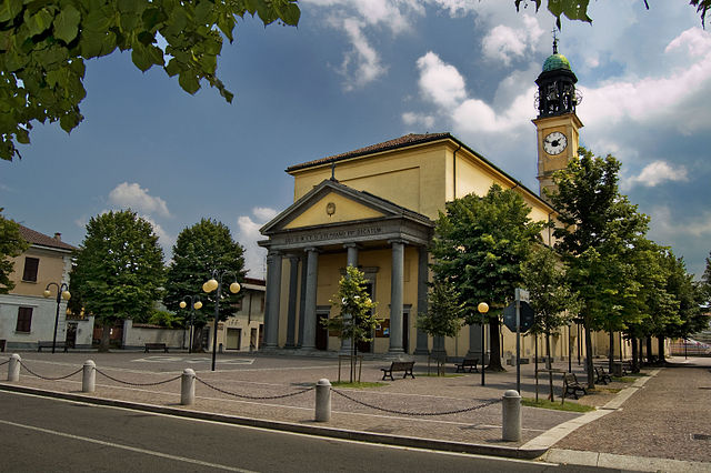
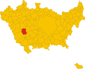
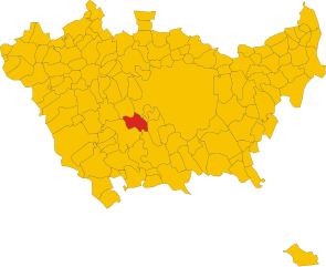
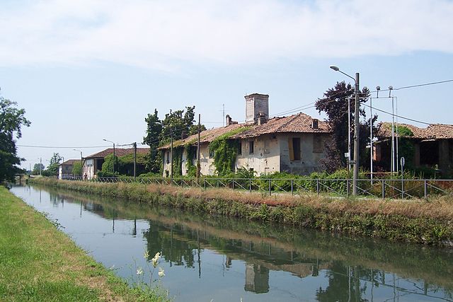
Gaggiano (Gaggiano)
.svg)
- Italian comune
 Hiking in Gaggiano
Gaggiano, located in the Lombardy region of Italy, is known for its picturesque landscapes and serene surroundings, making it a lovely destination for hiking. Although it may not be a major hiking destination compared to some of the more famous mountains and valleys in Italy, there are still plenty of opportunities for outdoor activities.
Key Highlights for Hiking in Gaggiano:
-
Natural Scenery: The area surrounding Gaggiano is characterized by beautiful countryside, rivers, and lush greenery. You can enjoy peaceful walks along the banks of the Naviglio Grande, a historic canal that offers lovely views and a tranquil atmosphere.
-
Walking Paths: There are various walking paths and trails in and near Gaggiano that are suitable for different skill levels. These paths often meander through fields, forests, and along the waterways, making for a varied and enjoyable hiking experience.
-
Local Flora and Fauna: As you hike, keep an eye out for local wildlife and plant species. The region has a rich biodiversity, which can add to the charm of your hike.
-
Cultural Attractions: Along your hike, you may encounter charming villages and historical sites, which provide a cultural dimension to your outdoor adventure. Be sure to explore local churches, farmhouses, and quaint streets.
-
Best Time to Hike: Spring and fall are ideal for hiking in Gaggiano, as the temperatures are comfortable and the scenery is particularly beautiful during these seasons.
-
Accessibility: Gaggiano is easily accessible from Milan, making it a great option for a day hike if you're in the city and looking to escape to nature for a bit.
Tips for Hiking in Gaggiano:
- Stay Hydrated: Bring plenty of water, especially on warm days.
- Wear Proper Footwear: Good hiking shoes can enhance your comfort and safety.
- Check Weather Conditions: Always check the weather forecast before setting out to ensure a safe and pleasant hike.
- Respect Nature: Follow the Leave No Trace principles to help keep the natural areas pristine.
While Gaggiano may not offer the rugged mountains of northern Italy, its peaceful countryside and charming landscapes provide a lovely setting for enjoying the outdoors. Whether you’re looking for a leisurely walk or a more challenging hike, you can find something to suit your preferences in this beautiful region.
- Country:

- Postal Code: 20083
- Local Dialing Code: 02
- Licence Plate Code: MI
- Coordinates: 45° 24' 17" N, 9° 2' 6" E


- GPS tracks (wikiloc): [Link]
- AboveSeaLevel: 117 м m
- Area: 26.26 sq km
- Population: 9131
- Web site: http://www.comune.gaggiano.mi.it
- Wikipedia en: wiki(en)
- Wikipedia: wiki(it)
- Wikidata storage: Wikidata: Q42169
- Wikipedia Commons Category: [Link]
- Freebase ID: [/m/0gj60c]
- GeoNames ID: Alt: [6537116]
- OSM relation ID: [44843]
- UN/LOCODE: [ITGGI]
- ISTAT ID: 015103
- Italian cadastre code: D845
Shares border with regions:


Cusago
- Italian comune
Hiking in Cusago
Cusago is a small town located in the Lombardy region of Italy, close to Milan. While it might not be as famous for hiking as other mountainous regions in Italy, it does offer some delightful opportunities for outdoor walks and nature exploration. Here are some aspects to consider when hiking in and around Cusago:...
- Country:
- Postal Code: 20090
- Local Dialing Code: 02
- Licence Plate Code: MI
- Coordinates: 45° 27' 0" N, 9° 2' 0" E
- GPS tracks (wikiloc): [Link]
- AboveSeaLevel: 126 м m
- Area: 11.46 sq km
- Population: 3917
- Web site: [Link]
Noviglio
- Italian comune
Hiking in Noviglio
Noviglio, located in the Lombardy region of Italy, offers a scenic backdrop for hiking enthusiasts, though it may not be as well-known as some of the major hiking destinations in the region. The area is characterized by its flat landscapes, vineyards, and agricultural fields, making it ideal for leisurely hikes rather than strenuous mountain trekking....
- Country:
- Postal Code: 20082
- Local Dialing Code: 02
- Licence Plate Code: MI
- Coordinates: 45° 22' 0" N, 9° 3' 0" E
- GPS tracks (wikiloc): [Link]
- AboveSeaLevel: 103 м m
- Area: 15.86 sq km
- Population: 4584
- Web site: [Link]

Rosate
- Italian comune
Hiking in Rosate
Rosate is a small town located in the Lombardy region of Italy, not far from Milan. While it may not be known for extensive hiking trails, the surrounding areas offer several opportunities for outdoor activities and nature exploration. Here are some insights and tips for hiking in and around Rosate:...
- Country:
- Postal Code: 20088
- Local Dialing Code: 02
- Licence Plate Code: MI
- Coordinates: 45° 20' 0" N, 9° 1' 0" E
- GPS tracks (wikiloc): [Link]
- AboveSeaLevel: 107 м m
- Area: 18.68 sq km
- Population: 5762
- Web site: [Link]


Gudo Visconti
- Italian comune
Hiking in Gudo Visconti
Gudo Visconti is a small municipality in the Lombardy region of Italy, located not far from Milan. While it may not be as well-known as some other hiking destinations in Italy, it offers a peaceful environment and opportunities for outdoor activities in its surrounding areas....
- Country:
- Postal Code: 20088
- Local Dialing Code: 02
- Licence Plate Code: MI
- Coordinates: 45° 23' 0" N, 9° 0' 0" E
- GPS tracks (wikiloc): [Link]
- AboveSeaLevel: 116 м m
- Area: 6.1 sq km
- Population: 1658
- Web site: [Link]


Vermezzo
- settlement in the italian municipality of Vermezzo con Zelo
Hiking in Vermezzo
Vermezzo is a small town located in the Lombardy region of Italy, known more for its proximity to larger cities like Milan than for extensive hiking networks. However, the surrounding areas offer some opportunities for outdoor activities, including hiking....
- Country:
- Postal Code: 20080
- Local Dialing Code: 02
- Licence Plate Code: MI
- Coordinates: 45° 24' 0" N, 8° 58' 0" E
- GPS tracks (wikiloc): [Link]
- AboveSeaLevel: 111 м m
- Area: 6.31 sq km
- Population: 3931
- Web site: [Link]


Cisliano
- Italian comune
Hiking in Cisliano
Cisliano is a quaint municipality located in the Lombardy region of Italy, near Milan. While it may not be well-known as a major hiking destination, there are still opportunities for outdoor enthusiasts to enjoy the beautiful Italian countryside in and around the area....
- Country:
- Postal Code: 20080
- Local Dialing Code: 02
- Licence Plate Code: MI
- Coordinates: 45° 27' 0" N, 8° 59' 0" E
- GPS tracks (wikiloc): [Link]
- AboveSeaLevel: 128 м m
- Area: 14.68 sq km
- Population: 4867
- Web site: [Link]

Albairate
- Italian comune
Hiking in Albairate
Albaitare, a small municipality located in the Lombardy region of Italy, is known for its beautiful landscapes and proximity to nature, making it a delightful place for hiking. Here are some key points to guide you about hiking in this area:...
- Country:
- Postal Code: 20080
- Local Dialing Code: 02
- Licence Plate Code: MI
- Coordinates: 45° 25' 0" N, 8° 56' 0" E
- GPS tracks (wikiloc): [Link]
- AboveSeaLevel: 124 м m
- Area: 14.98 sq km
- Population: 4708
- Web site: [Link]

Trezzano sul Naviglio
- Italian comune
Hiking in Trezzano sul Naviglio
Trezzano sul Naviglio, located in the metropolitan area of Milan, Italy, is not primarily known for extensive hiking opportunities compared to mountainous regions. However, it provides some pleasant walking and outdoor activities suitable for those looking to enjoy nature and the nearby surroundings....
- Country:
- Postal Code: 20090
- Local Dialing Code: 02
- Licence Plate Code: MI
- Coordinates: 45° 26' 0" N, 9° 4' 0" E
- GPS tracks (wikiloc): [Link]
- AboveSeaLevel: 116 м m
- Area: 10.77 sq km
- Population: 20944
- Web site: [Link]

Zibido San Giacomo
- Italian comune
Hiking in Zibido San Giacomo
Zibido San Giacomo, a small town in the Lombardy region of Italy, is not as well-known for hiking as some other areas in the region, but it does offer opportunities for outdoor activities in its surrounding landscapes. Here are some key points about hiking in and around Zibido San Giacomo:...
- Country:
- Postal Code: 20080
- Local Dialing Code: 02
- Licence Plate Code: MI
- Coordinates: 45° 22' 0" N, 9° 7' 0" E
- GPS tracks (wikiloc): [Link]
- AboveSeaLevel: 111 м m
- Area: 24.58 sq km
- Population: 6856
- Web site: [Link]