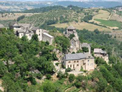
Clairvaux-d'Aveyron (Clairvaux-d'Aveyron)
- commune in Aveyron, France
- Country:

- Postal Code: 12330
- Coordinates: 44° 25' 39" N, 2° 24' 38" E


- GPS tracks (wikiloc): [Link]
- Area: 25.14 sq km
- Population: 1162
- Wikipedia en: wiki(en)
- Wikipedia: wiki(fr)
- Wikidata storage: Wikidata: Q1082390
- Wikipedia Commons Category: [Link]
- Freebase ID: [/m/03m93dm]
- GeoNames ID: Alt: [6447079]
- SIREN number: [211200662]
- BnF ID: [15247042n]
- PACTOLS thesaurus ID: [pcrtxJgD6vsuro]
- WOEID: [586113]
- INSEE municipality code: 12066
Shares border with regions:


Balsac
- former commune in Aveyron, France
- Country:

- Postal Code: 12510
- Coordinates: 44° 24' 11" N, 2° 26' 42" E


- GPS tracks (wikiloc): [Link]
- Area: 15.57 sq km
- Population: 618


Druelle
- former commune in Aveyron, France
- Country:

- Postal Code: 12510
- Coordinates: 44° 20' 40" N, 2° 29' 35" E


- GPS tracks (wikiloc): [Link]
- Area: 35.68 sq km
- Population: 2388
- Web site: [Link]


Goutrens
- commune in Aveyron, France
- Country:

- Postal Code: 12390
- Coordinates: 44° 26' 34" N, 2° 22' 10" E


- GPS tracks (wikiloc): [Link]
- AboveSeaLevel: 560 м m
- Area: 25.99 sq km
- Population: 510


Mayran
- commune in Aveyron, France
- Country:

- Postal Code: 12390
- Coordinates: 44° 23' 18" N, 2° 21' 49" E


- GPS tracks (wikiloc): [Link]
- Area: 15.36 sq km
- Population: 640
- Web site: [Link]
Moyrazès
- commune in Aveyron, France
- Country:

- Postal Code: 12160
- Coordinates: 44° 20' 36" N, 2° 26' 22" E


- GPS tracks (wikiloc): [Link]
- Area: 48.67 sq km
- Population: 1161


Valady
- commune in Aveyron, France
- Country:

- Postal Code: 12330
- Coordinates: 44° 27' 19" N, 2° 25' 35" E


- GPS tracks (wikiloc): [Link]
- Area: 15.51 sq km
- Population: 1509


Belcastel
- commune in Aveyron, France
- Country:

- Postal Code: 12390
- Coordinates: 44° 23' 19" N, 2° 20' 14" E


- GPS tracks (wikiloc): [Link]
- Area: 10.74 sq km
- Population: 190
- Web site: [Link]
