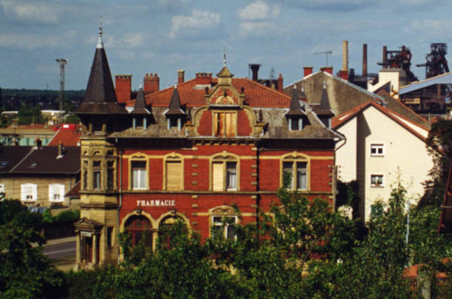
Clouange (Clouange)
- commune in Moselle, France
- Country:

- Postal Code: 57185
- Coordinates: 49° 15' 43" N, 6° 5' 49" E


- GPS tracks (wikiloc): [Link]
- Area: 3.01 sq km
- Population: 3708
- Wikipedia en: wiki(en)
- Wikipedia: wiki(fr)
- Wikidata storage: Wikidata: Q21907
- Wikipedia Commons Category: [Link]
- Freebase ID: [/m/03nq6xt]
- Freebase ID: [/m/03nq6xt]
- GeoNames ID: Alt: [6437447]
- GeoNames ID: Alt: [6437447]
- SIREN number: [215701434]
- SIREN number: [215701434]
- BnF ID: [15265652j]
- BnF ID: [15265652j]
- PACTOLS thesaurus ID: [pcrtvO9nhEtylD]
- PACTOLS thesaurus ID: [pcrtvO9nhEtylD]
- MusicBrainz area ID: [570c0b53-e266-4cfe-bd7a-a16804f0b2c6]
- MusicBrainz area ID: [570c0b53-e266-4cfe-bd7a-a16804f0b2c6]
- INSEE municipality code: 57143
- INSEE municipality code: 57143
Shares border with regions:


Rombas
- commune in Moselle, France
- Country:

- Postal Code: 57120
- Coordinates: 49° 14' 58" N, 6° 5' 41" E


- GPS tracks (wikiloc): [Link]
- Area: 11.69 sq km
- Population: 9846
- Web site: [Link]


Vitry-sur-Orne
- commune in Moselle, France
- Country:

- Postal Code: 57185
- Coordinates: 49° 15' 56" N, 6° 6' 32" E


- GPS tracks (wikiloc): [Link]
- Area: 7.61 sq km
- Population: 3010
- Web site: [Link]


Rosselange
- commune in Moselle, France
- Country:

- Postal Code: 57780
- Coordinates: 49° 15' 30" N, 6° 4' 10" E


- GPS tracks (wikiloc): [Link]
- Area: 5.35 sq km
- Population: 2767
