
Moselle (Moselle)


- French department
- Country:

- Capital: Metz
- Coordinates: 49° 2' 2" N, 6° 39' 43" E


- GPS tracks (wikiloc): [Link]
- Area: 6216 sq km
- Population: 1044486
- Web site: http://www.moselle.pref.gouv.fr/
- Wikipedia en: wiki(en)
- Wikipedia: wiki(fr)
- Wikidata storage: Wikidata: Q12652
- Wikipedia Commons Gallery: [Link]
- Wikipedia Commons Category: [Link]
- Freebase ID: [/m/0mgq_]
- GeoNames ID: Alt: [2991627]
- SIREN number: [225700012]
- BnF ID: [119893595]
- VIAF ID: Alt: [143875300]
- OSM relation ID: [51854]
- GND ID: Alt: [4115247-5]
- archINFORM location ID: [2755]
- Library of Congress authority ID: Alt: [nr94004915]
- MusicBrainz area ID: [53c460a2-89a2-4879-b3ff-ad4c3ef82f16]
- TGN ID: [7002972]
- SUDOC authorities ID: [027963438]
- Encyclopædia Britannica Online ID: [place/Moselle]
- ISNI: Alt: [0000 0001 0668 6208]
- NUTS code: [FR413]
- INSEE department code: [57]
- ISO 3166-2 code: FR-57
Includes regions:


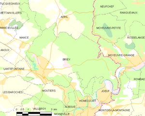
Giraumont
- commune in Meurthe-et-Moselle, France
- Country:
- Postal Code: 54780
- Coordinates: 49° 10' 16" N, 5° 54' 51" E
- GPS tracks (wikiloc): [Link]
- Area: 7.63 sq km
- Population: 1371


Les Baroches
- commune in Meurthe-et-Moselle, France
- Country:
- Postal Code: 54150
- Coordinates: 49° 13' 48" N, 5° 53' 32" E
- GPS tracks (wikiloc): [Link]
- Area: 13.28 sq km
- Population: 362


Baslieux
- commune in Meurthe-et-Moselle, France
- Country:
- Postal Code: 54620
- Coordinates: 49° 26' 0" N, 5° 45' 33" E
- GPS tracks (wikiloc): [Link]
- Area: 10.17 sq km
- Population: 594

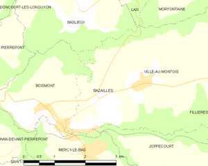
Bazailles
- commune in Meurthe-et-Moselle, France
- Country:
- Postal Code: 54620
- Coordinates: 49° 24' 30" N, 5° 45' 55" E
- GPS tracks (wikiloc): [Link]
- AboveSeaLevel: 327 м m
- Area: 4.23 sq km
- Population: 143


Avril
- commune in Meurthe-et-Moselle, France
- Country:
- Postal Code: 54150
- Coordinates: 49° 17' 16" N, 5° 57' 50" E
- GPS tracks (wikiloc): [Link]
- Area: 20.02 sq km
- Population: 1107

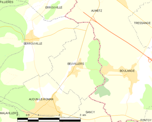
Beuvillers
- commune in Meurthe-et-Moselle, France
- Country:
- Postal Code: 54560
- Coordinates: 49° 23' 1" N, 5° 54' 55" E
- GPS tracks (wikiloc): [Link]
- Area: 5.95 sq km
- Population: 399


Gorcy
- commune in Meurthe-et-Moselle, France
- Country:
- Postal Code: 54730
- Coordinates: 49° 32' 5" N, 5° 41' 5" E
- GPS tracks (wikiloc): [Link]
- Area: 4.1 sq km
- Population: 2656
- Web site: [Link]


Cons-la-Grandville
- commune in Meurthe-et-Moselle, France
- Country:
- Postal Code: 54870
- Coordinates: 49° 29' 3" N, 5° 42' 4" E
- GPS tracks (wikiloc): [Link]
- Area: 8.25 sq km
- Population: 544


Épiez-sur-Chiers
- commune in Meurthe-et-Moselle, France
- Country:
- Postal Code: 54260
- Coordinates: 49° 29' 30" N, 5° 30' 17" E
- GPS tracks (wikiloc): [Link]
- Area: 5.19 sq km
- Population: 180


Crusnes
- commune in Meurthe-et-Moselle, France
- Country:
- Postal Code: 54680
- Coordinates: 49° 26' 4" N, 5° 54' 59" E
- GPS tracks (wikiloc): [Link]
- Area: 6.06 sq km
- Population: 1592

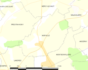
Murville
- commune in Meurthe-et-Moselle, France
- Country:
- Postal Code: 54490
- Coordinates: 49° 20' 17" N, 5° 49' 33" E
- GPS tracks (wikiloc): [Link]
- Area: 5.57 sq km
- Population: 239

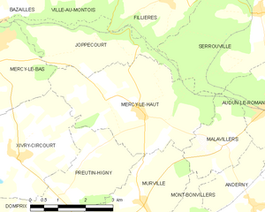
Mercy-le-Haut
- commune in Meurthe-et-Moselle, France
- Country:
- Postal Code: 54560
- Coordinates: 49° 22' 4" N, 5° 49' 32" E
- GPS tracks (wikiloc): [Link]
- Area: 13.35 sq km
- Population: 278

Puxe
- commune in Meurthe-et-Moselle, France
- Country:
- Postal Code: 54800
- Coordinates: 49° 9' 23" N, 5° 47' 33" E
- GPS tracks (wikiloc): [Link]
- Area: 5.89 sq km
- Population: 107

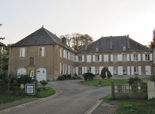
Villette
- commune in Meurthe-et-Moselle, France
- Country:
- Postal Code: 54260
- Coordinates: 49° 28' 29" N, 5° 32' 45" E
- GPS tracks (wikiloc): [Link]
- Area: 4.63 sq km
- Population: 183


Tucquegnieux
- commune in Meurthe-et-Moselle, France
- Country:
- Postal Code: 54640
- Coordinates: 49° 18' 38" N, 5° 53' 59" E
- GPS tracks (wikiloc): [Link]
- Area: 9.16 sq km
- Population: 2502
- Web site: [Link]

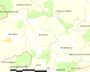
Mouaville
- commune in Meurthe-et-Moselle, France
- Country:
- Postal Code: 54800
- Coordinates: 49° 12' 37" N, 5° 46' 16" E
- GPS tracks (wikiloc): [Link]
- Area: 8.44 sq km
- Population: 99

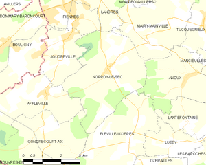
Norroy-le-Sec
- commune in Meurthe-et-Moselle, France
- Country:
- Postal Code: 54150
- Coordinates: 49° 16' 48" N, 5° 48' 39" E
- GPS tracks (wikiloc): [Link]
- Area: 13.77 sq km
- Population: 417


Olley
- commune in Meurthe-et-Moselle, France
- Country:
- Postal Code: 54800
- Coordinates: 49° 9' 53" N, 5° 45' 46" E
- GPS tracks (wikiloc): [Link]
- Area: 9.48 sq km
- Population: 255


Saint-Ail
- commune in Meurthe-et-Moselle, France
- Country:
- Postal Code: 54580
- Coordinates: 49° 10' 52" N, 5° 59' 44" E
- GPS tracks (wikiloc): [Link]
- AboveSeaLevel: 260 м m
- Area: 7.38 sq km
- Population: 456

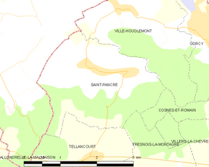
Saint-Pancré
- commune in Meurthe-et-Moselle, France
- Country:
- Postal Code: 54730
- Coordinates: 49° 31' 45" N, 5° 38' 54" E
- GPS tracks (wikiloc): [Link]
- Area: 6.13 sq km
- Population: 325


Preutin-Higny
- commune in Meurthe-et-Moselle, France
- Country:
- Postal Code: 54490
- Coordinates: 49° 20' 40" N, 5° 47' 29" E
- GPS tracks (wikiloc): [Link]
- Area: 7.02 sq km
- Population: 140


Viviers-sur-Chiers
- commune in Meurthe-et-Moselle, France
- Country:
- Postal Code: 54260
- Coordinates: 49° 28' 23" N, 5° 38' 1" E
- GPS tracks (wikiloc): [Link]
- Area: 16.24 sq km
- Population: 640


Lubey
- commune in Meurthe-et-Moselle, France
- Country:
- Postal Code: 54150
- Coordinates: 49° 14' 41" N, 5° 51' 19" E
- GPS tracks (wikiloc): [Link]
- Area: 3.93 sq km
- Population: 232


Joudreville
- commune in Meurthe-et-Moselle, France
- Country:
- Postal Code: 54490
- Coordinates: 49° 17' 8" N, 5° 46' 38" E
- GPS tracks (wikiloc): [Link]
- Area: 5.58 sq km
- Population: 1160

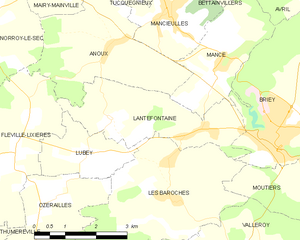
Lantéfontaine
- commune in Meurthe-et-Moselle, France
- Country:
- Postal Code: 54150
- Coordinates: 49° 15' 0" N, 5° 54' 32" E
- GPS tracks (wikiloc): [Link]
- Area: 8.06 sq km
- Population: 761


Landres
- commune in Meurthe-et-Moselle, France
- Country:
- Postal Code: 54970
- Coordinates: 49° 19' 17" N, 5° 48' 19" E
- GPS tracks (wikiloc): [Link]
- Area: 8.04 sq km
- Population: 980
- Web site: [Link]


Mont-Bonvillers
- commune in Meurthe-et-Moselle, France
- Country:
- Postal Code: 54111
- Coordinates: 49° 19' 36" N, 5° 50' 6" E
- GPS tracks (wikiloc): [Link]
- Area: 7.44 sq km
- Population: 957

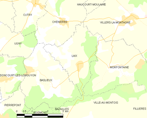
Laix
- commune in Meurthe-et-Moselle, France
- Country:
- Postal Code: 54720
- Coordinates: 49° 26' 48" N, 5° 46' 48" E
- GPS tracks (wikiloc): [Link]
- Area: 7.55 sq km
- Population: 199


Fresnois-la-Montagne
- commune in Meurthe-et-Moselle, France
- Country:
- Postal Code: 54260
- Coordinates: 49° 29' 40" N, 5° 38' 45" E
- GPS tracks (wikiloc): [Link]
- Area: 8.59 sq km
- Population: 412
- Web site: [Link]


Fillières
- commune in Meurthe-et-Moselle, France
- Country:
- Postal Code: 54560
- Coordinates: 49° 24' 12" N, 5° 50' 37" E
- GPS tracks (wikiloc): [Link]
- Area: 14.21 sq km
- Population: 508


Jeandelize
- commune in Meurthe-et-Moselle, France
- Country:
- Postal Code: 54800
- Coordinates: 49° 9' 46" N, 5° 47' 21" E
- GPS tracks (wikiloc): [Link]
- Area: 6.75 sq km
- Population: 377


Mairy-Mainville
- commune in Meurthe-et-Moselle, France
- Country:
- Postal Code: 54150
- Coordinates: 49° 18' 13" N, 5° 51' 32" E
- GPS tracks (wikiloc): [Link]
- AboveSeaLevel: 200 м m
- Area: 12.42 sq km
- Population: 561


Jouaville
- commune in Meurthe-et-Moselle, France
- Country:
- Postal Code: 54800
- Coordinates: 49° 9' 39" N, 5° 57' 18" E
- GPS tracks (wikiloc): [Link]
- Area: 11.32 sq km
- Population: 310


Homécourt
- commune in Meurthe-et-Moselle, France
- Country:
- Postal Code: 54310
- Coordinates: 49° 13' 23" N, 5° 59' 34" E
- GPS tracks (wikiloc): [Link]
- Area: 4.44 sq km
- Population: 6157
- Web site: [Link]

Onville
- commune in Meurthe-et-Moselle, France
- Country:
- Postal Code: 54890
- Coordinates: 49° 1' 1" N, 5° 58' 12" E
- GPS tracks (wikiloc): [Link]
- Area: 9.27 sq km
- Population: 543
- Web site: [Link]


Hagéville
- commune in Meurthe-et-Moselle, France
- Country:
- Postal Code: 54470
- Coordinates: 49° 1' 55" N, 5° 51' 41" E
- GPS tracks (wikiloc): [Link]
- Area: 8.94 sq km
- Population: 114


Cutry
- commune in Meurthe-et-Moselle, France
- Country:
- Postal Code: 54720
- Coordinates: 49° 29' 1" N, 5° 44' 31" E
- GPS tracks (wikiloc): [Link]
- Area: 5.97 sq km
- Population: 1023


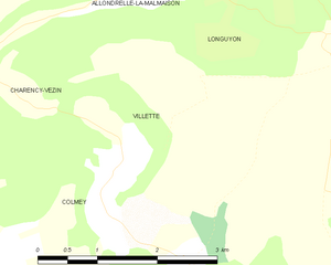
Allondrelle-la-Malmaison
- commune in Meurthe-et-Moselle, France
- Country:
- Postal Code: 54260
- Coordinates: 49° 30' 37" N, 5° 33' 48" E
- GPS tracks (wikiloc): [Link]
- Area: 13.61 sq km
- Population: 635
- Web site: [Link]

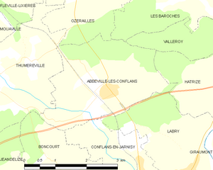
Abbéville-lès-Conflans
- commune in Meurthe-et-Moselle, France
- Country:
- Postal Code: 54800
- Coordinates: 49° 11' 52" N, 5° 50' 40" E
- GPS tracks (wikiloc): [Link]
- Area: 7.73 sq km
- Population: 225


Allamont
- commune in Meurthe-et-Moselle, France
- Country:
- Postal Code: 54800
- Coordinates: 49° 7' 23" N, 5° 45' 42" E
- GPS tracks (wikiloc): [Link]
- Area: 9.06 sq km
- Population: 158


Thil
- commune in Meurthe-et-Moselle, France
- Country:
- Postal Code: 54880
- Coordinates: 49° 28' 23" N, 5° 54' 30" E
- GPS tracks (wikiloc): [Link]
- Area: 3.32 sq km
- Population: 1730


Thumeréville
- commune in Meurthe-et-Moselle, France
- Country:
- Postal Code: 54800
- Coordinates: 49° 12' 4" N, 5° 47' 48" E
- GPS tracks (wikiloc): [Link]
- Area: 7.89 sq km
- Population: 79

Xonville
- commune in Meurthe-et-Moselle, France
- Country:
- Postal Code: 54800
- Coordinates: 49° 3' 19" N, 5° 50' 55" E
- GPS tracks (wikiloc): [Link]
- Area: 7.27 sq km
- Population: 135
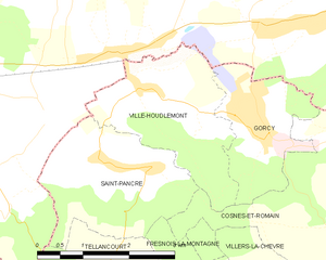
Ville-Houdlémont
- commune in Meurthe-et-Moselle, France
- Country:
- Postal Code: 54730
- Coordinates: 49° 32' 40" N, 5° 38' 54" E
- GPS tracks (wikiloc): [Link]
- Area: 6.09 sq km
- Population: 658


Ville-sur-Yron
- commune in Meurthe-et-Moselle, France
- Country:
- Postal Code: 54800
- Coordinates: 49° 7' 7" N, 5° 51' 58" E
- GPS tracks (wikiloc): [Link]
- Area: 11.3 sq km
- Population: 300

Waville
- commune in Meurthe-et-Moselle, France
- Country:
- Postal Code: 54890
- Coordinates: 49° 0' 37" N, 5° 56' 59" E
- GPS tracks (wikiloc): [Link]
- Area: 11.43 sq km
- Population: 430


Saint-Jean-lès-Longuyon
- commune in Meurthe-et-Moselle, France
- Country:
- Postal Code: 54260
- Coordinates: 49° 27' 14" N, 5° 27' 54" E
- GPS tracks (wikiloc): [Link]
- Area: 4.21 sq km
- Population: 421


Villecey-sur-Mad
- commune in Meurthe-et-Moselle, France
- Country:
- Postal Code: 54890
- Coordinates: 49° 0' 24" N, 5° 57' 33" E
- GPS tracks (wikiloc): [Link]
- Area: 7.41 sq km
- Population: 329


Valleroy
- commune in Meurthe-et-Moselle, France
- Country:
- Postal Code: 54910
- Coordinates: 49° 12' 43" N, 5° 56' 8" E
- GPS tracks (wikiloc): [Link]
- Area: 12.26 sq km
- Population: 2359

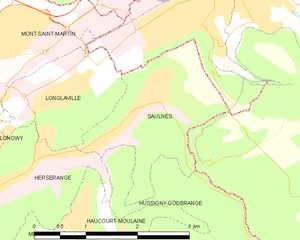
Saulnes
- commune in Meurthe-et-Moselle, France
- Country:
- Postal Code: 54650
- Coordinates: 49° 31' 58" N, 5° 49' 33" E
- GPS tracks (wikiloc): [Link]
- Area: 4 sq km
- Population: 2419
- Web site: [Link]


Herserange
- commune in Meurthe-et-Moselle, France
- Country:
- Postal Code: 54440
- Coordinates: 49° 31' 6" N, 5° 47' 3" E
- GPS tracks (wikiloc): [Link]
- Area: 3.54 sq km
- Population: 4361
- Web site: [Link]


arrondissement of Forbach
- former arrondissement in the Moselle department of France
- Country:
- Capital: Forbach
- Coordinates: 49° 5' 0" N, 6° 50' 0" E
- GPS tracks (wikiloc): [Link]
- Population: 244285


Avillers
- commune in Meurthe-et-Moselle, France
- Country:
- Postal Code: 54490
- Coordinates: 49° 19' 24" N, 5° 44' 9" E
- GPS tracks (wikiloc): [Link]
- AboveSeaLevel: 268 м m
- Area: 5.16 sq km
- Population: 120

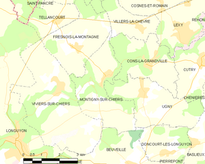
Montigny-sur-Chiers
- commune in Meurthe-et-Moselle, France
- Country:
- Postal Code: 54870
- Coordinates: 49° 28' 47" N, 5° 40' 9" E
- GPS tracks (wikiloc): [Link]
- Area: 9.36 sq km
- Population: 499
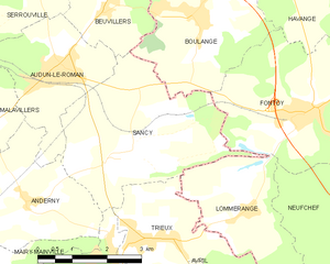
Sancy
- commune in Meurthe-et-Moselle, France
- Country:
- Postal Code: 54560
- Coordinates: 49° 20' 51" N, 5° 55' 30" E
- GPS tracks (wikiloc): [Link]
- AboveSeaLevel: 340 м m
- Area: 13.19 sq km
- Population: 333


Anderny
- commune in Meurthe-et-Moselle, France
- Country:
- Postal Code: 54560
- Coordinates: 49° 20' 7" N, 5° 52' 56" E
- GPS tracks (wikiloc): [Link]
- Area: 9.62 sq km
- Population: 256


Béchamps
- commune in Meurthe-et-Moselle, France
- Country:
- Postal Code: 54800
- Coordinates: 49° 12' 38" N, 5° 44' 19" E
- GPS tracks (wikiloc): [Link]
- Area: 9.28 sq km
- Population: 87

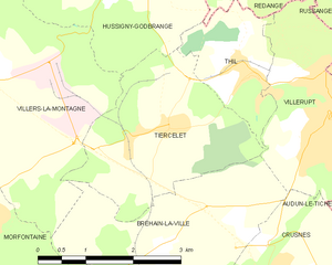
Tiercelet
- commune in Meurthe-et-Moselle, France
- Country:
- Postal Code: 54190
- Coordinates: 49° 27' 43" N, 5° 53' 3" E
- GPS tracks (wikiloc): [Link]
- Area: 7.68 sq km
- Population: 650


Réhon
- commune in Meurthe-et-Moselle, France
- Country:
- Postal Code: 54430
- Coordinates: 49° 30' 6" N, 5° 45' 18" E
- GPS tracks (wikiloc): [Link]
- AboveSeaLevel: 310 м m
- Area: 3.73 sq km
- Population: 3870

Batilly
- commune in Meurthe-et-Moselle, France
- Country:
- Postal Code: 54980
- Coordinates: 49° 10' 23" N, 5° 58' 3" E
- GPS tracks (wikiloc): [Link]
- Area: 6.37 sq km
- Population: 1249

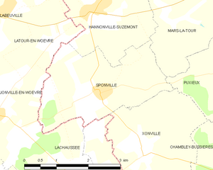
Sponville
- commune in Meurthe-et-Moselle, France
- Country:
- Postal Code: 54800
- Coordinates: 49° 4' 20" N, 5° 49' 58" E
- GPS tracks (wikiloc): [Link]
- Area: 7.2 sq km
- Population: 124


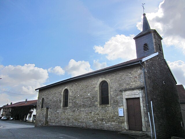
Pierrepont
- commune in Meurthe-et-Moselle, France
- Country:
- Postal Code: 54620
- Coordinates: 49° 24' 57" N, 5° 42' 41" E
- GPS tracks (wikiloc): [Link]
- Area: 7.02 sq km
- Population: 874

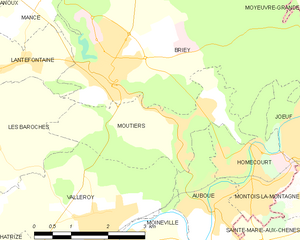
Moutiers
- commune in Meurthe-et-Moselle, France
- Country:
- Postal Code: 54660
- Coordinates: 49° 14' 3" N, 5° 57' 50" E
- GPS tracks (wikiloc): [Link]
- Area: 6.82 sq km
- Population: 1574
- Web site: [Link]

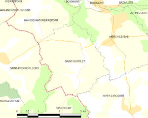
Saint-Supplet
- commune in Meurthe-et-Moselle, France
- Country:
- Postal Code: 54620
- Coordinates: 49° 22' 54" N, 5° 44' 5" E
- GPS tracks (wikiloc): [Link]
- Area: 7.43 sq km
- Population: 149


Puxieux
- commune in Meurthe-et-Moselle, France
- Country:
- Postal Code: 54800
- Coordinates: 49° 4' 37" N, 5° 53' 16" E
- GPS tracks (wikiloc): [Link]
- Area: 5.67 sq km
- Population: 258


Hannonville-Suzémont
- commune in Meurthe-et-Moselle, France
- Country:
- Postal Code: 54800
- Coordinates: 49° 5' 54" N, 5° 50' 1" E
- GPS tracks (wikiloc): [Link]
- Area: 8.68 sq km
- Population: 264

Trieux
- commune in Meurthe-et-Moselle, France
- Country:
- Postal Code: 54750
- Coordinates: 49° 19' 28" N, 5° 56' 11" E
- GPS tracks (wikiloc): [Link]
- Area: 8.62 sq km
- Population: 2521

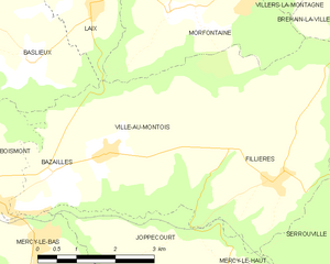
Ville-au-Montois
- commune in Meurthe-et-Moselle, France
- Country:
- Postal Code: 54620
- Coordinates: 49° 24' 41" N, 5° 46' 56" E
- GPS tracks (wikiloc): [Link]
- Area: 12.33 sq km
- Population: 268


Tronville
- commune in Meurthe-et-Moselle, France
- Country:
- Postal Code: 54800
- Coordinates: 49° 5' 6" N, 5° 55' 12" E
- GPS tracks (wikiloc): [Link]
- Area: 7 sq km
- Population: 203


Fléville-Lixières
- commune in Meurthe-et-Moselle, France
- Country:
- Postal Code: 54150
- Coordinates: 49° 14' 43" N, 5° 49' 23" E
- GPS tracks (wikiloc): [Link]
- Area: 14.38 sq km
- Population: 307


Villers-la-Chèvre
- commune in Meurthe-et-Moselle, France
- Country:
- Postal Code: 54870
- Coordinates: 49° 30' 16" N, 5° 41' 37" E
- GPS tracks (wikiloc): [Link]
- Area: 4.02 sq km
- Population: 568
Mexy
- commune in Meurthe-et-Moselle, France
- Country:
- Postal Code: 54135
- Coordinates: 49° 30' 1" N, 5° 46' 57" E
- GPS tracks (wikiloc): [Link]
- Area: 4.9 sq km
- Population: 2254
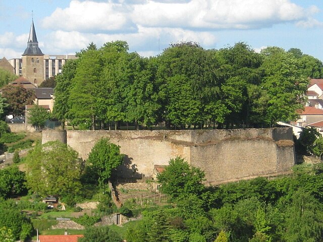
Briey
- former commune in Meurthe-et-Moselle, France
- Country:
- Postal Code: 54150
- Coordinates: 49° 14' 55" N, 5° 56' 22" E
- GPS tracks (wikiloc): [Link]
- AboveSeaLevel: 240 м m
- Area: 27.13 sq km
- Population: 5819
- Web site: [Link]


Mercy-le-Bas
- commune in Meurthe-et-Moselle, France
- Country:
- Postal Code: 54960
- Coordinates: 49° 23' 1" N, 5° 45' 7" E
- GPS tracks (wikiloc): [Link]
- Area: 8.23 sq km
- Population: 1271


Gondrecourt-Aix
- commune in Meurthe-et-Moselle, France
- Country:
- Postal Code: 54800
- Coordinates: 49° 14' 44" N, 5° 46' 9" E
- GPS tracks (wikiloc): [Link]
- Area: 12.28 sq km
- Population: 181


Moineville
- commune in Meurthe-et-Moselle, France
- Country:
- Postal Code: 54580
- Coordinates: 49° 12' 23" N, 5° 56' 37" E
- GPS tracks (wikiloc): [Link]
- Area: 8.12 sq km
- Population: 1083


Ozerailles
- commune in Meurthe-et-Moselle, France
- Country:
- Postal Code: 54150
- Coordinates: 49° 13' 51" N, 5° 50' 27" E
- GPS tracks (wikiloc): [Link]
- Area: 6.32 sq km
- Population: 146
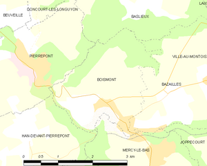
Boismont
- commune in Meurthe-et-Moselle, France
- Country:
- Postal Code: 54620
- Coordinates: 49° 24' 22" N, 5° 44' 22" E
- GPS tracks (wikiloc): [Link]
- Area: 5.43 sq km
- Population: 418


Mancieulles
- former commune in Meurthe-et-Moselle, France
- Country:
- Postal Code: 54790
- Coordinates: 49° 17' 1" N, 5° 53' 34" E
- GPS tracks (wikiloc): [Link]
- Area: 4.39 sq km
- Population: 1875


Petit-Failly
- commune in Meurthe-et-Moselle, France
- Country:
- Postal Code: 54260
- Coordinates: 49° 26' 22" N, 5° 29' 32" E
- GPS tracks (wikiloc): [Link]
- Area: 8.12 sq km
- Population: 86
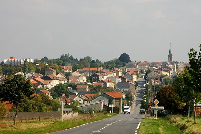
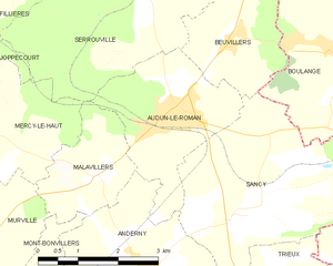
Audun-le-Roman
- commune in Meurthe-et-Moselle, France
- Country:
- Postal Code: 54560
- Coordinates: 49° 22' 13" N, 5° 53' 45" E
- GPS tracks (wikiloc): [Link]
- Area: 7.57 sq km
- Population: 2463


Saint-Marcel
- commune in Meurthe-et-Moselle, France
- Country:
- Postal Code: 54800
- Coordinates: 49° 7' 18" N, 5° 57' 15" E
- GPS tracks (wikiloc): [Link]
- Area: 11.35 sq km
- Population: 155
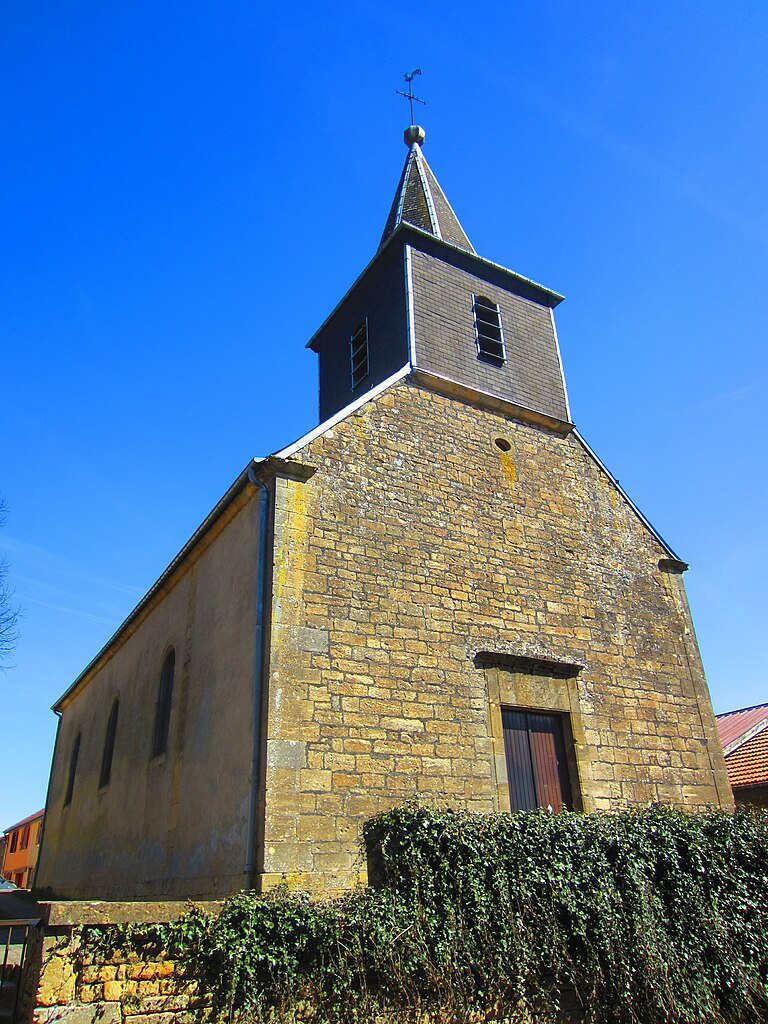
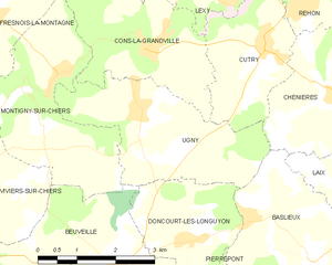
Ugny
- commune in Meurthe-et-Moselle, France
- Country:
- Postal Code: 54870
- Coordinates: 49° 28' 17" N, 5° 41' 55" E
- GPS tracks (wikiloc): [Link]
- Area: 9.14 sq km
- Population: 733


Bettainvillers
- commune in Meurthe-et-Moselle, France
- Country:
- Postal Code: 54640
- Coordinates: 49° 18' 1" N, 5° 54' 19" E
- GPS tracks (wikiloc): [Link]
- Area: 4.53 sq km
- Population: 356


Chambley-Bussières
- commune in Meurthe-et-Moselle, France
- Country:
- Postal Code: 54890
- Coordinates: 49° 2' 54" N, 5° 53' 55" E
- GPS tracks (wikiloc): [Link]
- Area: 19.25 sq km
- Population: 685


Mars-la-Tour
- commune in Meurthe-et-Moselle, France
- Country:
- Postal Code: 54800
- Coordinates: 49° 5' 56" N, 5° 53' 10" E
- GPS tracks (wikiloc): [Link]
- Area: 12.64 sq km
- Population: 964


Malavillers
- commune in Meurthe-et-Moselle, France
- Country:
- Postal Code: 54560
- Coordinates: 49° 21' 23" N, 5° 52' 10" E
- GPS tracks (wikiloc): [Link]
- Area: 4.37 sq km
- Population: 140


Villers-le-Rond
- commune in Meurthe-et-Moselle, France
- Country:
- Postal Code: 54260
- Coordinates: 49° 27' 54" N, 5° 29' 23" E
- GPS tracks (wikiloc): [Link]
- Area: 4.45 sq km
- Population: 100


Doncourt-lès-Conflans
- commune in Meurthe-et-Moselle, France
- Country:
- Postal Code: 54800
- Coordinates: 49° 8' 38" N, 5° 56' 3" E
- GPS tracks (wikiloc): [Link]
- Area: 7.34 sq km
- Population: 1196


Dampvitoux
- commune in Meurthe-et-Moselle, France
- Country:
- Postal Code: 54470
- Coordinates: 49° 0' 47" N, 5° 50' 34" E
- GPS tracks (wikiloc): [Link]
- Area: 9.19 sq km
- Population: 60


Chenières
- commune in Meurthe-et-Moselle, France
- Country:
- Postal Code: 54720
- Coordinates: 49° 28' 16" N, 5° 45' 56" E
- GPS tracks (wikiloc): [Link]
- Area: 8.5 sq km
- Population: 637
Achâtel
- former commune in France
- Country:
- Coordinates: 48° 56' 34" N, 6° 18' 1" E
- GPS tracks (wikiloc): [Link]


Longwy
- commune in Meurthe-et-Moselle, France
- Country:
- Postal Code: 54400
- Coordinates: 49° 31' 11" N, 5° 45' 38" E
- GPS tracks (wikiloc): [Link]
- AboveSeaLevel: 254 м m
- Area: 5.34 sq km
- Population: 14437
- Web site: [Link]

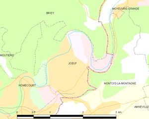
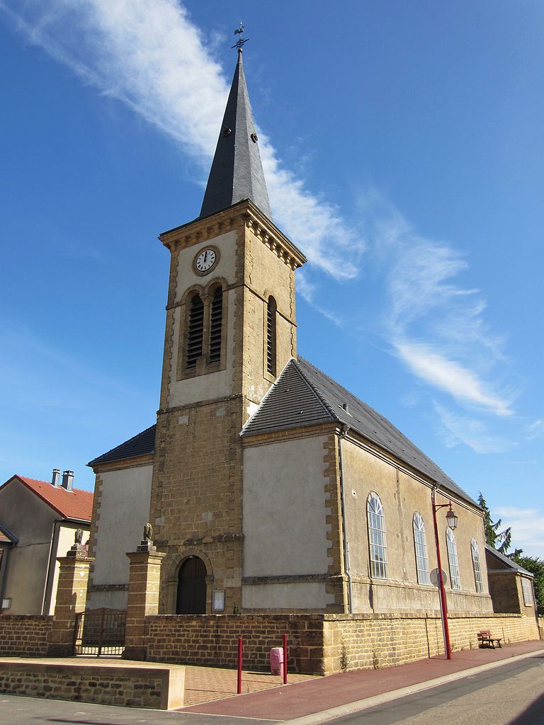
Jœuf
- commune in Meurthe-et-Moselle, France
- Country:
- Postal Code: 54240
- Coordinates: 49° 13' 47" N, 6° 0' 32" E
- GPS tracks (wikiloc): [Link]
- Area: 3.18 sq km
- Population: 6518

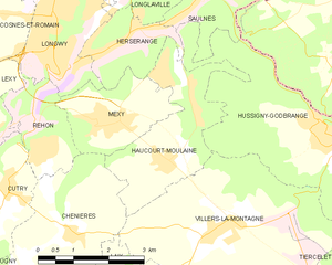
Haucourt-Moulaine
- commune in Meurthe-et-Moselle, France
- Country:
- Postal Code: 54860
- Coordinates: 49° 29' 23" N, 5° 48' 23" E
- GPS tracks (wikiloc): [Link]
- Area: 7.42 sq km
- Population: 3076


Auboué
- commune in Meurthe-et-Moselle, France
- Country:
- Postal Code: 54580
- Coordinates: 49° 12' 43" N, 5° 58' 37" E
- GPS tracks (wikiloc): [Link]
- Area: 4.54 sq km
- Population: 2509


Anoux
- commune in Meurthe-et-Moselle, France
- Country:
- Postal Code: 54150
- Coordinates: 49° 16' 31" N, 5° 52' 7" E
- GPS tracks (wikiloc): [Link]
- Area: 9.88 sq km
- Population: 255

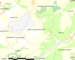
Saint-Julien-lès-Gorze
- commune in Meurthe-et-Moselle, France
- Country:
- Postal Code: 54470
- Coordinates: 49° 0' 52" N, 5° 54' 2" E
- GPS tracks (wikiloc): [Link]
- Area: 10.38 sq km
- Population: 164


Piennes
- commune in Meurthe-et-Moselle, France
- Country:
- Postal Code: 54490
- Coordinates: 49° 18' 24" N, 5° 47' 11" E
- GPS tracks (wikiloc): [Link]
- Area: 4.67 sq km
- Population: 2480


Grand-Failly
- commune in Meurthe-et-Moselle, France
- Country:
- Postal Code: 54260
- Coordinates: 49° 25' 14" N, 5° 30' 52" E
- GPS tracks (wikiloc): [Link]
- Area: 21.87 sq km
- Population: 307


Villers-la-Montagne
- commune in Meurthe-et-Moselle, France
- Country:
- Postal Code: 54920
- Coordinates: 49° 28' 15" N, 5° 49' 17" E
- GPS tracks (wikiloc): [Link]
- Area: 18.12 sq km
- Population: 1482

Morfontaine
- commune in Meurthe-et-Moselle, France
- Country:
- Postal Code: 54920
- Coordinates: 49° 26' 40" N, 5° 48' 30" E
- GPS tracks (wikiloc): [Link]
- Area: 11.42 sq km
- Population: 1098


Errouville
- commune in Meurthe-et-Moselle, France
- Country:
- Postal Code: 54680
- Coordinates: 49° 24' 58" N, 5° 54' 10" E
- GPS tracks (wikiloc): [Link]
- Area: 5.13 sq km
- Population: 761


Jarny
- commune in Meurthe-et-Moselle, France
- Country:
- Postal Code: 54800
- Coordinates: 49° 9' 32" N, 5° 52' 38" E
- GPS tracks (wikiloc): [Link]
- AboveSeaLevel: 220 м m
- Area: 15.6 sq km
- Population: 8307
- Web site: [Link]


Beuveille
- commune in Meurthe-et-Moselle, France
- Country:
- Postal Code: 54620
- Coordinates: 49° 25' 55" N, 5° 41' 25" E
- GPS tracks (wikiloc): [Link]
- Area: 11.9 sq km
- Population: 772


arrondissement of Sarreguemines
- arrondissement of France
- Country:
- Capital: Sarreguemines
- Coordinates: 49° 5' 0" N, 7° 20' 0" E
- GPS tracks (wikiloc): [Link]
- Population: 99647

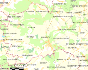
Longuyon
- commune in Meurthe-et-Moselle, France
- Country:
- Postal Code: 54260
- Coordinates: 49° 26' 49" N, 5° 36' 2" E
- GPS tracks (wikiloc): [Link]
- Area: 29.7 sq km
- Population: 5397
- Web site: [Link]

Joppécourt
- commune in Meurthe-et-Moselle, France
- Country:
- Postal Code: 54620
- Coordinates: 49° 23' 17" N, 5° 47' 43" E
- GPS tracks (wikiloc): [Link]
- Area: 6.98 sq km
- Population: 161


Tellancourt
- commune in Meurthe-et-Moselle, France
- Country:
- Postal Code: 54260
- Coordinates: 49° 30' 29" N, 5° 38' 0" E
- GPS tracks (wikiloc): [Link]
- Area: 3.76 sq km
- Population: 551


Othe
- commune in Meurthe-et-Moselle, France
- Country:
- Postal Code: 54260
- Coordinates: 49° 29' 44" N, 5° 26' 34" E
- GPS tracks (wikiloc): [Link]
- Area: 2.97 sq km
- Population: 31


arrondissement of Boulay-Moselle
- arrondissement of France
- Country:
- Capital: Boulay-Moselle
- Coordinates: 49° 10' 0" N, 6° 30' 0" E
- GPS tracks (wikiloc): [Link]


arrondissement of Château-Salins
- former arrondissement of France
- Country:
- Capital: Château-Salins
- Coordinates: 48° 50' 0" N, 6° 35' 0" E
- GPS tracks (wikiloc): [Link]


arrondissement of Sarrebourg
- former arrondissement of France
- Country:
- Capital: Sarrebourg
- Coordinates: 48° 45' 0" N, 7° 0' 0" E
- GPS tracks (wikiloc): [Link]


arrondissement of Thionville-Est
- former arrondissement of France
- Country:
- Capital: Thionville
- Coordinates: 49° 20' 0" N, 6° 20' 0" E
- GPS tracks (wikiloc): [Link]


arrondissement of Thionville-Ouest
- former arrondissement of France
- Country:
- Capital: Thionville
- Coordinates: 49° 20' 0" N, 6° 5' 0" E
- GPS tracks (wikiloc): [Link]

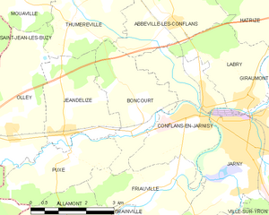
Boncourt
- commune in Meurthe-et-Moselle, France
- Country:
- Postal Code: 54800
- Coordinates: 49° 10' 6" N, 5° 49' 45" E
- GPS tracks (wikiloc): [Link]
- Area: 6.73 sq km
- Population: 191


Bréhain-la-Ville
- commune in Meurthe-et-Moselle, France
- Country:
- Postal Code: 54190
- Coordinates: 49° 26' 15" N, 5° 52' 53" E
- GPS tracks (wikiloc): [Link]
- Area: 10.08 sq km
- Population: 372


Cosnes-et-Romain
- commune in Meurthe-et-Moselle, France
- Country:
- Postal Code: 54400
- Coordinates: 49° 31' 9" N, 5° 42' 40" E
- GPS tracks (wikiloc): [Link]
- Area: 16.23 sq km
- Population: 2652
- Web site: [Link]

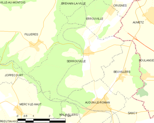
Serrouville
- commune in Meurthe-et-Moselle, France
- Country:
- Postal Code: 54560
- Coordinates: 49° 23' 55" N, 5° 53' 16" E
- GPS tracks (wikiloc): [Link]
- Area: 15.57 sq km
- Population: 705


Friauville
- commune in Meurthe-et-Moselle, France
- Country:
- Postal Code: 54800
- Coordinates: 49° 8' 45" N, 5° 50' 29" E
- GPS tracks (wikiloc): [Link]
- Area: 6.34 sq km
- Population: 367

Brainville
- commune in Meurthe-et-Moselle, France
- Country:
- Postal Code: 54800
- Coordinates: 49° 7' 44" N, 5° 48' 20" E
- GPS tracks (wikiloc): [Link]
- AboveSeaLevel: 200 м m
- Area: 9.92 sq km
- Population: 156

Charency-Vezin
- commune in Meurthe-et-Moselle, France
- Country:
- Postal Code: 54260
- Coordinates: 49° 28' 58" N, 5° 30' 39" E
- GPS tracks (wikiloc): [Link]
- Area: 14.79 sq km
- Population: 652


Conflans-en-Jarnisy
- commune in Meurthe-et-Moselle, France
- Country:
- Postal Code: 54800
- Coordinates: 49° 10' 3" N, 5° 51' 24" E
- GPS tracks (wikiloc): [Link]
- Area: 8.71 sq km
- Population: 2356


Colmey
- commune in Meurthe-et-Moselle, France
- Country:
- Postal Code: 54260
- Coordinates: 49° 27' 28" N, 5° 33' 27" E
- GPS tracks (wikiloc): [Link]
- Area: 9.9 sq km
- Population: 259


Doncourt-lès-Longuyon
- commune in Meurthe-et-Moselle, France
- Country:
- Postal Code: 54620
- Coordinates: 49° 26' 21" N, 5° 42' 44" E
- GPS tracks (wikiloc): [Link]
- Area: 5.62 sq km
- Population: 307


Domprix
- commune in Meurthe-et-Moselle, France
- Country:
- Postal Code: 54490
- Coordinates: 49° 19' 51" N, 5° 45' 29" E
- GPS tracks (wikiloc): [Link]
- Area: 7.7 sq km
- Population: 81


Bruville
- commune in Meurthe-et-Moselle, France
- Country:
- Postal Code: 54800
- Coordinates: 49° 7' 52" N, 5° 54' 59" E
- GPS tracks (wikiloc): [Link]
- Area: 10.81 sq km
- Population: 229
Affléville
- commune in Meurthe-et-Moselle, France
- Country:
- Postal Code: 54800
- Coordinates: 49° 16' 13" N, 5° 45' 48" E
- GPS tracks (wikiloc): [Link]
- Area: 9.42 sq km
- Population: 179
Shares border with regions:


Rhineland-Palatinate
- state of Germany
 Hiking in Rhineland-Palatinate
Rhineland-Palatinate, located in western Germany, is a fantastic destination for hiking enthusiasts. This region is known for its diverse landscapes, ranging from the rolling vineyards of the Moselle Valley to the rugged terrain of the Eifel Mountains and the picturesque trails of the Rhine Gorge....
- Country:

- Capital: Mainz
- Coordinates: 49° 54' 47" N, 7° 26' 59" E
- GPS tracks (wikiloc): [Link]
- AboveSeaLevel: 0 м m
- Area: 19853.36 sq km
- Population: 4011582
- Web site: [Link]


Saarland
- state of Germany
Hiking in Saarland
Saarland, one of the smaller states in Germany, offers a range of beautiful hiking opportunities, combining lush landscapes, historical sites, and charming villages. Here's a brief overview of what to expect when hiking in Saarland:...
- Country:
- Capital: Saarbrücken
- Coordinates: 49° 22' 38" N, 6° 52' 42" E
- GPS tracks (wikiloc): [Link]
- Area: 2570.0 sq km
- Population: 995597
- Web site: [Link]


Meurthe-et-Moselle
- French department
- Country:
- Capital: Nancy
- Coordinates: 48° 40' 0" N, 6° 10' 0" E
- GPS tracks (wikiloc): [Link]
- Area: 5246 sq km
- Population: 734403
- Web site: [Link]


Bas-Rhin
- French department
- Country:
- Capital: Strasbourg
- Coordinates: 48° 49' 0" N, 7° 47' 0" E
- GPS tracks (wikiloc): [Link]
- Area: 4755 sq km
- Population: 1121407
- Web site: [Link]