Cluny (Cluny)

- commune in Saône-et-Loire, France
- Country:

- Postal Code: 71250
- Coordinates: 46° 26' 4" N, 4° 39' 33" E


- GPS tracks (wikiloc): [Link]
- AboveSeaLevel: 574 м m
- Area: 23.71 sq km
- Population: 4803
- Web site: http://www.cluny-tourisme.com
- Wikipedia en: wiki(en)
- Wikipedia: wiki(fr)
- Wikidata storage: Wikidata: Q192982
- Wikipedia Commons Gallery: [Link]
- Wikipedia Commons Category: [Link]
- Wikipedia Commons Maps Category: [Link]
- Freebase ID: [/m/025kr]
- Freebase ID: [/m/025kr]
- GeoNames ID: Alt: [6454611]
- GeoNames ID: Alt: [6454611]
- SIREN number: [217101377]
- SIREN number: [217101377]
- BnF ID: [15273110z]
- BnF ID: [15273110z]
- VIAF ID: Alt: [241412268]
- VIAF ID: Alt: [241412268]
- GND ID: Alt: [4010317-1]
- GND ID: Alt: [4010317-1]
- archINFORM location ID: [562]
- archINFORM location ID: [562]
- WOEID: [12641858]
- WOEID: [12641858]
- Quora topic ID: [Cluny]
- Quora topic ID: [Cluny]
- Encyclopædia Britannica Online ID: [place/Cluny-France]
- Encyclopædia Britannica Online ID: [place/Cluny-France]
- Gran Enciclopèdia Catalana ID: [0018335]
- Gran Enciclopèdia Catalana ID: [0018335]
- Twitter username: Alt: [VilledeCluny]
- Twitter username: Alt: [VilledeCluny]
- Michelin Voyages ID: [europe/france/bourgogne/saone-et-loire/cluny]
- Michelin Voyages ID: [europe/france/bourgogne/saone-et-loire/cluny]
- INSEE municipality code: 71137
- INSEE municipality code: 71137
Shares border with regions:


Donzy-le-Pertuis
- commune in Saône-et-Loire, France
- Country:
- Postal Code: 71250
- Coordinates: 46° 27' 3" N, 4° 43' 14" E
- GPS tracks (wikiloc): [Link]
- Area: 6.11 sq km
- Population: 163


Azé
- commune in Saône-et-Loire, France
- Country:
- Postal Code: 71260
- Coordinates: 46° 25' 55" N, 4° 45' 38" E
- GPS tracks (wikiloc): [Link]
- Area: 14.97 sq km
- Population: 1021
- Web site: [Link]


Château
- commune in Saône-et-Loire, France
- Country:
- Postal Code: 71250
- Coordinates: 46° 25' 38" N, 4° 36' 6" E
- GPS tracks (wikiloc): [Link]
- Area: 14.04 sq km
- Population: 231


La Vineuse
- former commune in Saône-et-Loire, France
- Country:
- Postal Code: 71250
- Coordinates: 46° 28' 16" N, 4° 35' 51" E
- GPS tracks (wikiloc): [Link]
- Area: 15.75 sq km
- Population: 287


Verzé
- commune in Saône-et-Loire, France
- Country:
- Postal Code: 71960
- Coordinates: 46° 22' 38" N, 4° 44' 6" E
- GPS tracks (wikiloc): [Link]
- Area: 19.84 sq km
- Population: 773
- Web site: [Link]


Cortambert
- commune in Saône-et-Loire, France
- Country:
- Postal Code: 71250
- Coordinates: 46° 28' 42" N, 4° 42' 52" E
- GPS tracks (wikiloc): [Link]
- Area: 16.02 sq km
- Population: 230

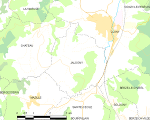
Jalogny
- commune in Saône-et-Loire, France
- Country:
- Postal Code: 71250
- Coordinates: 46° 25' 8" N, 4° 37' 50" E
- GPS tracks (wikiloc): [Link]
- Area: 10.15 sq km
- Population: 352

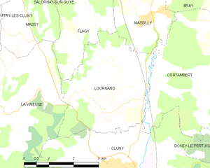
Lournand
- commune in Saône-et-Loire, France
- Country:
- Postal Code: 71250
- Coordinates: 46° 27' 21" N, 4° 39' 1" E
- GPS tracks (wikiloc): [Link]
- Area: 11.22 sq km
- Population: 328

Igé
- commune in Saône-et-Loire, France
- Country:
- Postal Code: 71960
- Coordinates: 46° 23' 52" N, 4° 44' 29" E
- GPS tracks (wikiloc): [Link]
- Area: 14.61 sq km
- Population: 863
- Web site: [Link]


Sainte-Cécile
- commune in Saône-et-Loire, France
- Country:
- Postal Code: 71250
- Coordinates: 46° 23' 19" N, 4° 37' 10" E
- GPS tracks (wikiloc): [Link]
- Area: 7.26 sq km
- Population: 288


Berzé-le-Châtel
- commune in Saône-et-Loire, France
- Country:
- Postal Code: 71960
- Coordinates: 46° 23' 4" N, 4° 41' 21" E
- GPS tracks (wikiloc): [Link]
- Area: 5.53 sq km
- Population: 59