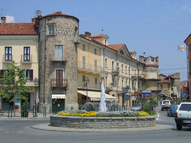
Coazze (Coazze)

- Italian comune
 Hiking in Coazze
Coazze, a charming village located in the Susa Valley in the Piedmont region of Italy, offers a variety of hiking opportunities that cater to all levels of experience. The surrounding landscape features lush forests, stunning mountain views, and picturesque trails, making it a great destination for outdoor enthusiasts.
Hiking Trails in Coazze
-
Path of the San Giovanni Valley: This trail takes you through beautiful wooded areas and offers breathtaking views of the surrounding mountains. It's a moderate hike, suitable for those who are reasonably fit.
-
Trail to Monti della Luna: This is a more challenging hike that leads to the Monti della Luna peak. The trail rewards hikers with panoramic views of the Susa Valley and surrounding Alps. Make sure you're prepared for a strenuous trek.
-
Val Sangone Trail: This route is less known but offers a chance to explore the local flora and fauna. It’s perfect for nature lovers and those seeking a quieter hiking experience.
-
A morning hike to Eremo di San Bartolomeo: A shorter hike that leads to the Hermitage of San Bartolomeo. The trail is marked and relatively easy, making it ideal for families and those new to hiking.
Tips for Hiking in Coazze
- Gear Up: Always wear appropriate hiking shoes and bring layers, as temperatures can change quickly in the mountains.
- Stay Hydrated: Carry enough water, especially in warmer months, and snacks for energy.
- Trail Maps: Familiarize yourself with the trails before heading out, and consider bringing a physical map or using a hiking app for navigation.
- Wildlife Awareness: Respect local wildlife and carry a camera to capture the amazing scenery.
- Local Regulations: Follow local guidelines and regulations regarding trail use and conservation.
Best Time to Hike
The best time for hiking in Coazze typically spans from late spring to early autumn (May to October) when the weather is pleasant and the trails are less likely to be muddy or snow-covered.
Overall, Coazze provides a fantastic hiking experience with beautiful landscapes and well-maintained trails. Whether you're a beginner or an experienced hiker, you can find a trail that suits your abilities and enjoy the natural beauty of the region. Happy hiking!
- Country:

- Postal Code: 10050
- Local Dialing Code: 011
- Licence Plate Code: TO
- Coordinates: 45° 3' 7" N, 7° 18' 2" E


- GPS tracks (wikiloc): [Link]
- AboveSeaLevel: 750 м m
- Area: 56.57 sq km
- Population: 3203
- Web site: http://www.comune.coazze.to.it/
- Wikipedia en: wiki(en)
- Wikipedia: wiki(it)
- Wikidata storage: Wikidata: Q9298
- Wikipedia Commons Category: [Link]
- Freebase ID: [/m/0g6vp7]
- GeoNames ID: Alt: [6539898]
- BnF ID: [14598386r]
- VIAF ID: Alt: [130394608]
- OSM relation ID: [43983]
- ISTAT ID: 001089
- Italian cadastre code: C803
Shares border with regions:

Roure
- Italian comune
Hiking in Roure
Roure, located in the Piedmont region of Italy, is a charming town nestled in the Susa Valley. The area offers a multitude of hiking opportunities, characterized by stunning landscapes, rich history, and a diverse range of trails suitable for all skill levels....
- Country:
- Postal Code: 10060
- Local Dialing Code: 0121
- Licence Plate Code: TO
- Coordinates: 45° 0' 0" N, 7° 8' 0" E
- GPS tracks (wikiloc): [Link]
- AboveSeaLevel: 750 м m
- Area: 59.37 sq km
- Population: 832
- Web site: [Link]


San Giorio di Susa
- Italian comune
Hiking in San Giorio di Susa
San Giorio di Susa is a charming village located in the Susa Valley of the Piedmont region in northern Italy. Nestled in the foothills of the Alps, it offers a variety of hiking opportunities that cater to different skill levels and preferences....
- Country:
- Postal Code: 10050
- Local Dialing Code: 0122
- Licence Plate Code: TO
- Coordinates: 45° 8' 0" N, 7° 10' 0" E
- GPS tracks (wikiloc): [Link]
- Area: 19.74 sq km
- Population: 996
- Web site: [Link]


Sant'Antonino di Susa
- Italian comune
Hiking in Sant'Antonino di Susa
Sant'Antonino di Susa is located in the Susa Valley of the Piedmont region in northern Italy, and it's known for its stunning natural landscapes and outdoor recreational opportunities, particularly hiking. The area is rich in history, culture, and scenic vistas, making it an attractive destination for hikers of all abilities....
- Country:
- Postal Code: 10050
- Local Dialing Code: 011
- Licence Plate Code: TO
- Coordinates: 45° 6' 25" N, 7° 16' 20" E
- GPS tracks (wikiloc): [Link]
- Area: 9.79 sq km
- Population: 4251
- Web site: [Link]


Vaie
- Italian comune
Hiking in Vaie
Vaie is a picturesque village located in the Dolomites region of northern Italy, in the province of Trento. This area is known for its stunning alpine scenery, rich woodlands, and numerous hiking trails suitable for outdoor enthusiasts of varying skill levels. Here are some key points to consider if you're planning to hike in Vaie:...
- Country:
- Postal Code: 10050
- Local Dialing Code: 011
- Licence Plate Code: TO
- Coordinates: 45° 6' 8" N, 7° 17' 22" E
- GPS tracks (wikiloc): [Link]
- Area: 7.23 sq km
- Population: 1456
- Web site: [Link]


Valgioie
- Italian comune
Hiking in Valgioie
Valgioie, located in the Susa Valley in the Piedmont region of Italy, offers a range of hiking opportunities that showcase its beautiful landscapes, rich flora, and stunning views of the surrounding mountains. The area is known for its natural beauty and is less crowded than some other tourist hotspots, making it a perfect destination for hiking enthusiasts looking for a peaceful experience in nature....
- Country:
- Postal Code: 10094
- Local Dialing Code: 011
- Licence Plate Code: TO
- Coordinates: 45° 5' 0" N, 7° 20' 0" E
- GPS tracks (wikiloc): [Link]
- AboveSeaLevel: 870 м m
- Area: 9.12 sq km
- Population: 973
- Web site: [Link]


Villar Focchiardo
- Italian comune
Hiking in Villar Focchiardo
Villar Focchiardo is a beautiful destination for hiking enthusiasts located in the Piedmont region of Italy, not far from the larger city of Turin. This area is characterized by its stunning natural landscapes, including lush valleys, rolling hills, and various flora and fauna. Here’s what you need to know about hiking in Villar Focchiardo:...
- Country:
- Postal Code: 10050
- Local Dialing Code: 011
- Licence Plate Code: TO
- Coordinates: 45° 7' 0" N, 7° 14' 0" E
- GPS tracks (wikiloc): [Link]
- Area: 25.69 sq km
- Population: 1987
- Web site: [Link]


Chiusa di San Michele
- Italian comune
Hiking in Chiusa di San Michele
Chiusa di San Michele, located in the Susa Valley in the Piedmont region of Italy, is a fantastic hiking destination known for its stunning landscapes, historical significance, and diverse trails. The area includes scenic views of the surrounding mountains and valleys, as well as charming villages and rich cultural heritage....
- Country:
- Postal Code: 10050
- Local Dialing Code: 011
- Licence Plate Code: TO
- Coordinates: 45° 6' 0" N, 7° 19' 0" E
- GPS tracks (wikiloc): [Link]
- AboveSeaLevel: 378 м m
- Area: 5.92 sq km
- Population: 1667
- Web site: [Link]

Giaveno
- Italian comune
Hiking in Giaveno
Giaveno is a picturesque town located in the Susa Valley in the Piedmont region of Italy, known for its stunning natural landscapes, rich history, and a variety of hiking opportunities. Here are some highlights of hiking in the Giaveno area:...
- Country:
- Postal Code: 10094
- Local Dialing Code: 011
- Licence Plate Code: TO
- Coordinates: 45° 2' 0" N, 7° 21' 0" E
- GPS tracks (wikiloc): [Link]
- AboveSeaLevel: 506 м m
- Area: 71.74 sq km
- Population: 16417
- Web site: [Link]


Perosa Argentina
- Italian comune
Hiking in Perosa Argentina
Perosa Argentina is a picturesque village located in the Susa Valley of the Piedmont region in Italy. While it may not be as widely known as some other hiking destinations, it offers beautiful landscapes and outdoor activities....
- Country:
- Postal Code: 10063
- Local Dialing Code: 0121
- Licence Plate Code: TO
- Coordinates: 44° 57' 0" N, 7° 12' 0" E
- GPS tracks (wikiloc): [Link]
- AboveSeaLevel: 630 м m
- Area: 26.09 sq km
- Population: 3209
- Web site: [Link]