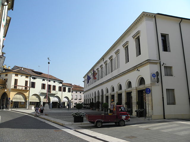
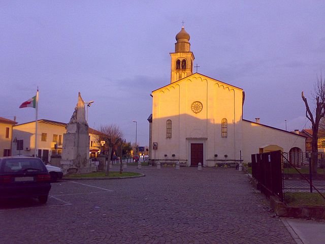
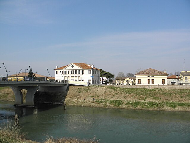
Codevigo (Codevigo)
.svg)
- Italian comune
 Hiking in Codevigo
Codevigo is a charming municipality located in the province of Padua, within the Veneto region of Italy. While it may not be as renowned for hiking as some of Italy's more mountainous areas, it offers opportunities for outdoor activities and exploring the picturesque landscape typical of the Venetian Plain.
Hiking Opportunities in Codevigo
-
Surrounding Nature Trails:
- Codevigo is surrounded by agricultural landscapes and waterways, making it suitable for leisurely walks and easy hikes. You can follow trails that meander along canals, through fields, and past charming rural scenery.
-
Po Delta Park:
- A short drive from Codevigo takes you to the Po Delta Regional Park, which offers a unique landscape of wetlands, marshes, and diverse wildlife. The park features various trails and paths for hiking, birdwatching, and experiencing the local flora and fauna.
-
Cycling Paths:
- While not strictly hiking, many of the trails in and around Codevigo are also suitable for cycling. Exploring by bike can provide a different perspective on the beautiful landscapes.
-
Nearby Historic Towns:
- Incorporate hikes to nearby towns such as Chioggia, famous for its canals and seafood markets, or the Lagoon of Venice, which has various walking paths and scenic views.
Practical Tips
- Best Time to Hike: Spring (April to June) and fall (September to October) are ideal for hiking in this region due to mild temperatures and beautiful scenery.
- What to Bring: Water, snacks, comfortable hiking shoes, a map or GPS device, and appropriate clothing for the weather.
- Local Guidance: Consider connecting with local guides or hiking clubs who know the region best and can offer insights into hidden gems.
While Codevigo may not boast high mountain trails, it does provide a beautiful setting for those looking to enjoy nature as well as the agricultural and ecological landscapes of the Veneto region.
- Country:

- Postal Code: 35020
- Local Dialing Code: 049
- Licence Plate Code: PD
- Coordinates: 45° 16' 2" N, 12° 6' 5" E


- GPS tracks (wikiloc): [Link]
- AboveSeaLevel: 3 м m
- Area: 70.02 sq km
- Population: 6463
- Web site: http://www.comune.codevigo.pd.it
- Wikipedia en: wiki(en)
- Wikipedia: wiki(it)
- Wikidata storage: Wikidata: Q34680
- Wikipedia Commons Category: [Link]
- Freebase ID: [/m/0gk48_]
- GeoNames ID: Alt: [6536669]
- VIAF ID: Alt: [236095068]
- OSM relation ID: [44530]
- UN/LOCODE: [ITOOG]
- ISTAT ID: 028033
- Italian cadastre code: C812
Shares border with regions:
Piove di Sacco
- Italian comune
Hiking in Piove di Sacco
Piove di Sacco, a charming town in the Veneto region of Italy, is not typically known as a hiking destination in the same way that larger national parks or mountainous areas are. However, there are certainly opportunities for hiking and enjoying the natural scenery in and around the area....
- Country:
- Postal Code: 35028
- Local Dialing Code: 049
- Licence Plate Code: PD
- Coordinates: 45° 17' 48" N, 12° 2' 13" E
- GPS tracks (wikiloc): [Link]
- AboveSeaLevel: 5 м m
- Area: 35.73 sq km
- Population: 19902
- Web site: [Link]
Correzzola
- Italian comune
Hiking in Correzzola
Correzzola, a small village in the Veneto region of Italy, is surrounded by beautiful natural landscapes that make it a lovely spot for hiking enthusiasts. Although Correzzola itself is not a major hiking destination, its proximity to various natural parks and regions offers several opportunities for outdoor activities....
- Country:
- Postal Code: 35020
- Local Dialing Code: 049
- Licence Plate Code: PD
- Coordinates: 45° 14' 0" N, 12° 4' 0" E
- GPS tracks (wikiloc): [Link]
- AboveSeaLevel: 2 м m
- Area: 42.33 sq km
- Population: 5194
- Web site: [Link]
Arzergrande
- Italian comune
Hiking in Arzergrande
Arzergrande is a small town located in the Veneto region of Italy, which is characterized by its picturesque landscapes, lush greenery, and historical sites. While it may not be a well-known hiking destination compared to more prominent areas like the Dolomites or Lake Garda, there are still several options for hiking enthusiasts looking to explore the region's natural beauty and charming countryside....
- Country:
- Postal Code: 35020
- Local Dialing Code: 049
- Licence Plate Code: PD
- Coordinates: 45° 16' 23" N, 12° 2' 48" E
- GPS tracks (wikiloc): [Link]
- AboveSeaLevel: 6 м m
- Area: 13.64 sq km
- Population: 4834
- Web site: [Link]
Pontelongo
- Italian comune
Hiking in Pontelongo
Pontelongo, a quaint town in the Veneto region of Italy, offers a unique blend of natural beauty and cultural heritage. Although it may not be as widely recognized as other hiking destinations in Italy, there are several charming trails and walking paths in and around the area that cater to outdoor enthusiasts....
- Country:
- Postal Code: 35029
- Local Dialing Code: 049
- Licence Plate Code: PD
- Coordinates: 45° 15' 0" N, 12° 1' 0" E
- GPS tracks (wikiloc): [Link]
- AboveSeaLevel: 5 м m
- Area: 10.89 sq km
- Population: 3741
- Web site: [Link]


Campagna Lupia
- Italian comune
Hiking in Campagna Lupia
Campagna Lupia is a charming area located in the province of Venice, Italy. While it's not a large or widely recognized hiking destination, it can offer some pleasant outdoor experiences in the Veneto region. Here are some aspects to consider if you're thinking about hiking in and around Campagna Lupia:...
- Country:
- Postal Code: 30010
- Local Dialing Code: 041
- Licence Plate Code: VE
- Coordinates: 45° 21' 0" N, 12° 6' 0" E
- GPS tracks (wikiloc): [Link]
- AboveSeaLevel: 4 м m
- Area: 87.59 sq km
- Population: 7225
- Web site: [Link]
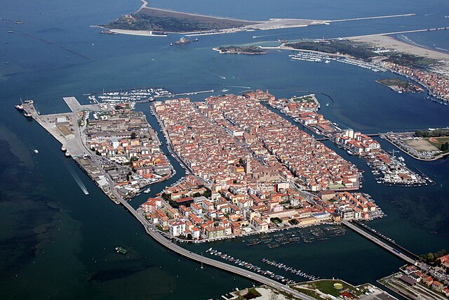

Chioggia
- Italian comune
Hiking in Chioggia
Chioggia, located on the Venetian Lagoon in Italy, is primarily known for its charming canals, colorful buildings, and rich fishing heritage rather than hiking trails. However, if you're looking to combine some outdoor exploration with the scenic beauty of the area, there are a few options nearby....
- Country:
- Postal Code: 30015
- Local Dialing Code: 041
- Licence Plate Code: VE
- Coordinates: 45° 13' 8" N, 12° 16' 43" E
- GPS tracks (wikiloc): [Link]
- AboveSeaLevel: 2 м m
- Area: 187.91 sq km
- Population: 49430
- Web site: [Link]