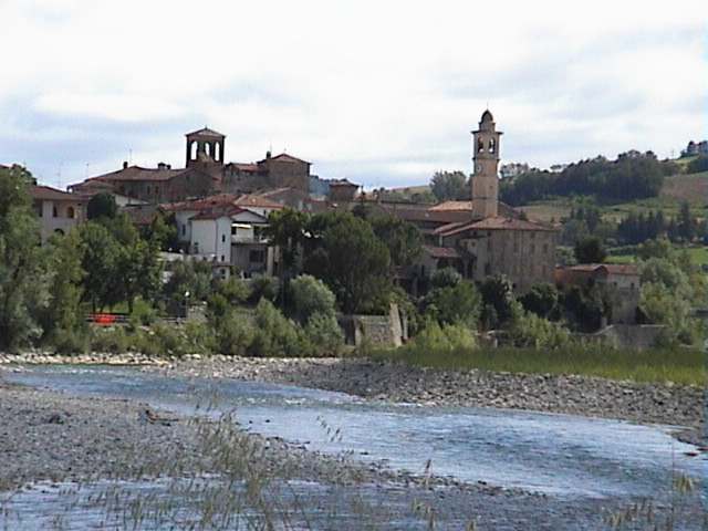
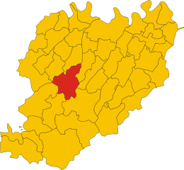
Coli, Emilia-Romagna (Coli)
.svg)
- Italian comune
 Hiking in Coli, Emilia-Romagna
Coli, located in the Emilia-Romagna region of Italy, offers a wealth of hiking opportunities amid stunning landscapes and rich natural diversity. Nestled in the Apennine Mountains, Coli is known for its lush forests, rolling hills, and picturesque views, making it an excellent destination for outdoor enthusiasts.
Hiking Trails:
-
Sentiero dei Manfrede: This trail leads through beautiful woodlands and offers panoramic views. It’s relatively easy and suitable for families, with opportunities to spot local flora and fauna.
-
Monte Sillara Trail: A more challenging hike that rewards adventurers with breathtaking vistas from the summit. This 1,862-meter peak is the highest mountain in the area and offers a sense of accomplishment for those who reach the top.
-
Sentiero delle Volte: A scenic path that traverses historical landscapes, allowing hikers to explore the cultural heritage of the area while enjoying the natural surroundings.
Best Time to Hike:
The best times for hiking in Coli are spring (April to June) and fall (September to October). During these periods, the weather is typically mild, and the landscapes are particularly beautiful, with blooming flowers in spring and vibrant autumn colors.
Preparation and Tips:
- Gear: Wear sturdy hiking boots and dress in layers, as temperatures can vary throughout the day. Don’t forget a hat, sunscreen, and plenty of water.
- Maps and Guides: Having a map or a guided tour can enhance your experience and help you navigate the trails safely.
- Wildlife: Be mindful of local wildlife and practice Leave No Trace principles to protect the natural habitat.
Additional Attractions:
While in Coli, consider exploring nearby towns and local cuisine, as the Emilia-Romagna region is famous for its gastronomy, including pasta, cheeses, and cured meats. Visiting local villages can provide cultural enrichment during your hiking trip.
Hiking in Coli can be a rejuvenating escape into nature, offering tranquility and adventure amid the beauty of Italy’s landscape.
- Country:

- Postal Code: 29020
- Local Dialing Code: 0523
- Licence Plate Code: PC
- Coordinates: 44° 45' 0" N, 9° 25' 0" E


- GPS tracks (wikiloc): [Link]
- AboveSeaLevel: 638 м m
- Area: 71.69 sq km
- Population: 873
- Web site: http://www.comune.coli.pc.it
- Wikipedia en: wiki(en)
- Wikipedia: wiki(it)
- Wikidata storage: Wikidata: Q102643
- Wikipedia Commons Category: [Link]
- Freebase ID: [/m/0gkcsf]
- GeoNames ID: Alt: [6536334]
- VIAF ID: Alt: [240557603]
- OSM relation ID: [43488]
- ISTAT ID: 033016
- Italian cadastre code: C838
Shares border with regions:


Bettola
- Italian comune
Hiking in Bettola
Bettola is a charming town located in the Emilia-Romagna region of Italy, surrounded by beautiful landscapes that make it a great destination for hiking enthusiasts. Here are some highlights and tips for hiking in and around Bettola:...
- Country:
- Postal Code: 29021
- Local Dialing Code: 0523
- Licence Plate Code: PC
- Coordinates: 44° 46' 42" N, 9° 36' 31" E
- GPS tracks (wikiloc): [Link]
- AboveSeaLevel: 329 м m
- Area: 122.37 sq km
- Population: 2759
- Web site: [Link]


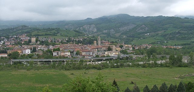
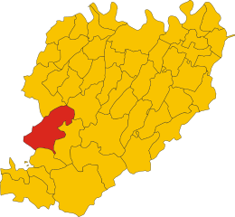
Corte Brugnatella
- Italian comune
Hiking in Corte Brugnatella
Corte Brugnatella is a charming municipality located in the province of Piacenza, in the Emilia-Romagna region of Italy. This area offers a fantastic range of hiking opportunities, thanks to its picturesque landscapes, rolling hills, and rich natural beauty. Here are a few key points to consider for hiking in and around Corte Brugnatella:...
- Country:
- Postal Code: 29020
- Local Dialing Code: 0523
- Licence Plate Code: PC
- Coordinates: 44° 41' 45" N, 9° 23' 7" E
- GPS tracks (wikiloc): [Link]
- AboveSeaLevel: 476 м m
- Area: 46.31 sq km
- Population: 580
- Web site: [Link]
Farini, Emilia-Romagna
- Italian comune
Hiking in Farini, Emilia-Romagna
Farini is a charming village located in the Emilia-Romagna region of Italy, nestled in the Apennine Mountains. It's an excellent destination for hiking enthusiasts seeking natural beauty, picturesque views, and a peaceful environment....
- Country:
- Postal Code: 29023
- Local Dialing Code: 0523
- Licence Plate Code: PC
- Coordinates: 44° 43' 0" N, 9° 34' 0" E
- GPS tracks (wikiloc): [Link]
- AboveSeaLevel: 424 м m
- Area: 112.36 sq km
- Population: 1198
- Web site: [Link]
Ferriere
- Italian comune
Hiking in Ferriere
Ferriere is a charming town located in the Province of Piacenza, in the Emilia-Romagna region of northern Italy. Known for its picturesque landscapes, Ferriere offers a range of hiking opportunities that showcase the natural beauty of the surrounding Apennine mountains. Here are some highlights for hiking in and around Ferriere:...
- Country:
- Postal Code: 29024
- Local Dialing Code: 0523
- Licence Plate Code: PC
- Coordinates: 44° 38' 38" N, 9° 29' 48" E
- GPS tracks (wikiloc): [Link]
- AboveSeaLevel: 626 м m
- Area: 178.5 sq km
- Population: 1238
- Web site: [Link]
Travo
- Italian comune
Hiking in Travo
Travo, located in the Corsica region of France, offers a unique blend of scenic beauty, rich history, and outdoor adventures for hiking enthusiasts. Here are some key points about hiking in and around Travo:...
- Country:
- Postal Code: 29020
- Local Dialing Code: 0523
- Licence Plate Code: PC
- Coordinates: 44° 52' 0" N, 9° 33' 0" E
- GPS tracks (wikiloc): [Link]
- AboveSeaLevel: 171 м m
- Area: 81.01 sq km
- Population: 2121
- Web site: [Link]
Bobbio
- Italian comune
Hiking in Bobbio
Bobbio is a charming town located in the Emilia-Romagna region of northern Italy, surrounded by the beautiful landscape of the Apennine Mountains. This area is rich in natural beauty, history, and opportunities for outdoor activities, making it an appealing destination for hiking enthusiasts....
- Country:
- Postal Code: 29022
- Local Dialing Code: 0523
- Licence Plate Code: PC
- Coordinates: 44° 46' 17" N, 9° 23' 11" E
- GPS tracks (wikiloc): [Link]
- AboveSeaLevel: 272 м m
- Area: 106.53 sq km
- Population: 3589
- Web site: [Link]