Conat (Conat)

- commune in Pyrénées-Orientales, France
- Country:

- Postal Code: 66500
- Coordinates: 42° 36' 48" N, 2° 21' 24" E


- GPS tracks (wikiloc): [Link]
- Area: 19.12 sq km
- Population: 56
- Wikipedia en: wiki(en)
- Wikipedia: wiki(fr)
- Wikidata storage: Wikidata: Q1093149
- Wikipedia Commons Category: [Link]
- Freebase ID: [/m/03qlsfm]
- GeoNames ID: Alt: [6450530]
- SIREN number: [216600544]
- BnF ID: [15270965q]
- VIAF ID: Alt: [122686049]
- OSM relation ID: [2828302]
- Gran Enciclopèdia Catalana ID: [0019201]
- INSEE municipality code: 66054
Shares border with regions:


Nohèdes
- commune in Pyrénées-Orientales, France
- Country:
- Postal Code: 66500
- Coordinates: 42° 37' 23" N, 2° 17' 20" E
- GPS tracks (wikiloc): [Link]
- Area: 30.91 sq km
- Population: 65


Urbanya
- commune in Pyrénées-Orientales, France
- Country:
- Postal Code: 66500
- Coordinates: 42° 38' 20" N, 2° 18' 18" E
- GPS tracks (wikiloc): [Link]
- Area: 14.4 sq km
- Population: 46

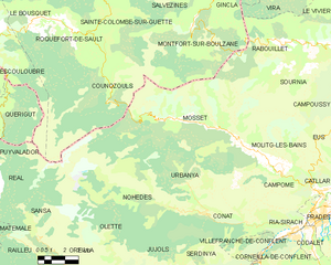
Mosset
- commune in Pyrénées-Orientales, France
- Country:
- Postal Code: 66500
- Coordinates: 42° 40' 5" N, 2° 20' 54" E
- GPS tracks (wikiloc): [Link]
- Area: 71.93 sq km
- Population: 300


Villefranche-de-Conflent
- commune in Pyrénées-Orientales, France
- Country:
- Postal Code: 66500
- Coordinates: 42° 35' 14" N, 2° 22' 4" E
- GPS tracks (wikiloc): [Link]
- Area: 4.46 sq km
- Population: 212
- Web site: [Link]

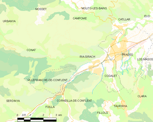
Ria-Sirach
- commune in Pyrénées-Orientales, France
- Country:
- Postal Code: 66500
- Coordinates: 42° 36' 30" N, 2° 23' 59" E
- GPS tracks (wikiloc): [Link]
- AboveSeaLevel: 380 м m
- Area: 12.82 sq km
- Population: 1314
- Web site: [Link]


Serdinya
- commune in Pyrénées-Orientales, France
- Country:
- Postal Code: 66360
- Coordinates: 42° 34' 5" N, 2° 19' 18" E
- GPS tracks (wikiloc): [Link]
- Area: 16.91 sq km
- Population: 244