Congerville-Thionville (Congerville-Thionville)

- commune in Essonne, France
- Country:

- Postal Code: 91740
- Coordinates: 48° 22' 40" N, 1° 59' 40" E


- GPS tracks (wikiloc): [Link]
- Area: 8.47 sq km
- Population: 228
- Wikipedia en: wiki(en)
- Wikipedia: wiki(fr)
- Wikidata storage: Wikidata: Q276536
- Wikipedia Commons Category: [Link]
- Freebase ID: [/m/03mgd9k]
- Freebase ID: [/m/03mgd9k]
- GeoNames ID: Alt: [3023910]
- GeoNames ID: Alt: [3023910]
- SIREN number: [219106135]
- SIREN number: [219106135]
- BnF ID: [15280218g]
- BnF ID: [15280218g]
- INSEE municipality code: 91613
- INSEE municipality code: 91613
Shares border with regions:

Oysonville
- commune in Eure-et-Loir, France
- Country:
- Postal Code: 28700
- Coordinates: 48° 23' 37" N, 1° 57' 14" E
- GPS tracks (wikiloc): [Link]
- Area: 9.63 sq km
- Population: 519
- Web site: [Link]

Mérobert
- commune in Essonne, France
- Country:
- Postal Code: 91780
- Coordinates: 48° 24' 57" N, 2° 0' 26" E
- GPS tracks (wikiloc): [Link]
- Area: 10.71 sq km
- Population: 595

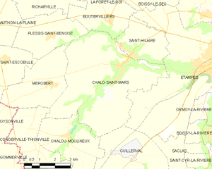
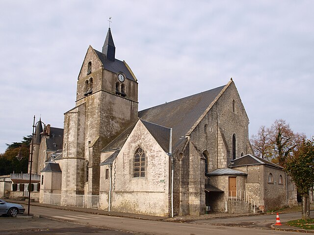
Chalo-Saint-Mars
- commune in Essonne, France
- Country:
- Postal Code: 91780
- Coordinates: 48° 25' 37" N, 2° 3' 58" E
- GPS tracks (wikiloc): [Link]
- Area: 28.67 sq km
- Population: 1133
- Web site: [Link]

Pussay
- commune in Essonne, France
- Country:
- Postal Code: 91740
- Coordinates: 48° 20' 57" N, 1° 59' 34" E
- GPS tracks (wikiloc): [Link]
- Area: 11.55 sq km
- Population: 2165
- Web site: [Link]

Chalou-Moulineux
- commune in Essonne, France
- Country:
- Postal Code: 91740
- Coordinates: 48° 23' 6" N, 2° 1' 19" E
- GPS tracks (wikiloc): [Link]
- Area: 10.47 sq km
- Population: 430


Gommerville
- former commune in Eure-et-Loir, France
- Country:
- Postal Code: 28700; 28310
- Coordinates: 48° 20' 43" N, 1° 56' 41" E
- GPS tracks (wikiloc): [Link]
- Area: 27.23 sq km
- Population: 637